Cuttack District Guide 2026: Map, Blocks, Places & History
Comprehensive guide to Cuttack district in Odisha. Census 2011 demographics, 14 administrative blocks, Vidhan Sabha seats, history, places to visit, and map.
Cuttack district anchors the administrative, judicial, and cultural landscape of coastal Odisha. Flanked by the Mahanadi River to the north and the Kathajodi River to the south, the district headquarters functions as the state’s judicial capital and historic urban center. The surrounding rural blocks encompass fertile river basins, ancient riverine trade terminals, and dense wildlife corridors along the Eastern Ghats foothills.
Key Takeaways
- Cuttack covers 3,932 square kilometers across 14 community development blocks and three revenue subdivisions.
- The district recorded a population of 2,624,470 during Census 2011, achieving an 85.50 percent literacy rate.
- Landmark heritage sites include the 14th-century Barabati Fort, Netaji Birthplace Museum, and Dhabaleswar Island Temple.
- Major economic drivers center on agro-processing, heavy manufacturing at Choudwar, and world-renowned Tarakasi silver filigree.
- National Highway 16 and Cuttack railway junction (CTC) supply arterial transit across the eastern coastal corridor.
Demographic & Geographic Profile of Cuttack District
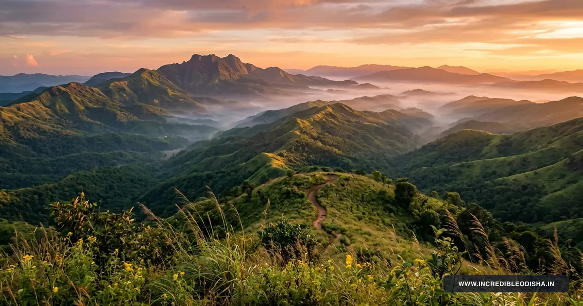
Cuttack occupies the apex of the Mahanadi delta in east-central Odisha. The district extends across flat riverine floodplains in the east and rises into broken quartzite ridges toward Athagarh and Narasinghpur in the west. The Mahanadi River splits into major distributaries near the municipal boundaries, giving birth to the Kathajodi, Birupa, Kuakhia, Chitrotpala, and Luna river systems.
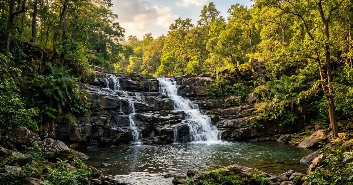
Alluvial soils dominate the deltaic plains, providing high natural fertility for multi-crop agriculture. Forest cover concentrates predominantly in the western subdivisions, where mixed deciduous woodlands border the Satkosia gorge ecosystem and Chandaka wildlife sanctuary buffer zones.
The district forms an essential cultural corridor connecting coastal pilgrimage routes with sacred heritage temples across Odisha. Official administrative boundaries and census statistics are documented in the Census 2011 Official Cuttack District Directory and corroborated through the Incredible India Official Odisha Tourism Portal.
| Demographic & Geographic Indicator | Statistical Measurement | State Context & Baseline |
|---|---|---|
| Total Geographical Area | 3,932 sq km | Ranked 14th among Odisha districts |
| Total Population (Census 2011) | 2,624,470 residents | 1,338,767 males and 1,285,703 females |
| Population Density | 667 persons / sq km | Far above state average of 270 |
| Sex Ratio | 960 females per 1,000 males | Coastal average baseline |
| Overall Literacy Rate | 85.50% | Male: 91.11% | Female: 79.55% |
| Administrative Headquarters | Cuttack City | Situated between Mahanadi and Kathajodi rivers |
| Revenue Division | Central Revenue Division | Divisional Commissioner headquarters at Cuttack |
| Revenue Subdivisions | 3 Subdivisions | Cuttack Sadar, Athagarh, Banki |
| Community Development Blocks | 14 CD Blocks | Administering 373 Gram Panchayats |
| Revenue Tehsils | 15 Tehsils | Cadastral revenue administration |
| Inhabited Villages | 1,845 rural settlements | High rural settlement density |
| Motor Vehicle RTO Code | OD-05 | Regional Transport Office, Cuttack |
| Primary River Systems | Mahanadi, Kathajodi, Birupa, Kuakhia | Deltaic network draining to Bay of Bengal |
| Bordering Districts | Dhenkanal, Angul, Nayagarh, Khordha, Puri, Jagatsinghpur, Kendrapara, Jajpur | Bordered by eight adjoining districts |
Annual rainfall averages approximately 1,440 millimeters, with monsoon downpours arriving between June and September. The low-lying spit between the Mahanadi and Kathajodi rivers required extensive historical flood defenses, leading to the creation of ancient stone revetments that still protect the city center.
Landmark Directory: In Which District Is Each Destination Located?
Researchers, administrative job aspirants, and travelers regularly seek verification regarding the territorial location of key cultural institutions and natural reserves in central Odisha. The directory below confirms the official district and block assignments for famous regional destinations.
| Landmark / Destination | District Assignment | Block / Subdivision | Geographic Setting & Connectivity |
|---|---|---|---|
| Barabati Fort & Moat | Cuttack District | Cuttack Sadar Subdivision | Cantonment Road, 3 km from Cuttack Junction railway station |
| Netaji Birthplace Museum | Cuttack District | Cuttack Sadar Subdivision | Odia Bazaar, Janakinath Bhawan memorial site |
| Maa Katak Chandi Temple | Cuttack District | Cuttack Sadar Subdivision | Chandi Chowk, presiding Shakti shrine of the city |
| Dhabaleswar Island Temple | Cuttack District | Athagarh Block | Riverine island in Mahanadi River, accessed via suspension footbridge |
| Odisha State Maritime Museum | Cuttack District | Cuttack Sadar Subdivision | Jobra barrage waterfront, restored 1869 British canal workshop |
| Ansupa Freshwater Lake | Cuttack District | Banki-Dampada Subdivision | Horseshoe lake near Saranda Hills, 40 km from Cuttack |
| Maa Charchika Temple | Cuttack District | Banki Block | Renuka shrine on the banks of Renuka river, Banki town center |
| Bhattarika Temple | Cuttack District | Badamba Block | River cliff shrine on the Mahanadi River, 95 km west of Cuttack |
| Paramahansa Shiva Temple | Cuttack District | Cuttack Sadar Block | Ancient Shiva shrine located 12 km east of Cuttack on Birupa canal |
| National Rice Research Institute | Cuttack District | Cuttack Sadar Block | Bidyadharpur agricultural research campus along NH-16 |
Administrative Structure & Revenue Subdivisions
Administrative governance across Cuttack district operates under the authority of the District Magistrate and Collector based at the Collectorate on Cantonment Road. The territory divides into three administrative subdivisions: Cuttack Sadar, Athagarh, and Banki. Each subdivision is headed by a Sub-Collector who oversees revenue enforcement, public order, and municipal coordination.
Fifteen revenue tehsils deliver cadastral land administration, mutation processing, and disaster relief. Urban governance functions separately through the Cuttack Municipal Corporation (CMC), which oversees 59 municipal wards. Rural areas are administered through 14 Community Development Block offices and 373 Gram Panchayats.
Complete Directory of Community Development (CD) Blocks
The 14 community development blocks manage rural welfare delivery, primary education, rural drinking water systems, and agricultural extension services. These blocks represent diverse ecological zones, from coastal agricultural tracts to rugged riverine uplands.
| Block Name | Revenue Subdivision | Block Headquarters | Gram Panchayats | Primary Economic & Geographic Profile |
|---|---|---|---|---|
| Cuttack Sadar | Cuttack Sadar | Cuttack (42 Mouza) | 23 GPs | Peri-urban agrarian belt, dairy farming, vegetable cultivation |
| Baranga | Cuttack Sadar | Baranga | 16 GPs | Southern corridor bordering Nandankanan, logistics, suburban growth |
| Tangi-Choudwar | Cuttack Sadar | Tangi | 23 GPs | Major industrial zone, ferro-alloys, textile units, NH-16 junction |
| Salepur | Cuttack Sadar | Salepur | 36 GPs | Fertile Chitrotpala river plain, dairy co-ops, sweetmaking trade |
| Mahanga | Cuttack Sadar | Mahanga | 36 GPs | Paddy cultivation, canal irrigation, eastern border with Jajpur |
| Nischintakoili | Cuttack Sadar | Nischintakoili | 30 GPs | Agrarian heartland along Luna River, multi-crop horticulture |
| Niali | Cuttack Sadar | Niali | 23 GPs | Prachi Valley heritage belt, intensive milk production, river alluvium |
| Kantapada | Cuttack Sadar | Kantapada | 19 GPs | Southern rural plain, betel vine cultivation, paddy agriculture |
| Athagarh | Athagarh | Athagarh | 34 GPs | Former princely state capital, forest buffer zones, sugarcane mills |
| Tigiria | Athagarh | Tigiria | 17 GPs | Smallest princely unit, traditional handloom weaving, terracotta crafts |
| Badamba | Athagarh | Badamba | 34 GPs | Upland agrarian tracts, Bhattarika pilgrimage hub, forest produce |
| Narasinghpur | Athagarh | Narasinghpur | 36 GPs | Western border with Angul and Nayagarh, Satkosia fringe forests |
| Banki | Banki | Banki | 24 GPs | Mahanadi southern bank, historical trade hub, vegetable marketing |
| Dampada | Banki | Dampada | 18 GPs | Foothill agrarian belt, Ansupa lake wetlands, Chandaka boundary |
Vidhan Sabha (MLA) Seats & Parliamentary Constituencies
Cuttack district comprises nine legislative assembly (Vidhan Sabha) constituencies based on the Delimitation Commission orders of 2008. The entire district forms the core of the Cuttack Parliamentary Constituency (Lok Sabha Seat 14), with peripheral rural blocks contributing to neighboring parliamentary seats.
Constituency boundaries and reservation statuses are officially published in the Election Commission of India Delimitation Directory.
| AC No. | Vidhan Sabha Constituency | Reservation Status | Territorial Coverage & Associated Blocks |
|---|---|---|---|
| 87 | Barabati-Cuttack | General | Central Cuttack Municipal Corporation wards, historic trade core |
| 88 | Choudwar-Cuttack | General | Industrial Choudwar town and northern CMC municipal wards |
| 89 | Cuttack Sadar | Scheduled Caste (SC) | Cuttack Sadar CD Block and surrounding rural gram panchayats |
| 90 | Salepur | General | Salepur CD Block and associated canal farming settlements |
| 91 | Mahanga | General | Mahanga CD Block and neighboring eastern agrarian villages |
| 92 | Banki | General | Banki Block, Dampada Block, and Banki Notified Area Council |
| 93 | Athagarh | General | Athagarh Block, Tigiria Block, and Athagarh Notified Area Council |
| 94 | Baramba | General | Badamba Block and Narasinghpur Block up to western district limits |
| 95 | Niali | Scheduled Caste (SC) | Niali Block, Kantapada Block, and surrounding Prachi river basin |
The Cuttack Parliamentary Seat has historically served as a decisive political center in Odisha politics, electing notable state figures and veteran parliamentarians since the first general election in 1951.
Deep History, Princely Heritage & Freedom Movements
Historical records trace the foundation of Cuttack to 989 CE under King Nrupa Keshari of the Somavamshi (Keshari) dynasty. The strategic triangular tongue of land between two major rivers offered formidable natural military defenses. In 1006 CE, King Marakata Keshari constructed the monumental stone revetment along the banks of the Kathajodi River, an early hydraulic engineering feat that prevented severe erosion during catastrophic monsoon floods.
During the 13th century, King Anangabhima Deva III of the Eastern Ganga dynasty transferred his imperial capital from Jajpur to Cuttack, christening the settlement Abhinava Varanasi Kataka. He laid the foundation of the massive stone citadel of Barabati Fort.
The citadel was subsequently expanded under the Suryavamshi Gajapati emperors, who ruled an empire stretching from the Ganges to the Kaveri. After the fall of Mukunda Deva in 1568, Cuttack passed through Mughal and Maratha control before British forces annexed the citadel in October 1803.
[!NOTE] Key Historical Milestones of Cuttack:
- 989 CE: Founded by King Nrupa Keshari of the Somavamshi dynasty.
- 1006 CE: Stone revetment built along Kathajodi River by King Marakata Keshari.
- 1211 CE: Declared imperial capital Abhinava Varanasi Kataka by King Anangabhima Deva III.
- 1803 CE: Annexed by British East India Company forces.
- 1948 CE: High Court of Orissa formally established at Cuttack.
Under British rule, Cuttack served as the administrative headquarters of the Odisha Division within the Bengal Presidency. The city led regional resistance against colonial authorities during the Prajamandal movements in the tributary states of Athagarh, Tigiria, Badamba, and Narasinghpur. Freedom activists led large Salt Satyagraha demonstrations along river trading posts, while regional writers ignited the Odia linguistic identity movement from printing presses located throughout the old town.
The city hosted maritime traders who embarked on voyages to Southeast Asian ports like Bali, Java, and Sumatra. This ancient seafaring tradition continues to be commemorated each autumn during the historic Bali Jatra open-air trade festival along the banks of the Mahanadi. National monuments within the district remain protected under the mandate of the Archaeological Survey of India Protected Monuments Directory.
Notable Personalities and Freedom Fighters of Cuttack
Cuttack has produced leading statesmen, constitutional scholars, and literary giants who guided Odisha’s political and cultural evolution.
- Netaji Subhash Chandra Bose (1897–1945): Born on January 23, 1897, at Janakinath Bhawan in Odia Bazaar, Netaji completed his early schooling at Protestant European School and Ravenshaw Collegiate School before leading the Indian National Army.
- Utkal Gourav Madhusudan Das (1848–1934): The architect of modern Odisha, lawyer, and social reformer. He founded the Utkal Sammilani in 1903 to unite Odia-speaking tracts and established Utkal Tannery to pioneer domestic industrial craftsmanship.
- Biju Patnaik (1916–1997): Renowned aviator, national freedom fighter, and twice Chief Minister of Odisha. Born in Tulsipur, Cuttack, he flew daring rescue missions during the Indonesian independence struggle.
- Dr. Radhanath Rath (1896–1998): Freedom fighter, long-serving editor of The Samaja daily newspaper, and cabinet minister who championed rural welfare and humanitarian service across the state.
- Bhakta Kabi Madhusudan Rao (1853–1912): Classical poet and educationalist whose foundational primers shaped modern Odia literary instruction and linguistic pride.
Strategic Economy, Mineral Wealth & Agriculture
The economic profile of Cuttack district combines traditional riverine agriculture with industrial manufacturing and artisan cottage crafts.
Agriculture and Allied Sectors
Over sixty percent of the district’s rural workforce relies on agricultural activities. The deltaic plains formed by the Mahanadi, Chitrotpala, and Birupa rivers yield bumper harvests of paddy, pulses, sugarcane, and groundnuts. The National Rice Research Institute (NRRI) at Bidyadharpur conducts cutting-edge varietal research, introducing high-yield cultivars suited to coastal flood conditions.
Horticulture thrives in the riverbed tracts of Banki and Dampada, supplying fresh vegetables, pointed gourd, and watermelons to the twin cities of Cuttack and Bhubaneswar. Niali and Salepur blocks host extensive dairy cooperatives that funnel thousands of liters of fresh milk daily to the OMFED distribution grid.
Industrial Corridors and Traditional Handicrafts
Choudwar functions as the traditional manufacturing anchor of the district, hosting paper mills, thermal power facilities, and ferro-alloy smelting plants. The Jagatpur Industrial Estate on the northern bank of the Mahanadi houses medium-scale engineering works, chemical processing plants, plastic manufacturing facilities, and food-processing hubs.
Cuttack is globally renowned for its exquisite silver filigree craft, locally known as Tarakasi, which holds Geographical Indication (GI) registration. Artisans weave hair-thin silver wires into intricate jewelry, decorative artifacts, and majestic backdrops utilized during the grand Cuttack Durga Puja silver tableau celebrations. In the western blocks of Tigiria and Badamba, skilled weavers produce traditional cotton handlooms and Maniabandha silk sarees.
Major Educational Institutions and Healthcare Facilities
Cuttack has served as the academic and medical nucleus of Odisha for over a century, attracting students and patients from across eastern India.
Higher Education Centers
- Ravenshaw University: Established as Ravenshaw College in 1868, this historic institution gained university status in 2006. It has educated generations of eastern India’s political leaders, academics, and administrators.
- National Law University Odisha (NLUO): Located in Naraj, NLUO stands among India’s leading national law academies, offering specialized undergraduate and postgraduate legal degrees.
- Sri Sri University: Situated in Godi Sahi near Bidyadharpur, the campus provides programs in management, agriculture, and alternative therapies.
- Sailabala Women’s Autonomous College: Founded in 1913, this institution pioneered women’s higher education across the coastal belt.
Public Healthcare Infrastructure
Public medical care centers upon the historic S.C.B. Medical College and Hospital, a major 5,000-bed tertiary care referral institution serving patients from Odisha, Jharkhand, West Bengal, and Chhattisgarh. The campus houses specialized institutes including the Acharya Harihar Post Graduate Institute of Cancer (AHPGIC) and the Sardar Vallabhbhai Patel Post Graduate Institute of Paediatrics, popularly known as Sishu Bhawan.
District sub-divisional hospitals at Athagarh and Banki, supported by community health centers (CHCs) across all 14 blocks, provide essential primary healthcare and maternity services to rural populations.
Iconic Gastronomy: Traditional Foods and Sweets of Cuttack
The culinary culture of Cuttack reflects centuries of river trade, royal patronage, and busy street bazaars.
Signature Flavors of Cuttack:
- Cuttack Dahibara Aloo Dum: Lentil dumplings soaked in seasoned curd water, served with fiery potato curry, yellow peas ghuguni, chopped onions, and fresh coriander.
- Salepur Rasagola: Soft, brownish cottage cheese dumplings cooked in boiling light sugar syrup, popularized across Odisha by confectioner Bikalananda Kar.
- Chhena Mudki & Peda: Dry milk confections prepared in brass cauldrons across traditional sweet stalls in Buxi Bazaar and Choudhury Bazaar.
Street food culture centers on the legendary Dahibara vendors who navigate town squares on bicycles carrying earthen pots and stainless steel containers. Visitors can sample authentic Odisha traditional foods ranging from fresh Mahanadi freshwater fish curries to steaming hot aloo chop and ghuguni served on sal leaf plates at evening markets.
Top Tourist Attractions and Sacred Shrines in Cuttack
Planning a dedicated sightseeing trip? Read our companion guide to the 23 Best Places to Visit in Cuttack District Travel Guide for detailed itineraries, entry tickets, and photo viewpoints.
1. Barabati Fort and Moat
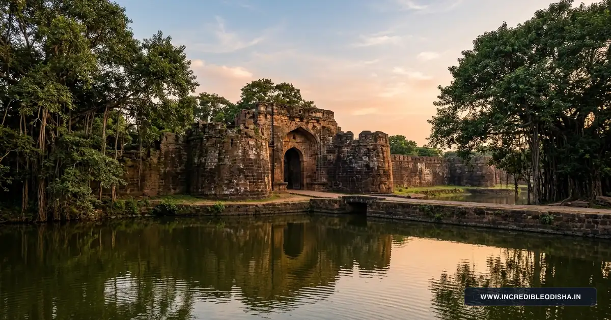
Constructed in the 14th century by the Eastern Ganga rulers, the ruins of Barabati Fort occupy a strategic bend on the Mahanadi River. Visitors can examine the nine-story palace foundation mounds, intact laterite gateway arches, and the wide defense moat surrounded by manicured public gardens.
2. Maa Katak Chandi Temple
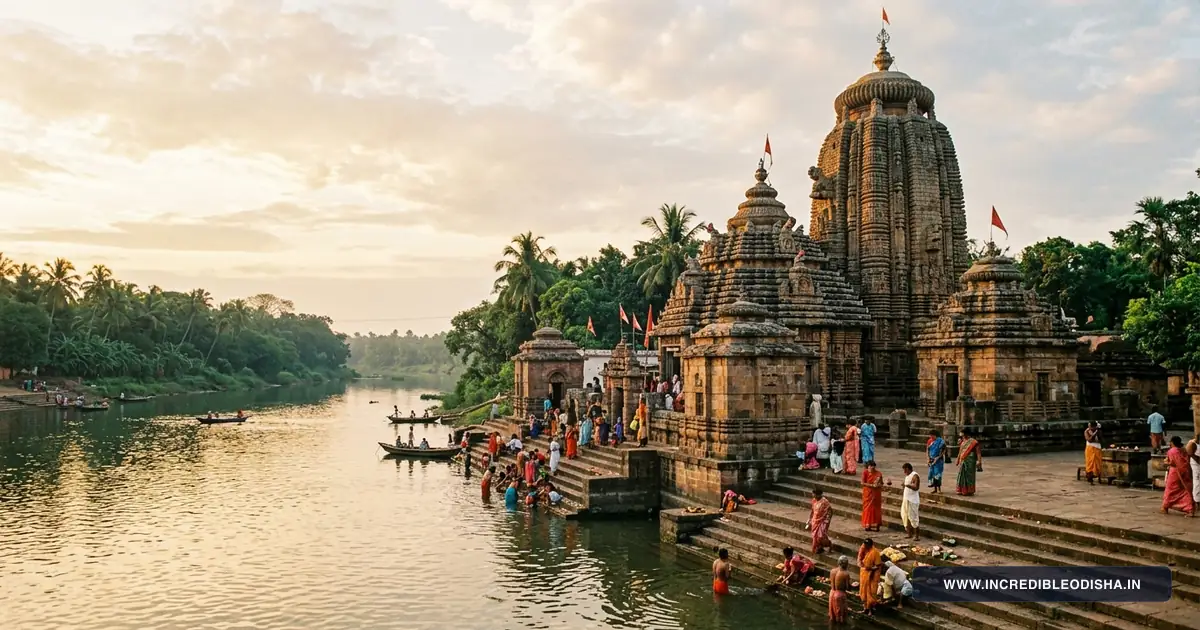
The sacred shrine of Goddess Chandi serves as the presiding Shakti deity of the city. Situated near Chandi Chowk, the temple attracts tens of thousands of devotees during the annual Durga Puja festivities, when the goddess is adorned in elaborate festive disguises known as Beshas.
3. Dhabaleswar Island Shiva Temple
Perched on a scenic riverine island in the Mahanadi River near Athagarh, this medieval shrine honors Lord Shiva. Pilgrims reach the temple either by mechanized country boats or by crossing an engineered suspension footbridge offering panoramic views of the river gorge.
4. Odisha State Maritime Museum (Jobra)
Set inside the restored 19th-century Jobra canal workshop where colonial engineers built navigation vessels, this museum features ten interactive galleries. Displays present ancient trans-oceanic navigation tools, boat-building timber carpentry, maritime trade routes to Bali, and preserved antique steam engines.
5. Netaji Birthplace Museum (Janakinath Bhawan)
The ancestral residence of Netaji Subhash Chandra Bose in Odia Bazaar has been converted into an insightful biographical memorial. The museum displays original family heirlooms, Netaji’s personal letters, study chambers, photographs, and records from his leadership of the Indian National Army.
6. Ansupa Freshwater Lake
Located between the Saranda and Bishnupur hills in Banki subdivision, Ansupa is the state’s largest natural freshwater horseshoe lake. The lake wetland supports seasonal migratory waterfowl, blooming lotus patches, and an eco-tourism park equipped with tented cottages.
Where to Stay: OTDC Panthanivas & Town Hotels
Cuttack provides diverse lodging choices ranging from state-run tourism panthanivas units to commercial business hotels situated close to rail and road terminals.
Government Accommodations
- OTDC Panthanivas, Cuttack: Located along Buxi Bazaar Road, this government property offers clean air-conditioned and non-air-conditioned guest rooms, an on-site restaurant serving regional Odia meals, and travel desk facilities bookable through the Odisha Tourism Development Corporation Official Portal.
Private Hotels and Commercial Lodging
- Badambadi & Link Road Cluster: Positioned within short walking distance of the central bus terminal, this zone provides economical family lodges, transit rooms, and vegetarian eateries.
- Cantonment & Ring Road Belt: Offers mid-range business hotels, executive suites, and banquet venues near the High Court, Barabati Stadium, and administrative offices.
Month-by-Month Climate & Seasonal Travel Advisory
The climate of Cuttack features tropical conditions characterized by warm summers, active monsoon downpours, and comfortable winter months.
Winter Season (October to February)
Winter presents the most comfortable window for regional sightseeing, heritage walks, and outdoor river exploration. Daytime temperatures hover comfortably between 16°C and 28°C with minimal humidity. This period coincides with the annual Bali Jatra trade fair and major cultural festivals across the waterfront.
Summer Season (March to June)
Summers bring high humidity and hot conditions, with mercury levels frequently climbing between 36°C and 43°C during May and June. Travelers visiting during this period should schedule temple excursions and outdoor sightseeing during early morning or evening hours to avoid intense heat.
Monsoon Season (July to September)
The southwest monsoon deposits over eighty percent of the district’s annual precipitation, refreshing agricultural plains and filling rivers. While seasonal rains give water bodies and wetlands a verdant appearance, heavy downpours can cause temporary urban waterlogging in low-lying pockets along the old town canal banks.
How to Reach Cuttack & Inter-City Road Distance Matrix
Cuttack acts as the central transit junction for coastal Odisha, enjoying high-speed road networks and trunk railway corridors. Travel routes can be traced in detail on our Odisha road and railway connectivity map.
Cuttack Transit Summary:
- By Rail: Cuttack Junction (CTC) sits on the main Howrah-Chennai trunk line under the East Coast Railway zone, connecting to all major metropolitan centers.
- By Road: National Highway 16 runs directly through the district, connecting Cuttack to Kolkata and Chennai via six-lane expressways. State Highway 9A leads northeast to the coastal mangrove delta, detailed in our comprehensive Kendrapara district guide.
- By Air: Biju Patnaik International Airport (BBI) in Bhubaneswar sits just 28 kilometers south, offering regular domestic flights to major Indian cities.
Inter-City Road Distance Matrix
| Origin City / Transit Center | Primary Driving Route | Driving Distance | Approximate Travel Time |
|---|---|---|---|
| Bhubaneswar | NH-16 (Twin City Expressway) | 28 km | 45 minutes |
| Puri | NH-316 & NH-16 via Bhubaneswar | 85 km | 2 hours |
| Paradeep Port | State Highway 12 (Cuttack-Paradeep Road) | 82 km | 2 hours |
| Dhenkanal | NH-55 via Choudwar | 55 km | 1 hour 15 minutes |
| Balasore | NH-16 via Panikoili and Bhadrak | 175 km | 3 hours 30 minutes |
| Sambalpur | NH-55 via Angul and Redhakhol | 255 km | 5 hours 30 minutes |
| Kolkata | NH-16 via Kharagpur and Baleswar | 415 km | 8 hours |
Postal PIN Codes, Transport RTO & Emergency Helplines
The postal and emergency directory below assists travelers, competitive examination candidates, and administrative personnel navigating local municipal zones.
Major Postal PIN Codes in Cuttack
| Post Office Name | PIN Code | Postal Classification | Block / Region Covered |
|---|---|---|---|
| Cuttack Head Post Office (HPO) | 753001 | Head Post Office | Buxi Bazaar, High Court, Collectorate |
| College Square Sub Post Office | 753003 | Sub Post Office | Ravenshaw University, Railway Station |
| SCB Medical College Sub Post Office | 753007 | Sub Post Office | Medical Campus, Mangalabag |
| Choudwar Sub Post Office | 754025 | Sub Post Office | Choudwar Industrial Town, Tangi |
| Salepur Sub Post Office | 754202 | Sub Post Office | Salepur Block, Chitrotpala River Basin |
| Athagarh Sub Post Office | 754029 | Sub Post Office | Athagarh Subdivision, Dhabaleswar |
| Banki Sub Post Office | 754008 | Sub Post Office | Banki Subdivision, Charchika Temple |
| Badamba Sub Post Office | 754031 | Sub Post Office | Badamba Block, Bhattarika Pitha |
Regional Transport Office (RTO)
All motor vehicles, commercial permits, and driving licenses registered in Cuttack district carry the transport registration prefix OD-05. A secondary registration wing operates under the Cuttack RTO to manage commercial freight across the Choudwar-Jagatpur industrial cluster.
Emergency and Administrative Helplines
| Administrative & Emergency Service | Contact Helpline / Phone | Operational Availability |
|---|---|---|
| Integrated Emergency Response | 112 | 24 Hours Nationwide Emergency |
| Police Commissionerate Control Room | 0671-2303100 / 100 | Round-the-clock law enforcement |
| District Collectorate Control Room | 0671-2508200 | Office hours (10:00 AM to 5:30 PM) |
| SCB Medical College Casualty / Ambulance | 0671-2414080 / 108 | 24 Hours Emergency Trauma Center |
| Fire and Disaster Management Station | 0671-2301101 / 101 | 24 Hours Fire and Rescue Response |
Frequently Asked Questions About Cuttack District
How many community development blocks are there in Cuttack district?
Cuttack district comprises 14 community development blocks administered under three revenue subdivisions. These blocks coordinate rural administration and agricultural welfare across 373 gram panchayats.
What is the motor vehicle RTO registration code for Cuttack?
The official motor vehicle registration prefix for Cuttack district is OD-05. Vehicle registration certificates and commercial transport licenses are administered by the Regional Transport Office located in Cuttack city.
In which district is Barabati Fort located?
Barabati Fort is located in Cuttack district within the municipal limits of Cuttack city. The 14th-century citadel ruins and ancient stone gateway stand beside the Mahanadi River near the historic Cantonment area.
What is the signature culinary specialty of Cuttack?
The signature culinary dish of Cuttack is Dahibara Aloo Dum, consisting of curd-soaked lentil fritters served with spicy potato curry and yellow peas ghuguni. The city is also widely celebrated for its traditional Salepur Rasagola and artisanal Chhena sweets.
What is the best time of year to visit Cuttack district?
The best time to visit Cuttack district extends from October to February when winter daytime temperatures remain pleasantly moderate between 16°C and 28°C. This seasonal window also features the famous Bali Jatra open-air trade festival along the Mahanadi riverbank.