Bhadrak District Guide 2026: Map, Blocks, Places & History
Comprehensive Bhadrak district guide with administrative blocks, Census 2011 demographics, Akhandalamani Temple, Rakta Tirtha Eram, Dhamra Port, and history.
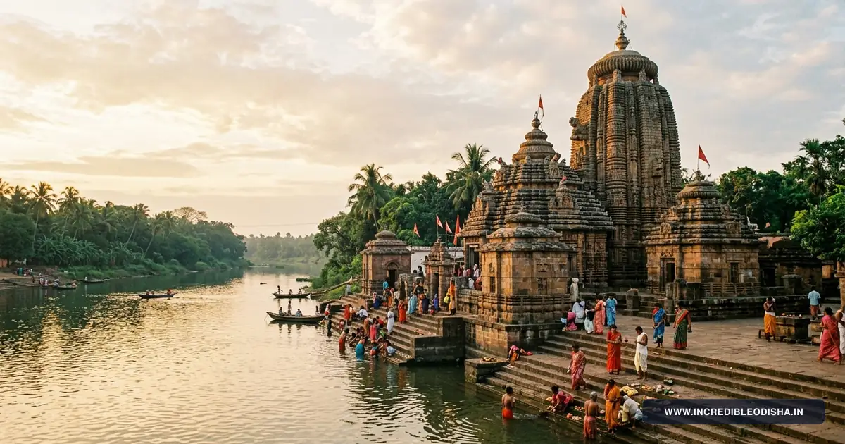
Carved out of undivided Balasore on April 1, 1993, Bhadrak district forms a vital agrarian and maritime corridor along the coastal plains of northern Odisha. Bordered by the Bay of Bengal on the east and intersected by the perennial Baitarani and Salandi river systems, the district bridges ancient port commerce with modern deepwater maritime logistics.
Key Takeaways
- Bhadrak spans 2,505 square kilometers across seven community development blocks and one revenue subdivision.
- The district recorded a population of 1,506,522 during Census 2011, achieving an 82.74 percent literacy rate.
- Major cultural landmarks include the sacred Akhandalamani Shiva Temple at Aradi and the ancient Maa Bhadrakali shrine.
- Rakta Tirtha Eram in Basudevpur marks the historic 1942 Quit India police firing known across India as the Second Jallianwala Bagh.
- National Highway 16 and the Bhadrak railway junction (BHC) provide direct high-speed transit toward Bhubaneswar and Kolkata.
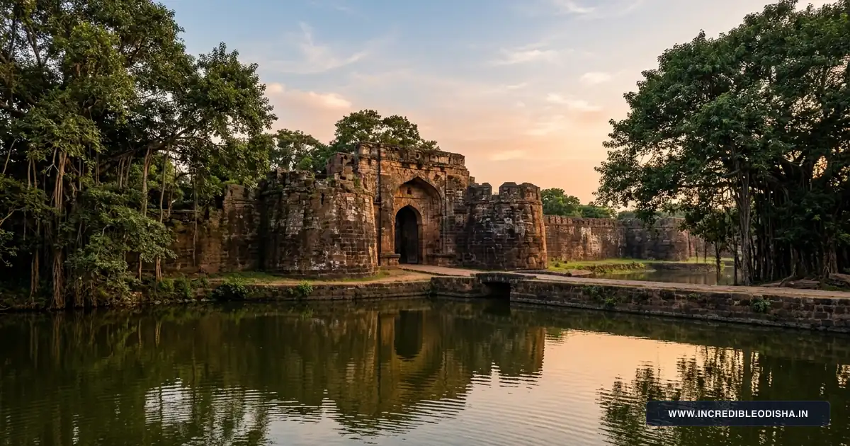
Bhadrak derives its identity from Goddess Bhadrakali, whose historic shrine presides along the banks of the Salandi River just south of the municipal headquarters. From medieval riverine trading posts at Chandabali to modern industrial bulk terminals at Dhamra Port, the district combines rich coastal wetlands with fertile agricultural deltas.
Demographic & Geographic Profile of Bhadrak District
Bhadrak occupies a low-lying alluvial tract formed by the deltaic drainage of the Baitarani, Salandi, Genguti, and Matai rivers. Soil composition across inland blocks consists primarily of fertile entisols and inceptisols supporting multi-crop paddy farming, while eastern blocks feature coastal saline alluvium suitable for brackish aquaculture.
Official administrative boundaries and census statistics are documented in the Census 2011 Official Bhadrak District Directory and corroborated through the Incredible India Official Odisha Tourism Portal.
| Demographic & Geographic Indicator | Statistical Measurement | State Context & Baseline |
|---|---|---|
| Total Geographical Area | 2,505 sq km | Ranked 23rd among Odisha districts |
| Total Population (Census 2011) | 1,506,522 residents | 760,260 males and 746,262 females |
| Population Density | 601 persons / sq km | Exceeds Odisha state average (270 / sq km) |
| Sex Ratio | 981 females per 1,000 males | Coastal average baseline |
| Overall Literacy Rate | 82.74% | Male: 89.64% | Female: 75.75% |
| Administrative Headquarters | Bhadrak Town | Situated on NH-16 and Salandi River |
| Revenue Division | Central Division | Headquarters at Cuttack |
| Revenue Subdivisions | 1 (Bhadrak Sadar) | Centralized sub-divisional governance |
| Community Development Blocks | 7 CD Blocks | 218 Gram Panchayats |
| Revenue Tehsils | 7 Tehsils | Full cadastral land coverage |
| Inhabited Villages | 1,370 rural settlements | Predominantly agrarian rural population |
| Motor Vehicle RTO Code | OD-22 | Regional Transport Office, Bhadrak |
| Primary River Systems | Baitarani, Salandi, Matai, Genguti | Coastal drainage into Bay of Bengal |
| Bordering Districts | Balasore, Jajpur, Kendrapara, Keonjhar | Bay of Bengal on the eastern boundary |
Agricultural lands across Bhadrak depend heavily on seasonal discharge from the Salandi Dam upstream in Keonjhar district, as well as lift irrigation canals fed by the Baitarani River. Low elevation exposes coastal pockets in Basudevpur and Chandabali blocks to seasonal tropical cyclones and storm surges originating in the northern Bay of Bengal.
Landmark Directory: In Which District Is Each Destination Located?
Travelers, researchers, and competitive exam aspirants frequently need to verify administrative jurisdictions for cultural and geographic landmarks across coastal Odisha. The directory below confirms official district assignments for prominent destinations situated within Bhadrak.
| Landmark / Destination | District Assignment | Block / Subdivision | Geographic Setting & Connectivity |
|---|---|---|---|
| Akhandalamani Temple (Aradi) | Bhadrak District | Chandabali Block | Situated on the banks of Baitarani River, 37 km from Bhadrak |
| Maa Bhadrakali Temple | Bhadrak District | Bhadrak Sadar | Located in Aharapada on the Salandi River, 10 km from town |
| Rakta Tirtha Eram Memorial | Bhadrak District | Basudevpur Block | 1942 Quit India martyr memorial ground, 45 km from Bhadrak |
| Dhamra Deepwater Port | Bhadrak District | Chandabali Block | Deepwater commercial port at Dhamra river mouth, 80 km from town |
| Chandabali River Port | Bhadrak District | Chandabali Block | Historic inland river terminal on Baitarani, 50 km from Bhadrak |
| Biranchinarayan Sun Temple | Bhadrak District | Tihidi Block | 13th-century stone Sun temple at Palia village, 15 km from town |
| Palia Aredi Shrines | Bhadrak District | Tihidi Block | Rural temple cluster along the Bhadrak-Chandabali roadway |
Each of these destinations lies entirely under the administrative jurisdiction of the Bhadrak Collectorate and falls within the local police station network of Bhadrak district.
Administrative Structure & Revenue Subdivisions
Unlike larger western districts that manage multiple revenue subdivisions, Bhadrak operates under a unified single-subdivision model centered at the Bhadrak Sadar Sub-Collector office. This centralized arrangement coordinates seven tehsils, seven community development blocks, and four urban local bodies across coastal lowlands.
The District Magistrate and Collector exercises executive authority from the District Collectorate situated in Bhadrak town. Rural development initiatives, public health programs, and disaster management networks flow directly from the Collectorate to the seven block development offices.
Urban local administration is divided between two municipal councils and two notified area councils (NACs). Bhadrak Municipality and Basudevpur Municipality oversee civic maintenance, road lighting, and sanitation in primary commercial centers, while Dhamnagar NAC and Chandabali NAC deliver municipal services in expanding semi-urban settlements.
Complete Directory of Community Development (CD) Blocks
Bhadrak district is subdivided into seven community development blocks responsible for grassroots rural infrastructure, agricultural extension, and panchayat administration. Each block maintains an independent Panchayat Samiti office headed by a Block Development Officer (BDO).
The comprehensive table below profiles every block, its administrative seat, gram panchayat coverage, and primary economic focus.
| Block Name | Revenue Subdivision | Block Headquarters | Gram Panchayats | Primary Economic & Geographic Profile |
|---|---|---|---|---|
| Bhadrak Sadar | Bhadrak | Bhadrak Town | 37 GPs | Commercial trade hub, Salandi irrigation, educational institutions |
| Basudevpur | Bhadrak | Basudevpur | 36 GPs | Coastal agriculture, Chudamani marine fishing, Rakta Tirtha heritage |
| Bonth | Bhadrak | Bonth | 25 GPs | Paddy cultivation, Agarpara handloom trade, inland river plains |
| Chandabali | Bhadrak | Chandabali | 35 GPs | Maritime trade, Dhamra deepwater port, brackish water shrimp aquaculture |
| Dhamnagar | Bhadrak | Dhamnagar | 31 GPs | Alluvial farming between Baitarani and Genguti, rural craftsmanship |
| Tihidi | Bhadrak | Tihidi | 31 GPs | Double-crop agriculture, Biranchinarayan heritage, canal irrigation |
| Bhandaripokhari | Bhadrak | Bhandaripokhari | 23 GPs | NH-16 transit corridor, stone crushing, Baitarani river floodplains |
Bhadrak Sadar contains the largest concentration of public infrastructure and commercial markets, whereas Chandabali and Basudevpur dominate marine fisheries and coastal aquaculture output. Bonth and Bhandaripokhari serve as the primary inland granaries of the district.
Vidhan Sabha (MLA) Seats & Parliamentary Constituencies
Electoral geography across Bhadrak is demarcated under the Delimitation of Parliamentary and Assembly Constituencies Order, 2008. The district constitutes five single-member Legislative Assembly (Vidhan Sabha) segments that send representatives to the Odisha Legislative Assembly in Bhubaneswar.
Constituency boundaries and reservation statuses are officially published in the Election Commission of India Delimitation Directory.
| AC No. | Vidhan Sabha Constituency | Reservation Status | Territorial Coverage & Associated Blocks |
|---|---|---|---|
| 41 | Bhandaripokhari | General | Bhandaripokhari block and portions of Bonth block |
| 42 | Bhadrak | General | Bhadrak Municipality and Bhadrak Sadar block |
| 43 | Basudevpur | General | Basudevpur Municipality and Basudevpur block |
| 44 | Dhamnagar | Scheduled Caste (SC) | Dhamnagar NAC, Dhamnagar block, and select Bonth panchayats |
| 45 | Chandabali | General | Chandabali NAC, Chandabali block, and Tihidi block |
At the national level, the entire district forms the core of the Bhadrak Parliamentary Constituency (Lok Sabha PC-07), which is reserved for candidates from the Scheduled Castes. In addition to the five assembly segments located within Bhadrak district, the Bhadrak Lok Sabha constituency includes Soro and Simulia assembly segments from neighboring Balasore district.
Deep History: Maritime Commerce, Kanika Raj, and Freedom Struggles
Archaeological records indicate that the coastal delta of Bhadrak functioned as an active trading gateway during the ancient maritime golden age of Kalinga. Riverine ports along the Baitarani River sheltered merchant vessels sailing across the Bay of Bengal toward Southeast Asian trade centers, a heritage closely linked with the wider maritime history of coastal Odisha.
During the medieval period, Bhadrak formed an administrative division known as Bhadrak Sarkar under Mughal and Maratha administrations. The town served as a military staging post and trade depot connecting Bengal with central Odisha along the historic Jagannath Sadak pilgrim route.
British colonial annexation in 1803 integrated Bhadrak as a sub-divisional headquarters under Balasore district. Coastal zamindaris such as the Kanika Raj exercised feudal authority over the mangrove tracts of Chandabali and the Baitarani estuary, collecting river tariffs and salt revenues.
Nationalist sentiment erupted across the district during the Salt Satyagraha of 1930. Villagers across Basudevpur and Chudamani defied British salt monopolies by manufacturing salt along the tidal marshes, enduring police beatings and mass arrests.
The defining moment of anti-colonial resistance occurred during the Quit India Movement in 1942 at Eram in Basudevpur block. On September 28, 1942, British police led by Deputy Superintendent Kunjabihari Mohanty surrounded a peaceful gathering of over five thousand freedom fighters in Melana Ground, an enclosed space surrounded on three sides by water channels.
Police opened fire on the trapped crowd without warning, killing twenty-nine unarmed villagers, including a local woman named Pari Bewa, and wounding fifty-six others. Because the victims were trapped in a single enclosed field without escape routes, historians recognize Eram as Rakta Tirtha, or the Blood Pilgrimage, revering the site as the Second Jallianwala Bagh of India.
Following Indian independence, Bhadrak remained a sub-division of Balasore until the administrative reorganisations of April 1993, when Chief Minister Biju Patnaik established it as an independent district, as documented in our Baleswar district administrative guide.
Notable Personalities and Freedom Fighters of Bhadrak
Bhadrak has produced political leaders, literary icons, and nationalist reformers who shaped the cultural and constitutional foundations of modern Odisha.
- Dr. Harekrushna Mahatab (1899–1987): Born in Agarpara village in Bonth block, Dr. Mahatab earned the honorific title Utkal Keshari, or the Lion of Utkal. He led the Salt Satyagraha and Prajamandal movements in coastal Odisha, served as the first Chief Minister of Odisha, and held the portfolio of Union Minister for Commerce and Industry. He also founded the influential Odia daily The Prajatantra and the literary monthly Jhankara.
- Kantakabi Laxmikanta Mohapatra (1888–1953): Hailing from Dagarpada in Bhadrak, Kantakabi composed Bande Utkala Janani, which the Government of Odisha designated as the official State Anthem. Despite suffering from severe physical ailments for decades, he wrote legendary nationalist poetry, satirical essays, and the masterpiece Odia novel Kana Mamu.
- Pari Bewa (1892–1942): A resident of Eram, Pari Bewa became the sole female martyr of the 1942 Eram massacre. She stepped forward during the police firing carrying the tricolor flag, sacrificing her life for national independence and becoming a symbol of female courage across coastal Odisha.
- Sardar Surendra Nath Das: An energetic organizer of the Indian National Congress in northern Odisha, Sardar Das mobilized coastal villagers during the 1930 Salt Satyagraha and established underground communication networks during the Quit India Movement.
The birthplaces and memorials of these figures continue to host annual literary congregations and patriotic commemorations attended by scholars across the state.
Strategic Economy: Deepwater Shipping, Aquaculture & Agriculture
The economic framework of Bhadrak balances traditional paddy farming with heavy coastal industrial investments and modern marine trade.
Agriculture and Allied Sectors
Agriculture provides livelihoods for over sixty percent of the district population. The Baitarani and Salandi alluvial plains yield extensive kharif and rabi paddy harvests, earning Bhadrak recognition as one of coastal Odisha’s primary rice surplus districts. Secondary crops include pulses like black gram and green gram, mustard oilseeds, and betel vines cultivated across coastal ridges.
Brackish water aquaculture has emerged as a high-value commercial industry in Chandabali and Basudevpur blocks. Thousands of hectares of inland estuaries produce black tiger prawns (Penaeus monodon) and Pacific white shrimp (Litopenaeus vannamei) for direct cold-storage export to Japan, the European Union, and North America.
Marine fish landing centers at Chudamani and Dhamra supply sea fish, pomfrets, and hilsa to consumer markets in Kolkata and Cuttack.
Marine Logistics and Industrial Hubs
The commissioning of Dhamra Port has transformed Bhadrak into an international maritime logistics gateway. Operated by Adani Ports and Special Economic Zone, Dhamra Port operates as an all-weather, multi-user deepwater port with an 18-meter draft capable of handling super capesize bulk vessels.
The port handles imports of thermal and coking coal, limestone, and container freight, while exporting iron ore pellets and finished steel from mineral belts across Odisha and Jharkhand. A modern LNG regasification terminal with an annual capacity of five million metric tonnes supplies natural gas pipelines across eastern India.
Inland industrial corridors host major metallurgical manufacturing units. At Randia near Bhadrak town, the Ferro Alloys Corporation (FACOR), now a subsidiary of Vedanta Limited, operates a large-scale charge chrome smelting plant utilizing chromite ore from Keonjhar mines to supply domestic and global stainless steel producers.
Major Educational Institutions and Healthcare Facilities
Civic and human capital infrastructure across Bhadrak supports both the regional student community and rural patient populations seeking medical care.
Higher Education Centers
- Bhadrak Autonomous College: Established in 1948 in Bhadrak town, this historic state-aided institution delivers undergraduate and postgraduate education across arts, science, and commerce disciplines.
- Salandi College (Utkal University Affiliation): Located in Bhadrak sub-division, providing higher secondary and degree courses for students from surrounding rural blocks.
- Barapur Engineering & Industrial Training Institutes: Multiple government and private ITIs operate across Charampa and Dhamnagar, providing technical trade certifications in electrical mechanics, fitter trades, and marine instrumentation.
Public Healthcare Infrastructure
Tertiary and emergency medical care is centered at the District Headquarter Hospital (DHH) in Bhadrak town. Upgraded with a multi-story Maternal and Child Health (MCH) wing, the facility provides round-the-clock emergency casualty treatment, blood bank operations, and intensive care beds.
Community Health Centres (CHCs) operate at each block headquarters, including Basudevpur, Chandabali, Bonth, Dhamnagar, Tihidi, and Bhandaripokhari. Rural health sub-centres coordinate immunisation and public health outreach across 218 gram panchayats.
Iconic Gastronomy: Traditional Foods and Sweets of Bhadrak
Culinary traditions in Bhadrak highlight coastal ingredients, pure cow milk chenna, and sacred temple confections that stand alongside authentic Odisha traditional foods.
[!NOTE] Signature Flavors of Bhadrak:
- Bhadrak Palua Ladu: Arrowroot starch and pure desi ghee traditional confection.
- Aradi Mahaprasad: Sacred earthen-pot temple bhog offered to Lord Akhandalamani.
- Coastal Seafood: Estuarine tiger prawns, mud crabs, and hilsa curries from Dhamra.
- Baked Chenna Poda: Caramelized fresh cottage cheese dessert.
- Charampa Street Bara: Crisp black gram fritters served with spicy ghuguni.
Bhadrak Palua Ladu (Arrowroot Ladu)
The undisputed gastronomic crown jewel of Bhadrak is the Palua Ladu. Unlike common flour ladus, this specialty sweet is crafted from edible arrowroot starch (Maranta arundinacea), locally termed Palua.
Confectioners slowly roast the fine arrowroot starch in pure desi ghee until it turns golden brown, blending it with pulverized sugar, cardamom powder, and crushed cashews. The resulting ladu possesses a melt-in-the-mouth texture and digestive cooling properties, making it a sought-after culinary souvenir sold at sweet shops near Bhadrak old bus stand and Charampa market.
Aradi Temple Mahaprasad
At the Akhandalamani Temple in Aradi, priests prepare sanctified Mahaprasad using ancient earthen vessels over wood fires. Offerings feature Pakhala (fermented rice), aromatic Kanika (sweetened spiced rice), Dalma (lentils simmered with raw papaya and pumpkin), and Besara (vegetables tempered with mustard seed paste). Devotees gather at the temple courtyard daily to partake in this vegetarian feast.
Coastal Seafood Delicacies
With extensive estuarine waterways along Chandabali and Dhamra, coastal Bhadrak serves fresh seafood prepared in homestyle Odia gravies. Specialties include Chingudi Jhola (tiger prawns stewed in spiced mustard gravy), Kankada Kassa (spicy mud crab curry cooked with whole garam masalas), and Machha Besara (pan-fried hilsa fish simmered in tangy mustard and raw mango sauce).
Top Tourist Attractions and Sacred Shrines in Bhadrak
Bhadrak offers an engaging mix of pilgrimage shrines, historic riverports, and sacred freedom memorials situated across coastal plains.
[!TIP] Planning a dedicated sightseeing trip? Read our companion guide to the top landmarks, driving routes, and visitor tips across coastal Bhadrak and neighboring estuaries.
1. Akhandalamani Temple (Aradi)
Perched on the southern bank of the Baitarani River in Chandabali block, the Akhandalamani Temple is dedicated to Lord Shiva, affectionately called Baba Akhandalamani. Built in the seventeenth century by local royal patrons, the shrine attracts hundreds of thousands of pilgrims who believe bathing in the sacred Shivaganga tank and praying at the lingam cures chronic ailments.
The temple witnesses its largest congregation during the annual Maha Shivratri Jagara celebration, when devotees observe day-long fasts and wait through the night to witness the raising of the sacred Mahadipa atop the temple spire.
2. Maa Bhadrakali Temple
Located at Aharapada, roughly ten kilometers south of Bhadrak town along the banks of the Salandi River, this revered Shakta shrine houses the four-armed deity Maa Bhadrakali carved from black chlorite stone. Ancient stone inscriptions suggest that the deity was worshipped here during the medieval Bhaumakara and Somavamshi dynastic reigns.
Devotees throng the temple during the nine days of Sharadiya Navratri and Chaitra Durga Puja, when special Kali besha rituals and animal-shaped clay offerings are presented to the Mother Goddess.
3. Rakta Tirtha Memorial (Eram)
Situated forty-five kilometers northeast of Bhadrak town in Basudevpur block, the Eram memorial honors the twenty-nine martyrs executed by British police on September 28, 1942. The memorial ground features an obelisk bearing the names of the martyrs, a landscaped garden, and an interpretive pavilion detailing the events of the firing.
Every year on September 28, freedom fighters’ families, government dignitaries, and school students gather at Melana Ground to hoist the national tricolor and pay tribute to Pari Bewa and her fallen comrades.
4. Dhamra Port and Offshore Coast
Located eighty kilometers southeast of Bhadrak where the Dhamra River empties into the Bay of Bengal, Dhamra Port exemplifies modern marine engineering. Capesize bulk cargo vessels berth against deepwater jetties alongside LNG storage tankers. Across the tidal estuary lies the mangrove territory detailed in our definitive Kendrapara district guide, home to saltwater crocodiles and Gahirmatha turtle rookeries.
The offshore coastal strip sits adjacent to Abdul Kalam Island (formerly Wheeler Island), India’s primary integrated missile testing facility operated by the Defence Research and Development Organisation (DRDO).
5. Chandabali Riverine Gateway
Positioned fifty kilometers from Bhadrak town on the banks of the Baitarani River, Chandabali preserves remnants of its nineteenth-century colonial riverport warehouses. Today, Chandabali serves as the principal western river gateway for launching boat safaris into the estuarine mangrove channels of Bhitarkanika National Park river cruises.
Boats departing from Chandabali river jetty take passengers downstream through tranquil mangrove waters where saltwater crocodiles, monitor lizards, and kingfishers inhabit the tidal mudflats.
6. Biranchinarayan Temple (Palia)
Located in Palia village in Tihidi block, fifteen kilometers south of Bhadrak town, the Biranchinarayan Temple represents a rare medieval shrine dedicated to Lord Surya, the Sun God. Built during the thirteenth century using laterite stone and chlorite carvings, the temple houses a four-faced idol of Biranchinarayan carved from a single block of stone.
The architectural layout mirrors aspects of ancient Kalingan temple design, making it an essential destination for heritage photographers and architecture historians studying solar devotional worship in coastal Odisha.
Where to Stay: OTDC Panthanivas, Forest Rest Houses & Town Hotels
Accommodation infrastructure in Bhadrak accommodates pilgrimage travelers visiting Aradi, business executives visiting Dhamra Port, and tourists traveling through on NH-16.
Government Tourist Accommodations
- OTDC Panthasala, Aradi: Situated near the Akhandalamani Temple complex, offering air-conditioned and non-air-conditioned double rooms for pilgrimage families, bookable via the Odisha Tourism Development Corporation Official Portal.
- Irrigation Department Inspection Bungalow, Chandabali: Positioned along the Baitarani riverbank, offering budget rooms with river views for researchers and travelers heading toward Bhitarkanika.
- PWD Inspection Bungalow, Bhadrak: Located near the District Collectorate for government officials and visiting professionals.
Private Business and Transit Hotels
- Charampa Railway Station Cluster: Numerous modern budget and mid-tier business hotels operate along the station road in Charampa, featuring air-conditioned suites, multi-cuisine dining, and 24-hour reception services.
- NH-16 Highway Stays: Multiple modern motels and highway family resorts operate near Ranital and Motel Chhak along the highway, offering safe covered parking, clean highway dining, and fast checkout for road travelers.
- Port Executive Stays, Dhamra: Modern corporate guest houses and private boutique hotels near the Dhamra port gate provide accommodation for shipping agents and logistics managers.
Month-by-Month Climate & Seasonal Travel Advisory
Bhadrak experiences a tropical maritime climate characterized by humid summers, a vigorous southwest monsoon, and a mild winter season.
Winter Season (October to February)
Winter is the ideal travel window across Bhadrak. Daytime temperatures range comfortably between 18°C and 28°C with low humidity and clear sunny skies. This season provides optimal weather for exploring the open memorial fields of Rakta Tirtha Eram, river boating from Chandabali, and visiting the Akhandalamani shrine without summer heat fatigue.
Summer Season (March to June)
Summer months bring intense tropical heat, with daytime temperatures peaking between 36°C and 42°C in May and June. High coastal humidity makes outdoor walking uncomfortable between 11:00 AM and 4:00 PM. Travelers visiting temples during summer should schedule temple darshans during early morning hours (6:00 AM to 8:30 AM) or after sunset.
Monsoon Season (July to September)
The southwest monsoon delivers over eighty percent of the district’s annual rainfall (averaging 1,450 mm). The countryside transforms into verdant green paddy fields, and river water levels rise along the Baitarani and Salandi. Travelers should monitor weather forecasts during October and November, as coastal depressions in the Bay of Bengal can produce sudden cyclonic rainstorms and strong coastal winds.
How to Reach Bhadrak & Inter-City Road Distance Matrix
Bhadrak functions as a major transit junction in northern Odisha, benefiting from trunk rail connectivity and direct access to the Golden Quadrilateral national highway system. Travelers can review routes via our Odisha road and railway connectivity map.
[!NOTE] Bhadrak Transit Summary:
- By Rail: Bhadrak Junction (BHC) on the Howrah-Chennai mainline trunk corridor.
- By Road: National Highway 16 six-lane expressway with direct interstate bus links.
- By Air: Biju Patnaik International Airport (BBI) in Bhubaneswar (130 km south).
- State Route: State Highway 9 connecting Bhadrak town with Chandabali and Dhamra Port.
By Train
Bhadrak Railway Station (station code BHC) is an A-category junction managed by the Khurda Road Division of East Coast Railway. Situated on the main Howrah-Chennai trunk line, all major superfast and express trains stop here, including the Puri-Howrah Vande Bharat Express, Howrah Mail, Dhauli Express, and Coromandel Express. A dedicated rail branch connects Bhadrak junction directly to Dhamra Port for freight logistics.
By Road
National Highway 16 (NH-16, formerly NH-5) traverses directly through Bhadrak town, connecting the district to Kolkata to the north and Cuttack, Bhubaneswar, and Visakhapatnam to the south. State Highway 9 connects Bhadrak to Chandabali and Dhamra Port, providing paved two-lane transit across the eastern blocks. OSRTC express buses and private luxury coaches operate frequent services from the Bhadrak New Bus Stand to all major towns across Odisha.
By Air
Biju Patnaik International Airport (BBI) in Bhubaneswar sits approximately 130 kilometers south, serving as the nearest domestic and international air terminal with daily flights to Delhi, Mumbai, Kolkata, Bengaluru, and Dubai. Netaji Subhash Chandra Bose International Airport (CCU) in Kolkata is situated 315 kilometers north via NH-16.
Inter-City Road Distance Matrix
The table below lists highway driving distances and typical travel times from key transit centers to Bhadrak town center.
| Origin City / Transit Center | Primary Driving Route | Driving Distance | Approximate Travel Time |
|---|---|---|---|
| Bhubaneswar | NH-16 (via Cuttack & Panikoili) | 130 km | 2 hours 30 mins |
| Cuttack | NH-16 (via Chandikhole) | 105 km | 2 hours |
| Balasore | NH-16 (via Soro) | 70 km | 1 hour 20 mins |
| Jajpur Town | State Highway via Kuakhia / NH-16 | 45 km | 50 mins |
| Keonjhar (Kendujhar) | NH-20 & NH-16 (via Anandapur) | 125 km | 2 hours 45 mins |
| Chandabali | State Highway 9 | 50 km | 1 hour |
| Aradi (Akhandalamani) | Asurali - Aradi Road | 37 km | 50 mins |
| Dhamra Port | SH-9 & Port Access Highway | 80 km | 1 hour 45 mins |
| Kolkata (Howrah) | NH-16 (via Kharagpur & Jaleswar) | 315 km | 5 hours 30 mins |
Postal PIN Codes, Transport RTO & Emergency Helplines
Official postal codes, transport licensing registrations, and civic helpline numbers ensure visitors and residents access administrative assistance without delay.
Major Postal PIN Codes in Bhadrak
Postal sorting is coordinated through the Bhadrak Head Post Office (HPO), supported by sub-post offices covering rural tehsils.
| Post Office Name | PIN Code | Postal Classification | Block / Region Covered |
|---|---|---|---|
| Bhadrak Head Post Office (HPO) | 756100 | Head Post Office | Bhadrak Town & Collectorate |
| Charampa Sub Post Office | 756101 | Sub Post Office | Railway Station & Northern Urban Core |
| Basudevpur Sub Post Office | 756125 | Sub Post Office | Basudevpur Town & Coastal Belt |
| Chandabali Sub Post Office | 756133 | Sub Post Office | Chandabali Port & River Estuary |
| Dhamnagar Sub Post Office | 756117 | Sub Post Office | Dhamnagar Town & Genguti Basin |
| Bonth Sub Post Office | 756114 | Sub Post Office | Bonth Block & Inland Farmlands |
| Tihidi Sub Post Office | 756130 | Sub Post Office | Tihidi Block & Palia Heritage |
| Bhandaripokhari Sub Post Office | 756120 | Sub Post Office | Bhandaripokhari NH-16 Gateway |
| Aradi Sub Post Office | 756138 | Sub Post Office | Akhandalamani Temple Complex |
Regional Transport Office (RTO)
All motor vehicles in the district are registered under the Bhadrak Regional Transport Office carrying the designation OD-22. The RTO facility operates along the bypass road near Bhadrak town, providing driving licenses, vehicle registrations, and fitness permits.
Emergency and Administrative Helplines
Residents and traveling tourists can reach local emergency services using the direct contacts listed below.
| Administrative & Emergency Service | Contact Helpline / Phone | Operational Availability |
|---|---|---|
| Integrated Emergency Response | 112 | 24 Hours Nationwide |
| Police Control Room (SP Office) | 06784-251222 / 100 | Round-the-clock law enforcement |
| District Collectorate Helpline | 06784-251001 | Office hours (10:00 AM – 5:30 PM) |
| District Headquarter Hospital (DHH) | 06784-251525 / 108 | 24 Hours Emergency Casualty |
| Fire and Disaster Response Station | 06784-251101 / 101 | Emergency disaster management |
| Child Helpline | 1098 | 24 Hours Child Protection |
| Women Helpline | 181 | 24 Hours Support |
Frequently Asked Questions About Bhadrak District
Which district is Akhandalamani Temple located in?
Akhandalamani Temple is located in Bhadrak district at Aradi on the banks of the Baitarani River. The temple sits approximately 37 kilometers southeast of Bhadrak town and is reachable via the Asurali-Aradi roadway.
How many community development blocks are there in Bhadrak district?
Bhadrak district comprises seven community development blocks: Bhadrak Sadar, Basudevpur, Bonth, Chandabali, Dhamnagar, Tihidi, and Bhandaripokhari. These seven blocks administer 218 gram panchayats across coastal and agricultural belts.
Why is Rakta Tirtha Eram known as the Second Jallianwala Bagh?
On September 28, 1942, British police opened fire on a trapped crowd of five thousand peaceful Quit India protesters in Eram, killing twenty-nine unarmed freedom fighters. Because the gathering was trapped in an enclosed ground surrounded by water, historians recognize the massacre as the Second Jallianwala Bagh of India.
What is the motor vehicle RTO registration code for Bhadrak?
The official motor vehicle registration code for Bhadrak district is OD-22. The Regional Transport Office in Bhadrak town issues licenses and vehicle registration plates under this series.
What is the signature sweet specialty of Bhadrak?
The signature sweet of Bhadrak is Palua Ladu, crafted from roasted arrowroot starch, pure desi ghee, sugar, and fragrant cardamom. This sweet has a delicate melting texture and digestive cooling properties unique to northern coastal Odisha.