Jharsuguda District Guide 2026: Map, Blocks, Places & History
Comprehensive guide to Jharsuguda district in Odisha. Census 2011 demographics, 5 administrative blocks, Vidhan Sabha seats, history, places to visit, and map.
Jharsuguda district anchors the industrial, commercial, and aviation network of western Odisha. Situated along the drainage basin of the Ib and Bhedan rivers, the district functions as a multimodal logistics gateway connecting central India with eastern coastal ports. Beyond thermal power generation and metal smelting, the territory preserves prehistoric rock shelters, medieval hill forts, and river sanctuaries.
Key Takeaways
- Jharsuguda encompasses 2,114 square kilometers across five community development blocks and one revenue subdivision.
- The district recorded a population of 579,505 during Census 2011, achieving a 78.86 percent literacy rate.
- Signature cultural and natural landmarks include Koilighughar Waterfall, Vikramkhol prehistoric rock art, and Ulapgarh hill fort ruins.
- The regional economy thrives on the Ib Valley coalfields, large-scale aluminium manufacturing, and power generation.
- Veer Surendra Sai Airport (JRG) and Jharsuguda railway junction (JSG) supply arterial transit across western Odisha.
Demographic & Geographic Profile of Jharsuguda District
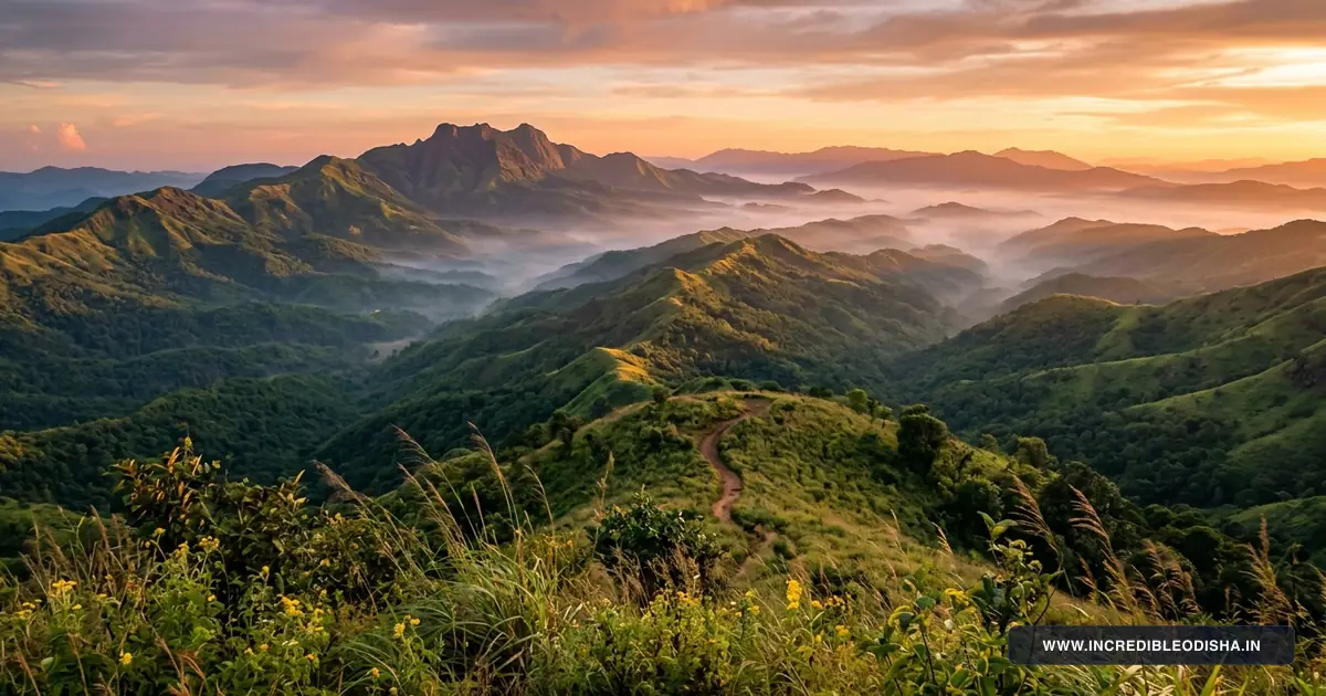
Jharsuguda occupies an undulating plateau characterized by rocky granite knolls, open deciduous forest ridges, and fertile alluvial valleys. The district is bounded by Sundargarh district to the north and east, Sambalpur district to the south and east, Bargarh district to the southwest, and Raigarh district of Chhattisgarh to the west. The perennial Ib River courses southward through the central plains before draining into the expansive Hirakud reservoir.
Alluvial soils border the river valleys, supporting vegetable cultivation and multi-crop paddy farming. In contrast, higher plateau tracts feature red sandy loams and laterites rich in commercial coal and mineral deposits.
Mixed deciduous forests shelter indigenous sal and mahua trees, creating scenic landscapes that rank among the 20 must-visit best tourist places in Odisha. Official administrative boundaries and census statistics are documented in the Census 2011 Official Jharsuguda District Directory and corroborated through the Incredible India Official Odisha Tourism Portal.
| Demographic & Geographic Indicator | Statistical Measurement | State Context & Baseline |
|---|---|---|
| Total Geographical Area | 2,114 sq km | Ranked 27th among Odisha districts |
| Total Population (Census 2011) | 579,505 residents | 296,690 males and 282,815 females |
| Population Density | 274 persons / sq km | Closely aligns with state baseline of 270 |
| Sex Ratio | 953 females per 1,000 males | Western Odisha baseline |
| Overall Literacy Rate | 78.86% | Male: 86.61% | Female: 70.73% |
| Administrative Headquarters | Jharsuguda Town | Situated along the Ib river trade corridor |
| Revenue Division | Northern Revenue Division | Divisional Commissioner headquarters at Sambalpur |
| Revenue Subdivisions | 1 Subdivision | Jharsuguda Sadar |
| Community Development Blocks | 5 CD Blocks | Administering 78 Gram Panchayats |
| Revenue Tehsils | 5 Tehsils | Cadastral revenue administration |
| Inhabited Villages | 351 rural settlements | Agrarian and industrial peri-urban villages |
| Motor Vehicle RTO Code | OD-23 | Regional Transport Office, Jharsuguda |
| Primary River Systems | Ib River, Bhedan River | Draining southward into Hirakud reservoir |
| Bordering Districts | Sundargarh, Sambalpur, Bargarh, Raigarh (Chhattisgarh) | Bordered by three Odisha districts and one neighboring state |
The regional climate experiences severe tropical extremes, with scorching summers and crisp, dry winters. Annual precipitation averages roughly 1,520 millimeters, the bulk of which falls during the southwest monsoon between July and September.
Landmark Directory: In Which District Is Each Destination Located?
Researchers, competitive examination aspirants, and cultural travelers frequently require confirmation regarding the administrative jurisdiction of regional destinations in western Odisha. The directory below confirms the official district and block assignments for famous regional landmarks.
| Landmark / Destination | District Assignment | Block / Subdivision | Geographic Setting & Connectivity |
|---|---|---|---|
| Koilighughar Waterfall | Jharsuguda District | Lakhanpur Block | 55 km west of town near Kushabhadra on National Highway 49 |
| Vikramkhol Prehistoric Rock Art | Jharsuguda District | Belpahar / Lakhanpur | 25 km west of town inside Belpahar reserve forest range |
| Ulapgarh Hill Fort Ruins | Jharsuguda District | Belpahar / Lakhanpur | Maheswar Pahad hilltop, 21 km from Jharsuguda |
| Jhadeswar Temple | Jharsuguda District | Jharsuguda Sadar Block | Ancient Shiva shrine on the banks of the Ib River, 3 km from town |
| Ramchandi Cave Temple | Jharsuguda District | Jharsuguda Sadar Block | River bluff cave shrine dedicated to Goddess Chandi, 10 km from town |
| Pikolgughar Forest Stream | Jharsuguda District | Kolabira Block | Forest picnic brook with shallow pools, 25 km southeast of town |
| Kolabira Fort Ruins | Jharsuguda District | Kolabira Block | Weathered 12th-century stone fort ruins of local chieftains |
| Chandi Mandir Brajarajnagar | Jharsuguda District | Brajarajnagar Municipality | Hilltop Shakti temple overlooking the industrial town, 12 km from town |
| Veer Surendra Sai Airport | Jharsuguda District | Jharsuguda Sadar Block | Durlaga aviation terminal along State Highway 10, 5 km from town |
Administrative Structure & Revenue Subdivisions
The governance of Jharsuguda district is led by the District Magistrate and Collector from the Collectorate complex in Jharsuguda town. The entire district falls under a single revenue subdivision, Jharsuguda Sadar, administered by a Sub-Collector who coordinates revenue enforcement, statutory magisterial functions, and municipal affairs.
Five revenue tehsils, namely Jharsuguda, Lakhanpur, Laikera, Kolabira, and Kirmira, manage land records, mutation petitions, and natural disaster relief. Urban governance operates across three municipal bodies: Jharsuguda Municipality, Brajarajnagar Municipality, and Belpahar Municipality. Rural communities are organized under five Community Development Blocks coordinating 78 Gram Panchayats.
Complete Directory of Community Development (CD) Blocks
The five community development blocks oversee grassroots rural welfare, primary education, irrigation projects, and village road infrastructure. The directory below details each block’s administrative headquarters, panchayat count, and socioeconomic profile.
| Block Name | Revenue Subdivision | Block Headquarters | Gram Panchayats | Primary Economic & Geographic Profile |
|---|---|---|---|---|
| Jharsuguda Sadar | Jharsuguda Sadar | Jharsuguda | 17 GPs | Peri-urban industrial belt, logistics parks, metal processing, dairy |
| Lakhanpur | Jharsuguda Sadar | Lakhanpur | 33 GPs | Largest block by area, Ib Valley coal mining, Koilighughar, Hirakud buffer |
| Laikera | Jharsuguda Sadar | Laikera | 11 GPs | Upland agrarian tracts, minor forest produce, pulse farming, sal groves |
| Kolabira | Jharsuguda Sadar | Kolabira | 10 GPs | Historic fort seat, brass handicraft artisans, Pikolgughar forest stream |
| Kirmira | Jharsuguda Sadar | Kirmira | 7 GPs | Northern agrarian border with Sundargarh, sugarcane farming, vegetables |
Lakhanpur contains the highest number of gram panchayats, driven by its extensive geographical reach along the banks of the Ib River and the upper reaches of the Hirakud reservoir. Kirmira represents a compact agrarian pocket focused on intensive irrigation and vegetable cultivation.
Vidhan Sabha (MLA) Seats & Parliamentary Constituencies
Jharsuguda district comprises two legislative assembly (Vidhan Sabha) constituencies under the 2008 Delimitation Commission framework. Both assembly constituencies fall entirely under the Bargarh Parliamentary Constituency (Lok Sabha Seat 3) for general elections.
Constituency boundaries and reservation statuses are officially published in the Election Commission of India Delimitation Directory.
| AC No. | Vidhan Sabha Constituency | Reservation Status | Territorial Coverage & Associated Blocks |
|---|---|---|---|
| 6 | Brajarajnagar | General | Brajarajnagar Municipality, Belpahar Municipality, Lakhanpur Block, and part of Jharsuguda Block |
| 7 | Jharsuguda | General | Jharsuguda Municipality, Jharsuguda Sadar Block, Kolabira Block, Laikera Block, and Kirmira Block |
Both legislative seats are unreserved general constituencies that witness competitive political contests driven by industrial labor welfare, environmental management, and infrastructure expansion. The district contributes significant electoral participation to the western Odisha parliamentary discourse.
Deep History, Princely Heritage & Freedom Movements
Archaeological discoveries confirm that human habitation in Jharsuguda dates back to the prehistoric era. The painted rock shelter at Vikramkhol, situated inside the dense reserve forests near Belpahar, contains pictographic inscriptions and animal engravings that scholars associate with Mesolithic and Neolithic hunter-gatherer cultures. These ancient rock paintings point to early human settlements flourishing along the Ib river system thousands of years before recorded dynastic chronicles.
During the medieval epoch, Jharsuguda formed an integral part of the kingdom of South Kosala and later came under the Chauhan rulers of Sambalpur. Local autonomous estates, including the Kolabira and Rampur zamindaris, fortified strategic hilltop outposts like Ulapgarh on Maheswar Pahad. These chieftains maintained independent garrisons to protect trade routes between Chhattisgarh and coastal Odisha.
Key Historical Milestones of Jharsuguda:
- Prehistoric Era: Creation of pictographic rock inscriptions and cave engravings at Vikramkhol.
- 12th Century: Construction of stone fortifications at Kolabira and Ulapgarh by regional dynasties.
- 1857: Active guerrilla participation in the Sambalpur rebellion under Veer Surendra Sai.
- 1891: Opening of the Bengal Nagpur Railway mainline, transforming Jharsuguda into a commercial transit junction.
- 1994: Separation from Sambalpur on January 1 to establish Jharsuguda as an independent revenue district.
During the 1857 Indian freedom movement, local chieftains and tribal warriors from Kolabira joined the legendary resistance led by Veer Surendra Sai against British forces. Chieftains like Karunakar Singh of Kolabira sacrificed their estates and lives resisting colonial expansion, cementing the region’s legacy of independence.
The district’s historical timeline is chronicled alongside broader state heritage in our guide to the ancient history of Odisha. Archaeological sites within the district remain recorded under the mandate of the Archaeological Survey of India Protected Monuments Directory.
Notable Personalities and Freedom Fighters of Jharsuguda
The soil of Jharsuguda has nurtured valiant freedom fighters, social reformers, and pioneering industrialists who steered the region through colonial subjugation into modern economic self-reliance.
- Veer Surendra Sai (1809–1884): The legendary hero of western Odisha who led an unyielding guerrilla resistance against the British East India Company for nearly three decades. His profound legacy is commemorated at the local airport.
- Karunakar Singh of Kolabira: The patriotic zamindar of Kolabira who mobilized local militia to support Veer Surendra Sai during the 1857 revolt. He was captured and martyred by colonial authorities for refusing to surrender his ancestral stronghold.
- Purna Chandra Rath: Dedicated historian, researcher, and archaeologist whose seminal field studies documented the prehistoric rock art of Vikramkhol and ancient Chauhan fortifications.
- Babu Chintamani Pujhari: Social reformer and education advocate who pioneered early schooling and vernacular printing presses in Jharsuguda town during the early twentieth century.
Strategic Economy, Mineral Wealth & Agriculture
The modern economy of Jharsuguda combines large-scale mineral extraction, heavy metallurgical industries, and rural riverine agriculture.
Ib Valley Coalfields and Heavy Industry
Jharsuguda sits atop one of the largest power-grade coal deposits in India. Mahanadi Coalfields Limited (MCL), a subsidiary of Coal India Limited, operates extensive open-cast and underground mines across the Ib Valley coalfields in Lakhanpur and Brajarajnagar. These mining operations provide raw fuel to thermal power stations across the country.
The district hosts Vedanta Aluminium, which operates a massive primary aluminium smelting complex and an associated captive power plant at Jharsuguda. Additionally, the Odisha Power Generation Corporation (OPGC) manages major thermal generation stations at Banharpalli, while TRL Krosaki Refractories at Belpahar manufactures specialized industrial refractory bricks for steelmakers nationwide.
Agriculture, River Irrigation and Forest Produce
Despite heavy industrialization, over fifty percent of the rural populace depends on agriculture. The alluvial valleys formed by the Ib and Bhedan rivers yield abundant crops of paddy, black gram, green gram, and mustard. Farmers utilize lift irrigation canals and riverbed aquifers to sustain vegetable farming during the winter months.
Forest communities in Laikera and Lakhanpur harvest valuable non-timber forest produce, including kendu leaves, mahua flowers, sal seeds, and natural wild honey. These forest commodities supply raw materials to regional cottage enterprises and provide vital supplemental household income during agricultural lean periods.
Major Educational Institutions and Healthcare Facilities
Educational facilities and medical infrastructure in Jharsuguda have expanded significantly to support the growing industrial workforce and urban population.
Higher Education and Technical Training
- Laxmi Narayan College (LN College): Established in 1969, this foundational degree institution provides comprehensive undergraduate programs in arts, science, and commerce.
- Government Engineering College, Jharsuguda: Delivers technical education and engineering diplomas focused on metallurgy, electrical systems, and mechanical trades.
- Belpahar Anchalik College: Serves higher education needs for students across the mining and industrial township of Belpahar.
- Government Women’s College, Jharsuguda: Provides specialized higher educational facilities for women from urban and rural communities.
Public Healthcare Infrastructure
District tertiary healthcare operates through the District Headquarter Hospital (DHH) located at Mangalbazar in Jharsuguda town. The hospital offers 24-hour emergency trauma care, pediatric units, pathology laboratories, and diagnostic imaging facilities.
Sub-divisional and community health centers (CHCs) in Brajarajnagar, Lakhanpur, Laikera, Kolabira, and Kirmira deliver essential outpatient services and maternity care to rural settlements. Industrial enterprises also operate dedicated occupational hospitals to care for their workforce and local surrounding villages.
Iconic Gastronomy: Traditional Foods and Sweets of Jharsuguda
The culinary identity of Jharsuguda is steeped in the robust flavors and rural agrarian traditions of western Odisha.
Signature Flavors of Jharsuguda:
- Chaula Bara: Crisp, golden fritters prepared from seasoned fermented rice and urad dal batter, deep-fried and served with fiery tomato-coriander chutney and spicy boiled potato curry.
- Bada Ghuguni: Puffy fried black gram lentil cakes paired with slow-cooked yellow pea gravy garnished with raw onions and green chilies.
- Sarsatia Sweet: A rare, delicate white lattice sweet made exclusively in western Odisha using resinous mucilage from the twigs of the Ganjer tree and fine rice flour.
- Mahua Pitha: Traditional steamed cakes flavored with sweet mahua flower nectar, cardamom, and fresh grated coconut.
Street food stalls across Purani Basti, Mangalbazar, and Sarbahal prepare hundreds of batches of fresh Chaula Bara every afternoon. Travelers exploring the local markets can sample authentic Odisha traditional foods, including flavorful river fish curries prepared with mustard gravy and fresh bamboo shoot curries known as Kardi.
Top Tourist Attractions and Sacred Shrines in Jharsuguda
Planning a dedicated sightseeing trip? Read our companion guide to the Best Places to Visit in Jharsuguda District Travel Guide for detailed itineraries, entry tickets, and photo viewpoints.
1. Koilighughar Waterfall
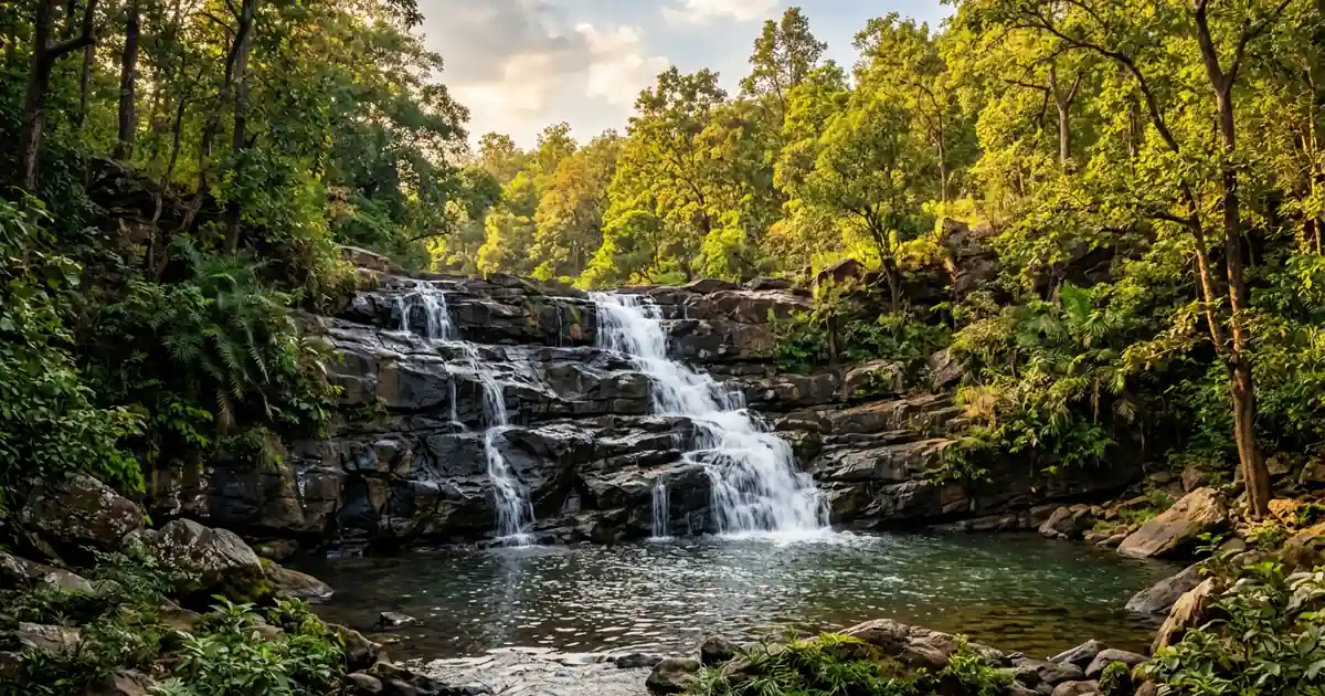
Situated near Kushabhadra village in Lakhanpur block, Koilighughar descends over 200 feet across tiered rocky ledges into a cool, natural forest pool. The stream feeds into the Ahiraj River before joining the Hirakud reservoir basin. Deep beneath the cascading water lies the submerged Maheswarnath Shiva lingam, which becomes visible during the dry summer months.
2. Bikramkhol Prehistoric Rock Art
Located in the Belpahar reserve forest range, Bikramkhol features an ancient sandstone rock shelter etched with prehistoric pictographic inscriptions. Discovered by modern archaeologists in the 1930s, the site preserves paintings and carved symbols dating back thousands of years. The shelter attracts historians and cultural researchers interested in India’s earliest communication systems.
3. Ulapgarh Hill Fort Ruins
Perched atop Maheswar Pahad near Belpahar, Ulapgarh preserves the stone foundations and ramparts of a medieval hilltop fortress constructed by the Naja dynasty. The elevated location provided strategic visual surveillance across river trade routes. Visitors can trek through forest paths to examine stone watchtower foundations and ancient water-harvesting cisterns carved directly into the rock.
4. Jhadeswar Temple
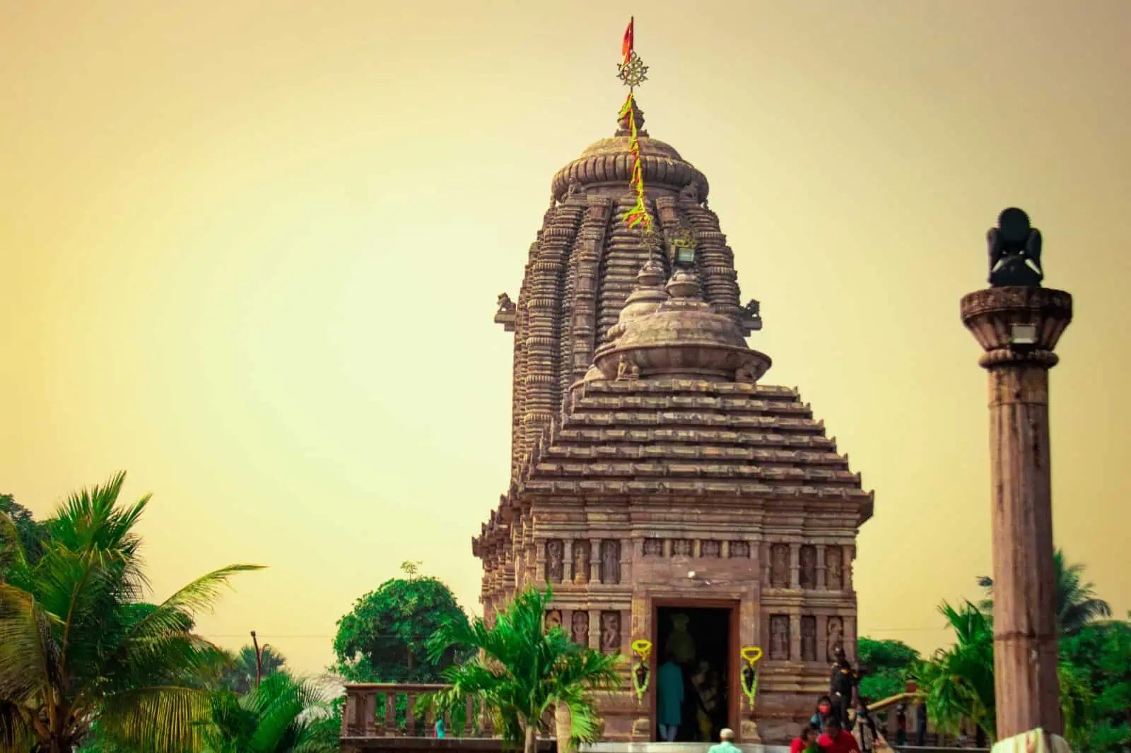
Positioned along the banks of the Ib River just three kilometers from the town center, Jhadeswar Temple honors Lord Shiva. The temple complex features landscaped riverfront gardens and hosts thousands of pilgrims during the annual Maha Shivratri festival, when devotees observe night-long fasts beside the riverbanks.
5. Ramchandi Cave Temple
Overlooking a scenic bend of the Ib River ten kilometers from Jharsuguda, Ramchandi Cave Temple is an ancient rock-cut shrine dedicated to Goddess Chandi. The river bluff setting provides peaceful vantage points across the water, making it a popular morning retreat for local families and spiritual seekers.
6. Kolabira Fort and Pikolgughar Stream
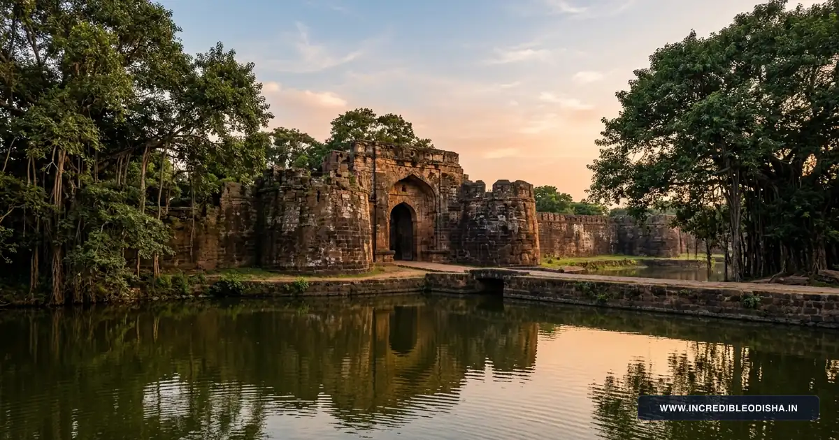
Kolabira preserves the weathered laterite gateway and crumbling stone defensive walls of the historic 12th-century Kolabira zamindari stronghold. A few kilometers away in the same block, Pikolgughar offers a tranquil forest stream with shallow sandstone pools and shaded picnic groves framed by sal and mahua trees.
Where to Stay: OTDC Panthanivas & Town Hotels
Jharsuguda provides convenient accommodation options catering to business executives, industrial consultants, and leisure travelers visiting western Odisha.
Government Accommodations
- OTDC Panthanivas, Jharsuguda: Conveniently located within reach of transit centers, offering air-conditioned rooms, a multi-cuisine restaurant serving regional Odia specialties, and conference amenities bookable via the Odisha Tourism Development Corporation Official Portal.
- Forest Rest Houses: Departmental rest houses at Lakhanpur and Belpahar provide economical stays for travelers planning early morning visits to Koilighughar or wildlife sanctuaries.
Private Business Hotels and Transit Lodging
- Sarbahal & Beheramal Corridor: Hosts contemporary business hotels, executive suites, and multi-cuisine restaurants equipped with Wi-Fi and conference facilities.
- Railway Station Road Cluster: Offers budget transit lodges, guest houses, and vegetarian dining halls suited for travelers arriving on late-night express trains.
Month-by-Month Climate & Seasonal Travel Advisory
The climate of Jharsuguda features intense summer heat, reliable monsoon rainfall, and pleasantly temperate winter conditions.
Winter Season (October to February)
Winter offers the best weather window for sightseeing, forest treks, and temple excursions across the district. Daytime temperatures range pleasantly between 14°C and 28°C with crisp breezes and clear skies. This period is ideal for picnicking at Koilighughar Waterfall and exploring the open-air archaeological ruins at Ulapgarh.
Summer Season (March to June)
Summers bring intense tropical heat, with daytime temperatures routinely exceeding 42°C during April and May due to mineral-rich rocky soils and industrial activity. Travelers visiting during the summer months should conduct outdoor activities during early morning hours and carry adequate hydration.
Monsoon Season (July to September)
The southwest monsoon brings heavy seasonal showers, transforming the dry scrub landscape into lush greenery. Forest streams and waterfalls achieve peak volume, making July and August spectacular for photography at Koilighughar, although rural dirt tracks can occasionally become muddy and slick.
How to Reach Jharsuguda & Inter-City Road Distance Matrix
Jharsuguda is one of the most accessible travel hubs in Odisha, boasting excellent air, rail, and road connections. Regional transportation arteries can be traced on our Odisha road and railway connectivity map.
Jharsuguda Transit Summary:
- By Air: Veer Surendra Sai Airport (JRG) at Durlaga operates daily commercial flights connecting Jharsuguda to Delhi, Kolkata, Bhubaneswar, Bengaluru, and Hyderabad.
- By Rail: Jharsuguda Junction (JSG) is a major five-way railway hub on the Howrah-Nagpur-Mumbai trunk line, served by dozens of daily superfast and express trains.
- By Road: National Highway 49 and the Biju Expressway (State Highway 10) connect the district seamlessly across northern, western, and southern Odisha.
Inter-City Road Distance Matrix
| Origin City / Transit Center | Primary Driving Route | Driving Distance | Approximate Travel Time |
|---|---|---|---|
| Sambalpur | Biju Expressway / NH-53 | 50 km | 1 hour |
| Sundargarh | State Highway 10 (SH-10) | 35 km | 45 minutes |
| Rourkela | Biju Expressway via Sundargarh | 130 km | 2 hours 30 minutes |
| Bargarh | NH-53 via Sambalpur bypass | 95 km | 2 hours |
| Bhubaneswar | NH-55 via Angul and Sambalpur | 330 km | 7 hours |
| Raigarh (Chhattisgarh) | NH-49 via Kanaktora border | 75 km | 1 hour 45 minutes |
| Raipur (Chhattisgarh) | NH-53 / NH-49 | 280 km | 5 hours 30 minutes |
Postal PIN Codes, Transport RTO & Emergency Helplines
The civic directory below provides essential postal codes, transport registration markers, and emergency contacts across the municipal and rural administrative divisions of Jharsuguda.
Major Postal PIN Codes in Jharsuguda
| Post Office Name | PIN Code | Postal Classification | Block / Region Covered |
|---|---|---|---|
| Jharsuguda Head Post Office (HPO) | 768201 | Head Post Office | Jharsuguda town core, Collectorate, Station |
| Industrial Estate Sub Post Office | 768203 | Sub Post Office | Vedanta complex, industrial corridor |
| Brajarajnagar Sub Post Office | 768216 | Sub Post Office | Brajarajnagar town, paper mill area |
| Belpahar Sub Post Office | 768218 | Sub Post Office | Belpahar town, TRL refractory zone |
| Lakhanpur Sub Post Office | 768219 | Sub Post Office | Lakhanpur block, Koilighughar region |
| Kolabira Sub Post Office | 768213 | Sub Post Office | Kolabira block, historic fort area |
| Laikera Sub Post Office | 768215 | Sub Post Office | Laikera block, northern forest belt |
Regional Transport Office (RTO)
All motor vehicles, commercial freight carriers, and driving permits registered in Jharsuguda carry the state registration code OD-23. The Regional Transport Office operates along the main administrative avenue near the Collectorate.
Emergency and Administrative Helplines
| Administrative & Emergency Service | Contact Helpline / Phone | Operational Availability |
|---|---|---|
| Integrated Emergency Response | 112 | 24 Hours Nationwide Emergency |
| Police Control Room (SP Office) | 06645-272222 / 100 | Round-the-clock law enforcement |
| District Collectorate Control Room | 06645-270003 | Office hours (10:00 AM to 5:30 PM) |
| District Headquarter Hospital (DHH) | 06645-272820 / 108 | 24 Hours Emergency Casualty |
| Fire and Disaster Response Station | 06645-272101 / 101 | 24 Hours Fire and Rescue Response |
Frequently Asked Questions About Jharsuguda District
How many community development blocks are there in Jharsuguda district?
Jharsuguda district comprises five community development blocks administered under the single revenue subdivision of Jharsuguda Sadar. These blocks coordinate local administration and welfare delivery across 78 gram panchayats.
What is the motor vehicle RTO registration code for Jharsuguda?
The official motor vehicle registration prefix for Jharsuguda district is OD-23. Vehicle registration certificates and transport permits are issued by the Regional Transport Office located in Jharsuguda town.
In which district is Koilighughar Waterfall located?
Koilighughar Waterfall is located in Jharsuguda district within Lakhanpur block near Kushabhadra village. The scenic waterfall cascades 200 feet over tiered rock shelves into a forest pool containing the submerged Maheswarnath Shiva lingam.
Does Jharsuguda have a commercial operational airport?
Jharsuguda hosts Veer Surendra Sai Airport (airport code JRG), located at Durlaga approximately five kilometers from the town center. The airport operates regular scheduled flights connecting western Odisha to major metropolitan destinations including Delhi, Kolkata, Bengaluru, and Bhubaneswar.
What is the best time of year to visit Jharsuguda district?
The best time to visit Jharsuguda district extends from October to February when winter temperatures stay pleasantly moderate between 14°C and 28°C. Summer months should generally be avoided for leisure sightseeing due to severe heat waves that frequently push temperatures above 42°C.