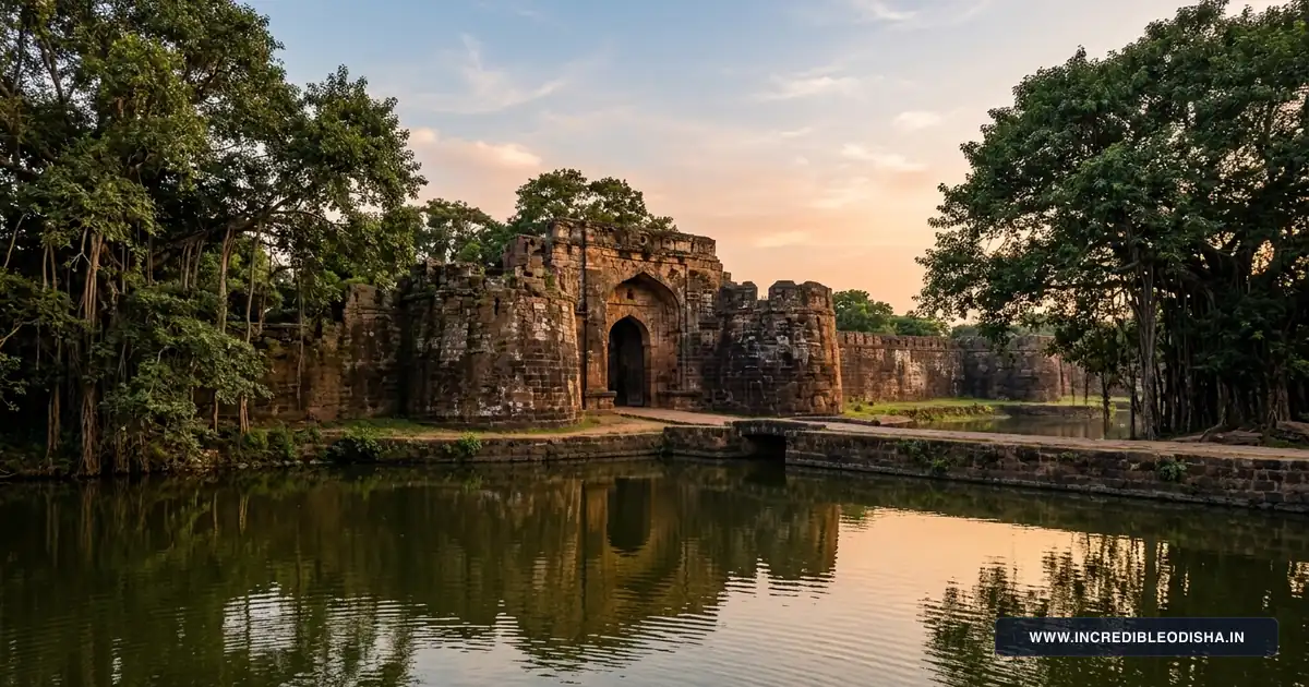
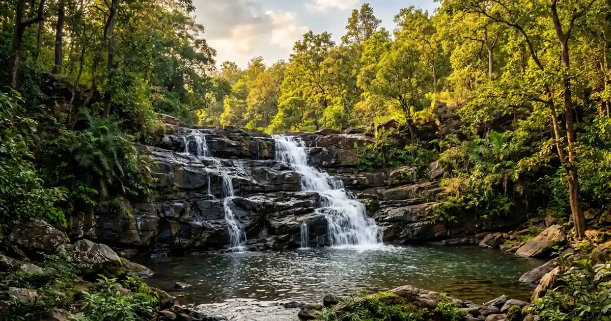
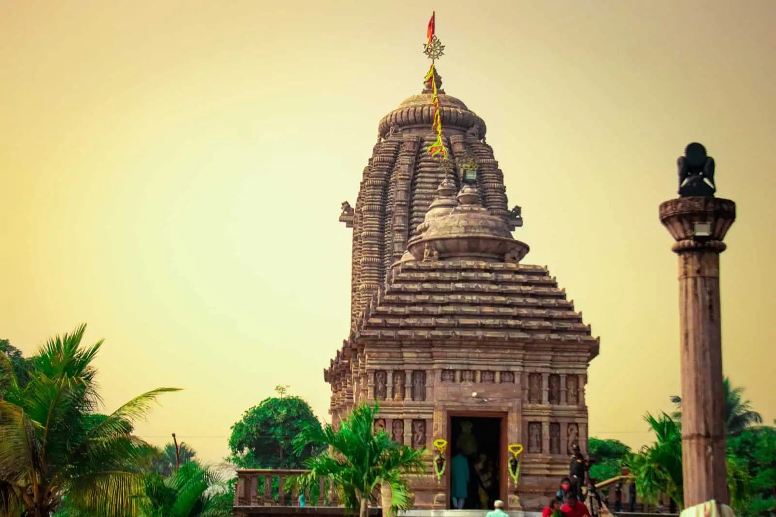
Koraput District Guide 2026: Map, Blocks, Places & History
Comprehensive guide to Koraput district in Odisha. Census 2011 demographics, 14 administrative blocks, Vidhan Sabha seats, history, places to visit, and map.
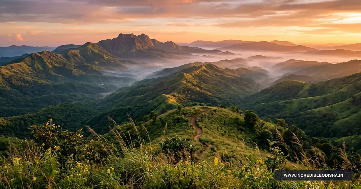
Koraput district anchors the southern highlands, indigenous cultural heritage, and mineral industrial network of Odisha. Situated in the elevated tracts of the Eastern Ghats, the district serves as an ecological sanctuary characterized by cloud-draped mountain peaks, deep river canyons, and sprawling coffee plantations. Alongside tribal agrarian traditions, Koraput hosts vital strategic assets including advanced aeronautical engineering at Sunabeda and primary alumina refining at Damanjodi.
Key Takeaways
- Koraput spans 8,807 square kilometers across 14 community development blocks and two revenue subdivisions.
- The district recorded a population of 1,379,647 during Census 2011, with a positive sex ratio of 1,032 females per 1,000 males.
- Signature landmarks include Deomali Peak, Duduma Waterfall on the Machkund River, and the sacred Gupteswar Cave temple.
- Major economic drivers center on NALCO bauxite refining, HAL aerospace manufacturing, GI-tagged Kotpad handloom textiles, and organic Arabica coffee.
- Jeypore Airport (PYB), Koraput railway junction (KRPU), and National Highway 26 supply vital connectivity across the southern plateau.
Demographic & Geographic Profile of Koraput District
Koraput occupies an undulating mountainous plateau averaging 870 meters above sea level in the southern spur of the Eastern Ghats. The district borders Nabarangpur to the north, Rayagada to the east, Malkangiri to the southwest, and neighboring Andhra Pradesh and Chhattisgarh to the south and west.
The perennial Kolab and Machkund rivers carve extensive valleys across this highland tableland. Both river networks descend through rugged gorges before entering the Godavari basin.
Lateritic red gravelly soils and sandy loams cover the mountain ridges, while rich alluvial clay lines the fertile valley floors of Jeypore and Kotpad. Forest canopy covers over twenty percent of the geographic area, featuring mixed moist deciduous woodlands, bamboo groves, and native sal trees.
These highland forests and cool mountain summits rank among the prominent tourist places in Odisha. Official administrative boundaries and demographic figures are verified in the Census 2011 Official Koraput District Directory and corroborated through the Incredible India Official Odisha Tourism Portal.
| Demographic & Geographic Indicator | Statistical Measurement | State Context & Baseline |
|---|---|---|
| Total Geographical Area | 8,807 sq km | Ranked 3rd largest district in Odisha |
| Total Population (Census 2011) | 1,379,647 residents | 678,809 males and 700,838 females |
| Population Density | 157 persons / sq km | Sparsely populated highland plateau |
| Sex Ratio | 1,032 females per 1,000 males | Significantly higher than state average |
| Overall Literacy Rate | 49.21% | Male: 60.32% | Female: 38.55% |
| Administrative Headquarters | Koraput Town | Located at an elevation of 870 meters |
| Largest Commercial Center | Jeypore | Historic royal capital and trading hub |
| Revenue Division | Southern Revenue Division | Revenue Divisional Commissioner at Berhampur |
| Revenue Subdivisions | 2 Subdivisions | Koraput Sadar and Jeypore |
| Community Development Blocks | 14 CD Blocks | Administering 240 Gram Panchayats |
| Revenue Tehsils | 15 Tehsils | Cadastral land administration |
| Inhabited Villages | 1,929 rural settlements | Dispersed tribal hamlets and agrarian villages |
| Motor Vehicle RTO Code | OD-10 | Regional Transport Office, Koraput |
| Primary River Systems | Kolab (Sabari), Machkund, Patali | Draining into the Godavari river basin |
| Highest Elevation Point | Deomali Peak (1,672 meters) | Highest mountain summit in Odisha |
| Bordering Districts & States | Nabarangpur, Rayagada, Malkangiri, Andhra Pradesh, Chhattisgarh | Bordered by three districts and two states |
The high elevation produces a moderate subtropical highland climate, sparing the district from the extreme summer heat felt across coastal Odisha. Annual precipitation averages roughly 1,560 millimeters, delivered predominantly during monsoon squalls between June and October.
Landmark Directory: In Which District Is Each Destination Located?
Travelers, researchers, and civil service aspirants frequently seek clarification regarding the administrative location of highland peaks, cave shrines, and river waterfalls across southern Odisha. The directory below confirms official district and block assignments for famous regional destinations.
| Landmark / Destination | District Assignment | Block / Subdivision | Geographic Setting & Connectivity |
|---|---|---|---|
| Deomali Mountain Peak | Koraput District | Pottangi Block | 45 km east of Koraput town; highest point in Odisha (1,672 m) |
| Duduma Waterfall | Koraput District | Lamtaput Block | 70 km southwest of Koraput on the Machkund River gorge |
| Gupteswar Cave Temple | Koraput District | Boipariguda Block | 55 km west of Jeypore inside dense reserve forest on Kolab River |
| Sabara Srikhetra Jagannath Temple | Koraput District | Koraput Sadar Block | Hilltop shrine in Koraput town celebrating tribal Jagannath ties |
| Kolab Dam & Reservoir | Koraput District | Koraput / Jeypore | 15 km from Koraput town; hydro-electric project with gardens |
| Tribal Museum Koraput | Koraput District | Koraput Sadar Block | Town center; repository of artifacts from 62 indigenous tribes |
| Subai Jain Temple Sculptures | Koraput District | Nandapur Block | 35 km south of Koraput; 4th-century rock-cut Tirthankara panels |
| Jeypore Royal Palace (Rani Mahal) | Koraput District | Jeypore Municipality | Historic city center of Jeypore; 19th-century royal seat |
| Kotpad Textile Weaving Village | Koraput District | Kotpad Block | 40 km north of Jeypore on NH-26; organic natural dye craft |
| Putsil Mountain Valley | Koraput District | Semiliguda Block | 35 km from Koraput near Deomali; scenic highland tableland |
Administrative Structure & Revenue Subdivisions
Administrative governance across Koraput district is coordinated by the District Magistrate and Collector from the Collectorate complex in Koraput town. The district is divided into two revenue subdivisions: Koraput Sadar and Jeypore. Each subdivision operates under a Sub-Collector responsible for revenue collection, magisterial administration, and tribal land protection.
Fifteen revenue tehsils handle cadastral land records, mutation settlements, and disaster mitigation. Urban administration is managed through municipal councils in Jeypore, Koraput, and Sunabeda, alongside the Notified Area Council (NAC) in Kotpad. Rural governance coordinates through 14 Community Development Block headquarters and 240 Gram Panchayats.
Complete Directory of Community Development (CD) Blocks
The 14 community development blocks oversee grassroots welfare schemes, tribal development agency projects, rural drinking water networks, and school education. The directory below outlines each block’s administrative subdivision, headquarters, panchayat count, and geographic focus.
| Block Name | Revenue Subdivision | Block Headquarters | Gram Panchayats | Primary Economic & Geographic Profile |
|---|---|---|---|---|
| Koraput | Koraput Sadar | Koraput Town | 17 GPs | Administrative nucleus, coffee estates, Sabara Srikhetra |
| Semiliguda | Koraput Sadar | Semiliguda | 16 GPs | Commercial market center, vegetable horticulture, NH-26 trade |
| Pottangi | Koraput Sadar | Pottangi | 16 GPs | High mountain terrain, Deomali foothills, border checkpost |
| Nandapur | Koraput Sadar | Nandapur | 17 GPs | Ancient kingdom capital, Batisa Singhasana, Jain rock carvings |
| Lamtaput | Koraput Sadar | Lamtaput | 16 GPs | Machkund river basin, Duduma access corridor, tribal haats |
| Dasamantapur | Koraput Sadar | Dasamantapur | 16 GPs | Rugged forested terrain, minor forest produce, watershed projects |
| Laxmipur | Koraput Sadar | Laxmipur | 17 GPs | Bauxite hill corridors, railway junction on Rayagada line |
| Narayanpatna | Koraput Sadar | Narayanpatna | 15 GPs | Forested mountain valley, shifting cultivation, cashew plantations |
| Bandhugaon | Koraput Sadar | Bandhugaon | 14 GPs | Eastern boundary with Andhra Pradesh, ginger and turmeric farming |
| Jeypore | Jeypore | Jeypore Town | 22 GPs | Commercial capital, rice mills, timber trade, Kolab canals |
| Borigumma | Jeypore | Borigumma | 30 GPs | Largest agrarian block, extensive paddy cultivation, highway junction |
| Kotpad | Jeypore | Kotpad | 17 GPs | Traditional handloom weaving, organic farming, Chhattisgarh border |
| Kundura | Jeypore | Kundura | 13 GPs | Tribal farming settlements, forest fruit gathering, river streams |
| Boipariguda | Jeypore | Boipariguda | 14 GPs | Gupteswar cave sanctuary, limestone karst, Malkangiri gateway |
Borigumma manages the highest number of gram panchayats, serving as the agricultural grain store of the district. In contrast, southern highland blocks like Pottangi and Nandapur focus heavily on horticulture and terrace farming along steep mountain slopes.
Vidhan Sabha (MLA) Seats & Parliamentary Constituencies
Koraput district comprises five legislative assembly (Vidhan Sabha) constituencies under the 2008 Delimitation Commission order. All five assembly constituencies form integral segments of the Koraput Parliamentary Constituency (Lok Sabha Seat 21), which is reserved for Scheduled Tribes (ST).
Constituency boundaries and reservation statuses are officially published in the Election Commission of India Delimitation Directory.
| AC No. | Vidhan Sabha Constituency | Reservation Status | Territorial Coverage & Associated Blocks |
|---|---|---|---|
| 141 | Laxmipur | Scheduled Tribe (ST) | Laxmipur Block, Dasamantapur Block, Narayanpatna Block, and Bandhugaon Block |
| 142 | Kotpad | Scheduled Tribe (ST) | Kotpad Block, Kundura Block, Kotpad NAC, and parts of Borigumma Block |
| 143 | Jeypore | General | Jeypore Municipality and rural panchayats of Jeypore Block |
| 144 | Koraput | Scheduled Caste (SC) | Koraput Municipality, Sunabeda Municipality, and Koraput Sadar Block |
| 145 | Pottangi | Scheduled Tribe (ST) | Pottangi Block, Semiliguda Block, Nandapur Block, and Lamtaput Block |
Electoral representation across the district reflects the substantial indigenous population, with four of the five seats reserved for Scheduled Tribes or Scheduled Castes. These constituencies consistently register high civic voter turnout during general and assembly elections.
Deep History, Princely Heritage & Freedom Movements
Human settlement in the Koraput highlands extends back to antiquity, evidenced by prehistoric microliths and early Jain rock shrines discovered around Nandapur and Subai. In the medieval era, Nandapur served as the capital of the Silavamsi dynasty.
The solar-dynasty Jeypore kingdom emerged under King Vinayaka Deva in the mid-fifteenth century. The rulers of Jeypore governed extensive domains stretching across southern Odisha and the northern Circars of Andhra Pradesh.
During the seventeenth century, King Vira Vikrama Deva shifted the royal capital from Nandapur to Jeypore, constructing fortifications, water tanks, and palatial residences. Under British colonial rule, the kingdom was organized into the Jeypore Zamindari Estate within the Madras Presidency. Colonial administrators established a military station at Koraput in 1870, choosing the elevated tableland for its cooler climate and strategic vantage over mountain passes.
Key Historical Milestones of Koraput:
- 4th–5th Century: Flourishing of early Jain hermitages and rock carvings in Nandapur.
- 1443 CE: Establishment of the Jeypore Kingdom under King Vinayaka Deva.
- 1648 CE: Transfer of the royal capital from Nandapur to Jeypore.
- 1870 CE: Establishment of Koraput as the administrative headquarters.
- 1942 CE: Quit India uprising led by tribal freedom hero Saheed Laxman Nayak.
- 1992 CE: Administrative reorganization separating undivided Koraput into four modern districts.
During the Indian freedom struggle, the tribal population organized powerful resistance movements against oppressive forest laws and colonial taxation. The most notable uprising occurred during the 1942 Quit India Movement under the leadership of Saheed Laxman Nayak. A native of Tentuliguma in Boipariguda block, Laxman Nayak mobilized thousands of tribal marchers before being arrested by British police and executed in Berhampur Central Jail.
The deep roots of regional history and dynastic traditions are detailed alongside broader state milestones in our guide to the ancient history of Odisha. Ancient shrines and sculptures in the district remain preserved under the mandate of the Archaeological Survey of India Protected Monuments Directory.
Notable Personalities and Freedom Fighters of Koraput
Koraput has produced revered freedom fighters, distinguished literary scholars, and visionaries whose contributions shaped modern Odisha.
- Saheed Laxman Nayak (1899–1943): Prominent tribal freedom hero and Gandhian activist from the Bhuyan community. He led mass demonstrations against colonial forest taxes before being falsely implicated and hanged on March 29, 1943.
- Maharaja Vikram Dev IV (1869–1951): The scholarly ruler of Jeypore whose generous financial patronage funded the establishment of Andhra University and supported the historic movement to create a separate Odisha province in 1936.
- Gopinath Mohanty (1914–1991): Celebrated Odia novelist and Jnanpith Award laureate who served as an administrative officer in Koraput. His masterpieces Paraja and Amrutara Santana offer profound literary studies of indigenous tribal life and customs.
- Radhakrushna Biswasroy (1905–1984): Foremost freedom fighter, social worker, and political leader known as the architect of the Congress movement across the Koraput hill tracts.
Strategic Economy, Mineral Wealth & Agriculture
The economic framework of Koraput combines large-scale public industrial complexes with indigenous forest trades and specialized mountain agriculture.
High-Technology Industry and Mining
Koraput hosts critical public-sector manufacturing hubs that contribute directly to India’s aerospace and metallurgical security. Hindustan Aeronautics Limited (HAL) operates its Engine Division at Sunabeda, manufacturing advanced turbojet engines and navigational systems for Indian Air Force fighter aircraft. The industrial township at Sunabeda provides modern civic infrastructure and technical employment.
In Damanjodi, National Aluminium Company Limited (NALCO) operates one of Asia’s largest open-cast bauxite mines at the Panchpatmali hills. An automated overland conveyor belt transports raw ore directly to the adjacent refinery, producing alumina hydrate shipped to domestic smelters and international export ports.
Specialty Agriculture and GI-Tagged Handlooms
Agricultural practice in the highlands focuses on finger millet (ragi), paddy, maize, and aromatic spices like turmeric and ginger. The elevation and cloud-cover conditions along the Eastern Ghats slopes support organic Arabica coffee cultivation. Supported by the Coffee Board of India, tribal smallholders harvest shade-grown specialty coffee marketed nationally under the Koraput Coffee brand.
In Kotpad, hereditary weavers of the Mirgan community produce hand-spun cotton textiles that hold Geographical Indication (GI) status. Artisans extract natural organic red and brown dyes from the roots of the local Aul (Indian madder) tree, creating sustainable fabrics adorned with tribal motifs of crab, boat, and bow symbols.
Major Educational Institutions and Healthcare Facilities
The district provides higher education and specialized healthcare networks serving the interior populations of southern Odisha.
Higher Education and Research Centers
- Central University of Odisha (CUO): Established in 2009 at Sunabeda, CUO offers undergraduate, postgraduate, and doctoral degrees in tribal studies, linguistics, biodiversity, and sciences.
- Saheed Laxman Nayak Medical College and Hospital (SLN MCH): Located in Koraput town, this government medical college provides tertiary medical training and healthcare.
- Vikram Deb Autonomous College: Founded in 1947 in Jeypore, this historic academic institution serves thousands of students across southern Odisha and neighboring districts.
- College of Agriculture (OUAT): Located in Koraput, providing specialized research into hill agricultural systems and soil preservation.
Public Healthcare Infrastructure
Tertiary medical care is centered at SLN Medical College and Hospital in Koraput, equipped with multi-specialty trauma centers, neonatal care, and modern diagnostic laboratories. The District Headquarter Hospital network is supported by sub-divisional hospitals in Jeypore and community health centers (CHCs) across all 14 blocks.
Specialized tribal health programs and mobile medical units deliver preventive healthcare and maternal services to remote forest settlements in Narayanpatna and Dasamantapur.
Iconic Gastronomy: Traditional Foods and Sweets of Koraput
Culinary practices in Koraput reflect the wild forest bounty and nutritious millet staples of the Eastern Ghats.
Signature Flavors of Koraput:
- Mandia Jau: Fermented finger millet porridge served cold with sour curd, chopped onions, and green chilies, offering cooling refreshment during midday heat.
- Kardi & Hendua: Freshly harvested tender bamboo shoots cooked with mustard paste, or sun-dried bamboo shavings simmered into sour lentil curries.
- Poda Pitha: Traditional slow-roasted rice and jaggery cakes baked inside sal leaves over charcoal embers during agricultural harvest festivals.
- Koraput Arabica Coffee: Freshly brewed highland coffee known for delicate citrus notes and rich chocolate undertones.
Street markets in Jeypore and Koraput serve hot aloo chop, crispy vada, and fresh local sweets including Manda Pitha. Visitors exploring weekly village haats can sample authentic Odisha traditional foods alongside wild forest mushrooms, roasted tubers, and fresh river fish caught in mountain streams.
Top Tourist Attractions and Sacred Shrines in Koraput
Planning a dedicated sightseeing trip? Read our companion guide to the 20 Best Places to Visit in Koraput Travel Guide for detailed itineraries, entry tickets, and photo viewpoints.
1. Deomali Mountain Peak
Rising to an altitude of 1,672 meters in Pottangi block, Deomali is the highest mountain peak in Odisha. The summit plateau provides panoramic views over rolling mountain ridges, deep green valleys, and swirling cloud formations. The state tourism department has developed eco-cottages and walking trails to support highland travelers and adventure paragliders.
2. Duduma Waterfall (Machkund Gorge)
Plunging 175 meters over vertical granite cliffs along the Odisha and Andhra Pradesh boundary, Duduma is one of India’s most dramatic waterfalls. The waterfall feeds the Machkund Hydroelectric Project, generating electricity across both states. The deep mist and thunderous plunge create an unforgettable natural spectacle for travelers visiting from Lamtaput.
3. Gupteswar Cave Temple
Located inside dense sal and teak forests in Boipariguda block, Gupteswar is a sacred limestone cave shrine housing a colossal natural stalagmite Shiva lingam. The cave sits beside the murmuring Sabari River and attracts thousands of devotees during the Maha Shivratri and Shravan pilgrimage seasons.
4. Sabara Srikhetra Jagannath Temple
Constructed atop a green hillock in Koraput town, Sabara Srikhetra honors the sacred relationship between Lord Jagannath and his indigenous Sabara tribal devotees. Unlike conventional temples, the complex promotes universal access and hosts an extensive tribal research museum and medicinal botanical garden.
5. Kolab Dam & Reservoir
Constructed across the Kolab River near Jeypore, this major hydro-electric reservoir forms an expansive water body dotted with green islands. The adjacent Kolab Botanical Garden features manicured lawns, terraced gardens, and illuminated water fountains that attract weekend family picnickers.
6. Subai Jain Temple Sculptures
Situated near Nandapur, Subai preserves rare historical traces of Jainism in southern Odisha. Dating to the early medieval era, the rock-cut panels feature finely carved Tirthankara relief figures, including Lord Rishabhanatha and Parshvanatha, surrounded by stone ruins of ancient monastic sanctuaries.
Where to Stay: OTDC Panthanivas & Town Hotels
Koraput and Jeypore offer comfortable lodging options suitable for holidaying families, backpackers, and business visitors.
Government Accommodations
- OTDC Panthanivas, Koraput: Located near the town center, offering air-conditioned rooms, a restaurant serving regional cuisine, and local travel desks bookable via the Odisha Tourism Development Corporation Official Portal.
- Deomali Eco Cottages: Eco-tourism tents and cottages managed by local community groups, offering scenic overnight stays on the mountain plateau.
Private Business Hotels and Town Lodges
- Jeypore Commercial Corridor: MG Road and Main Road host well-appointed business hotels with modern dining rooms, conference venues, and reliable travel desks.
- Koraput Town Center: Provides economical tourist lodges and family guest houses within short walking distance of the bus terminal and district offices.
Month-by-Month Climate & Seasonal Travel Advisory
Thanks to its elevated mountain setting, Koraput enjoys cooler weather than the coastal plains throughout the year.
Winter Season (October to February)
Winter presents the most delightful time for outdoor adventures, hill trekking, and sightseeing across the district. Daytime temperatures hover between 15°C and 25°C, while night temperatures can drop to 6°C at high altitudes like Deomali. Crisp air and clear blue skies make this period perfect for waterfall excursions and village market walks.
Summer Season (March to June)
Summers bring warm daytime conditions with temperatures averaging between 30°C and 37°C. While midday can feel warm, mornings and evenings remain pleasantly breezy compared to coastal Odisha. Travelers should carry sun protection and schedule mountain climbs during early morning hours.
Monsoon Season (July to September)
The southwest monsoon deposits heavy rainfall, turning hill slopes deep green and swelling waterfalls like Duduma to peak volume. Travelers should check road conditions before driving along mountain ghats, as persistent rainfall can occasionally trigger minor landslides.
How to Reach Koraput & Inter-City Road Distance Matrix
Koraput connects to regional transit centers through mountain rail lines, state highways, and regional air services. Routes can be surveyed on our Odisha road and railway connectivity map.
Koraput Transit Summary:
- By Air: Jeypore Airport (PYB) operates scheduled commercial flights to Bhubaneswar and Visakhapatnam. Visakhapatnam International Airport (VTZ) sits 200 kilometers south.
- By Rail: Koraput Junction (KRPU) sits on the famous Kottavalasa-Kirandul (K-K) line, offering overnight express services like the Hirakhand Express to Bhubaneswar.
- By Road: National Highway 26 connects Koraput with Raipur, Visakhapatnam, and Berhampur through paved mountain roads. Travelers journeying northward along NH-26 can consult our comprehensive Kalahandi district guide for temple and waterfall itineraries.
Inter-City Road Distance Matrix
| Origin City / Transit Center | Primary Driving Route | Driving Distance | Approximate Travel Time |
|---|---|---|---|
| Jeypore | NH-26 (Ghat Road) | 25 km | 45 minutes |
| Rayagada | NH-326 via Laxmipur | 110 km | 2 hours 45 minutes |
| Visakhapatnam (AP) | NH-26 via Salur Ghat | 200 km | 4 hours 30 minutes |
| Berhampur | NH-26 & NH-59 via Aska | 300 km | 7 hours |
| Bhubaneswar | NH-26 & NH-16 via Berhampur | 480 km | 10 hours |
| Jagdalpur (Chhattisgarh) | NH-63 via Jeypore | 105 km | 2 hours 30 minutes |
| Raipur (Chhattisgarh) | NH-26 & NH-30 | 340 km | 7 hours |
Postal PIN Codes, Transport RTO & Emergency Helplines
The civic directory below provides postal PIN codes, transport registration indicators, and essential administrative helplines for Koraput district.
Major Postal PIN Codes in Koraput
| Post Office Name | PIN Code | Postal Classification | Block / Region Covered |
|---|---|---|---|
| Koraput Head Post Office (HPO) | 764020 | Head Post Office | Koraput Town, Collectorate, SLN MCH |
| Jeypore Head Post Office (HPO) | 764001 | Head Post Office | Jeypore Town, commercial market |
| Sunabeda Sub Post Office | 763002 | Sub Post Office | HAL township, Central University |
| Damanjodi Sub Post Office | 763008 | Sub Post Office | NALCO township, Panchpatmali bauxite |
| Semiliguda Sub Post Office | 764036 | Sub Post Office | Semiliguda market, NH-26 corridor |
| Kotpad Sub Post Office | 764058 | Sub Post Office | Kotpad handloom center |
| Pottangi Sub Post Office | 764039 | Sub Post Office | Pottangi Block, Deomali foothills |
| Boipariguda Sub Post Office | 764043 | Sub Post Office | Boipariguda, Gupteswar shrine area |
Regional Transport Office (RTO)
All motor vehicles, commercial logistics carriers, and passenger buses registered in Koraput district carry the official registration prefix OD-10. A secondary transport office functions in Jeypore to handle commercial freight across the grain and mining corridors.
Emergency and Administrative Helplines
| Administrative & Emergency Service | Contact Helpline / Phone | Operational Availability |
|---|---|---|
| Integrated Emergency Response | 112 | 24 Hours Nationwide Emergency |
| Police Control Room (SP Office) | 06852-250325 / 100 | Round-the-clock law enforcement |
| District Collectorate Control Room | 06852-250222 | Office hours (10:00 AM to 5:30 PM) |
| SLN Medical College Casualty | 06852-250450 / 108 | 24 Hours Emergency Trauma Center |
| Fire and Disaster Management Station | 06852-250101 / 101 | 24 Hours Fire and Rescue Response |
Frequently Asked Questions About Koraput District
How many community development blocks are there in Koraput district?
Koraput district comprises 14 community development blocks administered under two revenue subdivisions, Koraput Sadar and Jeypore. These blocks supervise rural governance and welfare distribution across 240 gram panchayats.
What is the motor vehicle RTO registration code for Koraput?
The official motor vehicle registration prefix for Koraput district is OD-10. Vehicle registration documents and driving permits are administered by the Regional Transport Office in Koraput town.
In which district is Deomali Mountain Peak located?
Deomali Mountain Peak is located in Koraput district within Pottangi block approximately 45 kilometers east of Koraput town. Rising to an altitude of 1,672 meters, it represents the highest mountain summit in Odisha.
Does Koraput have an operational commercial airport?
Jeypore Airport (code PYB), located approximately 25 kilometers west of Koraput town, operates scheduled commercial flights connecting the region to Bhubaneswar and Visakhapatnam. Additional domestic and international flights operate from Visakhapatnam International Airport, situated 200 kilometers to the south.
What is the best time of year to visit Koraput district?
The best time to visit Koraput district extends from October to February when daytime temperatures stay pleasantly temperate between 15°C and 25°C. Crisp winter skies provide optimal conditions for mountain trekking at Deomali and visiting waterfalls across the plateau.