Kalahandi District: Heritage, Waterfalls, Indravati & Travel Guide
Discover Kalahandi district in Odisha. Explore Maa Manikeswari Temple, Chhatar Yatra, Karlapat Wildlife Sanctuary, Phurlijharan Falls, and complete travel logistics.
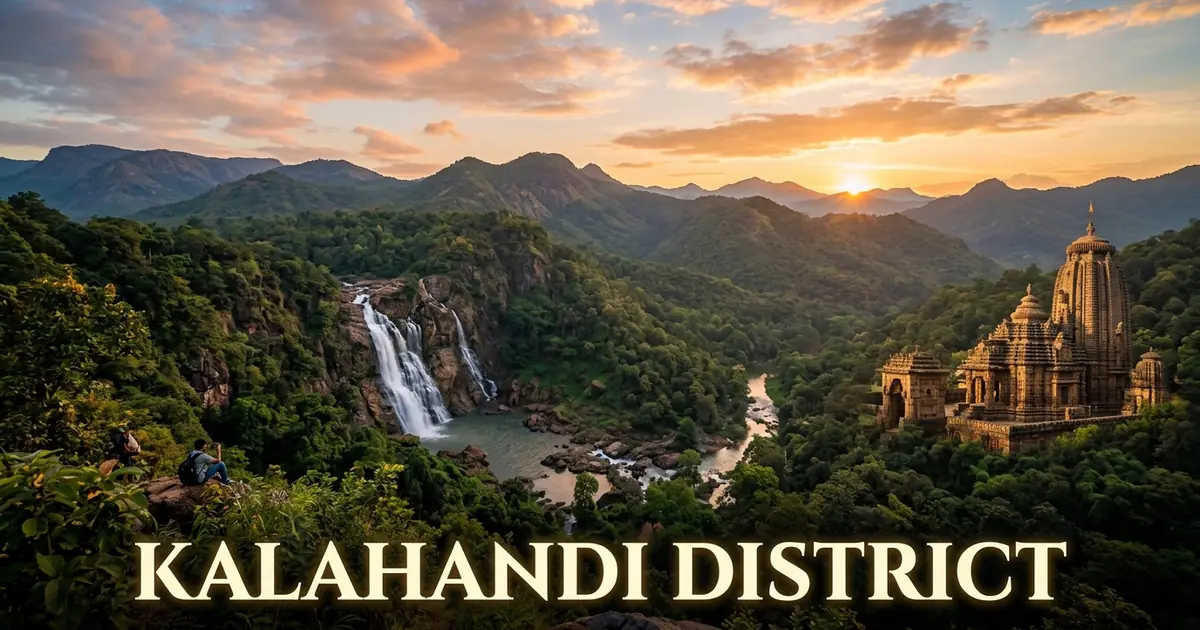
Kalahandi district occupies a prominent place across southwestern Odisha, distinguished by ancient river valleys, dense deciduous forests, and a remarkable modern economic turnaround. Known in classical antiquities as Mahakantara and Karonda Mandal, this territory was governed for centuries by the Naga dynasty, who established enduring religious shrines, mountain citadels, and distinctive cultural traditions.
Over recent decades, Kalahandi has transformed from a rain-dependent dryland into a major agricultural power center. The commissioning of the Upper Indravati Hydro Electric and Irrigation Project brought perennial canal water to vast plains, turning Dharmagarh and Junagarh into major paddy producers.
Alongside modern canal networks, the district preserves deep indigenous roots. The hill ranges shelter diverse Kondh and Gond communities, the heroic Ghumura martial dance echoes across harvest festivals, and weavers in Chicheguda create celebrated GI-tagged Habaspuri handloom textiles.
Key Takeaways
- Kalahandi spans 7,920 square kilometers across two administrative subdivisions, thirteen blocks, and thirteen tehsils.
- The district recorded a population of 1,576,869 in Census 2011, featuring a positive sex ratio of 1,003 females per 1,000 males.
- Maa Manikeswari Temple in Bhawanipatna hosts the famous Chhatar Yatra during Mahashtami of Durga Puja, drawing hundreds of thousands of devotees.
- The Upper Indravati Hydro Electric and Irrigation Project transformed the district into a leading rice producer across Odisha.
- Key cultural and natural attractions include Karlapat Wildlife Sanctuary, Phurlijharan Waterfall, Asurgarh archaeological settlement, Belkhandi temple ruins, and GI-tagged Habaspuri sarees.
Introduction to Kalahandi: The Land of Royal Legacies, Waterfalls & Agricultural Revival
Kalahandi is situated in southwestern Odisha, bounded by Balangir and Nuapada districts to the north, Nabarangpur and Koraput districts to the south, Rayagada and Kandhamal districts to the east, and Gariaband district of Chhattisgarh to the west. The district headquarters is Bhawanipatna, a historic princely town located along National Highway 26.
Geographically, Kalahandi forms a natural transit bridge between the coastal plains of eastern Odisha and the central Indian tablelands of Chhattisgarh. The district covers 7,920 square kilometers, accounting for over five percent of Odisha’s total land area. It ranges from rugged Eastern Ghat hill ranges reaching over 1,000 meters in Thuamul Rampur to the fertile alluvial plains of Dharamgarh and Junagarh.
Motor vehicle administration operates under the regional transport code OD-08, registered at the Regional Transport Office in Bhawanipatna.
| Geographic Metric | Canonical Statistic | Regional Context |
|---|---|---|
| Total Geographical Area | 7,920 sq km | Seventh-largest district territory in Odisha |
| District Headquarters | Bhawanipatna | Historic seat of the Naga royal rulers |
| Sub-Divisional Urban Centers | Bhawanipatna, Dharamgarh | Administrative and agricultural command hubs |
| Geographic Coordinates | 19°03’ N – 20°28’ N, 82°41’ E – 83°42’ E | Southwestern highland and river basin territory |
| Average Elevation | 248 meters (814 feet) above sea level | Ranging from 200-meter plains to 1,200-meter hill plateaus |
| Forest Cover | 2,538 sq km | Over 32.05% of district geographical area |
| Motor Vehicle Registration (RTO) | OD-08 | Regional Transport Office, Bhawanipatna |
The climate of Kalahandi is characterized by hot, dry summers, a reliable southwest monsoon, and cool winter months. During the peak summer period between April and June, daytime temperatures frequently rise above 42°C across the valley basins. In contrast, the high-altitude plateaus of Thuamul Rampur and Karlapat experience mild temperatures throughout the year.
The southwest monsoon brings an average annual precipitation of approximately 1,378 millimeters between June and September. This seasonal rainfall replenishes the reservoirs, nourishes the sal forests, and feeds numerous forest waterfalls across the Eastern Ghat escarpment.
Official government notifications and verified district tourism details are regularly published through the Odisha Tourism Official Portal and district administration archives.
Geographical Landscape, Tel-Indravati Watersheds & Eastern Ghats
The physical geography of Kalahandi represents a captivating intersection of two major river systems and high Eastern Ghats mountain plateaus. The northern and northeastern tracts drain into the Tel River, a major tributary of the Mahanadi, while the southern highland valleys drain into the Indravati River, a vital tributary of the Godavari.
The southern boundaries of the district are framed by dramatic geological formations, including the bauxite-rich Niyamgiri hills and the dense forests of Thuamul Rampur. These elevated plateaus receive substantial rainfall and function as critical water catchments for southwestern Odisha.
The drainage network of the district comprises several significant streams and seasonal tributaries:
- Tel River: The principal northern river that flows eastwards along the boundary with Balangir, carrying waters toward its confluence with the Mahanadi at Sonepur.
- Indravati River: Originating near Mardiguda in Thuamul Rampur block, this mighty river flows southwest into Koraput, Bastar, and eventually joins the Godavari.
- Hatti River: A major tributary of the Tel that meanders through the fertile agricultural plains of Dharamgarh and Junagarh.
- Uttei River: A prominent northern stream that originates in the Thuamul Rampur hills and unites with the Tel River at the historic temple site of Belkhandi.
- Sagada River: A perennial mountain stream that cuts through deep rocky ravines in Karlapat before joining the plains.
- Ret River: A north-flowing tributary that feeds local irrigation dams and agricultural farmlands around Kesinga and Bhawanipatna.
The geological foundation of Kalahandi includes ancient Archean gneisses, granites, and charnockites alongside high-grade bauxite cappings on hill summits. The high plateaus of Lanjigarh, Karlapat, and Niyamgiri hold some of the highest concentrations of metallurgical-grade bauxite in Asia.
These mineralized highlands feed perennial natural springs that flow through deep forest gorges, creating an interconnected hydrological network that sustains both village agriculture and forest wildlife.
Historical Evolution: Ancient Mahakantara, Naga Kings to Modern Era
The historical legacy of Kalahandi extends back over two millennia, with archaeological excavations confirming human settlements dating to the proto-historic and Mauryan epochs. During the 4th century CE, the territory formed an essential part of the forest kingdom known as Mahakantara, mentioned in the Allahabad pillar inscription of Gupta emperor Samudragupta.
The strategic trade routes through Kalahandi connected the coastal ports of Kalinga with the inland kingdoms of South Kosala and the Deccan plateau. Excavations at the ancient fortified city of Asurgarh revealed punch-marked silver coins, beads, terracottas, and defensive ramparts from the 3rd century BCE, illustrating sophisticated urban planning.
The political history of Kalahandi achieved lasting stability under the Naga dynasty, who began their rule in the 11th century CE. The Nagas established their initial capital at Junagarh along the banks of the Hatti River before shifting the royal seat to Bhawanipatna in the early 20th century.
Key historical milestones in Kalahandi’s development include:
- 3rd Century BCE to 5th Century CE: The flourishing of Asurgarh as a leading fortified trade station and political citadel of Mahakantara.
- 1005 CE: Accession of the Naga dynasty under King Raghunath Sai, commencing nine centuries of continuous royal dynastic governance.
- 12th to 14th Centuries CE: Construction of the magnificent stone temple complex and shaivite monastic shrines at Belkhandi under the patronage of the Somavamshis and early Nagas.
- 1849 to 1855 CE: Tribal uprisings led by Chakra Bisoi and Kondh leaders against British colonial administrative interventions.
- 1935 CE: The relocation of the princely administrative headquarters from Junagarh to Bhawanipatna by Maharaja Brajamohan Deo.
- 1948 CE: Kalahandi formally acceded to the Indian Union on January 1, initially functioning as an independent district before Nuapada was carved out as a separate revenue district in 1993.
The Naga rulers patronized traditional literature, architecture, and religious celebrations, creating a distinctive regional identity centered on the royal tutelary goddess Maa Manikeswari.
Today, preserved archaeological ruins and historic brick mounds scattered across Asurgarh, Belkhandi, and Junagarh offer valuable insights into this deep historical continuum. Further regional historical overviews are detailed on the Kalahandi District Administration Profile.
Administrative Framework: Subdivisions, 13 Blocks, Tehsils & Governance
Kalahandi is administered under the Revenue Divisional Commissioner of the Southern Division, with its headquarters located in Bhawanipatna. The Collector and District Magistrate oversees executive governance, developmental programming, and law enforcement in coordination with the Superintendent of Police.
To ensure effective grassroots administration across its expansive territory, the district is organized into two administrative subdivisions: Bhawanipatna and Dharamgarh. These subdivisions encompass thirteen community development blocks, thirteen tehsils, and 310 gram panchayats.
Urban administration is handled by two municipal councils and two notified area councils (NACs) managing civic services, sanitation, and urban road networks.
| Administrative Unit | Classification | Key Centers & Geographic Coverage |
|---|---|---|
| Bhawanipatna Subdivision | Administrative Subdivision | Bhawanipatna, Kesinga, Narla, Karlamunda, M. Rampur, Lanjigarh, Thuamul Rampur |
| Dharamgarh Subdivision | Administrative Subdivision | Dharamgarh, Junagarh, Golamunda, Koksara, Jaipatna, Kalampur |
| Bhawanipatna Municipality | Urban Local Body (ULB) | District administrative headquarters, commercial center, education hub |
| Kesinga Municipality | Urban Local Body (ULB) | Major railhead, commercial grain mandi, and trading depot |
| Junagarh NAC | Urban Local Body (ULB) | Historic royal capital, agricultural market town, transit junction |
| Dharamgarh NAC | Urban Local Body (ULB) | Command center of Indravati irrigation canal network |
| Gram Panchayats | Rural Local Governance | 310 revenue village clusters managing rural development |
Legislative representation for Kalahandi includes five legislative assembly constituencies: Lanjigarh (ST), Junagarh, Dharmagarh, Bhawanipatna (SC), and Narla. The entire district unites under the single Kalahandi Parliamentary Constituency in the Lok Sabha.
Decentralized governance through block development offices and panchayat samitis has accelerated rural electrification, road connectivity under the Pradhan Mantri Gram Sadak Yojana, and watershed development programs.
Modern administrative initiatives have also expanded rural healthcare facilities, established sub-divisional hospitals, and upgraded the Kalahandi University campus in Bhawanipatna into a major regional institution.
Demographic Profile & Tribal Heritage: Census 2011 Analysis
According to the official Census 2011 records, Kalahandi district has a total population of 1,576,869 persons, comprising 787,101 males and 789,768 females. A notable demographic feature is its positive sex ratio of 1,003 females per 1,000 males, which exceeds both the Odisha state average of 979 and the national benchmark of 940.
The population density stands at 199 persons per square kilometer, reflecting the presence of vast protected forests, mountain chains, and agricultural valleys.
The total literacy rate of the district stood at 59.22 percent in 2011, with male literacy recorded at 71.90 percent and female literacy at 46.68 percent. Educational initiatives and residential schools run by the state government continue to expand female literacy across rural and tribal habitations.
| Demographic Indicator | Census 2011 Measurement | Comparative Significance |
|---|---|---|
| Total Population | 1,576,869 | Over 3.75% of Odisha’s total population |
| Male Population | 787,101 | 49.91% of total district residents |
| Female Population | 789,768 | 50.09% of total district residents |
| Sex Ratio | 1,003 females / 1,000 males | Significantly above national and state averages |
| Population Density | 199 persons / sq km | Reflects extensive forest zones and hill terrain |
| Overall Literacy Rate | 59.22% | Expanding steadily through tribal residential schools |
| Male Literacy Rate | 71.90% | Steady growth in sub-divisional urban pockets |
| Female Literacy Rate | 46.68% | Major focus of ongoing rural literacy campaigns |
| Scheduled Tribe (ST) Proportion | 28.50% | Prominent Kondh, Gond, and Paroja tribal populations |
| Scheduled Caste (SC) Proportion | 18.17% | Substantial rural farming and artisan presence |
Kalahandi holds a rich tribal composition, with Scheduled Tribes accounting for 28.50 percent of the total population. The predominant indigenous communities include the Kondh (including Kutia Kondh and Dongria Kondh), Gond, Paroja, Bhatra, and Bhunjia.
The Dongria Kondh inhabit the upper slopes of the Niyamgiri hills, preserving ancient agro-forestry practices centered on sacred forest groves and shifting cultivation. They revere Niyam Raja, the protector of the hills, and maintain elaborate traditions of woven shawls, brass ornaments, and clan kinship networks.
The Gond and Paroja communities inhabit the lower valleys and plateaus, contributing significantly to sustainable forest gathering, traditional agriculture, and colorful folk ceremonies.
Agricultural Vanguard: The Upper Indravati Project & Rice Bowl Revolution
For decades, external narratives incorrectly characterized Kalahandi solely through recurrent droughts and rural hardship. However, the completion and commissioning of the Upper Indravati Hydro Electric and Irrigation Project (UIHEP) during the late 1990s initiated an extraordinary agricultural revolution.
The project impounded the waters of the Indravati River through a system of four major dams and eight dykes, creating a massive reservoir across the highland border touching the highland agricultural territory of Koraput district. Water diverted through mountain tunnels drives a 600-megawatt hydroelectric station before flowing into an extensive canal network across Dharamgarh, Junagarh, and Bhawanipatna blocks.
Today, Kalahandi ranks as one of the leading rice-producing districts in Odisha, earning Dharamgarh the widespread title of the “Rice Bowl of Western Odisha.”
Key dimensions of Kalahandi’s modern agrarian economy include:
- Extensive Canal Network: The Indravati Right Bank Canal, Left Bank Canal, and lift irrigation networks deliver perennial water to over 100,000 hectares of farmland.
- Double-Crop Farming: Perennial irrigation allows farmers to harvest two bumper crops of paddy annually alongside pulses, cotton, and oilseeds.
- Commercial Cotton Cultivation: Kalahandi has emerged as a major cotton belt in eastern India, supplying raw cotton to textile centers across Maharashtra and Gujarat.
- Modern Grain Markets: Regulated market committees (RMCs) in Kesinga, Junagarh, and Dharamgarh handle massive quantities of commercial paddy procurement every season.
- Horticulture Expansion: Vegetable cultivation, mango orchards, and commercial cashew plantations thrive on the higher slopes of Thuamul Rampur and Lanjigarh.
The agricultural transition has stimulated allied food processing industries, modern rice milling clusters, and agricultural equipment dealerships throughout the district.
This hydrological success illustrates how targeted public infrastructure investment can permanently overcome historical climatic vulnerability and support widespread rural prosperity.
Sacred Shrines & Royal Deities: Maa Manikeswari & Chhatar Yatra
The spiritual heart of Kalahandi resides in the worship of Maa Manikeswari, the royal tutelary goddess of the Naga rulers. Her primary sanctum stands within the palace precinct of Bhawanipatna, featuring traditional temple architecture adorned with ornate stone pillars and a sanctified sanctum.
Maa Manikeswari is revered as a manifestation of divine feminine energy, representing both royal protection and maternal benevolence for residents across southwestern Odisha.
The most celebrated festival of the district is the annual Chhatar Yatra, observed during the Mahashtami night and Mahanavami morning of Durga Puja.
Key spiritual and ritual traditions associated with Maa Manikeswari and regional shrines include:
- Chhatar Yatra Procession: The ceremonial umbrella (Chhatar) representing the deity is carried from the Jenakhal hill shrine back to the main Bhawanipatna temple at dawn. The procession is accompanied by rhythmic beats of Ghumura drums and thousands of devotees lining the roads.
- Lankeswari Temple of Junagarh: An ancient fortress shrine dedicated to Goddess Lankeswari, the former tutelary deity of the Naga kings during their reign in Junagarh. It is renowned for the solemn Khandabasa ritual during Dussehra.
- Dokarichanchra Shrines: Located near Koksara, this sacred natural forest gorge features rock-cut shrines dedicated to Dokari and Bhairav amidst cascades and deep pools.
- Budharaja Temple: Situated atop a prominent granite hill in Bhawanipatna, offering panoramic vistas of the town and housing an ancient Shiva lingam.
The Chhatar Yatra draws hundreds of thousands of pilgrims from across Odisha, Chhattisgarh, Andhra Pradesh, and Madhya Pradesh.
The solemn devotion during the procession creates an extraordinary display of faith, uniting diverse social communities under the protective mantle of the royal goddess.
Historic Strongholds & Antiquities: Asurgarh Fort & Belkhandi Temple
Kalahandi holds exceptional archaeological heritage, providing critical evidence of continuous civilization dating back to the Iron Age and the early historic era. The most renowned archaeological site is the fortified citadel of Asurgarh, situated near Narla along the banks of the Sandul River.
Excavated systematically by the Archaeological Survey of India (ASI) and regional universities, Asurgarh revealed a massive rectangular rampart enclosed by a protective moat. Excavations unearthed punch-marked silver coins from the Mauryan period, bead-making workshops, iron weapons, and red-slipped pottery from the 3rd century BCE to the 5th century CE.
Complementing Asurgarh’s ancient fortifications are the medieval temple complexes of Belkhandi, located at the scenic confluence of the Tel and Uttei rivers near Madanpur Rampur.
Key historic monuments and antiquities in Kalahandi include:
- Asurgarh Fortified Citadel: An Iron Age to early historic settlement spanning over 24 hectares, with specialized drainage systems and defensive ramparts.
- Belkhandi Dhabaleswar Temple: A 12th-century stone temple dedicated to Lord Shiva, displaying exquisite carvings of Saptamatrikas, Uma-Maheswara, and Mahishasuramardini.
- Belkhandi Archaeological Museum: An on-site government museum exhibiting salvaged stone sculptures, decorative friezes, and architectural fragments recovered from riverbed excavations.
- Junagarh Royal Fortress Ruins: Preserved ramparts, gate structures, and sacred ponds from the historic Naga capital along the Hatti River.
- Amathgad Fort: A ruined medieval hill fortress situated along the Tel River near Kesinga, historically constructed to guard trade routes into western Odisha.
The sculptures of Belkhandi reflect the distinctive artistic idiom of the Somavamshi and Kalachuri dynasties, balancing delicate facial expressions with robust physical proportions.
These archaeological treasures offer visitors an engaging journey through the early urban networks and medieval temple architecture of central-eastern India.
Wildlife Sanctuaries & Forest Ecology: Karlapat Nature Reserve
The natural landscape of Kalahandi is preserved within the expansive boundaries of the Karlapat Wildlife Sanctuary, situated approximately 35 kilometers from Bhawanipatna. Established in 1992, the sanctuary encompasses 175 square kilometers of dense dry deciduous and moist peninsular sal forests across rugged hill terrain.
The reserve provides a vital wildlife corridor connecting the Eastern Ghats forests of Rayagada and Kandhamal with the central Indian deciduous zones. It protects an impressive diversity of mammals, birds, and aquatic species along the protected watershed of the Sagada River.
Key ecological features and wildlife species found within Karlapat include:
- Mammalian Fauna: Healthy breeding populations of Indian leopards, Asian elephants, sambar, barking deer, chital, wild boar, sloth bears, and giant squirrels.
- Avian Diversity: Over 150 recorded bird species, including the Malabar pied hornbill, crested serpent eagle, emerald dove, peafowl, and Indian pitta.
- Forest Flora: Towering stands of sal (Shorea robusta), teak, bija, asan, haldu, mahua, and diverse species of medicinal climbers and wild orchids.
- Khandual Spring: A perennial mountain stream that cascades down forested granite boulders, providing reliable fresh water for wildlife throughout the summer.
Karlapat also features the scenic Jakham lake and rest house, managed by the state forest department for eco-tourism and nature education.
Visitors can explore designated forest safari tracks under the supervision of local tribal eco-guides, gaining firsthand appreciation for the undisturbed forest ecosystems of southwestern Odisha.
Conservation details and ecological surveys can be examined further on the Karlapat Wildlife Sanctuary Conservation Profile.
Cascading Natural Wonders: Phurlijharan & Rabandhar Waterfalls
The dramatic topography of the Eastern Ghats across Kalahandi creates numerous mountain waterfalls and forest streams. Foremost among these natural attractions is Phurlijharan Waterfall, situated just 16 kilometers from Bhawanipatna along the Karlapat road.
Phurlijharan cascades from a height of approximately 30 feet over a multi-tiered granite ledge into a clear rock basin. The surrounding deciduous forest and perennial spring flow make it a preferred destination for family outings, nature photography, and weekend relaxation.
For travelers seeking additional cascades across the state, our comprehensive guide to waterfalls in Odisha provides detailed route plans and seasonal tips.
Key natural waterfalls and forest cascades in Kalahandi include:
- Phurlijharan Waterfall: A perennial 30-foot spring cascade surrounded by landscaped forest walking tracks and viewing decks.
- Rabandhar Waterfall: A scenic mountain cataract located near Bhawanipatna, where mountain waters tumble through a narrow granite crevice into deep natural swimming pools.
- Khandual Waterfall: Situated deep within the core zone of Karlapat Wildlife Sanctuary, surrounded by untouched evergreen ravines and wild bamboo groves.
- Jakham Waterfalls: An untouched mountain cascade located near Thuamul Rampur, where mountain streams drop across terraced plateaus before feeding the Indravati river basin.
- Dokarichanchra Cascades: A series of rocky forest falls and deep natural gorges near Koksara, serving as both a scenic retreat and an ancient pilgrimage sanctum.
The best time to experience these cascades is immediately after the southwest monsoon between September and January.
During these months, mountain springs flow with crystal-clear water, and forest canopies retain their rich green appearance, offering exceptional outdoor experiences.
Indigenous Martial Art & Music: The Heroic Ghumura Dance
Kalahandi is celebrated as the ancestral home of Ghumura, one of the most dynamic and heroic martial folk dance traditions of eastern India. Rooted in ancient military traditions, Ghumura was historically performed by royal infantrymen to inspire courage on battlefields and celebrate victorious military campaigns.
The defining feature of this dance is the Ghumura drum itself, crafted from a clay pitcher with its mouth covered by monitor lizard skin or goat hide. Performers strap the drum across their chests, playing intricate rhythmic patterns with both hands while executing athletic jumps, spins, and synchronized footwork.
Key cultural facets of the Ghumura dance tradition include:
- Dynamic Choreography: Performers execute circular formations, battle marches, and acrobatic jumps, depicting scenes from ancient epics and mythological encounters.
- Acoustic Power: The earthen pot drum produces a deep, resonating sound that carries across long distances in outdoor village grounds.
- Accompanying Instruments: The rhythmic beats of the Ghumura drum are supported by cymbals (Taal), bronze gongs (Nishan), and natural brass horns (Bheri and Mahuri).
- Expressive Costumes: Dancers wear colorful turbans adorned with peacock feathers, embroidered vests, brass bells around their ankles (Ghungroo), and traditional armbands.
- Universal Community Participation: While historically associated with warrior clans, Ghumura is now practiced and celebrated across diverse rural communities during Dussehra and Nuakhai.
Today, Ghumura troupes from Kalahandi represent Indian folk culture on renowned international stages and national cultural festivals across New Delhi, Mumbai, and Kolkata.
The dance remains a proud symbol of regional resilience, artistic creativity, and martial heritage. A comprehensive cultural analysis is documented in the Ghumura Martial Dance Ethnomusicology Survey.
Textile Mastery: The GI-Tagged Habaspuri Handloom of Chicheguda
Alongside its performing arts, Kalahandi preserves an exceptional textile tradition in the Habaspuri handloom saree, which received prestigious Geographical Indication (GI) status in 2012. Originating in the village of Habaspur and now primarily nurtured by master weavers in Chicheguda near Dharamgarh, this handloom style is celebrated for its distinctive warp and weft tie-dye techniques.
Habaspuri sarees are traditionally hand-woven using fine cotton and mulberry silk yarns, requiring meticulous patience and exceptional precision on traditional pit looms.
To understand how this regional weaving tradition integrates into the broader textile history of the state, read our guide to the celebrated handloom saree heritage of Odisha.
Distinctive features of the authentic Habaspuri handloom include:
- Traditional Motifs: Borders and pallus feature geometric interpretations of local wildlife and spiritual emblems, including temples (kumbha), fish (matsya), elephants (hathi), and flowers (padma).
- Earth-Toned Palettes: Authentic Habaspuri textiles utilize rich natural dyes and muted mineral tones, including terracotta red, mustard yellow, deep indigo, forest green, and charcoal black.
- Unique Weft Rib Structure: The fabric structure incorporates a dense, tactile texture that ensures longevity, comfort in warm weather, and elegant draping qualities.
- Revival Initiatives: Government handloom societies and artisan cooperatives in Chicheguda provide training, modern looms, and direct marketing avenues to preserve this rare craft.
Purchasing an authentic Habaspuri saree directly from weavers’ cooperatives in Chicheguda or certified Boyanika outlets in Bhawanipatna supports local artisanal livelihoods.
Each saree represents weeks of skilled manual craftsmanship, embodying the artistic traditions of rural western Odisha. More background information is detailed in the Habaspuri Handloom Textile Monograph.
Culinary Identity: Kalahandi Rice Delicacies, Forest Bamboo & Traditional Sweets
The culinary culture of Kalahandi is shaped by its agricultural abundance, forest foraging traditions, and age-old regional cooking methods. With the expansion of canal irrigation, fine aromatic rice varieties form the foundation of everyday meals, prepared alongside indigenous pulses and seasonal vegetables.
Forest foraging plays a vital role in local cuisine, particularly among rural and tribal communities who collect wild mushrooms, tender bamboo shoots, and seasonal greens from the hills.
Key dishes and culinary specialties unique to Kalahandi include:
- Kardi & Hendua (Bamboo Shoot Delicacies): Fresh tender bamboo shoots (Kardi) and sun-dried fermented bamboo shoots (Hendua) are prepared with mustard paste and garlic, imparting an earthy, tangy flavor to curries.
- Kalahandi Aromatic Rice: Locally harvested medium-grain fragrant rice varieties cooked into steaming platters served with hot dalma and roasted vegetables.
- Badi Chura: Sun-dried black gram lentil dumplings crushed coarsely with roasted garlic, green chilies, onions, and cold-pressed mustard oil.
- Pakhala with Forest Greens: Fermented rice water served chilled with roasted local greens such as Leutia, Kosila, and Koshala saga, alongside fried river fish or spiced mashed potatoes.
- Arisa Pitha: A traditional deep-fried sweet made from rice flour dough and jaggery syrup, crusted generously with sesame seeds and cooked during harvest festivals.
- Chaula Bara: Crisp, golden fritters prepared from soaked rice batter and black gram paste, served hot with tangy tamarind and mint chutney at street-side stalls.
The food culture of Kalahandi emphasizes seasonal, locally harvested ingredients prepared with minimal artificial spices.
Dining at traditional eateries in Bhawanipatna or Dharamgarh offers travelers a flavorful introduction to genuine western Odisha gastronomy.
Transportation & Transit Logistics: Reaching and Navigating Kalahandi
Reaching and traveling through Kalahandi has become straightforward in recent years, supported by upgraded national highways, expanding railway corridors, and the operational launch of regional commercial aviation.
The primary transit hub of the district is Bhawanipatna, well connected to the coastal commercial corridor, western Odisha towns, and neighboring Chhattisgarh. Travelers frequently combine an excursion to Kalahandi with visits to the neighboring heritage center of Balangir district to explore the historic temples of western Odisha.
The logistics framework below provides comprehensive transit options for prospective travelers:
| Mode of Transport | Primary Hubs & Routes | Connectivity Details & Operational Status |
|---|---|---|
| Air Travel | Utkela Airport (UKE) / Swami Vivekananda Airport, Raipur (RPR) | Utkela operates scheduled regional flights to Bhubaneswar; Raipur (250 km) offers domestic nationwide flights |
| Rail Transport | Kesinga Railway Station (KSNG) / Bhawanipatna (BWIP) | Kesinga is a major junction on the Vizianagaram-Raipur mainline, hosting superfast trains across India |
| National Highways | NH-26 (Bargarh-Borigumma) / Biju Expressway | Four-lane express corridors providing smooth road journeys from Sambalpur, Raipur, and Visakhapatnam |
| State Highways | SH-16 (Bhawanipatna-Khariar) / SH-6 (M. Rampur) | Well-maintained arterial links connecting interior blocks and forest destinations |
| Intercity Bus Network | Bhawanipatna New Bus Stand | Daily express sleeper coaches to Bhubaneswar, Cuttack, Rourkela, Berhampur, and Raipur |
Kesinga Railway Station, situated just 35 kilometers north of Bhawanipatna, serves as the primary railhead for long-distance trains traveling between New Delhi, Kolkata, Chennai, Hyderabad, and Mumbai.
From Kesinga, pre-paid taxis, shared jeeps, and government buses depart continuously toward Bhawanipatna, Junagarh, and Dharamgarh.
Local travel within the district is facilitated by rental cars, auto-rickshaws, and private bus services operating regular schedules between all thirteen block headquarters.
Seasonal Weather & Optimal Travel Timings
Planning a trip to Kalahandi requires consideration of its seasonal weather cycles, as summer conditions can be quite demanding across the inland plains. The high plateaus around Thuamul Rampur and Karlapat remain cooler than the urban basins of Bhawanipatna and Kesinga.
The seasonal guide below details temperature ranges, precipitation levels, and practical travel guidance across the calendar year:
| Season | Calendar Months | Temperature Range | Weather Characteristics | Travel Feasibility & Advice |
|---|---|---|---|---|
| Winter | October to February | 10°C – 28°C | Cool morning breezes; mild sunny afternoons | Peak Travel Season: Ideal for Karlapat safari, Phurlijharan, Asurgarh, and temple tours |
| Summer | March to June | 26°C – 44°C | Hot, dry afternoons; warm evening breezes | Outdoor travel demanding; plan sightseeing during early mornings; stay hydrated |
| Monsoon | July to September | 24°C – 32°C | Heavy monsoon downpours; lush forest greenery | Great for viewing full waterfalls; exercise caution on interior hill roads |
The optimal window to explore Kalahandi district spans from October through February. During this winter period, comfortable temperatures make hiking to Phurlijharan waterfall, exploring the ancient fortifications of Asurgarh, and birdwatching in Karlapat Wildlife Sanctuary very pleasant.
Nighttime temperatures in elevated areas like Karlapat and Thuamul Rampur can drop near 10°C, making light woolens and warm shawls advisable for evening activities.
The monsoon months from July to September reveal lush green scenery as forest canopies revive and waterfalls roar at peak capacity. However, visitors should exercise caution on rural ghat roads during intense rain spells.
Summer months between April and June experience daytime temperatures exceeding 42°C in open valleys, making midday outdoor touring challenging.
Accommodation, Cultural Etiquette & Practical Travel Advice
Kalahandi offers a variety of comfortable accommodation choices catering to business travelers, spiritual pilgrims, and nature enthusiasts. In Bhawanipatna, modern business hotels, government inspection bungalows, and the OTDC Panthanivas are centered around College Road, Statue Chowk, and Collectorate Road, providing air-conditioned rooms and dining facilities.
For travelers exploring the agricultural plains, decent budget guest houses and private lodges operate around Dharamgarh and Junagarh.
To ensure a safe, culturally respectful, and smooth journey across Kalahandi, visitors should follow several sensible guidelines:
- Chhatar Yatra Etiquette: The Chhatar Yatra in Bhawanipatna attracts massive crowds during Mahashtami night. Secure accommodation well in advance, keep personal belongings secure, and follow traffic diversions established by local police.
- Waterfall Safety Caution: The granite boulders around Phurlijharan and Rabandhar are frequently covered with slippery moss. Wear sturdy footwear with good grip, avoid climbing steep wet rock ledges, and do not venture into deep whirlpool pools.
- Karlapat Sanctuary Guidelines: Obtain required forest entry permits at the sanctuary gate or the Divisional Forest Office (DFO) in Bhawanipatna. Maintain silence during forest drives, avoid littering plastic waste, and never attempt to feed wild animals.
- Respect for Tribal Hamlets: When traveling through Dongria or Kutia Kondh villages near Niyamgiri or Thuamul Rampur, always obtain polite consent before photographing community members or sacred village shrines (Ghar).
- Handloom Shopping: For authentic GI-tagged Habaspuri sarees, visit the registered weavers’ cooperative society in Chicheguda or the official Boyanika showroom in Bhawanipatna to guarantee fair prices and genuine artisan support.
Frequently Asked Questions (FAQ) About Kalahandi District
What is Kalahandi district famous for?
Kalahandi district is famous across eastern India for the historic Maa Manikeswari Temple and its traditional Chhatar Yatra festival, alongside the scenic Karlapat Wildlife Sanctuary and Phurlijharan Waterfall. The district is also renowned for its archaeological citadel at Asurgarh, the heroic Ghumura martial dance, and GI-tagged Habaspuri handloom sarees.
What is the historical significance of the Chhatar Yatra in Bhawanipatna?
Chhatar Yatra is the most important religious festival of Kalahandi, celebrated annually during Mahashtami of Durga Puja to honor the royal tutelary goddess Maa Manikeswari. The ceremonial umbrella representing the deity is carried in a massive dawn procession from Jenakhal back to the main palace temple, accompanied by traditional Ghumura drummers and thousands of devotees.
How did the Upper Indravati Project transform Kalahandi’s agriculture?
The Upper Indravati Hydro Electric and Irrigation Project impounded the Indravati River to deliver perennial canal irrigation across more than 100,000 hectares in Dharamgarh, Junagarh, and Bhawanipatna blocks. This irrigation infrastructure transformed the district from a drought-prone dryland into a leading rice producer, earning Dharamgarh the title of the Rice Bowl of Western Odisha.
Where can visitors buy authentic GI-tagged Habaspuri sarees in Kalahandi?
Visitors can purchase authentic GI-tagged Habaspuri handloom sarees directly from the master weavers’ cooperative societies located in Chicheguda village near Dharamgarh. Genuine pieces are also available through government-certified Boyanika handloom emporiums operating in Bhawanipatna.
What is the best time of year to visit Kalahandi district?
The best time to visit Kalahandi is between October and February when pleasant winter weather brings mild temperatures ranging from 10°C to 28°C. These cool, dry months provide comfortable conditions for exploring Karlapat Wildlife Sanctuary, touring ancient Asurgarh ruins, and enjoying Phurlijharan waterfall.