Nabarangpur District: Maize Capital, Podagada Fort & Travel Guide
Comprehensive guide to Nabarangpur district in Odisha. Discover ancient Podagada Nala ruins, Indravati reservoir, lacquer crafts, and travel routes.
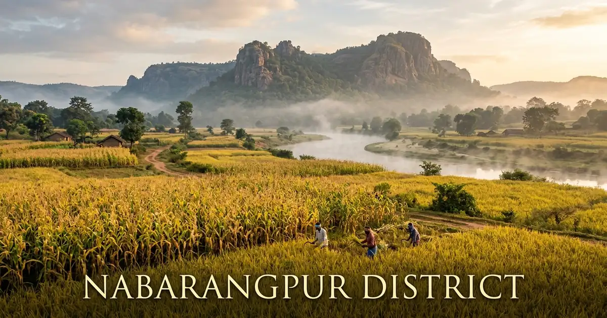
Nabarangpur district occupies a fertile undulating highland plateau in the southwestern corner of Odisha. Spanning 5,291 square kilometers along the interstate border with Chhattisgarh, the territory is celebrated for its golden cornfields, dense sal woodlands, and sacred river systems. The district forms an essential geographical bridge connecting the central highlands of peninsular India with the coastal watersheds of the Bay of Bengal.
The cultural identity of the district is rooted in the ancestral heritage of its indigenous tribal communities. Forming more than half of the total population, groups including the Bhatra, Gond, Paroja, Amanatya, and Kandha have preserved authentic pastoral traditions, weekly tribal haats, and sacred forest worship across generations.
Alongside tribal heritage, Nabarangpur has earned nationwide recognition as an agricultural powerhouse. Revered as the Maize Capital of Odisha, the district produces the majority of the state’s total maize yield while sustaining traditional lacquer crafts, bell metal artistry, and rich folklore traditions.
Key Takeaways
- Nabarangpur spans 5,291 square kilometers across one administrative subdivision, ten community development blocks, and ten revenue tehsils.
- The district recorded a population of 1,220,946 in Census 2011, featuring a high positive sex ratio of 1,019 females per 1,000 males and a population density of 231 persons per square kilometer.
- Scheduled Tribes constitute 55.79 percent of the population, preserving distinct cultural traditions, Desia dialects, and active village councils.
- Celebrated as the Maize Capital of Odisha, the district generates more than seventy percent of the state’s commercial maize production.
- Major heritage landmarks include the ancient Nala dynasty capital at Podagada, Maa Bhandargharani Temple, Maa Pendrani Temple, and the historic freedom struggle memorial at Papadahandi.
Introduction to Nabarangpur: The Land of Golden Cornfields, Ancient Forts & Tribal Traditions
Nabarangpur is situated in southwestern Odisha, bounded by Kalahandi district to the north, Koraput district and Malkangiri District southern border frontier to the south, and the Bastar, Kondagaon, and Kanker districts of Chhattisgarh to the west. The administrative headquarters is Nabarangpur town, situated along the tranquil banks of the Indravati River.
Historically an integral portion of the undivided Koraput district parent territory, Nabarangpur was formally created as an independent revenue district on 2 October 1992. The district spans 5,291 square kilometers, with an average elevation ranging between 550 and 700 meters above sea level. This elevated topography provides fertile agricultural soils, moderate temperatures, and abundant river drainage.
Motor vehicle administration is managed by the Regional Transport Office under the registration code OD-24, headquartered in Nabarangpur town.
| Geographic Metric | Canonical Statistic | Regional Context |
|---|---|---|
| Total Geographical Area | 5,291 sq km | High-altitude plateau bordering Chhattisgarh |
| District Headquarters | Nabarangpur Town | Commercial, administrative, and cultural center on Indravati River |
| Major Urban Municipalities | Nabarangpur, Umerkote | Twin urban economic and trade engines |
| Geographic Coordinates | 19°00’ N – 20°05’ N, 82°10’ E – 82°53’ E | Southwestern Odisha plateau and Indravati catchment |
| Average Elevation | 550 to 700 meters | Gently rolling plains with solitary granite hills |
| Forest Cover | Over 22% of total landmass | Sal, teak, piasal, and mixed dry deciduous forests |
| Motor Vehicle Registration (RTO) | OD-24 | Regional Transport Office, Nabarangpur |
The climate of Nabarangpur is classified as sub-tropical highland, marked by hot summers, a plentiful southwest monsoon, and pleasant winter months. Valley temperatures in summer reach 38°C, while cool evening breezes keep highland plateaus relatively comfortable. In contrast, winter nights from November through February bring crisp air, with temperatures dipping below 10°C in rural forest tracts.
The southwest monsoon brings an average annual precipitation of roughly 1,569 millimeters between June and September. This rainfall irrigates extensive agricultural fields, replenishes large river reservoirs, and supports the regional agrarian economy.
Official administrative announcements, cultural events, and travel updates are documented on the Odisha Tourism Official Portal and district administration archives.
Geographical Landscape, Indravati Basin & Topography
The topography of Nabarangpur is characterized by an expansive undulating plateau framed by residual granite hills, shallow river valleys, and fertile red loam soils. The district occupies the upper basin of the Indravati River, one of the primary interstate tributaries of the Godavari river system.
To the north, the terrain borders the agricultural highland tracts of Kalahandi district along the Tel River drainage. To the south, the plateau slopes toward the fertile plains of Kotpad and the Kolab river valley.
The hydrological network of Nabarangpur is anchored by several important rivers and perennial mountain streams:
- Indravati River: Originating in the Thuamul Rampur hills, it enters the district in Tentulikhunti block, flowing westward across Nabarangpur into Bastar.
- Turi River: A perennial mountain stream that originates near Papadahandi, joining the Indravati after carving the scenic Chandandhara waterfall.
- Bhaskel River: A prominent tributary flowing through Umerkote and Raighar blocks, providing essential irrigation for vegetable farming.
- Muran River: A southern river that feeds directly into the massive Indravati multipurpose hydroelectric reservoir at Khatiguda.
- Podagada Hill: A historic granite hill massif rising above the plains of Umerkote, holding ancient defensive fortifications and stone inscriptions.
- Hirli Dangar: A scenic rocky ridge on the outskirts of Nabarangpur town, developed into a popular eco-park and viewpoint.
The forest canopy covers over twenty-two percent of the district, featuring stands of Shorea robusta (sal), Terminalia tomentosa (asan), and bamboo groves.
These forests provide vital livelihood resources for tribal households, who collect mahua flowers, kendu leaves, wild mushrooms, and medicinal roots.
Historical Evolution: Ancient Nala Dynasty, Pushkari & Freedom Struggles
The historical heritage of Nabarangpur is among the most illustrious in southern Odisha, rooted in classical monarchies and legendary anti-colonial sacrifices. Archaeological findings along the Indravati basin indicate continuous human settlement since the Neolithic age.
During the classical era, the region served as the capital heartland of the powerful Nala dynasty, which ruled over the historic kingdom of Dandakaranya from the fourth to sixth centuries CE. The ancient capital city of Pushkari has been identified with modern Podagada near Umerkote. Royal stone inscriptions carved in Sanskrit, discovered at Podagada, celebrate the military victories of Nala kings Bhavadatta Varman and Arthapati over the imperial Vakatakas.
Following the decline of the Nalas, the territory was absorbed into the Kingdom of Nandapur, later known as the Kingdom of Jeypore under the Suryavanshi dynasty. Local feudal chiefs administered the land as feudatories, maintaining trade routes between the Deccan plateau and coastal Odisha.
Key historical milestones in Nabarangpur’s evolution include:
- 4th to 6th Century CE: Golden age of the Nala dynasty, establishing Pushkari at Podagada as a major center of Shaivite and Vaishnavite culture.
- 15th Century CE: Integration into the feudal empire of the Maharajas of Jeypore, with Nabarangpur serving as a northern administrative fort.
- 1850s CE: Expansion of the British East India Company’s administrative oversight across the agency tracts of Jeypore.
- August 24, 1942: The historic Papadahandi massacre during the Quit India movement, where British police fired on peaceful marchers, killing nineteen martyrs.
- 1936 CE: Inclusion of Nabarangpur as a prominent subdivision of undivided Koraput district in the newly created province of Odisha.
- 1992 CE: Formal inauguration of Nabarangpur as an independent revenue district on 2 October.
The heroic sacrifice at Papadahandi remains commemorated by the towering Shahid Minar beside the Turi River bridge, honoring the martyrs of the national independence movement.
Today, historical stone inscriptions, ancient temple mounds, and memorial pillars offer visitors inspiring historical perspectives. A detailed administrative history is preserved on the Nabarangpur District Profile.
Administrative Framework: 10 Blocks, Tehsils & Regional Governance
Nabarangpur is governed under the administrative jurisdiction of the Revenue Divisional Commissioner of the Southern Division, based in Berhampur. The Collector and District Magistrate directs executive administration, public welfare delivery, and infrastructure execution in coordination with the Superintendent of Police.
Unlike multi-subdivision districts, Nabarangpur comprises a single revenue subdivision centered at Nabarangpur town. The district is organized into ten community development blocks, ten revenue tehsils, and 189 gram panchayats.
Urban administration is managed by two municipal councils that oversee civic roads, sanitation, piped water supplies, and public health.
| Administrative Unit | Classification | Key Centers & Geographic Coverage |
|---|---|---|
| Nabarangpur Subdivision | Revenue Subdivision | Encompasses the entire district territory across 10 blocks |
| Nabarangpur Municipality | Urban Local Body (ULB) | District administrative headquarters and primary market hub |
| Umerkote Municipality | Urban Local Body (ULB) | Northern commercial center, grain market, and border transit hub |
| Tentulikhunti Block | Community Development Block | Hydroelectric generation center housing Khatiguda Dam on Indravati |
| Papadahandi Block | Community Development Block | Historic pilgrimage and freedom struggle memorial center |
| Chandahandi Block | Community Development Block | Northern border enclave connecting toward western Chhattisgarh |
| Gram Panchayats | Rural Governance | 189 village clusters managing grassroots rural development |
Democratic representation is organized through four legislative assembly constituencies: Nabarangpur (ST), Dabugam (ST), Umerkote (ST), and Jharigam (ST). In Parliament, the district forms the core of the Nabarangpur Lok Sabha constituency.
Decentralized governance has accelerated rural road development, linking remote border hamlets with commercial markets. To the east, modern transport corridors connect with neighboring highland markets of Rayagada district.
Government programs have also expanded residential schools for tribal youth, established new healthcare centers, and developed cold storage facilities for agricultural produce.
Demographic Profile & Tribal Heritage: Census 2011 Analysis
According to the official Census 2011, Nabarangpur district has a total population of 1,220,946 persons, comprising 604,812 males and 616,134 females. A prominent demographic feature is its positive sex ratio of 1,019 females per 1,000 males, comfortably higher than the national average of 940.
The population density stands at 231 persons per square kilometer, reflecting fertile agricultural plains, extensive rural settlements, and thriving market towns.
The literacy rate in Nabarangpur was recorded at 46.43 percent in Census 2011, with male literacy at 57.31 percent and female literacy at 35.80 percent. Educational initiatives over the past decade have expanded rural literacy significantly.
| Demographic Metric | Canonical Statistic | Regional Context |
|---|---|---|
| Total Population | 1,220,946 persons | Populous agricultural district in southwestern Odisha |
| Male Population | 604,812 | 49.54% of total district population |
| Female Population | 616,134 | 50.46% of total district population |
| Sex Ratio | 1,019 females / 1,000 males | High gender balance characteristic of indigenous societies |
| Population Density | 231 persons per sq km | Moderate density supported by intensive maize farming |
| Overall Literacy Rate | 46.43% | Rising steadily through residential tribal education |
| Scheduled Tribe Population | 55.79% (681,173 persons) | Major communities include Bhatra, Gond, Paroja, and Amanatya |
| Scheduled Caste Population | 14.53% (177,411 persons) | Integral to rural crafts, agriculture, and local commerce |
The social fabric of Nabarangpur is shaped by its diverse indigenous communities, who comprise over fifty-five percent of the total population. Major tribal groups include the Bhatra, Gond, Paroja, Amanatya, and Kandha.
The indigenous people speak Desia, a rhythmic south-Odia dialect that serves as the lingua franca across southwestern Odisha and bordering Bastar. Gondi and Bhatri dialects are also widely spoken in rural households.
Tribal communities maintain traditional village administrative councils, honoring village deities through seasonal festivals. The harmonious coexistence of ancient tribal rituals with mainstream Odia traditions gives the district its distinctive cultural character.
Top Tourist Attractions, Sacred Shrines & Natural Landmarks
Nabarangpur offers a captivating array of ancient historical monuments, sacred pilgrimage shrines, and tranquil riverfront attractions. Travelers can explore archaeological marvels, memorial parks, and cascading waterfalls across the district.
| Attraction Name | Classification | Distance from Nabarangpur | Key Highlights |
|---|---|---|---|
| Podagada Hill Fort | Ancient Archaeological Site | 75 km | 5th-century Nala capital, Sanskrit rock inscriptions, Vishnu footprints |
| Maa Bhandargharani Temple | Tutelary Goddess Shrine | In Town | Historic goddess shrine on Indravati riverfront, Chaitra Yatra |
| Maa Pendrani Temple | Sacred Folklore Shrine | 62 km | Dedicated to folk heroine Pendrani at Umerkote, major rural fair |
| Shahid Minar Papadahandi | Freedom Struggle Memorial | 12 km | Martyr monument commemorating 19 freedom fighters from 1942 |
| Chandandhara Waterfall | Natural Forest Cascade | 90 km | Scenic fall on Turi River in Jharigam with rock pools and picnic groves |
| Khatiguda Dam | Multipurpose Earthen Dam | 20 km | Huge reservoir on Indravati River with boating and scenic viewpoints |
| Hirli Dangar Eco-Park | Rocky Hilltop Viewpoint | 2 km | Landscaped eco-park with ancient stone statues and sunset vistas |
| Mandadangri Cave Shrine | Natural Cave Temple | 105 km | Ancient rock cavern dedicated to Lord Shiva in Chandahandi block |
Podagada Hill Fort: Capital of the Ancient Nala Kings
Located near Umerkote in the western corner of the district, Podagada stands as the most important archaeological treasure of Nabarangpur. Rising abruptly from the plains as a forested hill massif, Podagada was the fortified capital city of Pushkari under the imperial Nala dynasty during the fifth and sixth centuries CE.
Archaeologists have discovered ancient Sanskrit rock inscriptions in classical Brahmi script celebrating King Bhavadatta Varman and his son Arthapati. The hilltop features the sacred footprints of Lord Vishnu carved into rock, ancient cisterns, defensive stone ramparts, and natural cavern shelters. Further historical research is documented on the Nala Dynasty Archaeological Archive.
Maa Bhandargharani Temple in Nabarangpur Town
Maa Bhandargharani Temple serves as the supreme tutelary goddess shrine of Nabarangpur. Situated near the heart of town along the scenic Indravati riverfront, the goddess is revered as the divine storehouse guardian and protectress of regional granaries.
Local residents and visiting merchants visit the shrine daily to seek blessings for agricultural abundance and commercial prosperity. During the annual Chaitra Yatra, the temple complex hosts colorful processions, traditional Ghumura recitals, and night-long devotional music programs that draw devotees from across southern Odisha and Chhattisgarh.
Maa Pendrani Temple of Umerkote
Situated in the northern commercial center of Umerkote, Maa Pendrani Temple is dedicated to a celebrated folk heroine of regional mythology. According to legend, Pendrani was a pure and devoted maiden who gave her life to defend community honor against local tyranny, subsequently being revered as a protective deity.
The temple complex features traditional Kalingan architecture with modern decorative mandapas. Every year during Chaitra, a grand rural fair takes place in Umerkote, featuring folk dance performances, artisan craft stalls, and communal feasts honoring the goddess.
Shahid Minar at Papadahandi
Located 12 kilometers north of Nabarangpur town, the Shahid Minar at Papadahandi stands as a solemn monument to India’s freedom struggle. On August 24, 1942, during the height of the Quit India movement, British colonial police opened fire on hundreds of unarmed freedom fighters marching toward Papadahandi across the wooden bridge over the Turi River.
Nineteen freedom fighters were martyred on the spot, while dozens more were injured and imprisoned. Often described as the Jallianwala Bagh of southern Odisha, the site features a stone memorial tower surrounded by landscaped public gardens. Every year on August 24, the district observes Shahid Divas with state honors and patriotic gatherings.
Chandandhara Waterfall and Forest Retreat
Located in the deep forested hills of Jharigam block, Chandandhara Waterfall is a delightful natural cascade on the Turi River. The river tumbles over broad granite rock shelves, forming swirling white currents that gather in clear natural pools below.
The site is enclosed by sal and teak reserve forests, creating a cool retreat favored for weekend family outings and nature photography. The district administration has improved access roads, installed resting shelters, and created picnic spaces along the riverbank.
Indravati Basin, Water Reservoirs & Ecological Sanctuaries
The ecological vitality of Nabarangpur is sustained by the expansive drainage network of the Indravati River. The river originates in the high Eastern Ghats and flows across the central plateau, creating extensive wetland habitats and supporting diverse wildlife.
The most prominent water body in the district is the Khatiguda Dam, constructed across the Indravati River in Tentulikhunti block. This massive multipurpose earthen dam forms an immense freshwater reservoir that supports the upper Indravati hydroelectric project. The reservoir serves as a crucial fishery, provides irrigation to thousands of agricultural hectares, and creates a tranquil lakeside environment for migratory aquatic birds.
Forest tracts across Raighar, Chandahandi, and Umerkote provide safe natural corridors for wildlife migrating between Odisha and the neighboring Bastar forests of Chhattisgarh. Species inhabiting these woodlands include Indian leopards, barking deer, wild boars, spotted deer, sloth bears, and striped hyenas.
Avian life along the Indravati reservoir and forest streams is abundant. Birdwatchers regularly spot woolly-necked storks, cotton pygmy geese, crested serpent eagles, Indian rollers, and river lapwings. Local community forest committees work with the Forest Department to guard these wooded corridors against illegal hunting and timber felling.
Agriculture, Maize Capital Economy & Rural Markets
Agriculture forms the cornerstone of Nabarangpur’s economy, supporting more than eighty percent of rural families. The combination of well-drained red loam soils, moderate altitude, and reliable monsoon rainfall makes the plateau exceptionally productive for grain farming.
Nabarangpur is celebrated throughout India as the Maize Capital of Odisha. Farmers across all ten blocks cultivate high-yielding hybrid corn over vast expanses, generating more than seventy percent of the state’s total maize harvest. During the harvest season from September to December, golden cobs dry in village courtyards, and trucks carry grain to industrial mills and export markets nationwide.
| Agricultural Crop | Farming System | Production Scale & Market Reach |
|---|---|---|
| Commercial Maize | High-yielding hybrid rainfed | Over 70% of Odisha state output; major poultry feed and starch supply |
| Kharif Paddy | Valley plain terracing | High-volume rice cultivation across alluvial soils |
| Cashew Nuts | Upland plantation forestry | High-grade cashew processing units centered in Umerkote |
| Pulses (Arhar & Moong) | Intercropped with maize | Essential crop rotation providing soil nitrogen enrichment |
| Oilseeds (Mustard & Niger) | Winter post-paddy cropping | Premium oilseed harvests distributed through regional mandis |
| Fresh Vegetables | Riverbed irrigation farming | Tomato, cabbage, and chili supplies feeding regional markets |
In addition to maize, the district produces substantial harvests of high-grade paddy, pulses, sugarcane, and cashew nuts. Umerkote has emerged as a major cashew processing center, with mechanized factories shelling, roasting, and grading kernels for export.
Weekly rural markets, known locally as haats, serve as active trade centers across the countryside. Farmers gather at Papadahandi, Kosagumuda, and Dabugam to sell grains, forest produce, and handwoven textiles, maintaining lively community commerce.
Traditional Lacquer Craft, Rural Artisans & Folk Art
The artistic identity of Nabarangpur is highlighted by its indigenous lacquer craft, a unique handcraft that has flourished in the region for centuries. Practiced primarily by the Sankhari artisan community, this craft transforms natural tree resin into colorful, decorative works of art.
Artisans collect natural raw lac secreted by insects on forest host trees like kusum and ber. The resin is refined, heated over charcoal fires, and blended with natural mineral pigments to produce brightly colored lacquer rods. Craftsmen then use heated metal tools to apply intricate patterns onto terracotta boxes, bamboo baskets, toys, and bangles.
The signature product of Nabarangpur lacquer work is the decorated wedding box, traditionally gifted to brides during ceremonial occasions. These boxes feature motifs of peacocks, fish, temple towers, and floral vine patterns. The district administration and craft development boards are actively working to secure official Geographical Indication (GI) status for Nabarangpur Lac Craft to protect its heritage and promote global exports.
Beyond lacquerware, the district is home to skilled metalworkers who create brass figurines and lamps using the traditional lost-wax dhokra casting method. Terracotta potters produce clay grain storage bins and ceremonial pots, preserving ancient craft traditions across rural villages.
Tribal Culture, Indigenous Folklore & Community Festivals
The cultural life of Nabarangpur is enriched by the traditions, languages, and rituals of its indigenous tribal communities. Scheduled Tribes make up over fifty-five percent of the populace, with the Bhatra, Gond, Paroja, and Amanatya forming the cultural foundation of the region.
The Bhatra community maintains a structured social order guided by traditional village headmen called Naiks. They celebrate community solidarity through elaborate ancestral rituals, rhythmic folk dances, and sacred worship of village boundary deities. The Paroja and Gond communities contribute rich oral histories, mythological ballads, and harvest celebration songs.
A highlight of the cultural calendar is the Mondei Festival, the largest cultural festival of Nabarangpur district celebrated each November. The multi-day carnival brings together thousands of folk performers, displaying indigenous dances including the Dhemsa, Ghumura, and Bhatra folk dances. Visitors from across India attend the festival to experience regional music, artisan exhibitions, and traditional culinary stalls.
Religious festivals in the district blend tribal and classical traditions. The Chaitra Parva in Umerkote, Ratha Yatra in Nabarangpur, and Shiva Ratri at Mandadangri bring people together across communities in shared celebration and goodwill.
Local Food Culture, Corn Cuisine & Culinary Flavors
The cuisine of Nabarangpur reflects its agrarian wealth, tribal traditions, and status as the maize capital of eastern India. Meals feature fresh grains, forest herbs, and seasonal wild produce prepared with delicate, natural seasoning.
Given the district’s abundant corn harvests, maize forms a delicious component of daily cooking. Fresh corn cobs are roasted over wood embers and rubbed with lime, salt, and chili powder. Families prepare Makka Pitha (steamed or fried corn cakes) and Makka Jau (savory cornmeal porridge), offering wholesome nutrition and comforting flavor.
A daily dietary staple across tribal households is Mandia Jau, a nutritious finger millet porridge simmered with water or rice gruel. It is often served with chopped raw onions, green chilies, and tangy fermented curd, providing lasting energy for farmers working long days in the fields.
Forest foraging supplies delicious seasonal delicacies throughout the year. Wild mushrooms gathered during monsoon mornings are prepared with mustard paste or wrapped in banana leaves and roasted over coals. Tender young bamboo shoots, cooked fresh as Karadi or sun-dried as Hendua, lend a distinctive flavor to spicy lentil broths and vegetable curries.
Transportation Infrastructure, Highway Corridors & Connectivity
Nabarangpur’s strategic location along the interstate border provides excellent highway connectivity to major industrial centers, ports, and tourist destinations across southern Odisha and Chhattisgarh.
The district does not currently possess an operational commercial railway line within its borders. The nearest active railheads are Jeypore Railway Station, located 40 kilometers to the south, and Koraput Railway Junction, approximately 65 kilometers away. Both stations connect travelers to Visakhapatnam, Bhubaneswar, and Raipur via regular express trains. The nearest commercial airport is Jeypore Airport, with scheduled regional flights, while Visakhapatnam International Airport sits 230 kilometers away.
Roadways form the primary transportation network of the district. National Highway 26 runs near the district, while major state highways link Nabarangpur directly with Jeypore, Koraput, Umerkote, and Raipur. Well-maintained highway corridors provide easy access to the capital region of Khordha district via Kesinga and Phulbani.
The Odisha State Road Transport Corporation (OSRTC) and private operators run daily express sleeper buses connecting Nabarangpur with Bhubaneswar, Cuttack, Berhampur, Visakhapatnam, and Raipur. Local private buses connect block centers with town markets every thirty minutes.
| Route Corridor | Road Classification | Distance (km) | Driving Time & Route Highlights |
|---|---|---|---|
| Nabarangpur to Jeypore | State Highway | 40 km | 1.0 hour through flat agricultural plains |
| Nabarangpur to Koraput | SH & NH-26 | 65 km | 1.5 hours via Jeypore climbing toward hills |
| Nabarangpur to Umerkote | District Highway | 62 km | 1.5 hours via Papadahandi and Dabugam |
| Nabarangpur to Raipur | Interstate Corridor | 225 km | 5.0 hours via Nagri and Dhamtari |
| Nabarangpur to Bhubaneswar | NH-26 & NH-57 | 500 km | 10 to 11 hours via Bhawanipatna, Phulbani, and Nayagarh |
| Umerkote to Podagada | Rural Paved Road | 15 km | 30 minutes through shaded countryside |
Recommended Travel Itineraries for Nabarangpur
Exploring Nabarangpur allows travelers to discover ancient fort ruins, sacred temples, and beautiful waterfalls while enjoying scenic rural drives. These travel plans offer well-paced schedules for experiencing the district’s highlights.
2-Day Heritage and Highlights Tour
- Day 1: Town Shrines and Freedom Heritage. Arrive from Jeypore or Koraput in the morning. Visit Maa Bhandargharani Temple along the Indravati riverfront, walk through the artisan workshops to watch lacquer craftsmen at work, and drive to Papadahandi to pay respects at the historic Shahid Minar.
- Day 2: Podagada Ruins and Umerkote. Take a morning drive to the historic hill fort of Podagada. Hike up to inspect the ancient Sanskrit rock inscriptions and Vishnu footprints. In the afternoon, visit Maa Pendrani Temple in Umerkote before returning via Jeypore.
4-Day Comprehensive District Circuit
- Day 1: Indravati Reservoir and Nabarangpur Town. Arrive in Nabarangpur and check into your hotel. Visit the massive Khatiguda Dam on the Indravati River to enjoy peaceful reservoir views. In the evening, explore Hirli Dangar eco-park to watch the sunset over town.
- Day 2: Papadahandi and Northern Waterfalls. Drive north to Papadahandi to visit the Shahid Minar memorial on the Turi River. Continue to Jharigam to explore the cascading waters and rock pools of Chandandhara Waterfall. Stay overnight in Umerkote.
- Day 3: Archaeological Expedition at Podagada. Spend the morning exploring the ancient Nala capital of Pushkari at Podagada. Hike through the forested hills to view the fifth-century royal inscriptions and rock-cut cisterns. Return to Umerkote to tour the local cashew processing units.
- Day 4: Tribal Crafts and Artisan Villages. Travel through rural weekly haats in Kosagumuda or Dabugam to browse tribal textiles, bell-metal artifacts, and lacquer boxes. Enjoy a farewell meal of fresh roasted corn and Mandia Jau before your onward journey.
Accommodation, Visitor Advisory & Practical Travel Logistics
Visitor facilities in Nabarangpur have improved significantly in recent years, offering comfortable private hotels, state guesthouses, and budget lodges in key towns. Following local recommendations ensures a smooth and rewarding trip.
Nabarangpur town features several modern private hotels, air-conditioned guesthouses, and government circuit houses that provide clean accommodations and wholesome dining. Umerkote also offers reliable budget hotels and travelers’ lodges suited for visitors exploring Podagada and northern historical sites.
The ideal travel season extends from October through March when the weather is pleasantly mild and daytime temperatures are comfortable. Peak winter months (December to January) feature crisp mornings and cool evenings, making lightweight woolens advisable. The monsoon season from July to September brings verdant landscapes and full waterfalls, though outdoor hiking at Podagada can be slippery.
Visitors should observe respectful etiquette when touring rural tribal settlements. Always request permission before photographing local residents or entering domestic courtyards. Mobile network reception is dependable across Nabarangpur town, Papadahandi, and Umerkote, though signals can be intermittent near remote border hills. Carrying cash is recommended for village markets and fuel purchases.
Healthcare, Education & Civic Infrastructure
Civic infrastructure in Nabarangpur has experienced major public investment aimed at improving living standards across rural and tribal communities. Modern healthcare centers and educational facilities now serve both urban residents and distant villages.
Specialized medical care is provided by the District Headquarters Hospital in Nabarangpur, supported by the recently inaugurated Government Medical College and Hospital. Sub-divisional facilities in Umerkote and community health centers across all ten blocks deliver maternal care, emergency treatments, and immunization drives. Mobile medical units regularly visit remote border hamlets to provide basic healthcare checkups.
Educational institutions include several prominent regional colleges. The Nabarangpur Degree College, alongside vocational polytechnics and Industrial Training Institutes, provides higher education and technical skills for local youth. Dedicated Eklavya Model Residential Schools (EMRS) offer free education, boarding, and sports coaching to talented tribal students.
Rural development missions have expanded piped drinking water systems and upgraded rural electricity networks. High-capacity power lines and solar micro-grids now supply power to remote border hamlets, supporting small village workshops and rural schools.
Environmental Stewardship, Watershed Management & Future Horizons
Balancing agricultural development with environmental conservation is central to Nabarangpur’s long-term sustainable growth. Managing the Indravati watershed and protecting forest cover are vital priorities for the region’s future.
Intensive maize farming requires careful soil conservation to prevent erosion and preserve groundwater reserves. The state agriculture department actively promotes crop rotation with nitrogen-fixing pulses, organic compost utilization, and drip irrigation to safeguard soil vitality over the coming decades.
Preserving the upper Indravati catchment and surrounding sal forests is essential for maintaining regional biodiversity and stable river flows. Community forest protection samitis work closely with foresters to prevent woodland encroachment and curb seasonal forest fires.
The economic future of Nabarangpur lies in agro-processing modernization, GI certification for indigenous lacquer crafts, and sustainable eco-tourism. Developing solar-powered cold storage facilities, creating farmer producer cooperatives, and expanding eco-resorts around the Indravati reservoir will enable the district to generate prosperous livelihoods while preserving its natural heritage and timeless tribal traditions.
Frequently Asked Questions About Nabarangpur District
Why is Nabarangpur called the Maize Capital of Odisha?
Nabarangpur cultivates extensive high-yielding hybrid corn across its fertile undulating plateau, producing more than seventy percent of Odisha’s total maize yield annually. The district’s extensive maize harvests supply commercial food processing industries, poultry feed mills, and export mandis across eastern India.
What is the historical significance of Podagada Hill Fort in Nabarangpur?
Podagada served as the ancient fortified capital of the Nala dynasty between the fifth and sixth centuries CE, holding royal rock inscriptions carved in classical Sanskrit. Archaeologists have documented ancient footprints of Lord Vishnu, rock-cut defensive chambers, and stone ruins that reflect the classical sovereignty of ancient Pushkari.
What happened at the Shahid Minar of Papadahandi during the Quit India movement?
On August 24, 1942, British colonial police opened indiscriminate gunfire on unarmed freedom fighters gathered peacefully near the Turi river wooden bridge, killing nineteen local martyrs on the spot. The site is revered as the Jallianwala Bagh of Odisha, commemorating the ultimate sacrifice made by local tribal and peasant freedom fighters.
What is indigenous lacquer craft and where can travelers purchase it in Nabarangpur?
Lacquer craft is a traditional handcraft practiced by skilled Sankhari artisans who refine natural tree resin to embellish terracotta boxes, bamboo baskets, toys, and colorful bangles with intricate motifs. Travelers can purchase authentic lacquerware directly from artisan cooperatives in Nabarangpur town and weekly village haats across the district.
How can travelers reach Nabarangpur by train and road?
The nearest active railway station is Jeypore located 40 kilometers to the south, while Koraput railway junction sits approximately 65 kilometers away. Regular express buses along National Highway 26 connect Nabarangpur town with Bhubaneswar, Visakhapatnam, Raipur, and Jagdalpur.
Conclusion and Regional Travel Synthesis
Nabarangpur district represents one of Odisha’s most authentic and rewarding travel destinations. From the ancient royal stone inscriptions of Podagada and the sacred riverfront shrines of Maa Bhandargharani to the historic freedom memorial at Papadahandi and vast golden cornfields, the district blends historical grandeur with living tribal traditions.
Travelers exploring ancient fort ruins, witnessing the intricate artistry of traditional lacquer craft, or enjoying the quiet beauty of the Indravati reservoir will find Nabarangpur an inspiring destination. Plan your journey with care, respect local customs, and experience the timeless warmth and heritage of this extraordinary corner of Odisha.