Bhairaghumar Waterfall Kuhudi Nabarangpur: Picnic & Travel Guide
Plan your trip to Bhairaghumar Waterfall in Kuhudi, Nabarangpur. Explore the 50-foot forest cascade, Chandahandi hill trails, timings, route, and picnic tips.
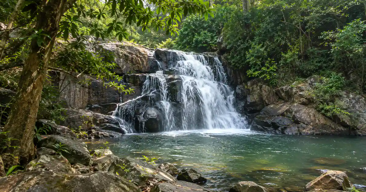
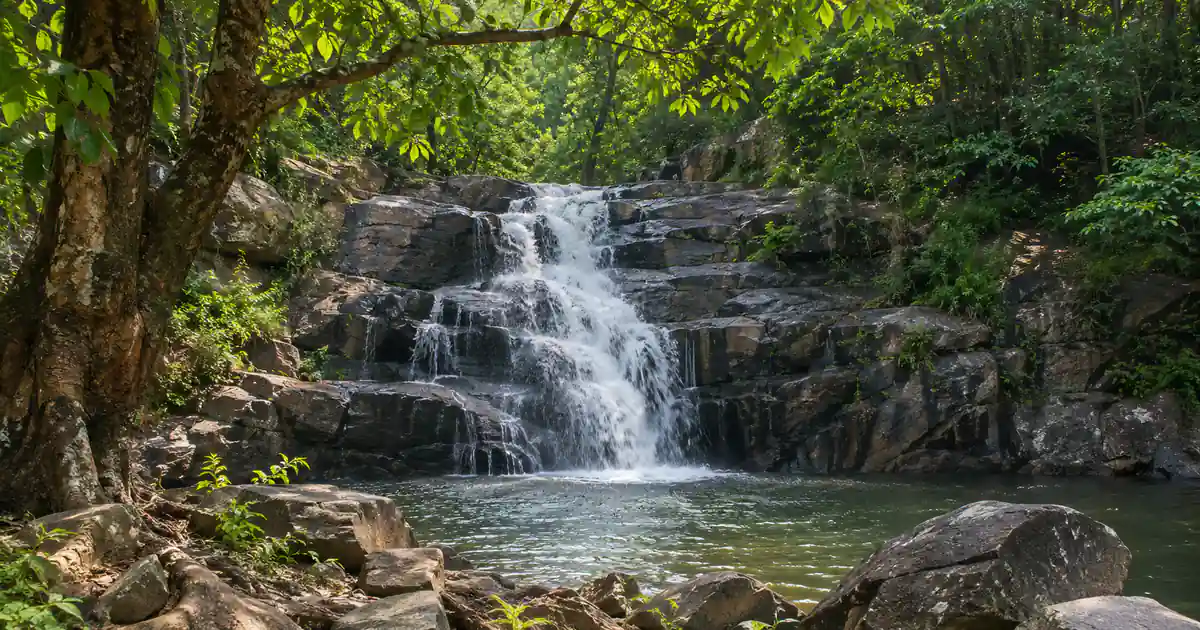
Bhairaghumar Waterfall in Nabarangpur district represents one of the most secluded natural cascades in southwestern Odisha. Situated near Kuhudi village in the highland forests of Chandahandi block, approximately one hundred kilometers northwest of Nabarangpur town, this mountain cascade tumbles fifty feet across weathered dark granite rock ledges into an expansive stone pool.
Located within the historic Dandakaranya forest tract near the Odisha-Chhattisgarh state boundary, the site offers an untouched wilderness retreat far removed from urban congestion.
The waterfall is fed by perennial mountain streams flowing out of the Eastern Ghats hill ranges that divide the Indravati and Tel river watersheds. Devotees and nature enthusiasts visit this woodland clearing during post-monsoon and winter months to explore hiking trails, enjoy tranquil forest acoustics, and offer reverence at a traditional rock shrine dedicated to Lord Bhairab.
The site is protected under the collaborative stewardship of local village forest protection committees and the Nabarangpur District Administration alongside regional eco-tourism initiatives promoted by Odisha Tourism.
Key Takeaways
- Geographic Setting: Situated near Kuhudi village in Chandahandi block, roughly 35 kilometers north of Umerkote and 100 kilometers from Nabarangpur town.
- Hydrological Profile: Features a 50-foot stepped granite cascade tumbling through dense sal and bamboo woods into a broad plunge pool.
- Cultural Heritage: Associated with ancient tribal folklore and a sacred stone rock shrine dedicated to the protective deity Lord Bhairab.
- Visitor Access: Free public entry accessible during daylight hours from 6:30 AM to 5:30 PM, with highest footfall during winter weekends.
- Route Logistics: Accessible by road via State Highway 39 from Umerkote, with nearest railway stations located at Jagdalpur and Jeypore.
Bhairaghumar Waterfall at a Glance: Timings, Height & Location
Bhairaghumar Waterfall Kuhudi Nabarangpur provides travelers with an authentic forest experience characterized by rocky topography and dense canopy shade. The mountain stream rushes over granite stone steps, generating gentle clouds of cool mist that refresh the surrounding rock amphitheater. The constant music of tumbling water blends naturally with bird calls, making the location a favorite escape for photographers and small travel groups.
The master reference table below presents core logistical parameters, geographic coordinates, and visiting hours for planning your visit to Chandahandi:
| Metric / Parameter | Visitor Information |
|---|---|
| Site Name | Bhairaghumar Waterfall (Kuhudi Cascade) |
| Administrative Territory | Chandahandi Block, Nabarangpur District, Odisha |
| Geographic Coordinates | 19.8200° N, 82.3800° E |
| Cascade Drop Height | Approximately 50 feet (15 meters) multi-tiered drop |
| Visiting Hours | 6:30 AM to 5:30 PM (Daily all year) |
| Entry Fee | Completely free public entry (No parking charges) |
| Nearest Commercial Town | Umerkote (35 km) |
| Nearest Railway Stations | Jagdalpur (JDB, 110 km) and Jeypore (JYP, 140 km) |
| Primary Road Corridor | SH 39 connecting Umerkote to Chandahandi |
| Recommended Visit Duration | 2 to 3 hours for trail walking, photography, and picnic |
Core Administrative and Geographic Metrics
Bhairaghumar is situated in the far northwestern boundary of the Nabarangpur district travel guide territory. The waterfall sits within the rugged uplands of Chandahandi block, bordering the Gariaband and Bastar regions of neighboring Chhattisgarh.
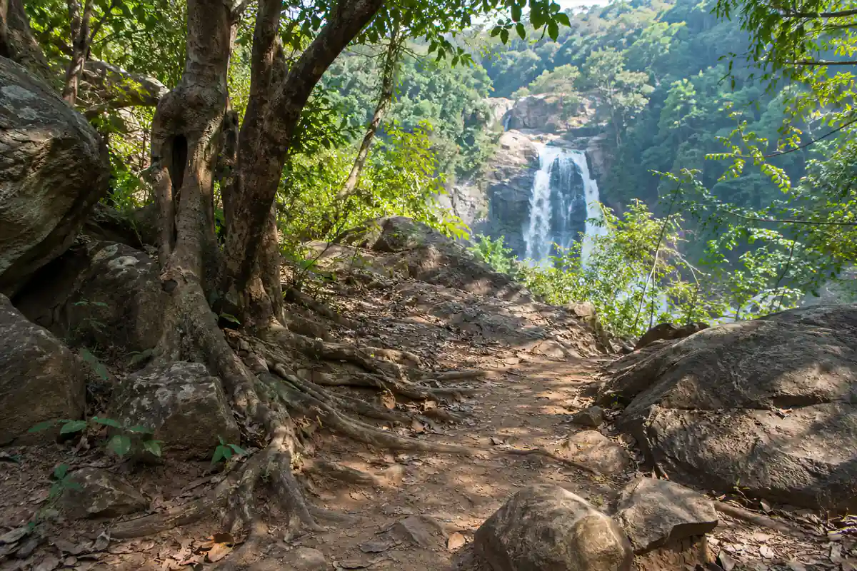
The final approach to the falls winds through rural agricultural fields, tribal settlements, and dense patches of reserve forest. A motorable dirt track branches off the main village road, terminating at an open grassy clearing roughly three hundred meters from the cascade base.
Key Highlights of the Chandahandi Highland Corridor
Chandahandi block represents one of the most heavily forested regions in southern Odisha, boasting undulating hills, perennial forest streams, and extensive bamboo reserves. The elevation of the plateau ensures that ambient temperatures remain several degrees cooler than the coastal plains.
Unlike developed municipal parks, this chandahandi waterfall offers a completely raw, non-commercialized environment. Visitors can sit on weathered stone slabs beneath the shade of tall sal trees, enjoying the clear air and refreshing mountain currents.
Waterfall Geometry, Rocky Pool & Dandakaranya Forest Setting
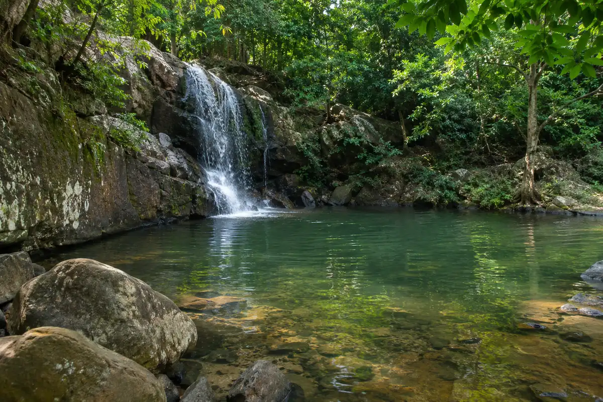
The cascade forms as a vigorous forest stream courses through an inclined rocky gorge before dropping vertically across dark granite benches. The cascade divides into two main channels during high flow, uniting in a deep stone pool flanked by gravel banks.
Hydrological Characteristics of the 50-Foot Drop
The geology of this kuhudi waterfall nabarangpur is defined by hard crystalline rock formations characteristic of the Precambrian Eastern Ghats mobile belt. The stream has carved polished channels and circular potholes into the dark stone ledges over millennia.
The main plunge pool spans roughly thirty meters in diameter, with water depths varying from shallow ankle-deep gravel beds along the perimeter to deeper crevices near the foot of the fall. The water remains remarkably clear during non-monsoon months, revealing submerged stones and small freshwater fish.
The table below outlines seasonal stream characteristics and water flow dynamics:
| Seasonal Phase | Water Volume & Current | Plunge Pool Condition | Exploration & Visit Rating |
|---|---|---|---|
| Post-Monsoon (Oct–Nov) | Heavy cascading volume | Deep, swirling clear pool | Excellent; roaring cascades and verdant green hills |
| Winter (Dec–Feb) | Moderate, crystal-clear flow | Calm, shallow wading areas | Outstanding; perfect temperatures for hiking and picnics |
| Summer (Mar–May) | Gentle trickle over boulders | Shallow, exposed rock basin | Moderate; water volume drops considerably |
| Monsoon (Jun–Sep) | Torrential muddy overflow | Turbulent, submerged ledges | Caution required; slick boulders and rapid currents |
Flora, Fauna and Forest Canopy of Kuhudi
The forest canopy enveloping this natural wonder consists of towering Sal, Teak, Bija, Asan, and dense clumps of wild hill bamboo. The surrounding vegetation forms part of the historical Dandakaranya forest expanse celebrated in ancient Indian epic literature.
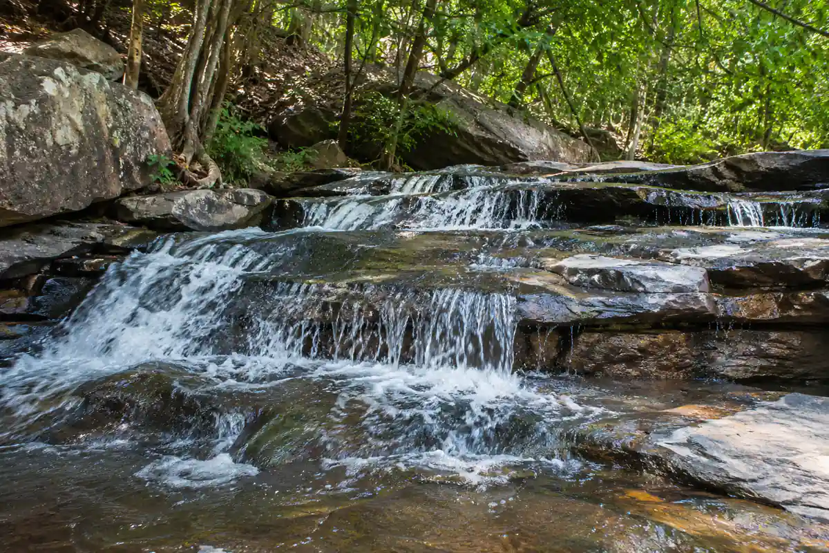
Birdwatchers can spot diverse resident woodland birds, including red junglefowl, emerald doves, Malabar pied hornbills, and paradise flycatchers. The clean stream waters support freshwater crabs and small forest amphibians that thrive along the damp mossy ledges.
Cultural Significance & Local Tribal Folklore
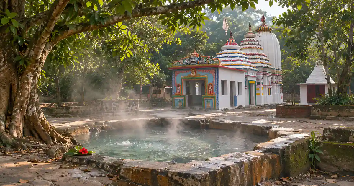
Beyond its natural beauty, this bhairaghumar fall holds profound cultural significance for the indigenous tribal communities inhabiting Chandahandi block. The site derives its name from Lord Bhairab, a formidable aspect of Lord Shiva venerated as the guardian deity of the surrounding hills and forests.
Beneath an ancient rock overhang near the cascade stands a traditional stone altar where local priests offer wild flowers, vermilion, and seasonal produce during village festivals. Devotees believe that propitiating the resident deity protects village herds and crops from wild predators and natural calamities.
Legends of the Forest Deity Shrine
Local tribal folklore relates that ancient ascetics meditated in the rocky caves surrounding the falls, drawing spiritual fortitude from the rhythmic sound of rushing water. The natural acoustics of the gorge amplify the rumble of the cascade, which traditional belief interprets as the divine heartbeat of Mother Earth.
Hunters and gatherers entering the deep forests historically stopped at the stream bank to offer prayers for safe passage. Even today, travelers visiting the area respectfully pause near the stone shrine before descending to the water line.
Annual Tribal Gatherings and Cultural Rites
During the harvest season in early winter, rural communities celebrate traditional thanksgiving rituals known as Chaitra Parva and Mandei. Villagers from Kuhudi, Chandahandi, and neighboring settlements gather near the stream to perform folk dances accompanied by the rhythmic beat of traditional changu and dhol drums.
These gatherings offer an authentic window into the enduring cultural customs of southwestern Odisha, where human life remains harmoniously linked with natural water bodies and forested hills.
Visiting Hours, Picnic Guidelines & Forest Safety
Bhairaghumar welcomes nature lovers throughout the daylight hours. Because the falls are situated in an open community forest area without gated admission, public access is entirely free of charge.
Daily Entry Schedule and Daylight Planning
The best time to visit is between 8:00 AM and 11:00 AM. Arriving during morning hours provides soft natural sunlight filtering through the bamboo canopy, excellent illumination for landscape photography, and peaceful surroundings before afternoon picnic parties arrive.
Visitors should conclude their excursion and depart before 5:00 PM in the evening. The access road passes through isolated forest sections that lack streetlights or mobile charging facilities after dark.
Picnic Etiquette and Forest Conservation Rules
During the winter months from November to February, Bhairaghumar is counted among the scenic nabarangpur picnic spots where families and travelers spend the day relaxing beside the riverbed.
To preserve the delicate woodland ecology, visitors must practice responsible travel etiquette:
- Pack all food packaging, plastic bottles, and paper plates into garbage bags and dispose of them properly at your hotel in Umerkote.
- Keep cooking campfires small, clear dry leaves from the fire pit perimeter, and extinguish all embers thoroughly with water before leaving.
- Do not bring commercial sound systems or amplify loud music in the forest, as sudden loud noise frightens wild animals and disrupts the natural woodland ambiance.
- Keep vehicle parking confined to designated open clearings to avoid damaging wild shrubs and saplings along the forest edge.
Water Depth and Slippery Boulder Precautions
While cooling off near the stream is enjoyable, travelers should observe reasonable safety precautions around the rock terraces. Granite boulders near the water spray are coated with microscopic algae that make footing slippery.
The safety guidelines table below summarizes essential recommendations for visitors:
| Safety Parameter | Hazard Level | Recommended Precaution |
|---|---|---|
| Wet Granite Boulders | Moderate to High | Wear high-traction rubber trekking shoes; avoid running on wet stone |
| Deep Plunge Basin | Moderate | Stay in outer shallow areas; avoid swimming directly below the main drop |
| Forest Track Navigation | Low to Moderate | High-clearance vehicles recommended during rainy or muddy conditions |
| Children’s Safety | Moderate | Keep children away from steep rock ledges and fast-moving water chutes |
How to Reach Bhairaghumar from Umerkote and Nabarangpur
Reaching Bhairaghumar involves traveling through the scenic plateau landscapes of western Nabarangpur district, following well-paved state highways before entering local rural tracks.
Driving Route from Umerkote via State Highway 39
The most practical base for visiting Bhairaghumar is Umerkote town, situated thirty-five kilometers to the south. From Umerkote market, follow State Highway 39 northward toward Chandahandi for approximately twenty-eight kilometers. Upon reaching the village road intersection near Kuhudi, turn west onto the rural link road for seven kilometers to reach the waterfall clearing.
The total driving time from Umerkote is roughly forty-five minutes. The road crosses open agricultural country, sal plantations, and charming tribal hamlets.
Travel from Nabarangpur Town and Jeypore
Travelers starting from Nabarangpur district headquarters take National Highway 26 north toward Papadahandi, then follow State Highway 39 through Dabugam to Umerkote. The total distance from Nabarangpur town is approximately one hundred kilometers, requiring around two and a half hours of driving.
For travelers coming from Jeypore or Koraput, the route proceeds via Borigumma and Nabarangpur town, spanning approximately 140 kilometers. Private taxis and rental cars provide the most flexible transport option for this remote excursion.
The transit distance table below provides key travel metrics from primary regional hubs:
| Origin Hub | Route Description | Distance | Estimated Travel Duration |
|---|---|---|---|
| Umerkote Town | SH 39 North to Kuhudi turnoff | 35 km | 45 minutes |
| Chandahandi Block Center | Local Rural Road southward | 12 km | 20 minutes |
| Nabarangpur Headquarters | NH 26 and SH 39 via Papadahandi | 100 km | 2 hours 30 minutes |
| Jagdalpur (Chhattisgarh) | SH 39 via Kundei and Umerkote | 110 km | 2 hours 45 minutes |
| Jeypore Railhead | NH 26 North via Borigumma | 140 km | 3 hours 30 minutes |
| Raipur Airport (RPR) | NH 30 and SH 39 via Dhamtari | 230 km | 5 hours |
Rail and Air Access via Jagdalpur and Raipur
For long-distance travelers, Jagdalpur Railway Station (Station Code: JDB) in neighboring Chhattisgarh sits roughly 110 kilometers southwest, offering broad rail connections to Visakhapatnam and central India.
Alternatively, Swami Vivekananda Airport in Raipur (RPR), located 230 kilometers northwest, serves as the closest commercial domestic airport with daily flights from major Indian metropolitan centers.
Bhairaghumar vs Chandandhara and Mangardora: Nabarangpur Waterfalls Compared
Nabarangpur district holds multiple captivating forest cascades that remain largely undiscovered on mainstream tourist circuits. Comparing Bhairaghumar against other waterfalls in Nabarangpur such as Chandandhara and Mangardora helps travelers plan an efficient sightseeing circuit.
Landscape Differences Across Western Nabarangpur Cascades
Chandandhara, situated on the Turi River in Jharigam block, cascades over broad, flat granite shelves into natural wading pools, surrounded by open picnic clearings. It is the most accessible cascade in the district, accommodating large family groups.
In Chandahandi block itself, our detailed guide to Mangardora Waterfall in Chandahandi features a secluded forest cascade tumbling past a sacred rock cave dedicated to Lord Shiva. Nearby, the ancient cave sanctuary at Ghumareswar Temple Waterfall in Nabarangpur features cold mountain waters flowing into sanctified natural stone bathing basins.
Bhairaghumar stands out for its vertical drop height and untamed forest isolation. Surrounded by tall sal trees and rocky hill terrain, it offers a dramatic visual contrast to the flatter, gentler flow of Chandandhara.
The comparative matrix below outlines key differences among the three cascades:
| Feature / Metric | Bhairaghumar (Kuhudi) | Chandandhara (Jharigam) | Mangardora (Chandahandi) |
|---|---|---|---|
| Cascade Drop Height | 50 feet (Tiered plunge) | 25 feet (Broad shelf cascade) | 35 feet (Rock face drop) |
| River / Stream Source | Perennial Eastern Ghats stream | Turi River | Forest mountain stream |
| Forest Setting | Deep sal and bamboo woods | Open forest clearing | Cave-sheltered woodland |
| Crowd Intensity | Very low (Secluded) | Moderate on weekends | Very low (Spiritual seekers) |
| Distance from Umerkote | 35 km north | 55 km east | 30 km northwest |
| Travel Vibe | Wilderness exploration | Family day outing | Nature and cave pilgrimage |
Which Waterfall Should You Include in Your Itinerary?
If you prefer broad, safe wading pools with paved approach tracks close to highway amenities, Chandandhara is the easiest choice for families with elderly relatives or small children.
However, if you want an off-the-beaten-track adventure through undisturbed Dandakaranya forest to witness a dramatic 50-foot stepped drop in peaceful solitude, Bhairaghumar offers an unforgettable excursion.
Best Time to Visit & Nearby Nabarangpur Attractions
Understanding seasonal weather patterns ensures that you experience the waterfall when water flow is robust and forest roads are easily navigable.
Seasonal Weather Patterns and Optimal Months
The best time to visit Bhairaghumar extends from October through February. The post-monsoon period in October and November brings full water flow and verdant green hills. Winter months from December to January feature crisp, pleasant daytime weather between 14°C and 26°C, creating ideal conditions for hiking and outdoor picnics.
Summer months from April to June bring high daytime temperatures exceeding 38°C in Nabarangpur, causing stream volumes to dwindle significantly. Visiting during summer is advisable only during early morning hours.
The table below provides a seasonal guide:
| Season | Calendar Period | Cascade Water Volume | Travel Advisory |
|---|---|---|---|
| Post-Monsoon (Peak Flow) | October to November | Heavy and energetic | Superb scenery; lush green forest and roaring cascade |
| Winter (Best Weather) | December to February | Moderate and clear | Ideal picnic season; comfortable daytime temperatures |
| Summer (Low Water) | March to June | Reduced flow | Warm daytime climate; plan early morning visits |
| Monsoon (Heavy Rain) | July to September | Surging torrent | High volume; dirt tracks may become muddy |
Pairing with Podagada Fort Ruins and Umerkote
Travelers can combine Bhairaghumar with other notable umerkote tourist places. Just twenty-five kilometers south near Umerkote lies the historical site of Podagada, an ancient hill fortress of the 5th-century Nala dynasty featuring rock-cut inscriptions, medieval temple ruins, and sweeping panoramic views over the surrounding plateau.
In Umerkote town, visitors can tour the Maa Pendrani Temple, a revered tribal Shakti shrine celebrating local folklore and annual festive fairs.
Exploring Nearby Scenic Spots in Southern Odisha
For travelers extending their journey through southern Odisha, regional highway networks connect Nabarangpur directly with the scenic hill destinations of Koraput district. Travelers can plan excursions to the popular places to visit in Koraput or trek across the windswept grasslands of Deomali mountain peak, the highest summit in Odisha.
Frequently Asked Questions (FAQs)
Where is Bhairaghumar Waterfall located in Nabarangpur?
The natural cascade is located near Kuhudi village in Chandahandi block of Nabarangpur district, Odisha. It is situated approximately thirty-five kilometers north of Umerkote and one hundred kilometers from Nabarangpur town.
How high is the cascade drop?
The waterfall drops approximately fifty feet across stepped dark granite rock ledges into a broad plunge pool. The stream maintains perennial flow nourished by forested catchment hills in the Eastern Ghats.
Is there an admission fee for visitors?
No, entry to the falls and forest shrine is completely free for all visitors. The cascade is located in an open community forest area with free open-air parking in nearby clearings.
What is the best season to explore the falls?
The ideal season to visit is between October and February when the mountain stream flow is vigorous and the weather is pleasantly cool. Post-monsoon months offer the greenest forest scenery and most energetic cascading water.
How far is the site from Umerkote town?
The scenic cascade is located roughly thirty-five kilometers north of Umerkote town via State Highway 39. The journey takes approximately forty-five minutes by private car or taxi.
Are there accommodation facilities in Kuhudi?
There are no hotels or guest houses located directly beside the stream in Kuhudi village. Comfortable lodging, government inspection bungalows, and dining options are readily available in Umerkote town thirty-five kilometers away.