Kandhamal District: Daringbadi, Turmeric Heritage, Waterfalls & Travel Guide
Comprehensive guide to Kandhamal district in Odisha. Discover Daringbadi hill station, GI-tagged Kandhamal Haldi, Putudi Waterfall, Belghar, and travel routes.
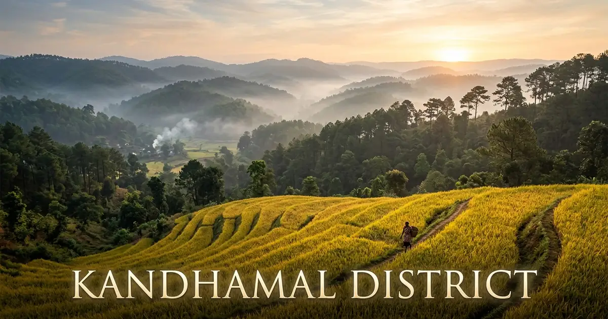
Kandhamal district occupies the high-altitude forested heartland of central-southern Odisha. Rising sharply above the coastal plains of the Bay of Bengal, the territory spreads across 8,021 square kilometers of rugged Eastern Ghats mountain ranges. Deep sal forest canopies, steep river gorges, and elevated plateaus characterize the landscape from its northern border along the Mahanadi valley to its southern mountain rim.
The spiritual and cultural identity of the district is rooted in the ancestral customs of the Kondha tribes. Known historically for their deep environmental stewardship and veneration of the Earth Goddess Dharni Penu, the people have preserved sacred groves, terrace farming traditions, and unique oral languages across countless generations.
Alongside ancient traditions, Kandhamal has achieved global acclaim for its agricultural excellence. The district is celebrated worldwide for GI-tagged Kandhamal Haldi, a fragrant organic turmeric cultivated across pesticide-free mountain slopes that provides sustainable livelihoods to tens of thousands of rural farmers.
Key Takeaways
- Kandhamal covers 8,021 square kilometers across two administrative subdivisions, twelve community development blocks, and twelve revenue tehsils.
- The district recorded a population of 733,110 in Census 2011, characterized by a high positive sex ratio of 1,037 females per 1,000 males and a sparse density of 91 persons per square kilometer.
- Scheduled Tribes constitute 53.58 percent of the total population, represented prominently by the Kui-speaking Kutia Kondh and Desia Kondh communities.
- Daringbadi, situated at 915 meters elevation, serves as the foremost hill station of Odisha, featuring pine groves, coffee plantations, and winter frosts.
- Landmark attractions include Putudi Waterfall on the Bada Salanki River, Belghar nature camp, the leaning Shiva shrines of Chakapad, and GI-certified organic turmeric farms.
Introduction to Kandhamal: The Highland Sanctuary of Mist, Pines & Golden Turmeric
Kandhamal sits at the crossroads of southern and western Odisha. It is bounded by Boudh District northern river valleys to the north, Nayagarh and Ganjam districts to the east, Rayagada district to the south, and Kalahandi district to the west. The administrative headquarters is Phulbani, a tranquil forest city situated along the Bada Salanki River.
Historically established as a separate revenue district in 1994 when undivided Phulbani was divided into Kandhamal and Boudh, the district spans 8,021 square kilometers. The terrain transitions from central valley river basins at 300 meters elevation to rugged mountain plateaus exceeding 1,100 meters above sea level. This unique geography provides dramatic scenery, fertile agricultural microclimates, and rich biodiversity.
Motor vehicle administration is directed by the Regional Transport Office under the registration code OD-12, headquartered in Phulbani town.
| Geographic Metric | Canonical Statistic | Regional Context |
|---|---|---|
| Total Geographical Area | 8,021 sq km | High-altitude Eastern Ghats mountain territory |
| District Headquarters | Phulbani | Administrative, commercial, and healthcare nerve center |
| Sub-Divisional Urban Centers | Phulbani, Baliguda | Twin administrative hubs for eastern and western tracts |
| Geographic Coordinates | 19°34’ N – 20°36’ N, 83°30’ E – 84°48’ E | Central Eastern Ghats watershed and river source |
| Average Elevation | 300 to 1,100 meters | Rising to 915 meters across Daringbadi plateau |
| Forest Cover | Over 66% of total landmass | Dense moist peninsular sal and mixed deciduous timber |
| Motor Vehicle Registration (RTO) | OD-12 | Regional Transport Office, Phulbani |
The climate of Kandhamal is characterized by temperate winters, a plentiful southwest monsoon, and moderate summer heat compared to coastal districts. During summer months, valley temperatures reach 36°C, but highland plateaus remain comfortably cool. In contrast, winter nights from November through February bring crisp mountain air across the plateau.
The southwest monsoon delivers an average annual precipitation of roughly 1,427 millimeters between June and October. This rainfall feeds numerous perennial hill streams, fills cascading waterfalls, and recharges vital regional aquifers across southern Odisha.
Official administrative announcements, cultural events, and travel updates are documented on the Odisha Tourism Official Portal and district administration archives.
Geographical Landscape, Rushikulya Headwaters & Eastern Ghats Ranges
The physical topography of Kandhamal is defined by ancient Precambrian rock formations, deep granite ravines, and fertile valley terraces. The district occupies a high structural ridge of the Eastern Ghats, forming a critical watershed separating the Mahanadi basin to the north from the Rushikulya basin to the south.
To the south and west, the mountain ranges connect with the bordering forest corridors of Rayagada district and the highlands of Kalahandi. To the east, the terrain drops dramatically down the famous Kalinga Ghat toward the coastal plains of Ganjam.
The hydrological network of Kandhamal is dominated by four major river systems and hundreds of perennial mountain streams:
- Rushikulya River: One of Odisha’s sacred coastal rivers, originating in the high ridges near Daringbadi at Rusimal hill before flowing eastward into the Bay of Bengal.
- Bada Salanki River: A major mountain river that flows past Phulbani, forming the thunderous cascades of Putudi Waterfall before joining the Mahanadi drainage.
- Salki River: A vital northern river that drains agricultural valleys across Khajuripada and Chakapad blocks.
- Brutunga River: A revered forest river flowing through Chakapad, along whose sacred banks ancient Shaivite shrines have stood for centuries.
- Daringbadi Plateau: An elevated tabletop highland sitting at 915 meters elevation, blanketed with pine woods, coffee estates, and terrace gardens.
- Kalinga Ghat: A formidable mountain pass on State Highway 5 featuring dramatic hairpin bends carved through dense reserve forests.
The forest canopy blankets over two-thirds of the district landmass, consisting of moist peninsular sal, bamboo brakes, and tropical dry deciduous woodlands.
These expansive woodlands provide valuable non-timber forest products, including wild forest honey, mahua flowers, sal seeds, and medicinal herbs that sustain rural indigenous families.
Historical Evolution: Ancient Khondmals, Tribal Sovereignty to Modern Formation
The historical legacy of Kandhamal dates back to ancient tribal epochs, with prehistoric burial cairns and polished stone celts discovered across the hills confirming continuous human presence. During classical antiquity, the impenetrable mountain ranges insulated the region from external political control, allowing local tribal chieftains to govern autonomously.
During the medieval epoch, peripheral tracts fell under nominal tributary relationships with neighboring royal dynasties, including the Bhanja rulers of Ghumusar and the kings of Boudh. However, effective internal authority remained vested in village headmen known as Malikas and Pradhans, who governed according to customary tribal codes.
To the east, the district shared strategic trade connections with the coastal trading routes of Ganjam district, exchanging mountain timber, honey, and hill turmeric for sea salt and metal implements.
Key historical milestones in Kandhamal’s evolution include:
- Ancient Era to 18th Century CE: Undisputed tribal sovereignty of the Kondha clans, organized into confederacies known as Mutthas.
- 1835 to 1856 CE: Armed anti-colonial resistance led by Kondha leaders Dora Bisoyi and Chakra Bisoyi against British East India Company troops during the Ghumusar wars.
- 1855 CE: Formal creation of the Khondmals Agency by British colonial authorities to suppress the customary human sacrifice ritual known as Meriah.
- 1894 CE: Establishment of Phulbani as the administrative headquarters of the Khondmals subdivision under British administration.
- 1948 CE: Integration of the feudatory state of Boudh and the Khondmals into the newly organized Boudh-Phulbani district within independent India.
- 1994 CE: Reorganization of the territory into an independent administrative entity, officially named Kandhamal district on 1 January.
The cultural memory of Kandhamal preserves tales of regional resistance, sacred clan alliances, and ancient stone worship.
Today, preserved oral traditions, stone megaliths, and colonial-era forest inspection bungalows offer travelers fascinating historical perspectives. A detailed administrative history is preserved on the Kandhamal District Administration Profile.
Administrative Framework: Subdivisions, 12 Blocks, Tehsils & Governance
Kandhamal is governed under the administrative jurisdiction of the Revenue Divisional Commissioner of the Southern Division, stationed at Berhampur. The Collector and District Magistrate oversees executive administration, developmental initiatives, and social welfare programs in coordination with the Superintendent of Police.
To ensure responsive governance across its vast mountainous territory, the district is organized into two administrative subdivisions: Phulbani and Baliguda. These subdivisions encompass twelve community development blocks, twelve tehsils, and 153 gram panchayats.
Urban civic administration is managed by two urban local bodies that maintain roads, public lighting, sanitation, and municipal health services.
| Administrative Unit | Classification | Key Centers & Geographic Coverage |
|---|---|---|
| Phulbani Subdivision | Administrative Subdivision | Phulbani, Khajuripada, Chakapad, Tikabali, G. Udayagiri, Raikia |
| Baliguda Subdivision | Administrative Subdivision | Baliguda, K. Nuagaon, Daringbadi, Tumudibandha, Kotagarh, Chakapad |
| Phulbani Municipality | Urban Local Body (ULB) | District administrative headquarters and primary commercial hub |
| G. Udayagiri NAC | Urban Local Body (ULB) | Commercial center in eastern highlands famous for cool climate |
| Daringbadi Block | Community Development Block | Tourism hub featuring coffee estates, pine forests, and eco-retreats |
| Kotagarh Block | Community Development Block | Southern ecological reserve zone sheltering wildlife corridors |
| Gram Panchayats | Rural Governance | 153 village clusters coordinating grassroots welfare delivery |
Democratic representation is organized through three legislative assembly constituencies: Phulbani (ST), Baliguda (ST), and G. Udayagiri (ST). The entire district is represented in Parliament under the Kandhamal Lok Sabha constituency.
Decentralized governance has accelerated rural connectivity through major hill road improvements, linking remote forest hamlets to central agricultural markets, mirroring the administrative outreach seen in the western river valleys of Balangir district.
Government programs have also expanded residential schools for tribal youth, modernized the district headquarters hospital in Phulbani, and established community health centers across all blocks.
Demographic Profile & Indigenous Heritage: Census 2011 Analysis
According to the official Census 2011, Kandhamal district has a total population of 733,110 persons, comprising 359,944 males and 373,166 females. A standout demographic attribute is its high positive sex ratio of 1,037 females per 1,000 males, well above both the Odisha state benchmark of 979 and the national average of 940.
The population density stands at 91 persons per square kilometer, reflecting the mountainous terrain, extensive reserve forests, and dispersed settlement patterns.
The literacy rate in Kandhamal has advanced to 64.13 percent, with male literacy at 76.93 percent and female literacy at 51.94 percent.
| Demographic Metric | Canonical Statistic | Regional Context |
|---|---|---|
| Total Population | 733,110 persons | Sparse highland population distribution |
| Male Population | 359,944 | 49.09% of total district population |
| Female Population | 373,166 | 50.91% of total district population |
| Sex Ratio | 1,037 females / 1,000 males | Significantly higher than state and national figures |
| Population Density | 91 persons per sq km | Among the lowest population densities in Odisha |
| Overall Literacy Rate | 64.13% | Substantial gains achieved through rural schooling |
| Scheduled Tribe Population | 53.58% (392,820 persons) | Predominantly Kui-speaking Kutia and Desia Kondh |
| Scheduled Caste Population | 15.77% (115,597 persons) | Integral part of rural agro-economy and artisan trades |
The demographic core of Kandhamal is defined by its indigenous tribal communities. Scheduled Tribes make up over half the total population, represented primarily by the Kondha ethnic group. The Kutia Kondh, recognized as a Particularly Vulnerable Tribal Group, reside primarily in the southern hills of Belghar and Tumudibandha.
The indigenous people speak Kui and Kuvi, distinct Dravidian languages with rich oral traditions and poetic folk compositions. Odia serves as the shared language for inter-community commerce, administrative affairs, and formal schooling.
The cultural identity of the Kondh people revolves around deep spiritual bonds with forest ecology. Sacred community spaces called Kuddis and seasonal dance ceremonies reflect an enduring commitment to social solidarity.
Top Tourist Attractions, Hill Stations & Natural Landmarks
Kandhamal presents a rare combination of mist-covered hill stations, powerful forest waterfalls, and ancient stone sanctuaries. Travelers seeking tranquil natural retreats find exceptional destinations across its highland plateau.
| Attraction Name | Classification | Distance from Phulbani | Key Highlights |
|---|---|---|---|
| Daringbadi Hill Station | Hill Station & Eco-Resort | 125 km | Pine forests, coffee gardens, winter frost, Hill View Point |
| Putudi Waterfall | Natural Waterfall | 14 km | 100-foot cascade on Bada Salanki River amidst sal woods |
| Belghar Nature Camp | Wildlife & Cultural Plateau | 155 km | Kutia Kondh homeland, wooden eco-cottages, 2,555 ft elevation |
| Chakapad Leaning Temples | Heritage Pilgrimage Center | 60 km | Birupaksha Temple with south-leaning stone spires on Brutunga River |
| Katramal Waterfall | Forest Waterfall | 33 km | Spring cascade dropping into pool with friendly freshwater fish |
| Urmagada Waterfall | Scenic Cascade | 50 km | Multi-tiered natural forest waterfall near Tikabali |
| Barala Devi Temple | Historic Shakti Shrine | 85 km | Wooden architectural carvings and annual Chaitra Yatra at Baliguda |
| Kotagarh Wildlife Sanctuary | Ecological Sanctuary | 115 km | 399 sq km reserve sheltering elephants, leopards, and bird colonies |
Daringbadi: The Kashmir of Odisha
Perched at an elevation of 915 meters above sea level, Daringbadi has earned widespread renown as the Kashmir of Odisha. The hill town is framed by tall pine groves planted during colonial forestry trials, sprawling coffee plantations, and fragrant black pepper vines.
Much like the highland coffee estates of Koraput district, Daringbadi cultivates premium shade-grown beans under silver oak canopies. During peak winter from December to January, temperatures regularly drop to near-freezing levels, blanketing meadows with morning frost.
Visitors to Daringbadi can explore Hill View Point, which offers expansive views across rolling forest ridges. The nearby Pine Forest provides peaceful walking trails under tall coniferous trees. Additional attractions include Lovers Point, surrounded by natural rock pools, and Midubanda Waterfall, where clear spring waters tumble through thick green woods. Comprehensive visitor details are documented on the Daringbadi Hill Station Overview.
Putudi Waterfall
Located just 14 kilometers from Phulbani, Putudi Waterfall ranks among the most spectacular natural cascades in southern Odisha. Here, the Bada Salanki River plunges over a sheer granite cliff drop of nearly one hundred feet into a deep forest pool. The entire gorge is enveloped by dense sal and piasal trees that amplify the thunderous sound of rushing water.
A stone staircase allows visitors to descend safely from the access road to the river basin. The surrounding forest is home to numerous woodland birds, making early mornings ideal for nature photography and birdwatching. Visitors should take care on wet rock surfaces near the pool during the post-monsoon months.
Belghar Nature Camp and Kutia Kondh Homeland
Belghar sits on a secluded mountain plateau at an elevation of 2,555 feet in the southern Baliguda subdivision. The region serves as the ancestral homeland of the Kutia Kondh community, who maintain their traditional culture and forest-centered way of life. The landscape features primary sal woodlands, medicinal plants, and rare wild orchids.
The Odisha Forest Department manages an eco-tourism retreat here featuring rustic wooden cabins and guided nature hikes. The sunset viewpoint at Belghar looks out over endless green hills stretching toward the horizon. The mountain road from Baliguda to Belghar offers a thrilling drive through tight hairpin bends and thick forest canopies.
Chakapad and Ancient Leaning Stone Temples
Chakapad holds deep religious importance as an ancient Shaivite pilgrimage destination along the Brutunga River. The sacred site features the historic Lord Birupaksha Temple, alongside companion shrines dedicated to Lord Anandeswar and Lord Jageswar. A fascinating architectural marvel distinguishes these stone temples, as every Shivalinga and spire leans slightly toward the south.
Local lore attributes this orientation to the mythological penance of sage Parasurama. Geologists suggest that gradual tectonic adjustments in the riverbed foundation over centuries caused the tilt. The temple complex draws thousands of devotees during Maha Shivratri, who bathe in the sacred river before offering prayers.
Katramal and Urmagada Waterfalls
Katramal Waterfall, located near Bandhasahi village, offers a delightful experience where clear spring waters flow into a tranquil rock basin filled with friendly freshwater fish. Visitors often bring puffed rice to feed the fish, which gather peacefully near the water’s edge. The setting remains surrounded by forested hills and peaceful tribal settlements.
Urmagada Waterfall, situated near Tikabali, flows over multiple stone ledges tucked inside a secluded forest valley. The gentle approach trail through rural farmland makes it a favorite destination for quiet family picnics and nature photography away from busy tourist spots.
Forests, Wildlife & Ecological Sanctuaries: Kotagarh Reserve
The expansive forests of Kandhamal constitute one of the most vital wildlife habitats in the Eastern Ghats. Forest cover spans over sixty-six percent of the total district area, encompassing moist peninsular sal forests, dry mixed deciduous timber, and dense bamboo groves.
Kotagarh Wildlife Sanctuary, covering 399 square kilometers in the southern sector of the district, forms the ecological centerpiece of the region. The sanctuary provides safe habitat for Asian elephants, Indian leopards, barking deer, spotted deer, wild boars, and the endangered Indian pangolin. Forest corridors connect across district boundaries into western plateau wildlife corridors of Kalahandi district, allowing seasonal elephant herds to migrate safely along river valleys.
Birdlife within the sanctuary and surrounding forest divisions is exceptionally diverse, with over two hundred bird species documented. Enthusiasts frequently spot Malabar pied hornbills, crested serpent eagles, Indian pittas, jungle fowl, and various species of owls. The dense tree cover also shelters rare butterfly species, including the blue Mormon, oakleaf butterfly, and common mime.
Community forest management initiatives led by village Van Suraksha Samitis play a critical role in preserving these natural habitats. Local tribal communities actively protect forest borders against timber theft and illegal hunting. These community efforts help ensure that valuable medicinal plants, such as Rauvolfia serpentina (sarpagandha) and wild asparagus, continue to thrive in the forest understory.
Agriculture, GI-Tagged Kandhamal Haldi & Forest Economy
Agriculture provides the primary livelihood for more than seventy-five percent of Kandhamal’s working populace. The hilly topography, traditional terrace farming techniques, and absence of chemical inputs have established the district as an organic farming leader in eastern India.
The most celebrated agricultural product of the region is Kandhamal Haldi, an indigenous golden turmeric variety. Grown by tribal farmers across terraced mountain slopes without synthetic fertilizers, this turmeric is prized for its golden color, intense aroma, and high curcumin content. Official recognition is detailed on the Kandhamal Haldi Geographical Indication Overview, which safeguards its intellectual property and ensures fair returns for indigenous growers.
| Agricultural Commodity | Cropping System | Economic & Market Value |
|---|---|---|
| GI Kandhamal Haldi | Organic slope terracing | Nationally celebrated turmeric with high curcumin content |
| Highland Organic Ginger | Rainfed valley farming | Aromatic ginger processed into dry flakes and powder |
| Arabica Coffee | High-altitude shade plantation | Premium shade-grown beans cultivated around Daringbadi |
| Black Pepper | Intercropped on silver oak | High-value spice cultivated alongside coffee estates |
| Finger Millet (Mandia) | Traditional shifting terrace | Essential dietary staple with high mineral content |
| Wild Forest Honey | Tribal forest collection | Pure multi-flora honey gathered by tribal cooperatives |
| Sal Seeds & Leaves | Non-timber forest harvest | Raw material for eco-friendly stitched dining plates |
Beyond spices, the district produces substantial yields of organic ginger, upland paddy, maize, and oilseeds such as niger and mustard. Highland climates around Daringbadi, G. Udayagiri, and Raikia support horticulture plantations producing quality arabica coffee, black pepper vines, and citrus fruits. Tribal marketing societies manage processing and distribution under fair-trade certifications.
Non-timber forest produce supplies crucial seasonal household income during dry periods. Forest-dwelling families collect kendu leaves, sal seeds, mahua blossoms, harida, bahada, and wild forest honey. Tribal women’s self-help groups transform these raw materials into stitched sal leaf dining plates, processed tamarind, and hill brooms for urban markets across Odisha.
Industrial Profile, Agro-Processing & Traditional Handicrafts
Kandhamal maintains an eco-friendly economic footprint free from large polluting industries, steel complexes, or extensive open-cast mining operations. Instead, the local economy focuses on agro-processing enterprises, forest-based cottage crafts, and sustainable eco-tourism.
Micro and small enterprises drive the district’s industrial activity. Spices processing units in Phulbani, Tikabali, and G. Udayagiri clean, dry, slice, and mill raw turmeric and ginger into packaged powders for national markets. The Kandhamal Apex Spices Association for Marketing (KASAM) operates central storage facilities and organic testing laboratories, providing reliable market access to over twelve thousand smallholder tribal cultivators.
Traditional handicrafts demonstrate deep ancestral skills using natural forest materials. Kondha artisans construct sturdy bamboo baskets, grain storage bins, fishing traps, and decorative wall hangings. Dokra bell-metal casting using the lost-wax method continues in small artisan hamlets, producing brass figures of forest animals, tribal deities, and lamps.
Terracotta pottery and carved wooden utensils also feature prominently in weekly rural markets. Skilled craftswomen in rural villages weave mats from wild grass fibers and manufacture biodegradable dining plates from pressed sal leaves. These green cottage industries provide steady supplementary earnings while preserving time-honored tribal craftsmanship.
Tribal Culture, Religious Shrines & Annual Festivals
The cultural identity of Kandhamal is shaped by its tribal traditions, language heritage, and sacred forest deities. The district is home to the Kondha community, with distinct cultural divisions including the Kutia Kondh and Desia Kondh.
The Kutia Kondh, who live mainly in the high hills of Belghar, maintain a close relationship with their natural environment. Living in traditional mud-walled homes with low thatched roofs, their community life centers on mutual cooperation and reverence for nature. They speak Kui, an expressive Dravidian language that has preserved ancient songs and oral folklore.
Tribal religious traditions honor Dharni Penu, the Earth Goddess who sustains life and ensures agricultural prosperity. Every farming season begins and concludes with ceremonial rituals to thank nature spirits and seek good harvests. The historic Kedu festival, celebrated across rural hamlets, features traditional dances accompanied by the rhythmic beats of the Changgu tambourine and Dhap drums.
The district also celebrates regional Odia festivals with great community participation. The annual Daringbadi Winter Carnival features tribal folk performances, music, and local art displays. Ratha Yatra in Phulbani, Maha Shivratri at Chakapad, and the Chaitra festival at Baliguda bring diverse communities together in joyous shared celebration.
Local Cuisine & Culinary Traditions: Highland Flavors
The culinary traditions of Kandhamal reflect its forest heritage, cool mountain climate, and reliance on fresh organic produce. Local dishes emphasize simple ingredients, subtle seasoning, and natural flavors over complex commercial spice mixtures.
A fundamental component of daily nutrition is Mandia Jau, a hearty porridge made from finger millet cooked with water or rice gruel, sharing dietary traditions with the indigenous hill communities of Gajapati district. Often enjoyed with raw onions, green chilies, or fresh curd, it provides lasting energy for outdoor farming activities. During winter, families make hot vegetable curries flavored with freshly ground Kandhamal turmeric and fresh ginger.
Forest foraging provides an assortment of seasonal ingredients unfamiliar to coastal cities. Wild edible mushrooms, known as Rutuka and Bali Chhatu, are gathered during monsoon mornings and prepared with mustard paste or roasted over wood coals. Young bamboo shoots, called Karadi when fresh and Hendua when dried, add a pleasant tangy flavor to lentil broths and vegetable preparations.
Traditional sweets celebrate rice harvests and natural cane jaggery. Varieties such as Arisa Pitha, Kakara, and steaming Enduri Pitha wrapped in turmeric leaves feature during major festivals. Sweet country mahua delicacies and freshly roasted field corn complete a nutritious, land-based culinary tradition.
Transportation Infrastructure, Railheads & Highway Corridors
Kandhamal’s mountainous landscape once made transportation difficult, but recent highway modernizations have greatly enhanced road travel. The district is now easily accessible via scenic highways connecting it to major coastal hubs and western Odisha centers.
The district does not presently have an operational railway track within its borders. The nearest major railhead is Berhampur Railway Station, located 165 kilometers southeast of Phulbani and 125 kilometers from Daringbadi.
Other accessible rail junctions include Sambalpur to the northwest and Bhubaneswar to the east. The closest commercial airport is Biju Patnaik International Airport in Bhubaneswar, located within the capital transit hub of Khordha district, roughly 210 kilometers away.
Roadways form the primary transport network across the district. National Highway 157 runs directly through Kandhamal, connecting Bhanjanagar and Aska in Ganjam to Phulbani and extending northward toward Boudh. The scenic Kalinga Ghat on State Highway 5 offers a memorable mountain drive featuring winding forest curves and spectacular valley views.
Public buses operated by OSRTC run regular daily services between Phulbani, Daringbadi, Bhubaneswar, Cuttack, Berhampur, and Sambalpur. Private bus lines connect smaller rural block centers. Rental taxis and private vehicles can be booked in Phulbani and Daringbadi for travelers visiting scenic waterfalls and nature camps.
| Route Corridor | Road Classification | Distance (km) | Driving Time & Route Highlights |
|---|---|---|---|
| Bhubaneswar to Phulbani | NH-57 & NH-157 | 210 km | 4.5 to 5.0 hours via Nayagarh, Charichhak, and Baunsuni |
| Berhampur to Phulbani | SH-5 & NH-157 | 165 km | 4.0 hours via Aska, Bhanjanagar, and Kalinga Ghat |
| Berhampur to Daringbadi | SH-33 & SH-5 | 125 km | 3.5 hours via Surada and dramatic mountain curves |
| Phulbani to Daringbadi | District Highland Road | 125 km | 3.5 hours via Baliguda and K. Nuagaon |
| Phulbani to Putudi Falls | Rural Forest Road | 14 km | 30 minutes through shaded sal woods |
| Baliguda to Belghar | Mountain Ghat Road | 70 km | 2.5 hours through hairpin turns and Kutia Kondh hills |
Recommended Travel Itineraries for Exploring Kandhamal
Exploring Kandhamal requires sensible travel pacing to navigate mountain roads safely and fully appreciate its tranquil natural environment. These structured travel plans offer practical schedules for experiencing the district’s top destinations.
2-Day Daringbadi Highland Getaway
- Day 1: Arrival and Highland Discoveries. Depart early from Berhampur or Bhubaneswar, climbing through Surada to reach Daringbadi by noon. Check into your eco-cottage, walk through the pine forest, visit the coffee and black pepper plantations, and watch the sunset from Hill View Point.
- Day 2: Waterfalls and Spice Gardens. Wake up early to enjoy the crisp morning air. Visit Lovers Point, take the stone steps down to Midubanda Waterfall, and tour a local turmeric processing cooperative before returning down the mountain highway.
4-Day Comprehensive Kandhamal Exploration
- Day 1: Phulbani and Wilderness Cascades. Arrive in Phulbani via the scenic Kalinga Ghat road. Check into your hotel, visit the historic Jagannath Temple in Phulbani, and spend the afternoon at the roaring Putudi Waterfall on the Bada Salanki River.
- Day 2: Leaning Temples and Forest Waterfalls. Travel to Chakapad to examine the ancient south-leaning spires of Birupaksha Temple along the Brutunga River. Continue to Katramal Waterfall to feed the friendly river fish, then travel westward to Baliguda for the night.
- Day 3: Belghar Wilderness and Tribal Culture. Take a morning drive to the elevated plateau of Belghar. Check in at the forest eco-camp, join a guided nature walk to see wild orchids, and visit the sunset viewpoint overlooking the endless ridges of the Eastern Ghats.
- Day 4: Daringbadi to Coastal Plains. Drive down from Belghar to Daringbadi. Tour the pine groves and organic spices drying units before descending the mountain pass toward Berhampur or Bhubaneswar.
Accommodation, Eco-Camps & Practical Travel Advisory
Tourism facilities in Kandhamal have developed steadily, featuring comfortable government-run nature camps, private hotels, and budget guesthouses across popular destinations. Keeping key seasonal pointers and local guidelines in mind ensures an enjoyable visit.
The Odisha Forest Department operates well-equipped eco-tourism camps at Daringbadi, Belghar, and Madikhol. These camps offer clean wooden cabins, wholesome local dining, and knowledgeable tribal guides. In Phulbani, travelers can find several private hotels, government inspection bungalows, and tourist rest houses managed by OTDC.
The best travel season extends from October through early March when highland weather is refreshingly cool. Peak winter months (December to January) require warm woolens, thermal garments, and windbreakers, particularly in Daringbadi and Belghar where overnight temperatures can dip below five degrees Celsius. The monsoon season from July to September brings lush greenery and full waterfalls, though drivers should remain alert on winding mountain roads.
Visitors should observe respectful etiquette when touring rural tribal settlements. Always request permission before taking photos of local residents or stepping into household courtyards. Mobile network reception is dependable in main towns like Phulbani and Daringbadi, but signals can be intermittent in remote forest areas around Belghar and Kotagarh. Carrying sufficient cash is advisable for fuel and local shopping.
Healthcare, Education & Civic Infrastructure
Public infrastructure in Kandhamal has seen sustained government investment designed to improve living standards across highland communities. Upgraded medical and educational facilities now serve both urban centers and distant rural villages.
Primary specialized medical care is centered at the District Headquarters Hospital in Phulbani, supported by the newly developed Government Medical College and Hospital. Sub-divisional hospitals at Baliguda and community health centers across all twelve blocks provide maternal healthcare, emergency services, and routine vaccinations. Mobile health clinics travel regularly to distant tribal settlements in Kotagarh and Tumudibandha to deliver basic medical care.
Educational institutions include well-regarded regional colleges. The Government College in Phulbani, alongside several technical and vocational training institutes, offers higher education for tribal youth. Dedicated Eklavya Model Residential Schools (EMRS) and Kasturba Gandhi Balika Vidyalayas provide free schooling, boarding, and athletics training to promising rural students.
Safe drinking water initiatives under rural infrastructure programs have introduced piped water networks across many hill villages. High-capacity power lines and solar micro-grids now supply electricity to once-remote mountain hamlets, supporting local schools and small village enterprises.
Conservation Challenges, Eco-Tourism & Sustainable Development
Protecting Kandhamal’s fragile mountain ecology while creating new economic avenues for local communities demands thoughtful regional stewardship. Responsible eco-tourism and organic agriculture offer viable paths for sustainable development.
A major ecological challenge involves seasonal forest fires during the dry summer months, often started accidentally or during traditional mahua blossom collection. The Forest Department works closely with village forest committees to build fire barriers, conduct community education, and monitor satellite fire alerts to respond quickly to woodland blazes.
Plastic waste management during peak winter tourism in Daringbadi presents an ongoing environmental concern. Local authorities have introduced clean-up campaigns, restricted single-use plastic bags in public parks, and encouraged visitors to choose biodegradable products.
The long-term prosperity of Kandhamal depends on developing its eco-friendly economy. Expanding national and global markets for GI-certified Kandhamal Haldi, growing fair-trade organic coffee initiatives, and training local youth as certified nature guides allow the district to build lasting prosperity while conserving its mountains, wildlife, and tribal heritage.
Frequently Asked Questions About Kandhamal District
Why is Daringbadi in Kandhamal called the Kashmir of Odisha?
Daringbadi sits on an Eastern Ghats plateau at an altitude of 915 meters, where pine forests, coffee gardens, and winter temperatures dropping close to freezing create a temperate hill station climate unique to eastern India. The region regularly witnesses morning frost blankets during peak December and January, drawing nature travelers from across the subcontinent.
What is Kandhamal Haldi and why does it have GI tag status?
Kandhamal Haldi is an indigenous organic turmeric variety cultivated without synthetic fertilizers by tribal farmers across the district’s high-altitude forested plateaus. It received official Geographical Indication registration in 2019 due to its distinctive golden aroma, high curcumin content, and proven antimicrobial qualities.
What is the best time of year to visit Kandhamal District?
The most pleasant travel period extends from October through early March when highland temperatures remain crisp and waterfalls flow with clear forest runoff. Winter travelers specifically target late December to mid-January to experience the cool mornings and pine-scented breezes of Daringbadi.
How can travelers reach Phulbani and Daringbadi by train and road?
Kandhamal lacks active railway tracks within its interior hills, making Berhampur railway station the nearest major railhead located 165 km from Phulbani and 125 km from Daringbadi. Regular state highway buses and private taxis connect Phulbani and Daringbadi along National Highway 157 and State Highway 5 from Bhubaneswar and Berhampur.
What wildlife species can visitors spot in Kotagarh Wildlife Sanctuary?
Kotagarh Wildlife Sanctuary preserves dense sal and mixed deciduous canopies sheltering Asian elephants, Indian leopards, barking deer, sambar, wild boars, and diverse peafowl populations. Eco-travelers exploring forest ranges also encounter rare highland butterfly species and predatory raptors native to the Eastern Ghats.
Conclusion and Regional Travel Synthesis
Kandhamal district represents one of Odisha’s most peaceful and ecologically intact highland travel destinations. From the cool pine groves of Daringbadi to the historic leaning stone spires of Chakapad and the secluded plateaus of Belghar, the region rewards discerning visitors with unspoiled nature, rich indigenous culture, and quiet mountain beauty.
Travelers exploring cool mountain retreats during winter, witnessing organic turmeric farming traditions firsthand, or hiking beside the spray of Putudi Waterfall will find Kandhamal an unforgettable destination. Plan your journey with care, respect delicate highland ecosystems, and discover the lasting enchantment of this Eastern Ghats mountain sanctuary.