Gajapati District: History, Geography, Mahendragiri & Travel Guide
Explore Gajapati district in Odisha. Discover Mahendragiri Peak, Jiranga Monastery, Gajapati Palace, GI Khajuri Guda, blocks, history, and travel logistics.
Gajapati district occupies the southern highlands of Odisha along the border of Andhra Pradesh. Named in honor of Maharaja Krushna Chandra Gajapati Narayana Dev, the legendary monarch who spearheaded the creation of the separate state of Odisha in 1936, the territory preserves an exceptional balance of royal heritage, tribal traditions, and mountain wilderness.
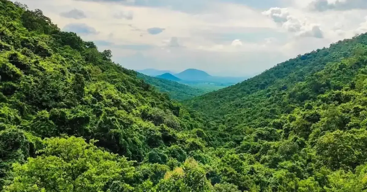
The district extends across the rugged escarpments of the Eastern Ghats. Its landscape ranges from the high-altitude cloud forests of Mahendragiri to the fertile agricultural plains of the Vamsadhara and Mahendratanaya river basins.
Modern Gajapati functions as a meeting ground of diverse cultural streams. The district headquarters at Paralakhemundi retains its royal palaces and classical Sanskrit learning centers. In the forested uplands of Chandragiri, Tibetan Buddhist refugees have built one of the largest monastic settlements in eastern India.
Key Takeaways
- Gajapati district spans 4,325 square kilometers across seven community development blocks and one revenue subdivision.
- The district recorded a population of 577,817 in Census 2011, with a positive sex ratio of 1,043 females per 1,000 males.
- Mahendragiri rises to 1,501 meters as the second-highest peak in Odisha, featuring ancient rock-cut Pandava shrines.
- Signature cultural assets include the Padmasambhava Mahavihara at Jiranga, Gajapati Palace, and GI-certified Lanjia Saura Idital paintings.
- The district produces GI-tagged Odisha Khajuri Guda (Date Palm Jaggery) and operates major cashew processing clusters.
Demographic & Geographic Profile of Gajapati District
Gajapati district sits in the southern interior zone of Odisha, bordered by Ganjam and Kandhamal districts to the north, Rayagada district to the west, and Srikakulam district of Andhra Pradesh to the east and south. The territory features complex topography dominated by steep crystalline hill ranges, deep gorges, and narrow alluvial river terraces.
The perennial Vamsadhara River flows along the western and southern boundaries of Kashinagar and Gosani blocks before crossing into Andhra Pradesh. The Mahendratanaya River originates on the slopes of the Mahendragiri range, flowing eastward past Paralakhemundi town to supply essential drinking and irrigation water.
Forest cover encompasses more than fifty-seven percent of the geographical area. The mountain canopy consists of moist deciduous woodlands, bamboo thickets, wild orchid colonies, and medicinal plant reserves.
Official demographic records from the Registrar General of India highlight a predominantly rural and indigenous population. According to the Census 2011 Official Gajapati District Directory, Gajapati recorded a total population of 577,817 citizens across 1,512 revenue villages.
Scheduled Tribes, particularly the Saura and Kondha communities, account for over fifty-four percent of the total population. The district registers a favorable sex ratio of 1,043 females per 1,000 males, reflecting strong gender balance across rural tribal societies.
The climate varies considerably with elevation. The lowland plains around Paralakhemundi experience hot, humid summers with temperatures reaching 40 degrees Celsius, while high-altitude tablelands like Chandragiri and Mahendragiri enjoy pleasant, cool weather throughout the year. The average annual rainfall averages 1,403 millimeters, arriving primarily during the southwest monsoon between June and October.
These cool mountain valleys and historical palaces rank among the prominent tourist destinations in Odisha for cultural travelers and trekkers. Further travel documentation is published through the Incredible India Official Odisha Tourism Portal.
| Demographic & Geographic Indicator | Statistical Measurement | State Comparison & Baseline |
|---|---|---|
| Total Geographical Area | 4,325 sq km | Southern highland territory of Odisha |
| Total Population (Census 2011) | 577,817 residents | 282,882 males and 294,935 females |
| Population Density | 133 persons / sq km | Sparsely populated mountainous terrain |
| Sex Ratio | 1,043 females / 1,000 males | Significantly higher than the state average |
| Child Sex Ratio (0–6 years) | 964 females / 1,000 males | Strong gender equity across tribal blocks |
| Overall Literacy Rate | 53.49% | Male: 64.38% | Female: 43.18% |
| Tribal Population Percentage | 54.2% of district population | Predominantly Lanjia Saura and Kondha groups |
| Forest Cover Percentage | ~57.4% of landmass | High biodiversity and wildlife corridors |
| Administrative Headquarters | Paralakhemundi | Historic royal capital and commercial center |
| RTO Registration Code | OD-20 | Paralakhemundi Regional Transport Office |
Administrative Divisions, Subdivisions & Community Development Blocks
Administrative governance in Gajapati district is organized under the District Collector and District Magistrate headquartered in Paralakhemundi. The district operates under a unified single revenue subdivision based at Paralakhemundi.
Rural administration is distributed across seven Community Development (CD) blocks that supervise 149 Gram Panchayats and 1,512 revenue villages. Land records and revenue collection are handled through seven corresponding tahsils, ensuring accessible administrative services for farmers and tribal landholders across remote mountain tracts.
Urban civic administration is managed by two Urban Local Bodies (ULBs). Paralakhemundi Municipality oversees municipal services for the historic district headquarters, while Kashinagar operates as a Notified Area Council (NAC) serving the commercial trading community along the Vamsadhara river plain.
| Subdivision | Community Development Block | Tahsil Center | Gram Panchayats | Headquarters Character |
|---|---|---|---|---|
| Paralakhemundi | Gosani | Paralakhemundi | 20 GPs | Border trade, agriculture, and cashew processing |
| Paralakhemundi | Kashinagar | Kashinagar | 14 GPs | Vamsadhara river plain farming and river trade |
| Paralakhemundi | Gumma | Gumma | 19 GPs | Tribal highland farming and terraced crops |
| Paralakhemundi | Rayagada | Rayagada | 18 GPs | Foothills of Mahendragiri and forest produce |
| Paralakhemundi | Nuagada | Nuagada | 19 GPs | Highland plateau, maize, and turmeric cultivation |
| Paralakhemundi | R. Udayagiri | R. Udayagiri | 16 GPs | Commercial crossroad and horticulture center |
| Paralakhemundi | Mohana | Mohana | 43 GPs | Largest block, Tibetan settlement, forest reserves |
Decentralized block administration enables effective delivery of tribal development programs. Special agencies, such as the Lanjia Saura Development Agency (LSDA) based at Serango, coordinate rural education, healthcare, and terraced farming support for indigenous hamlets.
Assembly & Parliamentary Constituencies
Electorally, Gajapati district constitutes a key democratic segment in southern Odisha. The entire district falls under the Berhampur Parliamentary Constituency (Lok Sabha Seat 20), which links Gajapati with the coastal commercial hubs of Ganjam district.
At the state level, the district is divided into two Vidhan Sabha (Legislative Assembly) constituencies. These two assembly seats represent the contrasting demographics of the district, balancing the tribal highland communities of the interior with the urban and farming populations of the southern border plains.
Constituency boundaries and official reservation details are verified in the Election Commission of India Delimitation Directory.
| Constituency Number | Assembly Constituency Name | Category | Administrative Extent & Block Coverage |
|---|---|---|---|
| AC-136 | Mohana | Scheduled Tribe (ST) | Mohana Block, R. Udayagiri Block, Nuagada Block, and Rayagada Block |
| AC-137 | Paralakhemundi | General | Paralakhemundi Municipality, Kashinagar NAC, Gosani Block, Gumma Block, and Kashinagar Block |
Elections across both constituencies consistently record high voter turnouts. Tribal communities from remote mountain hamlets walk long distances to exercise their franchise, demonstrating high civic engagement.
Deep History, Royal Gajapati Dynasty & Formation of Odisha
The history of Gajapati district is intertwined with the imperial Ganga dynasty and the emergence of modern Odia linguistic identity. In 1573 CE, Kolahomee, a prince of the royal Ganga line, established the independent feudatory kingdom of Paralakhemundi. The rulers maintained their independence through strategic hill forts, patronizing Odissi dance, classical literature, and temple building.
During British colonial rule, the kingdom was organized into the Paralakhemundi Estate under the Madras Presidency. The royal rulers established distinguished educational institutions, introduced modern irrigation reservoirs, and preserved ancient palm-leaf manuscripts.
The most renowned figure in regional history is Maharaja Krushna Chandra Gajapati Narayana Dev (1892–1974). A visionary statesman and scholar-king, the Maharaja realized that the Odia-speaking people were divided across multiple colonial provinces. He became a leading patron of the Utkal Sammilani movement alongside Utkal Gourav Madhusudan Das.
Key Historical Milestones of Gajapati District:
- 1573 CE: Establishment of the Paralakhemundi royal estate by Prince Kolahomee of the Ganga dynasty.
- 1892 CE: Birth of Maharaja Krushna Chandra Gajapati Narayana Dev.
- 1930–1931: Maharaja represents Odisha at the historic Round Table Conferences in London.
- April 1, 1936: Formation of the separate province of Odisha on linguistic lines, with the Maharaja serving as its first Prime Minister.
- 1963 CE: Tibetan refugees establish the Phuntsokling resettlement colony at Chandragiri.
- October 2, 1992: Undivided Ganjam district is partitioned to create independent Gajapati district.
The Maharaja traveled to London at his personal expense to address the Round Table Conferences in 1930 and 1931. His eloquent advocacy convinced British administrators of the necessity of uniting Odia-speaking tracts.
When Odisha was established as India’s first linguistic state on April 1, 1936, the Maharaja became its first Prime Minister. When undivided Ganjam was reorganized in October 1992, the new district was named Gajapati in tribute to his legacy.
Crown of the Eastern Ghats: Mahendragiri Peak & Ancient Shrines
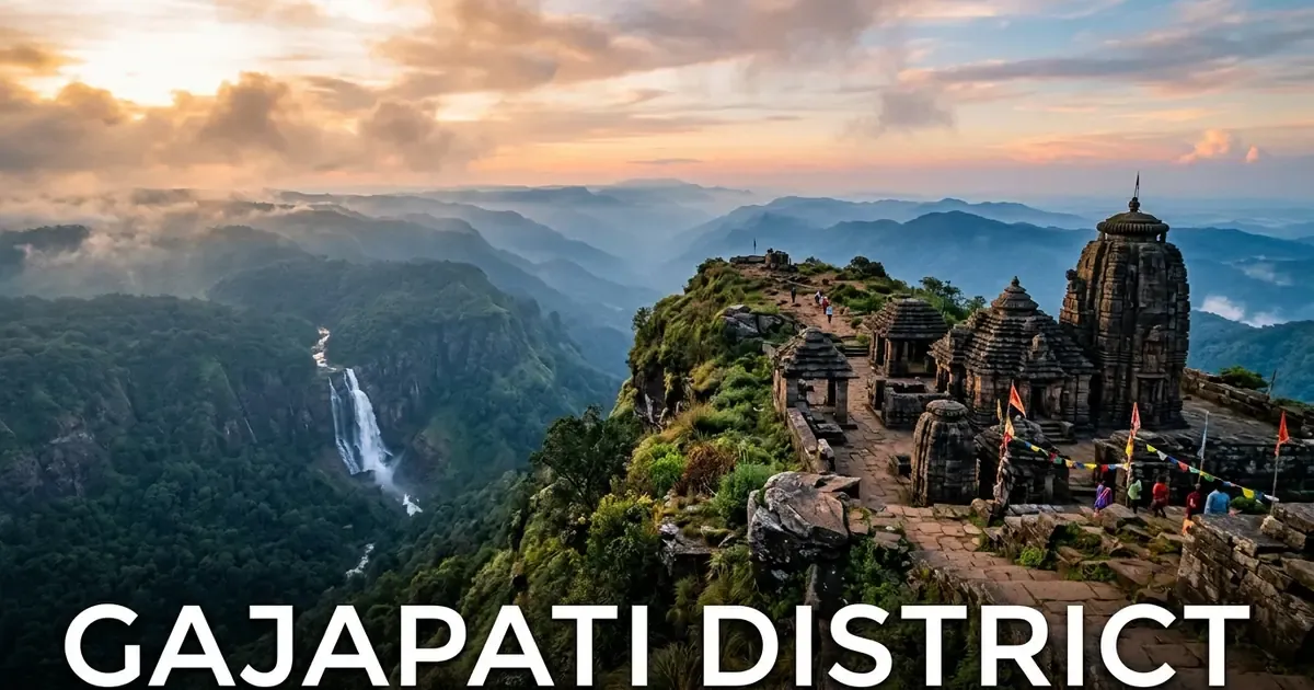
Towering to an elevation of 1,501 meters above sea level, Mahendragiri stands as the second-highest mountain summit in Odisha and one of the most sacred peaks in peninsular India. The mountain is revered in the Ramayana and Mahabharata as the hermitage of Sage Parashurama and the resting place of the Pandava brothers during their forest exile.
Near the rocky summit, three ancient stone temples built without mortar stand against mountain winds:
- Bhima Temple: An archaic stone shrine dating to the 6th century CE, assembled from massive uncarved stone blocks.
- Kunti Temple: An 8th-century temple featuring sculpted Kalinga architectural motifs and a small inner sanctum.
- Yudhisthira Temple: A rectangular stone sanctum perched on the highest rock spur.
The shrines on the summit remain protected monuments under the mandate of the Archaeological Survey of India Protected Monuments Directory. On Maha Shivaratri, thousands of pilgrims undertake a strenuous night-time trek from Kainpur and Burukhat, climbing through steep rocky ridges to greet the sunrise at the summit shrines.
Ecologically, Mahendragiri functions as a critical botanical bridge connecting the flora of the Himalayas with that of the Western Ghats. Over 600 species of flowering plants, wild medicinal herbs, and rare tree orchids flourish on its slopes. Trekkers planning an ascent can consult our dedicated Mahendragiri Hills nature guide and browse the complete catalog of places to visit in Gajapati district.
Tibetan Heritage in Chandragiri: Padmasambhava Mahavihara at Jiranga
Situated in the forested hills of Mohana block, roughly 85 kilometers north of Paralakhemundi, lies the Tibetan resettlement colony of Chandragiri, known in Tibetan as Phuntsokling (Land of Happiness). Established in 1963 to shelter Tibetan refugees following the Chinese occupation of Tibet, the settlement has grown into an international center of Mahayana Buddhist culture.
The architectural centerpiece of the colony is the Padmasambhava Mahavihara, consecrated by His Holiness the 14th Dalai Lama in January 2010. Rising five stories above manicured monastic lawns, it is recognized as the largest Tibetan Buddhist monastery in eastern India.
The monastery deula features intricate traditional artwork, golden dragon finials, and detailed frescoes illustrating Buddhist cosmology. Inside the main prayer hall, a monumental 23-foot gilded bronze statue of Guru Padmasambhava commands the sanctum, flanked by statues of Avalokiteshvara and Gautama Buddha.
Monks in maroon robes conduct daily evening prayer assemblies accompanied by chanting, low-frequency horns, and ceremonial cymbals. Visitors can tour the monastery gardens, spin traditional prayer wheels, and purchase hand-woven Tibetan wool carpets and incense crafted by local resident cooperatives. Visitors can find transit tips and visitor protocols in our Jiranga Buddhist Monastery guide.
Royal Palaces & Architectural Landmarks: Gajapati Palace & Brundaban Palace
The royal lineage of Paralakhemundi has endowed the town with magnificent palatial architecture that reflects a fusion of Odia, Islamic, and European design styles.
Gajapati Palace (Paralakhemundi Palace)
Constructed in 1835 by Maharaja Jagannath Gajapati and later renovated by Maharaja Krushna Chandra Gajapati, the royal palace stands in the heart of Paralakhemundi. Designed by British architect Robert Fellowes Chisholm, the palace combines Indo-Saracenic arches, European colonial pediments, and traditional Kalinga battlements.
The palace features a grand three-story facade flanked by defensive watchtowers. The historic Durbar Hall contains carved teakwood ceilings, royal thrones, crystal chandeliers, and portrait galleries of the Ganga dynasty. An underground tunnel network historically connected the royal chambers with surrounding hill outposts for defensive maneuvers during feudal sieges.
Brundaban Palace
Situated five kilometers south of Paralakhemundi on the banks of the Mahendratanaya River, Brundaban Palace served as the royal family’s summer retreat. The double-storied mansion is surrounded by mango orchards, flowering riverbanks, and formal lawns.
The palace reflects European country-house architecture with wide open verandas and shaded stone balconies overlooking the river. During the winter season, the quiet riverside gardens provide a favored location for cultural photography and peaceful historical walks.
Spectacular Waterfalls & Nature Escapes: Gandahati Falls & Harabhangi Dam
Gajapati’s mountainous terrain creates dramatic river gorges, forest cataracts, and scenic reservoirs that attract nature enthusiasts from across Odisha and northern Andhra Pradesh.
Gandahati Waterfall
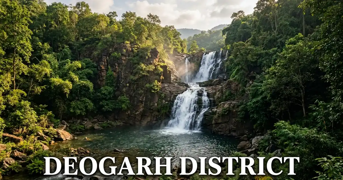
Located 30 kilometers north of Paralakhemundi near Rayagada block, Gandahati Waterfall drops approximately 30 meters over glistening granite ledges along the course of the Mahendratanaya River.
The waterfall is surrounded by dense semi-evergreen forest canopy that serves as an active wildlife corridor. Wild Asian elephant herds frequently visit the river pools upstream during summer evenings to bathe and drink. The state tourism department has developed paved walking paths, viewing pavilions, and garden rest houses around the cascade for visiting families.
Harabhangi Dam & Reservoir
Constructed across the Harabhangi stream near Adaba in Mohana block, this major medium irrigation reservoir nestles within a ring of densely wooded mountain ridges.
The expansive body of water features calm blue surfaces and isolated forested islands. During the winter migratory bird season from November to February, hundreds of waterfowl gather on the reservoir, making it an appealing destination for birdwatchers and day picnickers exploring northern Gajapati.
Indigenous Tribal Heritage: The Lanjia Saura & GI-Tagged Idital Art
Gajapati district is the ancestral heartland of the Lanjia Saura tribe, one of Odisha’s most culturally distinct Particularly Vulnerable Tribal Groups (PVTGs). Concentrated primarily in Gumma, Rayagada, and Nuagada blocks, the Lanjia Saura are distinguished by their traditional attire, ancient terraced agriculture, and sacred religious art.
Lanjia Saura farmers are masters of stone-terraced cultivation. Over centuries, they carved stone steps into steep mountainsides and developed gravity-fed spring channels to cultivate indigenous hillside paddy, millets, and pulses without mechanized equipment.
The greatest artistic contribution of the Lanjia Saura is Idital, an ancient sacred wall painting tradition. Lanjia Saura Painting was officially granted the Geographical Indication (GI) tag, recognizing its exclusive cultural authenticity.
Idital paintings are created on the interior red-clay walls of tribal dwellings as devotional offerings to ancestral spirits and protective deities. Tribal painters use brushes made from tender bamboo twigs and natural white pigments ground from rice paste and plant ash. The murals depict intricate human figures, horses, elephants, birds, and tree-of-life motifs arranged in symmetric geometric panels. Each icon represents ancestral protection, agricultural fertility, and communal harmony.
Renowned Agro-Artisanal Traditions: GI-Tagged Odisha Khajuri Guda
In addition to tribal art, Gajapati district holds international culinary fame as the primary producer of Odisha Khajuri Guda (Date Palm Jaggery), which was granted the prestigious Geographical Indication (GI) tag, recognizing its traditional forest heritage.
Unlike regular sugarcane jaggery, Khajuri Guda is prepared exclusively from the sweet sap harvested from wild date palm trees (Phoenix sylvestris) that grow across the hill valleys of Gumma, Rayagada, and Gosani blocks.
The production process follows centuries of tribal craftsmanship:
- Sap Collection: Skilled tribal tappers climb palm trees during cool winter dawns, making neat incisions in the trunk and hanging earthen pots to catch fresh sap overnight.
- Boiling and Reduction: The collected sap is transferred into broad iron pans and simmered slowly over firewood furnaces for several hours.
- Natural Crystallization: The syrup reduces into a thick golden paste without chemical bleaches or additives. It is then poured into round coconut shells or wooden molds to solidify.
Authentic Khajuri Guda has a distinctive deep chocolate-brown hue, a silky melt-in-the-mouth texture, and an aromatic caramel flavor. Tribal cooperatives organized under the Odisha State Palmgur Cooperative Federation market the jaggery across India for its low glycemic index and rich iron and mineral content.
Horticulture, Cash Crops & Cashew Processing Hubs
The agrarian economy of Gajapati is distinguished by its flourishing commercial horticulture and agro-processing industries. The district serves as the cashew processing capital of southern Odisha.
Dozens of modern and traditional cashew processing units operate in and around Paralakhemundi and Gosani block. The factories source raw cashew nuts from local orchards and neighboring districts, employing thousands of rural women in shelling, grading, and vacuum-packaging cashew kernels for export across Indian markets.
In the elevated highland blocks of Mohana, R. Udayagiri, and Nuagada, tribal farmers cultivate diverse cash crops:
- Pineapples and Bananas: The mild microclimate of Chandragiri supports extensive commercial pineapple orchards and Cavendish banana plantations.
- Hill Brooms: Wild hill broom grass (Thysanolaena maxima) is harvested sustainably from forest slopes, generating steady income for tribal women’s self-help groups.
- Turmeric and Ginger: Organic hill varieties grown in Nuagada command high prices for their strong aroma and high curcumin content.
- Maize and Millets: Terraced hill slopes produce finger millet (ragi) and maize under state agro-biodiversity promotion schemes.
River Basins, Forest Ecology & Biodiversity Corridors
The ecological health of Gajapati depends upon its two primary river systems and extensive mountain forest reserves.
The Vamsadhara River drains the western plateau, originating in the neighboring highlands before passing through Kashinagar block. The river valley provides fertile alluvial soils that sustain double-cropped paddy, sugarcane, and oilseed agriculture.
The Mahendratanaya River flows through the central heart of the district, originating from the Mahendragiri hills and supplying water to Paralakhemundi before crossing the border into Andhra Pradesh.
Gajapati’s forest canopy covers more than 2,400 square kilometers, forming an essential ecological bridge between the Satkosia elephant reserves and the southern hill tracts of Koraput district. The forests host healthy populations of Asian elephants, leopards, sloth bears, sambar deer, barking deer, wild dogs, and Indian giant squirrels. The state wildlife department maintains anti-poaching camps and solar-powered forest watering holes across elephant migration routes to mitigate human-wildlife conflict.
Educational Heritage & Healthcare Infrastructure
Gajapati has long enjoyed a distinguished reputation for academic excellence in southern Odisha, inherited from royal patronage of learning and science.
The flagship institution of higher education is the Sri Krushna Chandra Gajapati (SKCG) Autonomous College in Paralakhemundi. Established in 1896 by Maharaja Goura Chandra Gajapati and expanded by Maharaja Krushna Chandra Gajapati, it is one of the oldest degree colleges in Odisha. The college has educated generations of scholars, judges, civil servants, and authors.
Other notable academic centers in the district include:
- Centurion University of Technology and Management (CUTM): A leading private university campus located on the outskirts of Paralakhemundi, offering programs in engineering, agriculture, and vocational skill sciences.
- Jawahar Navodaya Vidyalaya, Betaguda: A distinguished residential school providing quality education to rural students.
Public healthcare delivery is anchored by the Gajapati District Headquarter Hospital (DHH) in Paralakhemundi, equipped with emergency trauma services, maternal care wards, and blood bank facilities. Community Health Centres (CHCs) in Mohana, R. Udayagiri, and Chandragiri ensure essential primary health access for tribal families in remote upland sectors.
Transportation Logistics: How to Reach Gajapati by Rail, Road & Air
Reaching Gajapati district is convenient via road and railway networks connecting southern Odisha with coastal corridors and Andhra Pradesh.
Reaching Gajapati by Road
State Highway 17 (SH-17) connects Paralakhemundi directly with Berhampur (115 km), the commercial capital of southern Odisha, where travelers connect to National Highway 16. State Highway 34 links the district with Mohana and Chandragiri. Frequent OSRTC state buses and private deluxe coaches run daily routes between Paralakhemundi and Bhubaneswar, Cuttack, Rayagada, and Visakhapatnam.
Reaching Gajapati by Rail
Paralakhemundi Railway Station (Station Code: PLOR) is situated on the Naupada-Gunupur broad-gauge branch line under the Waltair Railway Division of East Coast Railway. Daily passenger and express trains link Paralakhemundi with Naupada Junction on the Howrah-Chennai mainline, as well as Gunupur and Visakhapatnam. Travelers can easily board connecting express trains at Berhampur or Palasa railway stations.
Reaching Gajapati by Air
The nearest commercial airport is Visakhapatnam International Airport (VTZ) in Andhra Pradesh, located 175 kilometers south of Paralakhemundi. The airport operates domestic flights to all major Indian metropolitan cities and international flights to Southeast Asia. Biju Patnaik International Airport (BBI) in Bhubaneswar is situated 270 kilometers northeast, reachable within five hours by highway.
| Origin Hub | Distance to Paralakhemundi | Primary Route | Travel Time by Car |
|---|---|---|---|
| Berhampur | 115 km | SH-17 via Digapahandi | 2 hours 30 minutes |
| Palasa (AP) | 40 km | Interstate Highway via Kasibugga | 1 hour |
| Bhubaneswar | 270 km | NH-16 to Berhampur, then SH-17 | 5 hours |
| Visakhapatnam | 175 km | NH-16 to Palasa, then State Road | 3 hours 30 minutes |
| Rayagada | 135 km | State Highway via Gunupur | 3 hours |
Practical Travel Tips, Best Time to Visit & Ideal Itineraries
Travelers planning an expedition to Gajapati district can follow these seasonal recommendations and a curated two-day travel plan.
Optimal Travel Window
The best time to explore Gajapati district is during the winter months from October through March. Daytime temperatures remain comfortable between 16 and 28 degrees Celsius with clear skies and low humidity. This window is ideal for mountain trekking on Mahendragiri, exploring the temples of Chandragiri, and visiting palaces in Paralakhemundi.
The monsoon season from July to September brings gushing waterfalls and lush green valleys, but mountain roads around Mahendragiri can become slippery. Summer months from April to June are hot in the lowlands and should generally be avoided.
Accommodation Guidance
Paralakhemundi offers multiple private budget hotels, guest houses, and government inspection bungalows near the palace road and railway station. At Chandragiri, comfortable guest accommodations are available at the monastery guest house and nearby eco-cottages. Bookings can be coordinated through local travel desks and the Odisha Tourism Development Corporation Official Portal.
Recommended 2-Day Gajapati Heritage & Mountain Itinerary
- Day 1: Royal Legacy & Sacred Waterfalls:
- Morning: Tour the historic Gajapati Palace in Paralakhemundi to view the Durbar Hall and royal museum. Continue south to visit Brundaban Palace along the Mahendratanaya River.
- Afternoon: Enjoy lunch in Paralakhemundi and sample sweets prepared with authentic Khajuri Guda. Drive 30 kilometers to Gandahati Waterfall to photograph the forest cascade.
- Evening: Visit local artisan workshops in town to purchase authentic horn crafts and Lanjia Saura Idital souvenirs.
- Day 2: High Mountains & Monastic Peace:
- Morning: Depart early for Chandragiri in Mohana block (85 km). Explore the Padmasambhava Mahavihara monastery at Jiranga, spin prayer wheels, and tour the Tibetan carpet weaving workshops.
- Afternoon: Enjoy traditional Tibetan thukpa or momos for lunch. Drive toward the foothills of Mahendragiri or visit the scenic Harabhangi Dam reservoir.
- Evening: Depart via Mohana toward Berhampur or Bhubaneswar for your onward journey.
Frequently Asked Questions (FAQ) About Gajapati District
What is Gajapati district famous for?
Gajapati district is famous across India for Mahendragiri peak (Odisha’s second-highest mountain), the Padmasambhava Mahavihara Tibetan monastery at Jiranga, the historic Gajapati Palace in Paralakhemundi, Gandahati Waterfall, GI-tagged Odisha Khajuri Guda date palm jaggery, and GI-certified Lanjia Saura Idital tribal paintings.
Where is Mahendragiri located and how do travelers reach the summit?
Mahendragiri is situated in the Eastern Ghats of Gajapati district near the border of Andhra Pradesh, rising to an altitude of 1,501 meters. Trekkers can reach the summit by road up to Burukhat or Kainpur village, followed by a steep 4-kilometer mountain footpath leading to the ancient rock-cut Pandava shrines.
What is Jiranga Buddhist Monastery and who inaugurated it?
Jiranga Buddhist Monastery, officially named the Padmasambhava Mahavihara, is located in Chandragiri within the Mohana block of Gajapati district. It is the largest Tibetan Buddhist monastery in eastern India, standing five stories tall, and was officially inaugurated by His Holiness the 14th Dalai Lama in January 2010.
What are the two GI products of Gajapati district?
Gajapati district holds two official Geographical Indication (GI) tags granted by the Government of India: Odisha Khajuri Guda (a traditional date palm jaggery prepared by local tribal tappers) and Lanjia Saura Painting (ancient sacred Idital wall art created by the Lanjia Saura tribal community).
How far is Paralakhemundi from Berhampur and Visakhapatnam?
Paralakhemundi is situated 115 kilometers southwest of Berhampur via State Highway 17 (about 2.5 hours by road) and 175 kilometers north of Visakhapatnam via National Highway 16 and Palasa (about 3.5 hours by car).