Jajpur District: History, Biraja Temple, Kalinga Nagar & Guide
Explore Jajpur district in Odisha. Discover Biraja Temple Shakti Peetha, Ratnagiri Buddhist ruins, Kalinga Nagar steel hub, Baitarani River, and travel facts.
Jajpur district forms the sacred and industrial heartland of coastal Odisha. Historically celebrated as Biraja Kshetra and Yayatipura, this territory along the sacred Baitarani River served as the imperial capital of powerful regional dynasties for centuries.
Today, Jajpur presents a rare synthesis of ancient spiritual sanctity and modern economic dynamism. The district preserves the revered Maa Biraja Temple, the world-famous Buddhist monastic complexes of the Diamond Triangle, and one of India’s largest steel and mineral manufacturing corridors at Kalinga Nagar.
Geographically, Jajpur stretches from the mineral-bearing hills of the Sukinda chromite valley down to the fertile deltaic floodplains created by the Baitarani and Brahmani rivers. The district continues to attract scholars, pilgrims, industrial professionals, and heritage enthusiasts from across India.
Key Takeaways
- Jajpur district spans 2,899 square kilometers across ten community development blocks, ten tehsils, and one revenue subdivision.
- The district recorded a population of 1,827,192 in the Census 2011, maintaining an 80.13 percent literacy rate and a population density of 630 persons per square kilometer.
- Maa Biraja Temple in Jajpur town functions as an ancient Adi Shakti Peetha (Nabhi Gaya), where Goddess Durga is worshipped as a rare two-armed Mahishasuramardini.
- The district houses the world-renowned Buddhist Mahavihara ruins of Ratnagiri and Udayagiri, forming key anchors of Odisha’s Diamond Triangle.
- Kalinga Nagar in Danagadi and Sukinda blocks hosts heavy integrated steel plants and contains roughly 98 percent of India’s chromite reserves.
- Jajpur is connected by the six-lane National Highway 16 and the major East Coast railway mainline at Jajpur Keonjhar Road (JJKR).
Demographic & Geographic Profile of Jajpur District
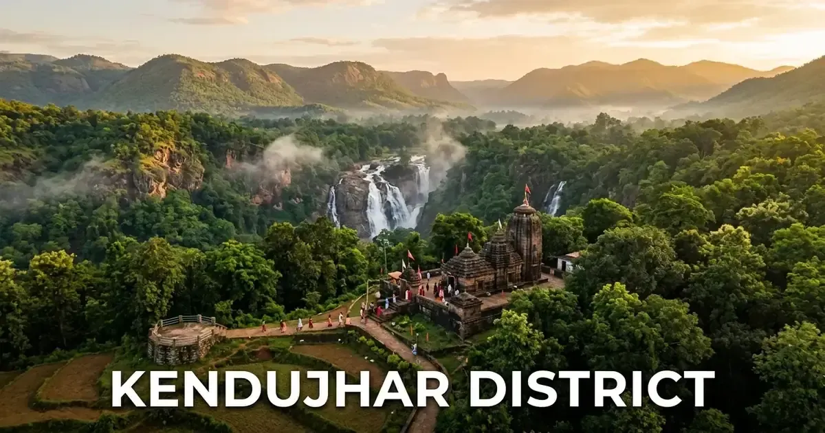
Jajpur district lies in the coastal deltaic tract of eastern Odisha, positioned between 20° 43’ N to 21° 10’ N latitude and 85° 40’ E to 86° 44’ E longitude. The district is bounded by the mineral-rich highlands detailed in our definitive Kendujhar district travel guide and Bhadrak district to the north, Cuttack and Kendrapara districts to the south, Dhenkanal district to the west, and Kendrapara district to the east.
The terrain slopes gently from the western forested tablelands toward the eastern alluvial coastal plains. In the western reaches, the Sukinda valley contains rocky hills rich in minerals, while the central and eastern belts are crisscrossed by a network of rivers and distributary canals that support productive agriculture.
The demographic data below reflects official figures recorded by the Jajpur District Administrative Records.
| Demographic / Geographic Indicator | Official Statistical Value | Administrative Notes & Verification |
|---|---|---|
| Total Geographic Area | 2,899 sq km | Covers 1.86% of Odisha’s total land area |
| Total District Population (2011) | 1,827,192 persons | 926,058 males and 901,134 females |
| Population Density | 630 persons per sq km | Well above the state average density of 270 |
| Decadal Population Growth (2001-2011) | 12.43% | Steady demographic stabilization |
| Sex Ratio | 973 females per 1,000 males | Child sex ratio (0-6 years) stands at 926 |
| Overall Literacy Rate | 80.13% | Male literacy: 86.84%; Female literacy: 73.29% |
| Administrative Headquarters | Panikoili / Jajpur Town | Collectorate situated at Panikoili on NH-16 |
| Revenue Division | Central Revenue Division | Headquarters located at Cuttack |
| Revenue Subdivisions | 1 (Jajpur) | Administering entire district territory |
| Community Development Blocks | 10 CD Blocks | Administering 311 Gram Panchayats |
| Revenue Tehsils | 10 Tehsils | Cadastral revenue management |
| Urban Local Bodies (ULBs) | 2 Municipalities | Jajpur Municipality and Vyasanagar Municipality |
| Motor Vehicle Registration (RTO) | OD-34 | Regional Transport Office, Jajpur |
| Major River Systems | Baitarani, Brahmani, Kharasrotha | Flow east toward the Bay of Bengal |
The district enjoys a tropical monsoon climate characterized by hot, humid summers, abundant monsoon rainfall, and mild winters. Average annual rainfall measures approximately 1,559 millimeters, with the southwest monsoon accounting for over 75 percent of annual precipitation between June and October.
Historical Trajectory: Somavamshi Capital to Modern Industrial Hub
The recorded history of Jajpur extends back more than two millennia, positioning it among the oldest continuously inhabited urban centers in eastern India. Ancient Puranic texts, Buddhist chronicles, and copper plate grants refer to the settlement variously as Biraja Kshetra, Parvati Tirtha, and Yayatipura.
During the rule of the Bhaumakara dynasty between the 8th and 10th centuries CE, the region served as a major political hub. The Bhaumakara queens and kings established their royal capital at Guhadevapataka (identified with modern Gohiratikiri near Jajpur). They patronized both Mahayana Buddhism and Shaivite monastic orders, creating an era of artistic flowering.
In the 10th century, King Jajati Keshari (Yayati I) of the Somavamshi dynasty transferred his political seat to this fertile riverbank, naming the city Yayatipura. Jajati Keshari conducted the legendary Dashaswamedha Yajna along the Baitarani River, inviting thousands of Vedic scholars from northern India to settle in the valley.
During the reign of the Eastern Ganga dynasty, King Anangabhima Deva III maintained Jajpur as a secondary administrative center before consolidating authority at Cuttack. Despite devastating invasions by the Bengal Sultanate in 1568 under Kalapahad, the cultural institutions of Jajpur persevered through the Maratha era and colonial British administration.
Following Indian independence, the territory functioned as an integral subdivision of undivided Cuttack district. On 1 April 1993, the Government of Odisha reorganized the state into thirty districts, formally creating Jajpur as an independent administrative entity. Travelers interested in these broader regional dynasties can explore our overview of the medieval dynastic history of Odisha.
Administrative Framework: Subdivisions, Blocks & Constituencies
Jajpur district is organized into an efficient administrative structure designed to oversee rural welfare, revenue settlement, and industrial development. The Collector and District Magistrate oversees administration from the integrated collectorate complex at Panikoili, strategically located at the intersection of National Highway 16 and National Highway 20.
The district comprises one revenue subdivision (Jajpur) containing ten community development blocks and ten tehsils. Urban civic administration is managed by two urban local bodies: the historic Jajpur Municipality along the Baitarani and the industrial commercial center of Vyasanagar Municipality (Jajpur Road).
The table below summarizes the ten community development blocks of Jajpur district, their headquarters, and primary economic activities.
| CD Block | Block HQ | Gram Panchayats | Primary Economic Drivers | Key Geographic Characteristics |
|---|---|---|---|---|
| Jajpur | Jajpur Town | 29 GPs | Heritage tourism, service sector, horticulture | Surrounds historic Biraja temple and urban center |
| Dasarathpur | Dasarathpur | 28 GPs | Rice cultivation, freshwater fishery, betel vines | Alluvial floodplains bordering Bhadrak district |
| Korei | Korei | 30 GPs | Agriculture, logistics, retail trade | Bisected by major railway and highway freight corridors |
| Binjharpur | Binjharpur | 32 GPs | Commercial paddy, dairy farming, vegetable trade | Deltaic plains watered by Kharasrotha distributaries |
| Bari | Bari | 29 GPs | Organic farming, pulse cultivation, handlooms | Historical freedom movement center on Brahmani river |
| Rasulpur | Brahmabarada | 33 GPs | Tussar silk weaving, brassware, small trade | Famous for Gopalpur rural handloom weaving clusters |
| Dharmasala | Jaraka | 41 GPs | Stone crushing, road logistics, agriculture | Transit gateway connecting NH-16 to Buddhist sites |
| Barchana | Chhatia | 35 GPs | Temple pilgrimage, agro-processing, transport | Foothills region hosting Chhatia Bata and NH-16 access |
| Danagadi | Danagadi | 24 GPs | Heavy steel manufacturing, industrial logistics | Core zone of Kalinga Nagar industrial complex |
| Sukinda | Sukinda | 30 GPs | Chromite opencast mining, mineral processing | Rugged forested valley holding deep mineral seams |
For democratic representation, Jajpur district is divided into seven single-member Odisha Legislative Assembly constituencies. All seven assembly segments fall entirely within the Jajpur Parliamentary Constituency (PC-08), which is reserved for Scheduled Caste candidates under the Election Commission of India Delimitation Order.
The seven legislative assembly constituencies within Jajpur district include:
- AC-48 Binjharpur: Reserved for Scheduled Castes (SC), encompassing Binjharpur block.
- AC-49 Bari: General category, covering the agricultural heartland of Bari block.
- AC-50 Barchana: General category, covering Barchana block and pilgrimage towns along NH-16.
- AC-51 Dharmasala: General category, comprising Dharmasala block and foothill transit corridors.
- AC-52 Jajpur: General category, covering Jajpur town, Biraja temple, and surrounding rural panchayats.
- AC-53 Korei: General category, including Korei block and parts of Vyasanagar municipal territory.
- AC-54 Sukinda: General category, covering Sukinda chromite valley and Danagadi industrial belts.
River Systems & Geography: Baitarani, Brahmani & Deltaic Plains
The geography of Jajpur is sculpted by two of Odisha’s most vital river systems: the Baitarani and the Brahmani. These perennial watercourses descend from the Chota Nagpur Plateau and Keonjhar highlands, depositing rich alluvial silt across the district before discharging into the Bay of Bengal.
The Baitarani River forms the northern boundary of Jajpur district, separating it from Bhadrak and Kendujhar. Revered in Hindu mythology as the river that cleanses all earthly impurities, the Baitarani flows gracefully past Jajpur town, where numerous ancient stone bathing ghats line its southern bank.
The Brahmani River enters the district from the west through Dhenkanal, flowing past Jenapur and Bari. Near Jenapur, the river splits into multiple braided channels, including the Kharasrotha, Kelua, and Birupa distributaries. This extensive riverine network creates fertile agricultural soil but also exposes low-lying villages to seasonal monsoon flooding.
In the western sector of the district, the Sukinda valley presents a starkly different topography. Steep quartzite and dolerite ridges rise abruptly from the surrounding plateau, cloaked in dry deciduous sal and teak forests. This hill tract contains the world’s most concentrated deposits of metallurgical-grade chromite ore.
Spiritual Core: Maa Biraja Temple & Ancient Biraja Kshetra
Maa Biraja Temple represents the spiritual pinnacle of Jajpur district. Positioned in the heart of Jajpur town, the temple is celebrated as one of the foremost Adi Shakti Peethas in India. According to traditional Shakta cosmology, when Lord Shiva carried the charred body of Goddess Sati across creation, her navel (Nabhi) fell at this consecrated site, earning it the sacred name Nabhi Gaya.
The presiding deity inside the sanctum sanctorum is Goddess Biraja, worshipped as a rare two-armed (Dwi-bhuja) Mahishasuramardini. The stone idol depicts the goddess piercing the chest of the buffalo demon Mahishasura with her trident using her right hand, while holding the demon’s tail in her left hand.
Iconographers consider this two-armed depiction to be one of the earliest sculptural forms of Durga in Indian art. It predates the more common eight-armed and ten-armed representations of the classical medieval period.
Adjacent to the temple kitchen within the inner courtyard lies the sacred Nabhi Gaya well. Devotees from across India travel to this well to offer Pinda Daan (ancestral rites) to liberate the souls of their departed ancestors. Performing Pinda Daan at Nabhi Gaya in Jajpur is considered spiritually equivalent to conducting rites at Gaya in Bihar or Brahma Kapala in Badrinath.
A singular ritual tradition of Maa Biraja Temple is the annual Singhadhwaja Ratha Yatra celebrated during the autumn Durga Puja festival. Maa Biraja is the only Hindu goddess in India who journeys atop a massive wooden chariot for nine consecutive days during Navaratri.
Pilgrims wishing to explore related spiritual sanctuaries can consult our comprehensive guide to revered temple complexes across Odisha. The temple’s architectural evolution is documented in detail through the Biraja Temple Epigraphical Survey.
The Diamond Triangle: Ratnagiri & Udayagiri Buddhist Monasteries
Jajpur district contains two of the three celebrated Buddhist monastic sites that comprise the world-famous Diamond Triangle of Odisha: Ratnagiri and Udayagiri (with the third site, Lalitgiri, situated just across the district boundary in Cuttack). Between the 5th and 12th centuries CE, this region was one of Asia’s most prominent centers of Mahayana and Vajrayana Buddhist philosophy, comparable to Nalanda and Vikramashila.
Ratnagiri, translating literally to the “Hill of Jewels,” sits atop a low hill in Bari block surrounded by rolling rural valleys. Excavations conducted by the Archaeological Survey of India uncovered two expansive brick monasteries, a massive stupa complex, and hundreds of sculpted stone images of Buddha, Tara, and Bodhisattvas.
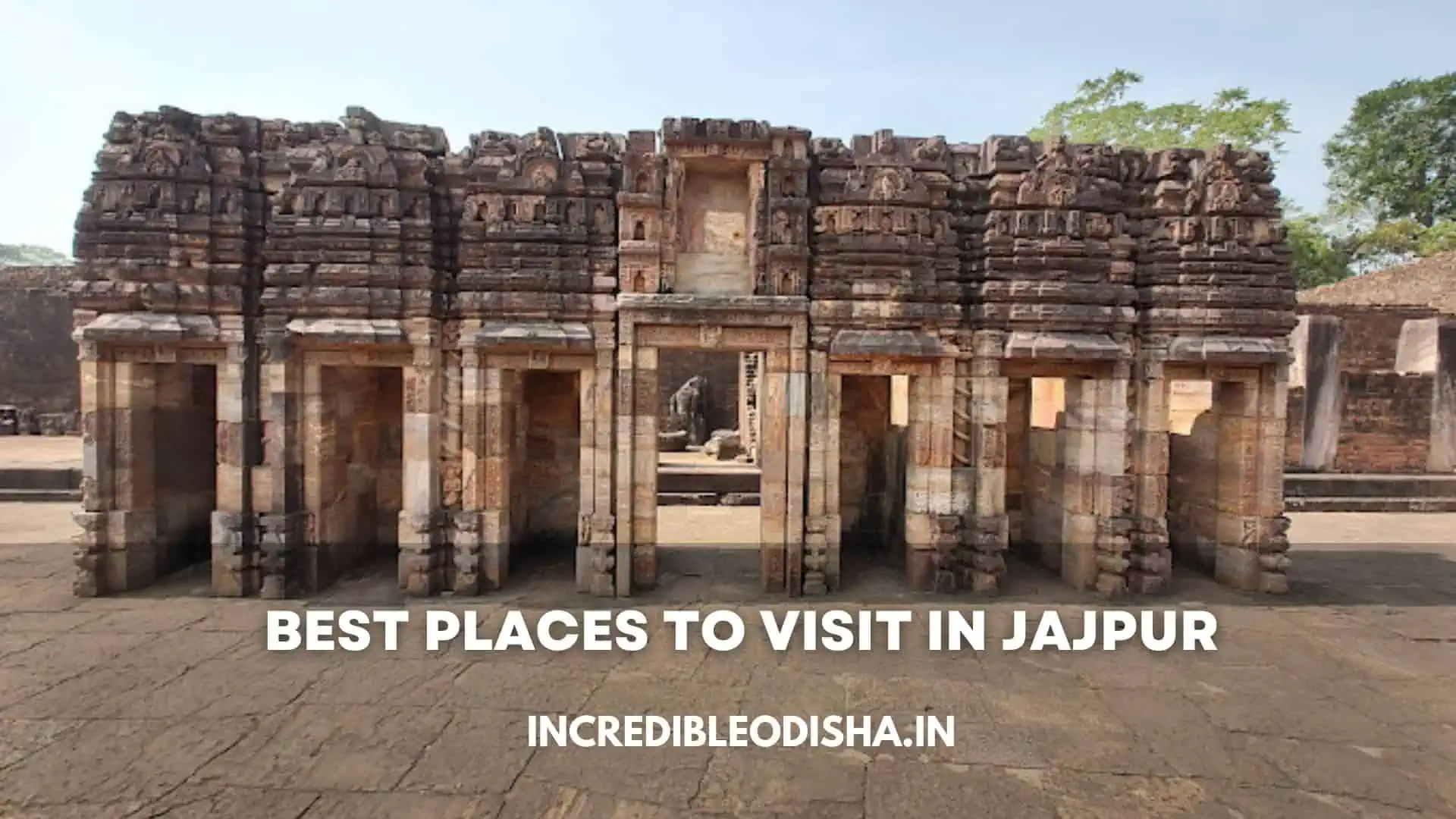
The entrance portal of Monastery 1 at Ratnagiri is universally regarded as a masterpiece of ancient Indian stone carving. Sculpted from greenish chlorite stone, the doorway displays intricate creepers, lotus motifs, flying celestial couples (Vidyadharas), and dvarapala guardians. Within the courtyard sits a colossal five-meter-tall seated Buddha in Bhumisparsha Mudra, exuding solemn majesty.
A few kilometers southeast lies Udayagiri, meaning the “Sunrise Hill.” Udayagiri is the largest monastic settlement in the Diamond Triangle, featuring sprawling excavated brick structures, an impressive stepped stone well, and rock-cut sculptures. Ancient terracotta seals recovered here bear the Sanskrit inscription of Sri Madhavapura Mahavihara, identifying the site’s original institutional name.
Scholars, historians, and international travelers visit the Diamond Triangle to study its remarkable Buddhist art. The ongoing preservation of these ancient monastic centers is documented in detail through the Ratnagiri Monastic Excavation Directory.
Sacred Riverfronts & Shrines: Dashaswamedha Ghata & Chhatia Bata
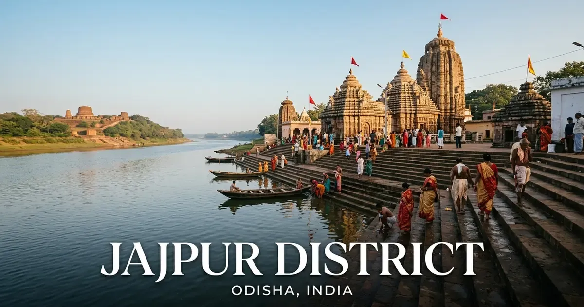
Beyond the main Biraja temple, Jajpur town contains magnificent riverfront architecture along the sacred Baitarani River. The most revered location is Dashaswamedha Ghata, a long flight of stone steps built along the riverbank by Somavamshi King Jajati Keshari in the 10th century.
Mythological tradition records that Lord Brahma performed ten horse sacrifices (Ashwamedha Yajna) upon these steps to consecrate the holy river. Adjoining the ghat sits the celebrated Saptamatruka temple, which enshrines colossal 10th-century stone carvings of the seven mother goddesses: Brahmani, Vaishnavi, Indrani, Chamunda, Kaumari, Varahi, and Maheshwari, accompanied by Lord Ganesha and Veerabhadra.
Every year during the auspicious Baruni Snana festival in early spring, tens of thousands of pilgrims gather at Dashaswamedha Ghata to take ritual dips in the Baitarani River. As dusk settles, priests perform Ganga Aarti ceremonies along the riverbank, with hundreds of flickering oil lamps drifting across the calm water.
In the southern part of the district along National Highway 16, Chhatia Bata serves as another major spiritual magnet. Dedicated to Lord Jagannath, this temple complex takes its name from an ancient banyan tree (Bata) associated with the 16th-century mystic poet Achyutananda Das. Devotees visit Chhatia to read from the sacred Malika texts and purchase the famous local Chhatia Gaja sweets.
Industrial Transformation: Kalinga Nagar & the Sukinda Chromite Valley
Over the past three decades, Jajpur district has evolved into one of India’s preeminent metallurgical manufacturing hubs, driven by the mineral wealth of the Sukinda valley and the rapid growth of the Kalinga Nagar Industrial Complex in Danagadi block.
The Sukinda valley holds an estimated 98 percent of India’s total proven reserves of chromite ore, an essential element used in the production of stainless steel, specialized alloys, and chemical refractory materials. Leading mining corporations, including Tata Steel Mining, the Odisha Mining Corporation (OMC), and IMFA, operate advanced extraction and beneficiation facilities across the valley.
Complementing this raw mineral base, Kalinga Nagar has emerged as a major steel center in eastern India. Spread over more than 13,000 acres, this planned industrial cluster hosts massive integrated steel production plants, including:
- Tata Steel Kalinganagar (TSK): A state-of-the-art integrated steel plant with multi-million-tonne annual capacity producing high-grade flat steel products.
- Jindal Stainless Limited (JSL): India’s largest stainless steel production facility, supplying domestic and international manufacturing markets.
- Neelachal Ispat Nigam Limited (NINL): An integrated steelmaker producing high-purity pig iron and specialized wire rods.
- MESCO Steel and Visa Steel: Major industrial units contributing to regional pig iron, sponge iron, and ferrochrome output.
This concentration of heavy industry has spurred rapid development across Jajpur Road (Vyasanagar), expanding commercial markets, banking services, engineering training institutes, and modern transport links.
Traditional Art & Weaving: Gopalpur Tussar Silk & Local Crafts
Alongside modern blast furnaces and industrial complexes, Jajpur district preserves centuries-old rural artisan traditions. Chief among these is the renowned Tussar silk weaving craft centered in the rural village of Gopalpur within Rasulpur block.
Weavers in Gopalpur produce exquisite wild Tussar silk sarees, stoles, and running fabrics using traditional pit looms. They extract wild silk filaments from silkworm cocoons harvested in the nearby tribal forest tracts of Keonjhar and Mayurbhanj, spinning the yarn by hand.
Weavers incorporate intricate temple border motifs (Kumbha) into the fabric. The handlooms of Gopalpur are celebrated across national exhibitions for their rich golden texture, lightweight drape, and natural organic sheen.
Beyond silk textiles, rural artisans in Bari and Dasarathpur blocks craft utilitarian baskets, mats, and decorative boxes using wild golden grass (Kaincha). Rural potters produce terracotta kitchenware and clay votive figurines for seasonal village rituals, demonstrating the living artisanal heritage of the Baitarani valley.
Culinary Identity: Chhatia Gaja & Traditional Jajpuri Cuisine
The culinary traditions of Jajpur district reflect coastal Odisha’s love for fresh river produce, rich dairy confections, and time-honored temple offerings. Visitors exploring the district encounter distinctive local specialties that cannot be replicated elsewhere.
The undisputed culinary crown of the district belongs to Chhatia Gaja. Originating from sweet shops surrounding the Chhatia Bata temple along National Highway 16, this confection is prepared from refined flour dough deep-fried in pure ghee until crispy and golden brown.
The confection is steeped in warm sugar syrup. Unlike softer varieties of gaja, Chhatia Gaja retains a crunchy crust with a sweet, syrupy interior that maintains freshness for weeks without refrigeration.
Other celebrated local dishes include:
- Chenna Mudki: Bite-sized cubes of fresh cow cottage cheese cooked in caramelized sugar syrup until coated with a thin sugary crust, popular in Jajpur town.
- Biraja Temple Bhoga: Sacred daily temple meals prepared without onions or garlic, featuring Kanika (sweet fragrant rice), Dalma (lentils simmered with raw papaya and pumpkin), and Besara.
- Baitarani Freshwater Fish Curry: Fresh river fish (Rohu and Bhakur) simmered in a light, fragrant gravy tempered with mustard paste, green chilies, and dried wild mango (Ambula).
- Poda Pitha: Traditional roasted rice and coconut cakes baked wrapped in banana leaves, particularly favored during the Olasuni Mela festival.
Fairs, Festivals & Sacred Observances: Baruni Snana & Rath Yatra
Jajpur district celebrates an extensive calendar of traditional fairs and religious festivals that draw hundreds of thousands of pilgrims to its riverbanks and shrines throughout the year.
The foremost annual gathering is the Baruni Snana, observed during the dark fortnight of the Odia month of Chaitra (March or April) at Dashaswamedha Ghata. Pilgrims believe that taking a ritual bath in the Baitarani River on this auspicious day washes away accumulated sins and grants spiritual liberation. When the astrological alignment forms the rare Maha Baruni yoga, attendance swells to more than half a million devotees.
During autumn, the Biraja Singhadhwaja Ratha Yatra coincides with Durga Puja. The wooden chariot carrying the bronze chalanti pratima of Goddess Biraja is pulled through the historic lanes of Jajpur town for nine consecutive days, culminating in Vijayadashami.
Other celebrated cultural festivals include:
- Olasuni Mela: Celebrated on Magha Ekadasi (January or February) on Olasuni Hill near the Kendrapara border, commemorating the samadhi of mystic saint Arakhita Das with folk music, dance, and community feasts.
- Chhatia Bata Dola Purnima: Spring festival in March featuring colorful palanquin processions of Radha and Krishna deities across surrounding villages.
- Kalinga Nagar Mahotsav: Annual cultural festival in Vyasanagar highlighting traditional Odissi dance, folk music, tribal arts, and industrial exhibitions.
Natural Excursions: Ashokjhar Waterfall & Mahavinayak Temple
While Jajpur is primarily celebrated for heritage and industry, the district also offers scenic natural escapes situated among the forested western hill tracts.
In the Sukinda valley, Ashokjhar Waterfall cascades down rugged red laterite rock shelves into a refreshing forest pool. Surrounded by dense sal and mahua groves, Ashokjhar provides a popular daytime picnic destination during the winter months. Families and photographers often stop here while traveling toward the Sukinda mines. For additional cascades across the state, explore our comprehensive directory of Odisha waterfalls.
At Chandikhole in the southern sector of the district, Mahavinayak Temple stands at the base of the verdant Barunabanta hills. This unique shrine enshrines a single swayambhu (self-manifested) stone lingam that devotees revere as the union of five deities: Shiva, Vishnu, Durga, Surya, and Ganesha. Natural mountain springs trickle through the temple gardens, creating an atmosphere of tranquility.
Nearby, atop a steep hillside reached by climbing stone steps, sits the peaceful Chandikhole Tapovan, an ashram established by the saint Swami Bhairabananda surrounded by forest foliage and roaming troops of monkeys.
Curated Travel Directory: Major Historical & Cultural Landmarks
Travelers planning an excursion to Jajpur can consult the curated landmark directory below, which summarizes practical visitor details for the district’s top attractions.
| Landmark / Attraction | Geographic Setting | Primary Heritage Distinction | Recommended Visiting Hours | Entry Fee |
|---|---|---|---|---|
| Maa Biraja Temple | Jajpur Town | Ancient Adi Shakti Peetha (Nabhi Gaya) | 4:00 AM – 1:00 PM; 3:00 PM – 10:00 PM | Free; modest traditional attire |
| Ratnagiri Buddhist Complex | Bari Block, 20 km from town | Excavated Vajrayana Mahavihara and monastery | 8:00 AM – 5:00 PM daily | ₹25 (Indians), ₹300 (Foreigners) |
| Udayagiri Buddhist Complex | 10 km from Ratnagiri | Largest Diamond Triangle monastic site | 8:00 AM – 5:00 PM daily | ₹25 (Indians), ₹300 (Foreigners) |
| Dashaswamedha Ghata | Riverfront, Jajpur Town | Sacred Baitarani bathing steps and Saptamatruka | 5:00 AM – 8:00 PM daily | Free public access |
| Chhatia Bata Temple | Barchana Block, on NH-16 | Jagannath shrine and Malika prophecies | 6:00 AM – 9:00 PM daily | Free admission |
| Mahavinayak Temple | Chandikhole, Barchana | Unique five-in-one swayambhu deity shrine | 5:30 AM – 8:30 PM daily | Free admission |
| Ashokjhar Waterfall | Sukinda Valley | Scenic forest cascade and picnic spot | 7:00 AM – 5:30 PM daily | Free entry |
| Gopalpur Weaving Village | Rasulpur Block | Authentic Tussar silk handloom weaving | 9:00 AM – 6:00 PM | Free; artisan purchase welcome |
| Langudi Hill Ruins | Mirzapur region | Ancient rock-cut Buddhist stupas and reliefs | 6:00 AM – 6:00 PM daily | Free entry; walking shoes needed |
For detailed point-by-point itineraries, local transport options, and photographic highlights, travelers can reference our curated guide to places to visit in Jajpur district.
Transportation & Transit Logistics: Reaching Jajpur District
Jajpur district occupies a central geographic position along Odisha’s primary transportation corridors, offering efficient road and rail connectivity to major metropolitan centers across India.
[!NOTE] Key Transit Access Points for Jajpur District:
- Rail Network: Jajpur Keonjhar Road Railway Station (JJKR) on Howrah-Chennai mainline, located 25 km from Jajpur town.
- Highway Network: National Highway 16 (6-lane expressway from Kolkata to Chennai) and National Highway 20 (Panikoili to Keonjhar).
- Air Connectivity: Biju Patnaik International Airport (BBI) in Bhubaneswar, located 100 km southwest by road.
The table below outlines key transit routes, distances, and typical travel times for travelers visiting Jajpur from regional transit hubs.
| Origin City / Transit Point | Travel Mode | Route & Highway Details | Distance | Typical Travel Time |
|---|---|---|---|---|
| Bhubaneswar | Rail | Direct Superfast train to Jajpur Keonjhar Road | 100 km | 1 hour 30 minutes |
| Bhubaneswar | Road / Bus | NH-16 via Cuttack and Chandikhole to Panikoili | 105 km | 2 hours 15 minutes |
| Cuttack | Road / Car | Direct 6-lane NH-16 expressway northward | 75 km | 1 hour 30 minutes |
| Kolkata (Howrah) | Rail | Howrah-Chennai mainline express (Dhauli/Coromandel) | 335 km | 4 hours 45 minutes |
| Bhadrak | Road / Bus | NH-16 south through Panikoili | 45 km | 50 minutes |
| Keonjhar Town | Road / Bus | NH-20 southward via Anandapur to Panikoili | 115 km | 2 hours 45 minutes |
Travelers arriving at Jajpur Keonjhar Road railway station can hire metered auto-rickshaws or private taxis outside the station exit. Shared regional passenger buses operate every ten minutes between the railway station and the central bus stand in Jajpur town. For travelers combining regional itineraries, Jajpur connects with the neighboring historic Cuttack district to the south, bordering Bhadrak district to the northeast, and western highland territory of Dhenkanal district.
Seasonal Weather & Optimal Travel Timings
Jajpur experiences three distinct seasons: a warm and dry summer, a rain-soaked monsoon, and a pleasant, sunny winter. Planning visits according to seasonal weather patterns ensures a comfortable journey, especially when exploring exposed archaeological sites like Ratnagiri and Udayagiri.
The seasonal guide below outlines climate trends across the calendar year.
| Season | Calendar Months | Temperature Range | Rainfall & Weather Conditions | Travel Feasibility & Advice |
|---|---|---|---|---|
| Winter | October to February | 14°C – 28°C | Cool, crisp mornings; bright pleasant sunshine | Peak Travel Season: Ideal for temple visits, Buddhist excavations, and festivals |
| Summer | March to June | 26°C – 42°C | Intense afternoon heat; high humidity levels | Feasible for early morning temple darshan; carry hydration and sun protection |
| Monsoon | July to September | 25°C – 33°C | Heavy downpours; high humidity; swollen rivers | Lush green countryside; caution required around flooded riverbanks and cascades |
The ideal period to visit Jajpur is between October and February. During these winter months, moderate daytime temperatures make touring open-air archaeological ruins comfortable, and the regional festive calendar is filled with celebrations like Durga Puja, the Biraja Ratha Yatra, and the Baruni Snana.
Accommodation, Local Etiquette & Practical Travel Advice
Jajpur offers diverse lodging facilities catering to pilgrims, archaeological researchers, and corporate business visitors traveling to Kalinga Nagar.
Most commercial hotels, modern guesthouses, and executive business lodges are concentrated in Vyasanagar (Jajpur Road) along the railway station road and in Panikoili along the National Highway 16 intersection. In Jajpur town, numerous traditional dharamsalas, pilgrim guesthouses (Panthasalas), and budget hotels cluster within walking distance of Maa Biraja Temple. Near Ratnagiri, the Odisha Tourism Development Corporation (OTDC) operates the comfortable Panthanivas guesthouse, providing rooms for heritage travelers.
When traveling in Jajpur, observing local customs enhances the travel experience:
- Temple Dress Codes: Modest traditional attire (dhoti, kurta, saree, or salwar kameez) is recommended when entering Maa Biraja Temple and other ancient shrines. Footwear and leather items must be left at secure entry counters.
- Photography Regulations: Photography is strictly prohibited inside the inner sanctum of Maa Biraja Temple. However, respectful photography is permitted in the outer temple grounds and throughout the open-air Buddhist ruins at Ratnagiri and Udayagiri.
- Hydration at Archaeological Sites: When exploring Ratnagiri, Udayagiri, and Langudi Hill, wear comfortable walking shoes with good grip and carry sufficient drinking water, as walking between monastic ruins involves exposed hillside terrain.
- Souvenir Shopping: Authentic Gopalpur Tussar silk sarees can be purchased directly from primary weaver cooperative societies in Gopalpur and Brahmabarada, ensuring fair prices and certified artisan craftsmanship.
Frequently Asked Questions (FAQ) About Jajpur District
What is Jajpur district famous for?
Jajpur district is famous for the revered Maa Biraja Temple (an ancient Adi Shakti Peetha where Durga is worshipped as a two-armed deity), the world-renowned Diamond Triangle Buddhist monastic ruins of Ratnagiri and Udayagiri, the sacred Dashaswamedha Ghata along the Baitarani River, traditional Chhatia Gaja sweets, handwoven Gopalpur Tussar silk sarees, and the heavy industrial steel hub of Kalinga Nagar.
What is the spiritual significance of Maa Biraja Temple in Jajpur?
Maa Biraja Temple is celebrated as Nabhi Gaya, marking the spot where Goddess Sati’s navel fell in Shakta tradition. Pilgrims visit the temple’s sacred Nabhi Gaya well to perform Pinda Daan ancestral rites to liberate the souls of their ancestors. In addition, Maa Biraja is the only Hindu goddess in India who rides a nine-day ceremonial chariot (Singhadhwaja Ratha) during Navaratri.
Which Buddhist sites are located in Jajpur district?
Jajpur district contains two major components of Odisha’s Diamond Triangle: Ratnagiri and Udayagiri. Ratnagiri features excavated Mahavihara monasteries, a sculpted chlorite doorway, and colossal seated Buddha statues. Udayagiri houses expansive brick monasteries, rock-cut reliefs, and an ancient stepped well. The nearby Langudi Hill also contains ancient rock-cut stupas.
How far is Jajpur from Bhubaneswar and Cuttack?
Jajpur town is located approximately 105 kilometers northeast of Bhubaneswar and roughly 75 kilometers north of Cuttack via the six-lane National Highway 16. The major railway junction at Jajpur Keonjhar Road (JJKR) is situated 25 kilometers from Jajpur town, accessible in 35 minutes by bus or taxi.
Why is Kalinga Nagar in Jajpur industrially important?
Kalinga Nagar in Jajpur district is one of India’s largest integrated steel manufacturing hubs, hosting major manufacturing complexes including Tata Steel, Jindal Stainless, and Neelachal Ispat Nigam Limited. Furthermore, the adjoining Sukinda valley contains approximately 98 percent of India’s total proven chromite ore reserves, powering national stainless steel production.