Kendujhar District: Mineral Heartland, Waterfalls & Travel Guide
Discover Kendujhar district in Odisha. Explore Ghatagaon Maa Tarini Temple, Sanaghagara Falls, Gonasika, Sitabinji frescoes, and complete travel logistics.
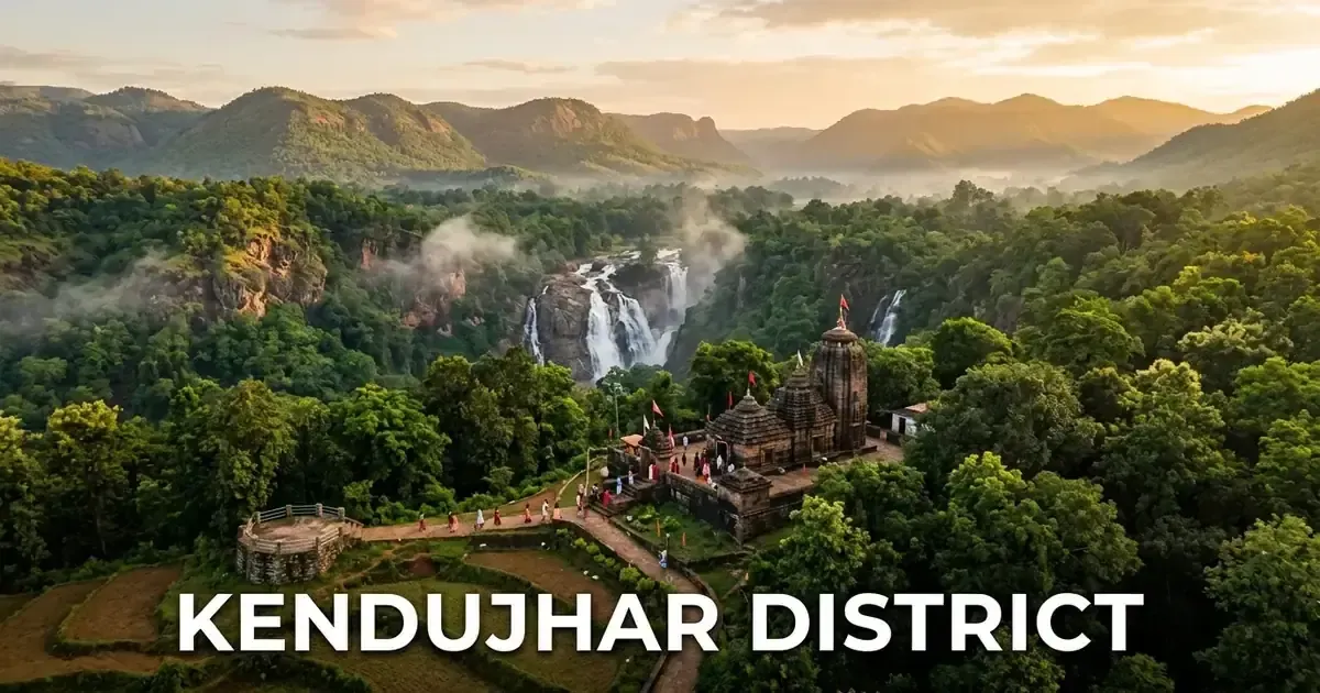
Kendujhar district, also officially known as Keonjhar, represents one of the most resource-rich and ecologically captivating regions of northern Odisha. Positioned along the mineral-laden plateaus of the Chota Nagpur fringe, the district brings together monumental open-cast iron ore operations with sacred river sources, ancient rock shelters, and roaring mountain cataracts.
From the sacred forest sanctum of Maa Tarini in Ghatagaon, where millions of travelers deposit coconuts to seek travel blessings, to the secluded peaks of Gonasika where the holy Baitarani River springs to life, Kendujhar balances deep spiritual reverence with heavy industrial energy. The district also nurtures the indigenous traditions of the ancient Juang and Bhuyan tribes alongside the crisp, poppy-seed-topped Keonjhar Phula Badi.
Today, Kendujhar stands as an essential destination for travelers seeking a diverse combination of natural waterfalls, prehistoric art, pilgrimage shrines, and industrial enterprise.
Key Takeaways
- Kendujhar covers 8,303 square kilometers across three subdivisions, thirteen community development blocks, and thirteen tehsils.
- The district recorded a population of 1,801,733 in Census 2011, with Scheduled Tribes representing over 45 percent of the total population.
- Ghatagaon Maa Tarini Temple serves as the primary spiritual sanctuary of northern Odisha, famous for its unbroken tradition of passing vehicular coconut offerings.
- The holy Baitarani River originates within the Gonasika hill range from a natural spring resembling a cow’s nostril.
- Key natural landmarks include Sanaghagara Waterfall, Badaghagara Waterfall, Gundichaghai Falls, Murga Mahadev spring, and the 5th-century Sitabinji tempera rock frescoes.
Introduction to Kendujhar: The Land of Minerals, Shrines & Cascading Valleys
Kendujhar district is situated in northern Odisha, located between 21°01’ N to 22°10’ N latitude and 85°11’ E to 86°22’ E longitude. The district is bounded by West Singhbhum district of Jharkhand to the north, Mayurbhanj and Bhadrak districts to the east, Jajpur and Dhenkanal districts to the south, and Sundargarh and Angul districts to the west.
Covering 8,303 square kilometers, Kendujhar constitutes approximately 5.33 percent of Odisha’s total land area. The district is divided geographically into two primary zones: Lower Kendujhar, comprising fertile river plains and valleys around Anandapur, and Upper Kendujhar, characterized by lofty mountain plateaus, iron ore ridges, and dense sal forests around Kendujhargarh, Champua, and Barbil.
Motor vehicle administration is managed by the Regional Transport Office under the registration code OD-09, headquartered in Kendujhargarh.
| Geographic Metric | Canonical Statistic | Regional Context |
|---|---|---|
| Total Geographical Area | 8,303 sq km | Fourth-largest district landmass in Odisha |
| District Headquarters | Kendujhargarh (Keonjhar Town) | Historic royal capital and administrative hub |
| Sub-Divisional Urban Centers | Champua, Anandapur, Barbil | Mining, agricultural, and commercial centers |
| Geographic Coordinates | 21°01’ N – 22°10’ N, 85°11’ E – 86°22’ E | Northern Odisha highland and Baitarani basin |
| Average Elevation | 480 meters (1,575 feet) above sea level | Ranging from coastal plain margins to 1,060-meter peaks |
| Forest Cover | 3,134 sq km | Over 37.7% of total district territory |
| Motor Vehicle Registration (RTO) | OD-09 | Regional Transport Office, Kendujhar |
The climate of Kendujhar is tropical dry sub-humid. Summers from March to June can be warm across southern plains, while high plateau areas like Barbil, Gonasika, and Kiriburu experience cooler mountain breezes. The southwest monsoon delivers an average annual precipitation of 1,535 millimeters between June and September, recharging the mountain aquifers and feeding numerous waterfalls.
Official gazettes, administrative notices, and regional travel announcements are published on the Odisha Tourism Official Portal and district portals.
Geographical Landscape, Baitarani Basin & Mountain Ranges
The physical topography of Kendujhar presents a dramatic landscape of ancient geological formations, rugged granite massifs, and deep river canyons. The district forms an integral section of the Singhbhum-Orissa Iron Ore Craton, housing rock formations that rank among the oldest stable crusts on the planet.
The landscape is dominated by high mountain ridges running from north to south. Prominent summits include Gandhamardan Peak rising to 1,060 meters, Mankadnacha Peak reaching 1,000 meters, and the sacred Gonasika Hill at 990 meters.
The hydrological lifeline of Kendujhar is the sacred Baitarani River, one of the six major river systems in Odisha. Originating from the Guptaganga spring at Gonasika, the river meanders through rocky gorges before descending into the agricultural lowlands of Anandapur and entering Jajpur district.
Key rivers and hydrological networks include:
- Baitarani River: Primary waterway of northern Odisha, originating at Gonasika and flowing past Kendujhargarh, Anandapur, and Jajpur toward the Dhamra estuary.
- Ardei River: Western tributary draining forested valleys in Banspal block before joining the Baitarani basin.
- Salandi River: Arises on the border ridges of Similipal and Keonjhar, dammed at Hadgarh to provide regional irrigation.
- Samakoi River: Southern river that flows through Telkoi block into the Brahmani drainage system.
- Kanjhari River: Significant stream supporting irrigation projects and village reservoirs in central Keonjhar.
Over 37 percent of Kendujhar is enveloped in dense forests categorized into Northern Tropical Moist Deciduous and Dry Deciduous types. Dense sal trees dominate the slopes of Banspal, Telkoi, and Ghatagaon, providing undisturbed habitats for Asian elephants, leopards, sambar deer, barking deer, and giant squirrels.
Valuable forest timber includes Sal (Shorea robusta), Asan, Kurum, and Mahua, alongside rich non-timber forest produce such as Harida, Bahada, and wild Kendu leaves.
Historical Evolution: The Bhanja Feudatory State to Modern Era
The territory of Kendujhar possesses an illustrious political history that evolved from medieval feudatory chieftaincies into a progressive princely state. In ancient times, the region formed part of the historic territory of Utkal and was inhabited by indigenous Juang and Bhuyan communities who maintained customary sovereignty over their mountain ranges.
According to historical records and copper plate grants, the royal dynasty of Kendujhar was established during the twelfth century by Jyoti Bhanja, a younger prince of the Bhanja dynasty of Mayurbhanj. Over centuries, the rulers of Kendujhar asserted full autonomy, managing administrative alliances with the Gajapati kings of Puri.
During the late eighteenth and nineteenth centuries, Kendujhar maintained a special political relationship with the indigenous Bhuyan tribes, who claimed the sacred right to crown the Maharaja during royal coronation ceremonies (Tika).
| Historical Period | Defining Milestone | Long-Term Regional Significance |
|---|---|---|
| 5th Century AD | Royal procession tempera frescoes painted at Sitabinji | Prehistoric artistic achievement and Brahmi epigraphy |
| 12th Century AD | Foundation of Kendujhar kingdom by Jyoti Bhanja | Establishment of autonomous Bhanja rule over mountain plateaus |
| 1868 & 1891 AD | Famous Bhuyan Meli peasant uprisings under Dharanidhar Naik | Tribal resistance against oppressive feudal taxation |
| 1900s–1920s | Discovery of colossal iron ore deposits by P.N. Bose and geologists | Birth of modern mining industry and industrial development |
| January 1, 1948 | Merger of Keonjhar State into independent India | Integration of the princely domain into Odisha province |
| 1960s to Present | Expansion of Joda-Barbil mining corridor and Ghatagaon pilgrimage | Transformation into India’s leading mineral and spiritual hub |
During the late nineteenth century, Kendujhar witnessed the famous Bhuyan Meli uprisings led by legendary tribal freedom fighter Dharanidhar Naik. Dharanidhar rallied the indigenous peasantry against forced labor (Bethi) and oppressive revenue demands, becoming an enduring symbol of tribal resistance against colonial exploitation.
Archival records and royal genealogies are documented in the Kendujhar District Administration Profile.
Following India’s independence, Maharaja Balabhadra Narayan Bhanja Deo signed the Instrument of Accession, leading to the merger of Keonjhar State with the province of Odisha on January 1, 1948.
Administrative Framework: Subdivisions, 13 Blocks, Tehsils & Governance
Kendujhar is structured into a streamlined administrative hierarchy designed to deliver civic services and regulatory oversight across its mountainous geography. Administrative leadership is directed by the District Collector and District Magistrate stationed at the Collectorate in Kendujhargarh.
The district is organized into three administrative revenue subdivisions: Kendujhar (Sadar), Champua, and Anandapur.
These three subdivisions oversee thirteen community development blocks and thirteen tehsils, coordinating rural welfare and land administration.
Urban administration operates through four municipalities located at Keonjhar, Barbil, Joda, and Anandapur, alongside one Notified Area Council at Champua.
| Administrative Tier | Structural Division Count | Designated Administrative Units |
|---|---|---|
| Revenue Subdivisions | 3 Subdivisions | Kendujhar (Sadar), Champua, Anandapur |
| Community Development Blocks | 13 Blocks | Kendujhar, Banspal, Telkoi, Ghatagaon, Harichandanpur, Saharpada, Patna, Champua, Jhumpura, Joda, Anandapur, Ghasipura, Hatadihi |
| Revenue Tehsils | 13 Tehsils | Standardized tehsils matching local block and mining jurisdictions |
| Urban Local Bodies (ULBs) | 5 ULBs | Keonjhar Municipality, Barbil Municipality, Joda Municipality, Anandapur Municipality, Champua NAC |
| Gram Panchayats | 297 Panchayats | Grassroots rural elected village panchayats |
| Assembly Constituencies (MLAs) | 6 Vidhan Sabha Seats | Telkoi (ST), Ghasipura (GEN), Anandapur (SC), Patna (ST), Keonjhar (ST), Champua (GEN) |
| Parliamentary Constituency | 1 Lok Sabha Seat | Keonjhar (ST) Parliamentary Constituency |
In democratic state governance, Kendujhar is represented by six members in the Odisha Legislative Assembly. Three of these assembly seats are reserved for Scheduled Tribes and one for Scheduled Castes, reflecting the demographic presence of indigenous communities.
The entire district unites under the Keonjhar Lok Sabha seat, which remains a key tribal parliamentary constituency in national affairs.
Demographic Profile & Tribal Communities: Census 2011 Analysis
According to the official 2011 Census of India, Kendujhar recorded a total population of 1,801,733 persons, showing a decadal growth rate of 15.42 percent over the 2001 census count. The population comprises 906,487 males and 895,246 females, resulting in a healthy sex ratio of 988 females per 1,000 males, which exceeds the national average.
The average population density stands at 217 persons per square kilometer, which remains moderate due to the 3,134 square kilometers of protected forests and rugged mining ranges.
The overall literacy rate reached 68.24 percent in 2011, with male literacy recorded at 78.12 percent and female literacy standing at 58.28 percent.
Over 85 percent of the district population resides in rural agricultural hamlets and forest settlements, while the remaining urban population is concentrated around Kendujhargarh, Joda, and Barbil.
| Demographic Metric | Census 2011 Figure | State & Regional Context |
|---|---|---|
| Total Population | 1,801,733 | 4.29% of Odisha’s total population |
| Male Population | 906,487 | 50.31% of total district population |
| Female Population | 895,246 | 49.69% of total district population |
| Sex Ratio | 988 females per 1,000 males | Higher than Odisha state average (979) |
| Population Density | 217 persons per sq km | Moderate density across mountainous terrain |
| Overall Literacy Rate | 68.24% | Steady growth in technical and school education |
| Male Literacy Rate | 78.12% | High literacy in industrial and mining centers |
| Female Literacy Rate | 58.28% | Consistent progress via rural residential hostels |
| Scheduled Tribe (ST) Share | 45.45% (818,878 persons) | Substantial indigenous tribal presence |
| Scheduled Caste (SC) Share | 11.62% (209,331 persons) | Concentrated in agricultural and artisan communities |
Kendujhar is celebrated for its rich indigenous tribal composition, with Scheduled Tribes representing 45.45 percent of the total population. Major tribal groups include the Juang, Bhuyan (Pauri Bhuyan), Ho, Munda, Bathudi, Kolha, and Gond.
The Juang tribe, recognized by the Government of India as a Particularly Vulnerable Tribal Group (PVTG), traces its ancestral origins directly to the Gonasika hills.
Each tribal community maintains customary village governance directed by village headmen, preserving centuries-old oral dialects, clan totems, and customary music.
Mineral Colossus: Iron Ore Corridors of Joda, Barbil & Bolani
Kendujhar is universally acknowledged as the iron ore capital of India, possessing some of the richest and highest-grade hematite deposits in the world. The northern subdivision of Champua, particularly the Joda-Barbil mining corridor, accounts for a massive share of the country’s iron ore and manganese production.
Geologically known as the Horse Shoe Synclinorium, the iron ore formations around Thakurani, Bolani, and Joda contain ore with iron content exceeding 64 to 66 percent.
These colossal deposits supply raw materials to major steel plants across India, including Tata Steel at Jamshedpur and Kalinganagar, the Rourkela Steel Plant, and coastal port loading docks at Paradip.
Industrial infrastructure and mining municipal records are preserved within the Barbil Mining Municipality Survey.
Major mining operators and industrial installations in Kendujhar include:
- Tata Steel Mining Operations: Large mechanized open-cast mines at Joda East, Khondbond, and Katamati, supported by automated ore processing plants.
- Steel Authority of India Limited (SAIL): Extensive mechanized iron ore mining facilities situated at Bolani, fueling public sector steel production.
- Odisha Mining Corporation (OMC): State-owned mining operations across the Gandhamardan, Daitari, and Serenda iron belts.
- Jindal Steel & Power (JSPL): Massive iron ore extraction and beneficiation operations at Kasia, feeding regional steel foundries.
- Chromite Mining Belt: Concentrated underground and open-cast chromite operations at Baula-Nuasahi in Hatadihi block.
Beyond raw extraction, the district has seen the installation of advanced iron ore beneficiation plants and cross-country slurry pipelines that transport iron concentrate directly to coastal pellet plants.
These industrial operations generate substantial royalty revenues for the District Mineral Foundation (DMF), which funds drinking water, rural roads, and modern hospitals across mining villages.
Sacred Pilgrimage Centers: Ghatagaon Maa Tarini Temple & Coconut Rituals
The spiritual heartbeat of Kendujhar resides at Ghatagaon, the sacred forest seat of Maa Tarini. Situated forty-five kilometers south of Keonjhar town along National Highway 20, the temple is one of the most visited and emotionally revered shrines in eastern India.
Maa Tarini is worshiped as a benevolent manifestation of Adi Shakti, residing in an open-air sanctum sheltered beneath sacred sal trees.
According to popular legend, the deity was brought from the royal fort of Kanchi by King Purushottama Deva of Puri following his historic Kanchi campaign. The deity agreed to accompany the king on the condition that he lead the way without looking back.
When the king looked back near the forests of Ghatagaon, the goddess transformed into a stone manifestation and established her permanent hermitage among the sal woods.
Pilgrims and vehicle owners across Odisha observe a famous sacred tradition: offering whole coconuts (Nadia) to Maa Tarini before beginning any journey.
Every passenger bus, freight truck, and family car passing through Ghatagaon halts at the temple gates to offer coconuts for road safety and personal blessings.
Even buses operating on routes far from the temple collect coconuts from passengers, dropping them off with designated temple couriers along the highway.
The temple celebrates its primary annual festival, the Chaitra Yatra, during the month of April (Maha Vishuva Sankranti), when hundreds of thousands of devotees assemble for holy darshan.
Travelers planning a pilgrimage can read our detailed sacred Ghatagaon Maa Tarini Temple guide for verified timings, coconut puja procedures, and festival schedules.
Devotional history and temple lore are also cataloged in the Maa Tarini Temple Ghatagaon Monograph.
Mythological Origins of the Baitarani: Gonasika & Guptaganga Sanctuary
High up in the forested mountain ridges of Banspal block, approximately thirty kilometers from Kendujhar town, lies the mythological sanctuary of Gonasika. Perched at an elevation of nearly nine hundred meters, Gonasika is revered across eastern India as the source of the sacred Baitarani River.
The name “Gonasika” translates literally to “Cow’s Nostril”, derived from a natural stone formation through which the river’s initial spring emerges.
According to enduring Vedic lore, the water emerges from two rock openings resembling the nostrils of a divine cow, giving birth to the stream locally called Guptaganga.
After flowing for a short distance through a rocky forest channel, the stream disappears underground into subterranean stone crevices, re-emerging several kilometers downstream at Brahmakunda.
Beside the sacred spring stands the ancient Brahmeswar Shiva Temple, believed to have been established by Sage Parashurama to atone for sins through penance.
Pilgrims from across Odisha and Jharkhand visit Gonasika during Makar Sankranti and Maha Shivratri to take ritual dips in Brahmakunda and offer prayers at the stone Shiva lingam.
The geographical features and cultural significance of the river are detailed in the Baitarani River Hydrological Survey.
Gonasika also holds deep cultural significance for the indigenous Juang tribe, who believe their first ancestors, Rusi and Rusiani, were created by the supreme deity Dharam Deota on these very mountain ridges.
Cascading Natural Wonders: Sanaghagara, Badaghagara & Gundichaghai Falls
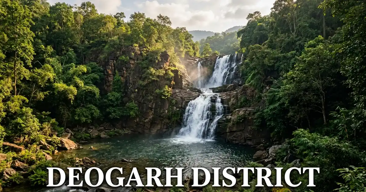
Kendujhar is celebrated as a paradise of mountain cascades, fed by the abundant runoff of the northern highlands. The most popular recreational waterfall in the district is Sanaghagara, located just five kilometers from Kendujhar town along National Highway 49.
Dropping from a height of thirty feet through a narrow granite notch, Sanaghagara is surrounded by landscaped gardens, children’s play parks, boating ponds, and paved walking paths.
The gentle roar of the water and cool forest breezes make it a favorite weekend destination for families, student groups, and picnickers throughout the winter season.
Three kilometers upstream along the same Machhakandana mountain stream lies Badaghagara Waterfall, which presents a much wilder and taller spectacle.
Plunging over a sheer vertical precipice from a height of sixty meters (two hundred feet), Badaghagara drops into a deep rock pool framed by towering sal canopies.
The surrounding forest gorge remains tranquil and undisturbed, attracting nature photographers and birdwatchers who hike along the riverbanks to observe kingfishers, flycatchers, and hornbills.
For broader travel planning across regional cascades, explore our complete directory of waterfalls in Odisha.
In the forested hills of Harichandanpur block, approximately thirty kilometers from Ghatagaon, lies the scenic Gundichaghai Waterfall. Here, the Mudala River cascades down a fifty-foot stone staircase into a broad pool surrounded by wild bamboo groves and dense sal woods.
Prominent waterfalls across Kendujhar include:
- Sanaghagara Waterfall: Scenic 30-foot cascade surrounded by landscaped parks, boating ponds, and walking promenades.
- Badaghagara Waterfall: Dramatic 60-meter vertical drop along the Machhakandana stream, set in undisturbed mountain forests.
- Gundichaghai Waterfall: 50-foot cascading terrace on the Mudala River, ideal for quiet forest outings near Ghatagaon.
- Khandadhar Waterfall (Keonjhar): Colossal 500-foot cascade located on the western border ridge near Telkoi, dropping into deep gorges.
- Handibhanga Waterfall: Scenic cascade located in the mineral belt near Joda, attracting local weekend visitors.
Ancient Rock Art & Rock Shelters: The 5th-Century Sitabinji Frescoes
Kendujhar preserves one of the most remarkable prehistoric and ancient artistic treasures in eastern India at Sitabinji, located thirty kilometers southwest of Keonjhar town. Situated beside the tranquil Sita stream, Sitabinji features dramatic rock formations, natural boulder shelters, and ancient tempera mural paintings dating back to the fifth century AD.
The most famous archaeological feature is the Ravan Chhaya (Shadow of Ravana), a massive natural rock overhang shaped like an enormous umbrella perched atop granite boulders.
On the underside of this rock shelter survives a rare fifth-century fresco painting executed using natural mineral pigments.
The mural depicts a majestic royal procession, featuring an ancient king riding an imposing tusker elephant, accompanied by four horsemen, a royal royal umbrella bearer, and foot soldiers holding bows and spears.
Beneath the painting runs an ancient four-line inscription written in northern Brahmi script of the fifth century AD, identifying the royal rider as King Disabhanja.
Archaeological highlights at Sitabinji include:
- Ravan Chhaya Rock Shelter: Enormous natural rock overhang protecting ancient tempera paintings from weathering.
- Royal Procession Mural: 5th-century fresco depicting King Disabhanja on elephant back with royal cavalry and retainers.
- Brahmi Inscriptions: Four-line painted inscription in northern Brahmi characters confirming the royal patronage of the artwork.
- Surrounding Boulder Caves: Natural rock shelters believed to have served as forest hermitages for ancient ascetics.
- Mukhalinga Sculpture: Ancient stone sculpture of a four-faced Shiva lingam discovered near the base of the rock shelter.
Sitabinji represents a rare surviving link in the ancient painting tradition of India, comparable to the classic rock murals of Ajanta and Bagh.
Sacred Springs & River Gorges: Murga Mahadev & The Legendary Bhimkund
Beyond its major waterfalls, Kendujhar harbors sacred natural springs and dramatic river gorges that combine natural grandeur with mythological folklore. Located at the foot of the Thakurani hill range in Champua subdivision lies the ancient shrine of Murga Mahadev.
Dedicated to Lord Shiva, the temple sits beside a perennial mountain spring that gushes through rock fissures, creating a clear stream where pilgrims take holy baths before darshan.
The cool, shaded forest canopy and clean mountain water make Murga Mahadev a popular pilgrimage and picnic destination during winter months.
On the eastern border separating Kendujhar from Mayurbhanj lies the magnificent natural water canyon known as Bhimkund. Formed on the swift-flowing Baitarani River near Boinda, Bhimkund features a two-tiered natural stone gorge where the river drops into a circular, vertical rock reservoir.
The water in the pool displays a striking deep-blue coloration, and local folklore maintains that the depth of the pool has never been measured by conventional diving lines.
According to the Mahabharata, the Pandava brothers lived in these forests during their period of exile.
When Draupadi became thirsty, the mighty hero Bhima struck his heavy mace (Gada) into the rocky riverbed, causing cool underground water to bubble up and create the natural pool.
Key scenic springs, gorges, and natural reservoirs across Kendujhar include:
- Murga Mahadev Temple & Spring: Mountain Shiva shrine surrounded by perennial clear forest springs in Champua block.
- Bhimkund River Canyon: Two-tiered natural gorge and deep circular blue pool on the Baitarani River associated with the Pandavas.
- Kanupur Dam Reservoir: Major irrigation reservoir on the Baitarani River near Basudevpur, offering vast open water views.
- Kanjhari Dam: Scenic irrigation reservoir in Ghatagaon block surrounded by gentle sal-covered hillocks.
- Asurchhanchra: Mythological rock formation and mountain cave in Banspal block linked to ancient folk legends.
Indigenous Juang & Bhuyan Culture: Dormitories, Changu Dance & Lore
The cultural soul of Kendujhar is deeply tied to the ancient traditions, oral folk epics, and community celebrations of its indigenous tribes. The Juang community, residing primarily in the rugged highlands of Gonasika in Banspal block, represents one of the oldest surviving tribal populations in India.
Traditional Juang village life revolves around the Majang (also known as the Mandaghar), an expansive central village dormitory and community hall for unmarried youth.
The Majang functions as the social, judicial, and cultural heart of the village. In the center of the Majang burns the sacred eternal hearth (Duni), which is kept alight day and night through generations.
Young boys and men gather around the fire to carve wooden tobacco boxes, repair agricultural tools, and practice rhythmic drumming on large circular tambourines called Changu.
The Changu Dance of the Juangs and Bhuyans is celebrated across Odisha for its circular, swaying rhythms.
Women link arms in curved lines, stepping forward and backward in synchronized movements while men leap dynamically in the circle center, beating large goatskin Changu drums.
| Cultural Tradition / Craft | Practicing Communities | Description & Artistic Characteristics |
|---|---|---|
| Majang (Mandaghar) | Juang tribe | Community youth dormitory and council hall housing the sacred eternal fire (Duni) |
| Changu Dance | Juang and Bhuyan | Circular swaying community dance set to the deep beat of large goatskin tambourines |
| Juang Wood Carvings | Juang village craftsmen | Intricately carved wooden tobacco containers, door frames, and musical drums |
| Pauri Bhuyan Rituals | Pauri Bhuyan community | Customary coronation ceremonies and forest deity worship of Dharam Deota |
| Karam Festival | Munda, Ho, Bathudi | Joyful harvest celebration centered around the sacred planting of the Karam tree branch |
| Maghe Parab | Ho and Munda tribes | Early spring festival celebrating new crops, village purification, and ancestral blessings |
These indigenous communities possess extensive traditional knowledge of medicinal forest herbs, harvesting wild roots and honey while protecting sacred forest groves (Gramasri and Jahera) from commercial felling.
Culinary Heritage: Keonjhar Phula Badi, Forest Mushrooms & Tribal Staples
The culinary culture of Kendujhar is defined by its sun-dried artisanal delicacies, seasonal forest produce, and nutritious grain preparations. The crowning culinary glory of the district is the world-renowned Keonjhar Phula Badi (also known as flower badi), a sun-dried lentil dumpling celebrated across Odisha for its delicate, melt-in-the-mouth texture.
Prepared from finely ground paste of black gram (Biri), water, and grated ash gourd (Pani Kakharu), the batter is whipped until light and airy.
Women artisans hand-drop the batter into delicate, floral-shaped rosettes upon clean cotton sheets, garnishing each dumpling with white poppy seeds (Posto).
When dried under crisp winter sunshine, these badis become light as flower petals. When lightly fried in mustard oil, they deliver a crisp, nutty crunch that enriches dalma, vegetable santula, and pakhala.
To learn more about beloved local dishes across the state, read our guide to the authentic traditional foods of Odisha.
In rural forested villages, seasonal wild mushrooms gathered from sal forests are prepared into rich, flavorful curries. Cherished varieties include Rugda (puffball mushrooms), Bhaira Chhatu, and Bali Chhatu, cooked with mustard paste, garlic, and wild spices.
Cherished culinary preparations and local dishes across Kendujhar include:
- Keonjhar Phula Badi: Delicate, light sun-dried black gram dumplings garnished with poppy seeds, fried crisp for meals.
- Wild Mushroom Curry (Chhatu Tarkari): Seasonal sal forest mushrooms simmered with freshly ground mustard and garlic gravy.
- Kardi & Hendua: Fresh and sun-dried bamboo shoot dishes prepared with tangy mustard seasonings.
- Mahua Preparations: Sweet edible flowers of the Mahua tree, sun-dried and cooked into sweet porridge or festive cakes.
- Ghatagaon Khai & Peda: Sacred prasad sweets offered to Goddess Tarini, featuring crisp puffed paddy and rich condensed milk pedas.
Visitors traveling through Kendujhar should stop by local sweet stalls in Ghatagaon and Keonjhargarh market to purchase fresh Phula Badi packs and warm milk pedas.
Transportation & Transit Logistics: Reaching and Navigating Kendujhar
Kendujhar is strategically positioned along primary industrial and freight arteries connecting the coastal plains of Odisha with the mineral hubs of Jharkhand and West Bengal. Travelers can easily reach the district via well-maintained national highways and broad-gauge passenger railways.
The primary highway backbone running across the district is National Highway 20 (NH-20), a four-lane highway linking Panikoili on NH-16 through Ghatagaon, Keonjhar town, Rimuli, and Barbil directly to Jamshedpur and Ranchi.
Another essential freight corridor is National Highway 49 (NH-49), connecting Keonjhar town westward to Sambalpur and eastward toward Bangriposi and Kharagpur.
Rail connectivity is managed through Kendujhargarh Railway Station (KDJR), located on the Padapahar-Jakhapura broad-gauge line. Daily express and passenger trains link the district headquarters directly with Bhubaneswar, Puri, Cuttack, and Visakhapatnam.
In the northern mining belt, Barbil and Bolani railway stations provide direct links to Tatanagar, Kolkata, and Rourkela.
Key transit routes, highway connections, and travel logistics include:
- Road Highways: NH-20 connects Keonjhar to Bhubaneswar (220 km) and Kolkata (330 km); NH-49 connects westward to Sambalpur (220 km).
- Rail Links: Daily trains connect Kendujhargarh to Bhubaneswar, Puri, and Howrah; Barbil connects daily to Howrah via the Jan Shatabdi Express.
- Bus Networks: The Central Bus Stand in Kendujhargarh operates frequent air-conditioned buses and OSRTC coaches to Bhubaneswar, Cuttack, Rourkela, Sambalpur, and Tata.
- Aviation Access: Nearest commercial airport is Biju Patnaik International Airport in Bhubaneswar (225 km south); Rourkela Airport is situated 160 km west.
The table below outlines travel distances, primary routes, and average travel times to Kendujhar town from major urban centers.
| Origin City | Travel Mode | Recommended Highway / Rail Route | Distance | Typical Travel Time |
|---|---|---|---|---|
| Bhubaneswar | Road / Bus | Four-lane NH-16 and NH-20 via Panikoili | 220 km | 4 hours 15 minutes |
| Bhubaneswar | Rail | Direct Kendujhargarh Express / Vande Bharat | 215 km | 4 hours 00 minutes |
| Cuttack | Road / Bus | Four-lane NH-16 and NH-20 via Panikoili | 195 km | 3 hours 45 minutes |
| Rourkela | Road / Rail | NH-143 and NH-49 / Intercity rail | 160 km | 3 hours 30 minutes |
| Sambalpur | Road | Direct NH-49 via Deogarh | 220 km | 4 hours 15 minutes |
| Jamshedpur (Tata) | Road / Rail | Direct NH-20 via Chaibasa | 165 km | 3 hours 45 minutes |
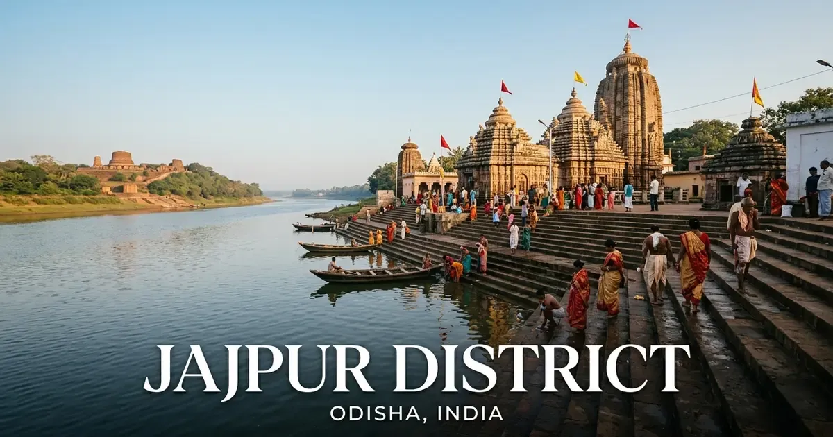
Local travel within Keonjhargarh, Ghatagaon, and Anandapur is serviced by auto-rickshaws, rental cars, and local transport minibuses. Travelers can easily combine journeys to visit the neighboring religious center of Jajpur district via NH-20.
Rental taxis are readily available at Kendujhargarh Railway Station for day excursions to Sanaghagara, Badaghagara, Gonasika, and Sitabinji.
Seasonal Weather & Optimal Travel Timings
Understanding northern Odisha’s highland climate is essential when planning a trip to Kendujhar, as temperature variations between seasons can be significant. The elevated plateau terrain around Keonjhargarh and Barbil ensures cooler evening conditions compared to the coastal delta.
The seasonal guide below outlines climate trends, temperature ranges, and sightseeing recommendations across the calendar year.
| Season | Calendar Months | Temperature Range | Weather Characteristics | Travel Feasibility & Advice |
|---|---|---|---|---|
| Winter | October to February | 8°C – 28°C | Cool crisp mornings; mild golden sunshine | Peak Travel Season: Perfect for Sanaghagara, Badaghagara, Gonasika, and temple tours |
| Summer | March to June | 24°C – 42°C | Warm dry afternoons; pleasant evening breezes | Limit sightseeing to early morning and late evening; stay hydrated |
| Monsoon | July to September | 22°C – 32°C | Copious rainfall; swollen mountain waterfalls | Excellent for viewing roaring waterfalls; check road safety in mining sectors |
The optimal period to visit Kendujhar district is between October and February. During these winter months, comfortable temperatures make hiking to Sanaghagara and Badaghagara waterfalls, touring the Sitabinji rock paintings, and visiting Gonasika hill sanctuaries pleasant.
Nighttime temperatures in elevated valleys like Gonasika and Kiriburu can drop below 8°C, making light woolens and warm jackets necessary for evening outings.
The monsoon season from July to September brings dramatic visual beauty as mountain waterfalls roar at full capacity and sal woodlands turn lush green. However, travelers should drive with extra caution along mining truck corridors during heavy rainstorms.
Summer months from April to June experience daytime temperatures exceeding 40°C in open valleys, making midday outdoor activities warm and demanding.
Accommodation, Temple Etiquette & Practical Travel Advice
Kendujhar offers a variety of hospitality accommodations suited for corporate visitors, pilgrims, wildlife enthusiasts, and nature travelers. In Kendujhargarh town, modern business hotels, government inspection bungalows, and OTDC Panthanivas cluster around Mining Road, Collectorate Road, and Judicial Colony, providing air-conditioned rooms and dining.
For pilgrims visiting Ghatagaon, numerous guest houses, dharamsalas, and tourist lodges line the temple approaches along National Highway 20.
In the northern mining belt, comfortable corporate hotels and executive clubs operate in Barbil and Joda.
To ensure a safe, culturally respectful, and fulfilling journey through Kendujhar, travelers should observe several practical guidelines:
- Ghatagaon Coconut Offering Etiquette: When visiting Maa Tarini Temple, purchase clean, unhusked coconuts from certified temple vendors. Avoid breaking coconuts personally near inner corridors; hand them to designated sevayats who perform the ceremonial offerings.
- Waterfall Safety Caution: Rocks around Sanaghagara, Badaghagara, and Gundichaghai are covered in slick moss and algae. Wear non-slip sports shoes, stay behind safety barricades, and avoid entering deep water pools where hidden currents exist.
- Mining Corridor Driving Safety: National Highway 20 and regional roads between Rimuli, Joda, and Barbil experience heavy iron ore tipper truck traffic. Maintain safe following distances, avoid overtaking on blind mountain turns, and exercise caution when driving in rain or winter morning mist.
- Gonasika Mountain Trekking: Visiting the Guptaganga spring requires climbing rocky forest stone steps. Carry drinking water and wear comfortable walking shoes suitable for uneven rock surfaces.
- Tribal Village Etiquette: When exploring indigenous hamlets in Banspal or Telkoi, always ask for permission before taking photographs of village residents, Majang dormitories, or sacred forest groves.
Frequently Asked Questions (FAQ) About Kendujhar District
What is Kendujhar district famous for?
Kendujhar district is famous across India for its massive high-grade iron ore deposits in the Joda-Barbil belt, the sacred Ghatagaon Maa Tarini Temple, and scenic waterfalls like Sanaghagara and Badaghagara. The district is also renowned for the mythological origin of the Baitarani River at Gonasika, 5th-century Sitabinji rock frescoes, and delicious Keonjhar Phula Badi.
What is the significance of offering coconuts at Ghatagaon Maa Tarini Temple?
Offering coconuts to Goddess Tarini at Ghatagaon is an ancient devotional custom believed to ensure safe travel and protection from accidents across northern Odisha. Drivers of public buses, freight trucks, and private vehicles regularly stop at the temple gates along National Highway 20 to deposit coconuts before continuing their journeys.
Where does the sacred Baitarani River originate in Kendujhar?
The Baitarani River originates in the Gonasika hills of Banspal block from a natural mountain spring known as Guptaganga, which emerges through stone crevices resembling a cow’s nostrils. The river flows underground for a short distance before reappearing at Brahmakunda beside the ancient Brahmeswar Shiva Temple.
What are the 5th-century Sitabinji frescoes in Keonjhar?
The Sitabinji frescoes are rare 5th-century tempera mural paintings preserved under a massive natural rock overhang named Ravan Chhaya in Kendujhar district. The painting depicts a royal procession of King Disabhanja on elephant back with cavalry, accompanied by a four-line inscription in northern Brahmi script.
What is the best time of year to visit Kendujhar district?
The optimal time to visit Kendujhar district is between October and February when pleasant winter weather brings temperatures ranging from 8°C to 28°C. These cool, dry months provide comfortable conditions for exploring Sanaghagara waterfall, hiking at Gonasika, and visiting temple shrines across the district.