Jagatsinghpur District: History, Paradip Port, Sarala Temple & Guide
Explore Jagatsinghpur district in Odisha. Discover Paradip Port, Maa Sarala Temple in Jhankada, Siali Beach, river deltas, blocks, and travel logistics.
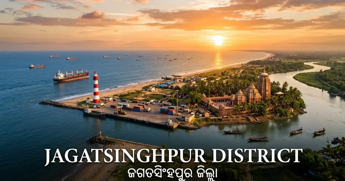
Jagatsinghpur district represents the maritime gateway and literary heart of coastal Odisha. Situated where the mighty Mahanadi and Devi rivers empty into the Bay of Bengal, this deltaic territory has shaped the commercial and cultural identity of eastern India for millennia.
Though it is geographically the smallest district in Odisha, Jagatsinghpur commands immense strategic and economic prominence. It houses the deepwater harbor of Paradip Port, expansive coastal petro-refineries, and fertile riverine plains producing prized betel vines and agricultural bounties.
At the same time, Jagatsinghpur preserves sacred spiritual roots. At Jhankada, the ancient shrine of Maa Sarala inspired Adikavi Sarala Das to compose the foundational Odia Mahabharata during the fifteenth century.
Key Takeaways
- Jagatsinghpur district spans 1,668 square kilometers across eight community development blocks, eight tehsils, and one revenue subdivision.
- The district recorded a population of 1,136,971 in Census 2011, maintaining an exceptional literacy rate of 86.59 percent and a population density of 682 persons per square kilometer.
- Paradip Port functions as one of India’s leading major seaports on the Bay of Bengal, handling massive volumes of coal, crude oil, iron ore, and dry bulk cargo.
- Maa Sarala Temple in Jhankada serves as a celebrated Shakta shrine and the historic birthplace of classical Odia literature.
- The district features a 67-kilometer coastline along the Bay of Bengal, highlighted by scenic coastal getaways like Siali Beach and the historic Paradip Lighthouse.
- Following the catastrophic 1999 Super Cyclone, Jagatsinghpur pioneered community disaster resilience through modern multi-purpose cyclone shelters and coastal mangrove protection.
Demographic & Geographic Profile of Jagatsinghpur District
Jagatsinghpur district occupies the coastal deltaic fringe of central Odisha, positioned between 19° 58’ N to 20° 23’ N latitude and 86° 03’ E to 86° 45’ E longitude. The district is bounded by Kendrapara district to the north across the Mahanadi, Cuttack district to the west, Puri district to the south across the Devi River, and the Bay of Bengal to the east.
The landscape is almost entirely flat, composed of rich deltaic alluvium deposited by the Mahanadi river system. With an average elevation of just six meters above sea level, the territory features a network of rivers, tidal creeks, drainage canals, and coastal sand dunes.
The demographic benchmarks below summarize official figures documented through the Jagatsinghpur District Administrative Survey.
| Demographic / Geographic Indicator | Official Statistical Value | Administrative Notes & Verification |
|---|---|---|
| Total Geographic Area | 1,668 sq km | Smallest district in Odisha by total surface area |
| Total District Population (2011) | 1,136,971 persons | 577,865 males and 559,106 females |
| Population Density | 682 persons per sq km | Second-highest population density in Odisha |
| Decadal Population Growth (2001-2011) | 7.50% | Demonstrates marked demographic stability |
| Sex Ratio | 968 females per 1,000 males | Child sex ratio (0-6 years) stands at 934 |
| Overall Literacy Rate | 86.59% | Male literacy: 92.53%; Female literacy: 80.59% |
| Administrative Headquarters | Jagatsinghpur Town | Situated 42 km east of Cuttack |
| Revenue Division | Central Revenue Division | Headquarters located at Cuttack |
| Revenue Subdivisions | 1 (Jagatsinghpur) | Covers all eight community blocks |
| Community Development Blocks | 8 CD Blocks | Administering 198 Gram Panchayats |
| Revenue Tehsils | 8 Tehsils | Cadastral land administration |
| Urban Local Bodies (ULBs) | 2 Urban Bodies | Jagatsinghpur Municipality and Paradip Municipality |
| Motor Vehicle Registration (RTO) | OD-21 | Regional Transport Office, Jagatsinghpur |
| Coastline Length | 67 kilometers | Open ocean frontage along the Bay of Bengal |
The district experiences a tropical coastal climate characterized by high humidity throughout the year, hot summers, and refreshing sea breezes. Annual rainfall averages approximately 1,514 millimeters, with heavy monsoon rains arriving between June and October.
Historical Journey: Ancient Hariharpur to Maritime Gateway
The human history of Jagatsinghpur is intertwined with coastal seafaring traditions and classical dynastic governance. In antiquity, the river estuaries of the Mahanadi and Devi served as natural harbors for Odia merchants (Sadhabas), who set sail on maritime expeditions across the Indian Ocean to trade spices, silks, and gemstones in Southeast Asian kingdoms.
During the medieval era, the territory flourished under the Bhaumakara, Somavamshi, and Eastern Ganga dynasties. By the fifteenth century, during the reign of the Suryavamshi Gajapati empire, the region gained immortal fame when the peasant poet Sarala Das composed the monumental Odia Mahabharata at Jhankada, elevating the Odia language into a classical literary medium.
Historically, the administrative center of the region was known as Hariharpur. In May 1633, British East India Company merchants led by Ralph Cartwright anchored ships along the Alaka River and founded a trading factory at Hariharpur. This factory became one of the earliest English commercial settlements established along the eastern seaboard of the Indian subcontinent.
During the Maratha period, the settlement was renamed Jagatsinghpur after Jagat Singh, a prominent regional governor. Under British colonial rule from 1803 onward, Jagatsinghpur functioned as a major revenue subdivision of undivided Cuttack district.
The region participated actively in the Indian freedom struggle. Local leaders led salt satyagraha marches along the coast at Kujanga and Ersama, while rural spinning ashrams promoted khadi production.
On 1 April 1993, the Government of Odisha separated Jagatsinghpur from Cuttack, officially establishing it as an autonomous administrative district. Travelers interested in these broader regional developments can explore our overview of the classical maritime history of Odisha.
Administrative Structure: Subdivisions, Blocks & Constituencies
Jagatsinghpur district is organized into an efficient administrative structure designed to coordinate rural community welfare, coastal safety, and port industrial operations. The Collector and District Magistrate directs administrative governance from the district collectorate located in Jagatsinghpur town.
The district comprises a single revenue subdivision (Jagatsinghpur) divided into eight community development blocks and eight revenue tehsils. Urban civic governance is provided by two municipalities: the historical interior headquarters of Jagatsinghpur Municipality and the coastal port industrial center of Paradip Municipality.
The table below outlines the eight community development blocks of Jagatsinghpur district, their headquarters, and primary economic activities.
| CD Block | Block HQ | Gram Panchayats | Primary Economic Drivers | Key Geographic Characteristics |
|---|---|---|---|---|
| Jagatsinghpur | Jagatsinghpur Town | 29 GPs | Trade, administration, dairy farming | Surrounds the historic municipal district capital |
| Raghunathpur | Raghunathpur | 19 GPs | Agriculture, horticulture, temple services | Western tract hosting the ancient Gorakhnath shrine |
| Tirtol | Tirtol | 24 GPs | Paddy farming, retail, cultural tourism | Cultural hub hosting Maa Sarala Temple in Jhankada |
| Kujanga | Kujanga | 30 GPs | Fisheries, port trade, coconut groves | Coastal hinterland adjoining Paradip harbor |
| Ersama | Ersama | 25 GPs | Marine fishing, aquaculture, betel farming | Coastal expanse with dense protective mangrove belts |
| Balikuda | Balikuda | 30 GPs | Betel vine cultivation, cashew processing | Southern coastal sector hosting scenic Siali Beach |
| Naugaon | Naugaon | 16 GPs | Riverine agriculture, vegetable farming | Fertile alluvial floodplains along the Devi River |
| Biridi | Biridi | 25 GPs | Intensive paddy farming, dairy cooperative | Western interior block bordering Cuttack district |
For legislative representation, Jagatsinghpur district is divided into four single-member Odisha Legislative Assembly constituencies:
- AC-101 Paradeep: General category, encompassing Paradip Municipality and Kujanga block.
- AC-102 Tirtol: Reserved for Scheduled Castes (SC), covering Tirtol, Biridi, and Raghunathpur blocks.
- AC-103 Balikuda-Erasama: General category, encompassing the coastal expanse of Balikuda and Ersama blocks.
- AC-104 Jagatsinghpur: General category, comprising Jagatsinghpur Municipality, Jagatsinghpur block, and Naugaon block.
At the national level, the entire district falls within the Jagatsinghpur Parliamentary Constituency (PC-16), which is reserved for Scheduled Caste candidates under the Election Commission of India Assembly Delimitation Profile.
Coastal Geography, River Deltas & Marine Ecosystems
The physical landscape of Jagatsinghpur is sculpted by the complex hydrology of coastal river mouths. The district represents the southern terminal zone of the great Mahanadi delta, where freshwater rivers meet the tidal currents of the Bay of Bengal.
The Mahanadi River flows along the northern perimeter of the district before branching into deltaic distributaries like the Paika, Chitrotpala, and Luna. At Paradip, the main channel empties directly into the sea through a broad, engineered estuary that shelters deepwater ocean berths.
Along the southern boundary flows the Devi River, a major distributary of the Mahanadi. The Devi river mouth forms an ecologically vital estuary characterized by sandbars, mudflats, and seasonal mangrove swamps.
These undisturbed coastal sands serve as an essential nesting habitat for endangered Olive Ridley sea turtles (Lepidochelys olivacea), which arrive by the thousands between December and March for their annual mass nesting (Arribada).
The interior plains are traversed by smaller watercourses, including the Alaka, Hansua, and Biluakhai rivers. While these meandering channels provide crucial canal irrigation for paddy fields, they also require well-maintained flood embankments to safeguard low-lying farmland during heavy monsoon rains.
Spiritual Epicenter: Maa Sarala Temple in Jhankada
Maa Sarala Temple stands as the foremost spiritual and cultural sanctuary of Jagatsinghpur district. Located at Kanakapur in the Jhankada region of Tirtol block, the temple is consecrated to Goddess Sarala, who is revered as a divine union of Saraswati (goddess of wisdom) and Durga (goddess of power).
The temple’s origins date back to the early medieval era. The sanctum sanctorum houses a revered eight-armed black chlorite idol of the goddess, sculpted in a seated posture holding a book, a musical veena, a trident, and a skull cup.
This distinctive iconography reflects a harmonious integration of Tantric rituals, Shakta theology, and literary wisdom. Devotees offer red hibiscus garlands, traditional bell-metal ornaments, and sacred bhoga during daily worship.
The spiritual legacy of the shrine is forever linked with the peasant poet Sarala Das. Born in the nearby village of Tentulipada during the reign of Emperor Kapilendra Deva in the fifteenth century, the poet was a humble farmer who worshipped Goddess Sarala with devotion.
According to tradition, the goddess blessed him with divine poetic inspiration, enabling him to compose the epic Odia Mahabharata, the Chandi Purana, and the Bilanka Ramayana.
The annual Maha Bisuba Sankranti festival in mid-April marks the grandest celebration at Jhankada. Tens of thousands of pilgrims assemble to witness the ritual fire-walking ceremonies (Jhamu Yatra), while poets and scholars gather to honor the literary father of the Odia language. Travelers comparing classical shrines across the state can consult our comprehensive guide to prominent historic temples of Odisha.
Maritime Powerhouse: Paradip Port & Coastal Industrial Belt
Paradip Port represents one of modern India’s most critical maritime logistics hubs, serving as a primary deepwater cargo gateway along the East Coast. Conceptualized by legendary Chief Minister Biju Patnaik, the foundation stone of the port was laid in 1962 by Prime Minister Jawaharlal Nehru, and it was formally opened for international shipping in 1966.
Today, Paradip Port Authority operates an expansive artificial deepwater harbor protected by breakwaters extending into the Bay of Bengal. The port routinely ranks among India’s top cargo-handling ports, processing over 135 million metric tonnes of cargo annually.
Key commodities handled at the docks include thermal coal from the Talcher coalfields, iron ore pellets from Keonjhar, crude petroleum, fertilizers, and liquefied chemicals. Detailed shipping operations and berthing guidelines are cataloged through the Paradip Port Authority Archives.
The presence of the deepwater harbor has transformed Paradip into a thriving coastal petrochemical and manufacturing complex. Major industrial installations include:
- IOCL Paradip Refinery: A 15-million-tonne-per-annum advanced petroleum refinery producing refined transportation fuels, petrochemical feedstocks, and polymers.
- IFFCO Fertilizer Complex: One of the world’s largest grass-roots phosphatic fertilizer plants, manufacturing critical DAP and complex fertilizers.
- Paradip Phosphates Limited (PPL): A major chemical producer supplying agricultural fertilizers across eastern and central India.
- Pellet Plants and Logistics Parks: Modern industrial units operated by Essar and ArcelorMittal Nippon Steel for processing iron ore fines for international export.
Paradip city provides comfortable modern infrastructure, with paved coastal boulevards, specialized maritime training colleges, and landscaped public spaces. Visitors can review the town’s urban amenities via Paradip Port Urban & Maritime Records.
Coastal Nature & Natural Shorelines: Siali Beach & Estuaries
Beyond industrial docks, Jagatsinghpur preserves some of the most tranquil and undisturbed coastal landscapes in eastern Odisha.
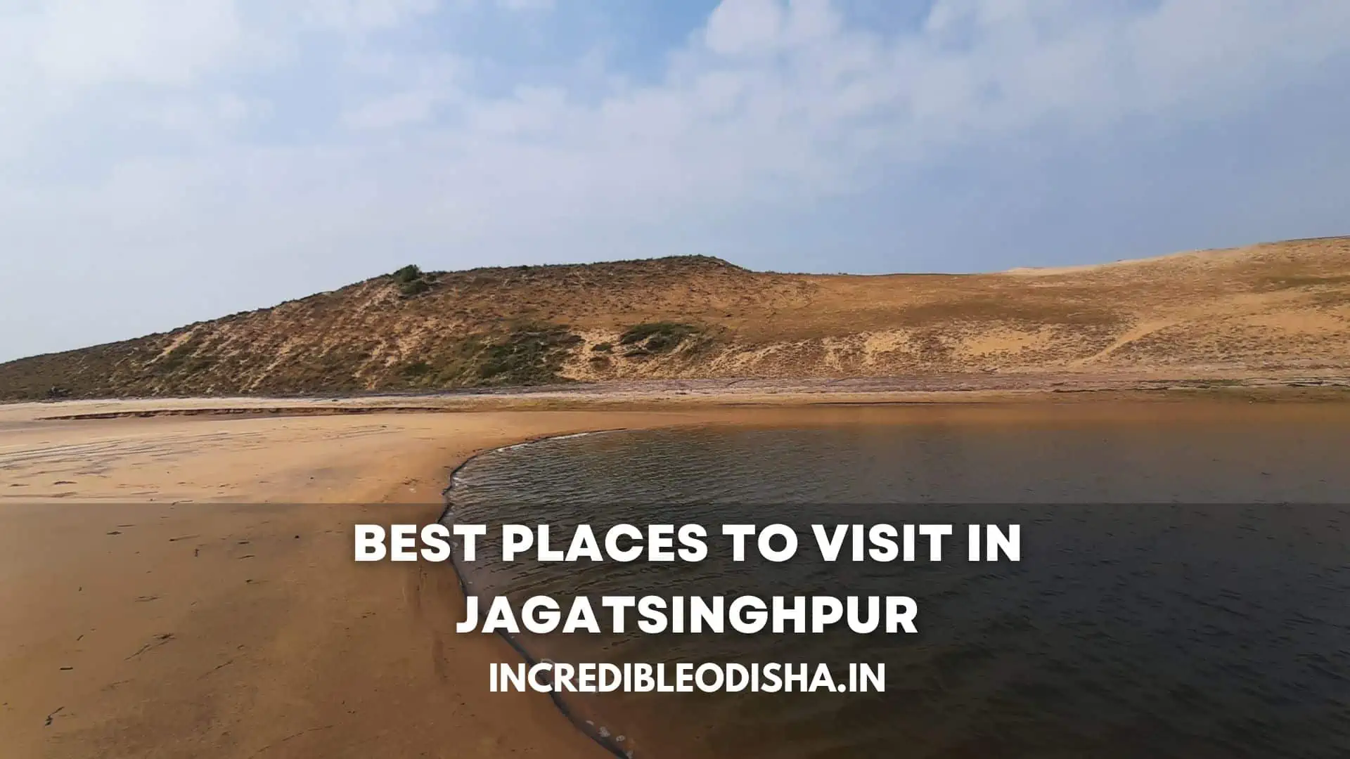
Siali Beach, located in Balikuda block roughly 45 kilometers from Jagatsinghpur town, is the district’s crown coastal retreat. Bordered by towering casuarina forest belts and rolling golden sand dunes, Siali offers a wide, gently shelving shoreline free from commercial noise.
The shallow ocean waters make it safe for family wading, while shaded picnic clearings beneath the casuarina trees attract holidaymakers from across coastal Odisha every winter. The beach provides an unforgettable vantage point for watching the sunrise over the Bay of Bengal.
In Paradip itself, Paradip Sea Beach stretches along the edge of the harbor breakwaters, offering sweeping views of international container ships and oil tankers anchored in the outer harbor.
Overlooking the shoreline stands the historic Paradip Lighthouse, built in the 1980s. Visitors can ascend to the observation gallery during evening public hours to enjoy 360-degree panoramic vistas across the coastline, harbor docks, and the deltaic waterways of the Mahanadi.
Sacred Shrines & Cultural Landmarks: Gorakhnath & Gada Kujanga
In addition to Maa Sarala Temple, Jagatsinghpur features several historic shrines that attract pilgrims and heritage researchers.
Gorakhnath Temple, situated in Raghunathpur block along the Cuttack-Paradip roadway, is an ancient Shaivite pilgrimage destination. Devotees revere the shrine as an early monastery associated with the Nath tradition of yogis and saint Gorakhnath.
The temple courtyard contains a sacred ancient banyan tree known as the Akshaya Bata, beneath which devotees tie colorful threads to pray for health, prosperity, and the fulfillment of personal vows.
In Kujanga block near Paradip, Gada Kujanga holds deep Vaishnavite significance as the historical Subhadra Kshetra. Centered around the revered Kunja Bihari temple, the complex is closely tied to the worship of Lord Jagannath.
According to historical lore, during Mughal invasions of Puri, the sacred wooden deities were secretly brought to the fortified island estates of Kujanga for protection.
Other prominent local shrines include:
- Dhyanapitha at Jagatsinghpur: A peaceful spiritual hermitage dedicated to meditation and spiritual discourses along the Alaka riverbank.
- Maa Mangala Temple at Naugaon: A popular rural Shakta shrine where villagers gather for blessing ceremonies during the harvest season.
Disaster Preparedness & Climate Resilience: Post-1999 Evolution
The contemporary identity of Jagatsinghpur district is defined by community resilience and disaster preparedness. On 29 October 1999, the devastating Odisha Super Cyclone struck the coastline near Ersama with sustained winds exceeding 260 km/h and a catastrophic seven-meter storm surge that swept up to 20 kilometers inland.
The disaster caused tragic loss of life and massive property damage, completely transforming the state’s approach to environmental hazards.
In the decades since that disaster, Jagatsinghpur has become an international model for climate adaptation and community-level disaster management. Working in partnership with state disaster agencies, the district established dozens of stilted multi-purpose cyclone shelters equipped with emergency power, clean drinking water, and wireless communication links.
Coastal communities participate in regular evacuation drills, while the Forest Department developed expansive bio-shield shelterbelts of casuarina and mangrove plantations along the vulnerable shorelines of Ersama and Balikuda.
To learn more about the institutional changes that followed this storm, readers can explore our detailed examination of coastal cyclone history and disaster management.
Agricultural Economy, Betel Vine Farming & Coastal Fisheries
While heavy industry and shipping anchor Paradip, the rural interior of Jagatsinghpur thrives on intensive agriculture, horticulture, and marine fisheries.
The district is renowned across India for its exceptional Betel Vine (Pan) Cultivation, particularly concentrated in the coastal blocks of Balikuda, Ersama, and Kujanga. Farmers cultivate the prized Mitha Pan and Sanchi Pan varieties inside shaded thatched enclosures known as Pan Barajas.
Constructed using bamboo poles, dry reeds, and paddy straw, these enclosures maintain high humidity and protect delicate creepers from intense sea winds. Jagatsinghpur betel leaves are prized for their soft texture and aromatic flavor, and are shipped daily to wholesale markets in Kolkata, Varanasi, Mumbai, and New Delhi.
Alongside betel vines, farmers cultivate high-yielding paddy across the rich alluvial soils of Biridi, Raghunathpur, and Naugaon blocks. Coastal aquaculture forms another lucrative livelihood pillar.
Brackish-water estuaries and backwater canals support modern black tiger prawn (Penaeus monodon) and Vannamei shrimp farming, producing certified seafood that is processed at coastal cold-storage plants for export to Europe, Japan, and the United States.
Handicrafts, Maritime Folklore & Odia Literary Heritage
Jagatsinghpur occupies a sacred position in the literary history of Odisha as the cradle of vernacular literature. Before the fifteenth century, religious texts in Odisha were composed almost exclusively in classical Sanskrit, restricting access to elite monastic circles.
By translating the Sanskrit Mahabharata into everyday Odia prose and verse, Adikavi Sarala Das democratized literature, enabling rural communities to connect with epic philosophy in their mother tongue.
The district also preserves rich folk art and handicraft traditions:
- Golden Grass Craft: Women artisans in Tirtol and Raghunathpur blocks weave fragrant golden grass (Kaincha) into elegant storage baskets, hand fans, table coasters, and decorative cases.
- Jatra and Folk Theater: Jagatsinghpur has produced some of Odisha’s finest open-air theater (Gananatya) troupes, staging musical dramas that travel across rural districts throughout the post-harvest winter season.
- Boita Bandana Traditions: On Kartika Purnima in November, communities gather at riverfronts and beaches to float miniature paper and cork boats decorated with lamps, betel leaves, and flowers, commemorating the ancient maritime journeys of Kalinga’s merchants.
Culinary Identity: Coastal Seafood, Rabidi Dahi & Traditional Flavors
The culinary culture of Jagatsinghpur reflects its coastal setting and rural dairying heritage. Visitors traveling through the district discover distinctive regional dishes prepared with fresh ingredients.
A signature specialty of Jagatsinghpur town is Rabidi Dahi. This refreshing dairy preparation combines thick, traditionally fermented cow curd with rich, slow-simmered rabidi (condensed milk with clotted cream layers). Lightly sweetened and served chilled in earthen clay pots (Khadika), Rabidi Dahi offers a soothing balance of tart curd and creamy sweetness, especially during hot summer afternoons.
Other celebrated local dishes include:
- Chilika and Coastal Prawn Curry: Freshly harvested tiger prawns simmered in a fragrant coconut milk and onion-ginger gravy, seasoned with green cardamoms and fried cumin.
- Machha Besara: Fresh river fish steaks (Rohu or Bhakur) cooked in a tangy yellow mustard paste gravy with tomatoes and dried wild mango.
- Sarala Bhoga Khichdi: Sacred sweet rice and lentil porridge prepared daily at Maa Sarala Temple, flavored with desi ghee, ginger, crushed black pepper, and bay leaves.
- Chenna Jhili: Spongy cottage cheese patties fried until golden and steeped in warm, aromatic sugar syrup.
Major Fairs, Coastal Festivals & Sacred Observances
Jagatsinghpur’s cultural calendar is filled with colorful fairs and festive celebrations that draw visitors to its shrines and beaches throughout the year.
The foremost annual gathering is the Jhamu Yatra at Maa Sarala Temple, observed on Maha Bisuba Sankranti in mid-April. Devotees known as Patowas observe strict fasting before performing awe-inspiring fire-walking rituals over beds of glowing charcoal to fulfill religious vows.
Other celebrated cultural and religious festivals include:
- Kalinga Bali Yatra at Paradip: An expansive multi-day coastal trade fair and cultural carnival celebrated during Kartika Purnima (November) on Paradip sea beach, highlighting maritime history, regional handlooms, and cultural performances.
- Maha Shivaratri at Gorakhnath: Night-long devotional vigil where thousands of pilgrims gather around the sacred Akshaya Bata to offer prayers and light earthen lamps.
- Nuakhai and Raja Parba: Agricultural celebrations in June and September that mark the arrival of the monsoon and the first consumption of newly harvested crops with swings, folk songs, and pithas.
Curated Travel Directory: Major Landmarks in Jagatsinghpur
Travelers planning an excursion to Jagatsinghpur can consult the curated directory below for information regarding visiting hours, locations, and access guidelines.
| Landmark / Attraction | Geographic Setting | Primary Heritage Significance | Recommended Visiting Hours | Entry Fee |
|---|---|---|---|---|
| Maa Sarala Temple | Jhankada, Tirtol Block | Historic 8th-century Shakti Peetha & literary cradle | 5:00 AM – 1:00 PM; 3:30 PM – 8:30 PM | Free; traditional attire |
| Paradip Port & Harbor | Paradip coastal city | Major deepwater seaport & breakwater views | Exterior harbor views throughout day | Free; restricted berth access |
| Siali Sea Beach | Balikuda Block, 45 km from town | Broad shoreline with dense casuarina forest | 6:00 AM – 6:30 PM daily | Free public access |
| Paradip Lighthouse | Marine Drive, Paradip Coast | 360-degree observation deck over port and ocean | 4:00 PM – 6:00 PM daily | ₹10 (Indians), ₹50 (Foreigners) |
| Gorakhnath Temple | Raghunathpur Block | Ancient Shaivite shrine and sacred Akshaya Bata | 6:00 AM – 8:00 PM daily | Free admission |
| Smruti Udyan Park | Paradip town center | Memorial park, fountains, and boating lake | 9:00 AM – 7:30 PM daily | Nominal park entry fee |
| Gada Kujanga Temple | Kujanga Block | Historic Subhadra Kshetra of Jagannath lore | 6:00 AM – 7:30 PM daily | Free public access |
For detailed touring suggestions and local transport advice, consult our curated guide to places to visit in Jagatsinghpur.
Transportation & Transit Logistics: Reaching Jagatsinghpur
Jagatsinghpur enjoys excellent highway and rail connectivity, linking it conveniently with the twin cities of Cuttack and Bhubaneswar.
[!NOTE] Key Transit Access Points for Jagatsinghpur District:
- Road Corridors: State Highway 42 connects Cuttack directly to Jagatsinghpur (42 km). National Highway 53 connects Paradip westward to Cuttack and Chandikhole.
- Railway Line: The Cuttack-Paradip railway branch line provides passenger and freight services, with key stations at Jagatsinghpur (Gorakhnath station), Rahama, and Paradip.
- Air Connectivity: Biju Patnaik International Airport (BBI) in Bhubaneswar is located approximately 65 kilometers west by road.
The transit table below outlines distances, routes, and typical travel times from major regional hubs to Jagatsinghpur town.
| Origin City | Travel Mode | Route Details | Distance | Typical Travel Time |
|---|---|---|---|---|
| Cuttack | Road / Bus | Direct SH-42 via Kandarpur | 42 km | 1 hour |
| Bhubaneswar | Road / Car | NH-16 to Cuttack, then SH-42 to Jagatsinghpur | 65 km | 1 hour 45 minutes |
| Paradip Port | Road / Bus | SH-42 / NH-53 via Tirtol and Kujanga | 50 km | 1 hour 15 minutes |
| Kendrapara | Road / Bus | SH-9A southward across the Mahanadi bridge | 45 km | 1 hour 10 minutes |
| Puri | Road / Car | Coastal highway via Gop, Nimapara, and Balikuda | 85 km | 2 hours 15 minutes |
Frequent state transport (OSRTC) buses and private express coaches operate every fifteen minutes between Cuttack (Badambadi bus terminal) and Jagatsinghpur town. Travelers can combine journeys to explore our neighboring historic Cuttack district to the west or journey northward across the river toward Kendrapara.
Seasonal Weather & Optimal Travel Timings
Planning visits according to coastal seasonal variations ensures a comfortable journey, especially when touring open beaches and port lookouts.
The seasonal guide below outlines weather conditions across the year.
| Season | Calendar Months | Temperature Range | Weather Characteristics | Travel Feasibility & Advice |
|---|---|---|---|---|
| Winter | October to February | 15°C – 28°C | Cool mornings; pleasant sun; gentle coastal breezes | Peak Season: Ideal for Siali Beach, lighthouse visits, and temple touring |
| Summer | March to June | 27°C – 38°C | High afternoon humidity; warm sea breezes | Suitable for early morning temple visits and evening beach strolls |
| Monsoon | July to September | 26°C – 33°C | Heavy downpours; high sea waves; swollen estuaries | Lush coastal countryside; avoid swimming in rough tidal currents |
The best period to explore Jagatsinghpur is between October and February. During these winter months, mild temperatures make coastal walks comfortable, and major festivals such as Kartika Purnima, the Kalinga Bali Yatra, and the winter bird migration bring the region to life.
Accommodation, Local Etiquette & Practical Travel Advice
Jagatsinghpur provides diverse lodging options for pilgrims, holidaymakers, and business visitors traveling to the port city.
Most modern business hotels, executive guest lodges, and star-rated properties are concentrated in Paradip along the Port Trust Road and Marine Drive. In Jagatsinghpur town, several comfortable private hotels, government inspection bungalows, and pilgrim guesthouses cluster near the bus terminal. Near Jhankada, temple committee dharamsalas offer budget rooms for devotees visiting Maa Sarala Temple.
To make the most of your journey, keep these travel tips in mind:
- Beach Safety at Siali and Paradip: The sea currents along the Bay of Bengal can be strong, particularly near river estuaries. Avoid venturing deep into the water, and swim only in designated shallow zones during low tide.
- Lighthouse Timings: Paradip Lighthouse is open to the general public only between 4:00 PM and 6:00 PM on weekdays. Arrive early to purchase visitor tickets and climb to the top for sunset views.
- Temple Etiquette: Modest traditional attire is recommended when visiting Maa Sarala Temple and Gorakhnath Temple. Footwear must be deposited at secure counters outside the main gate.
- Authentic Souvenirs: When traveling through Tirtol and Balikuda, look for handcrafted golden grass baskets and freshly packed Jagatsinghpur betel leaf bundles from local village artisans.
Frequently Asked Questions (FAQ) About Jagatsinghpur District
What is Jagatsinghpur district famous for?
Jagatsinghpur district is famous for the major deepwater seaport of Paradip, the revered 8th-century Maa Sarala Temple in Jhankada (the literary birthplace of the Odia Mahabharata), scenic Siali Beach, aromatic betel vine cultivation, and the delicious dairy confection Rabidi Dahi.
Why is Maa Sarala Temple culturally significant in Odisha?
Maa Sarala Temple is regarded as the literary cradle of Odisha. In the 15th century, the peasant poet Sarala Das worshipped here and received divine inspiration to compose the monumental Odia Mahabharata, which established the foundational classic of the Odia language and literature.
What are the main attractions in Paradip city?
The main attractions in Paradip include the Paradip Sea Beach, the historic Paradip Lighthouse with its 360-degree observation gallery, the breakwater viewpoint of the deepwater harbor, the Marine Aquarium, and Smruti Udyan memorial park.
How far is Jagatsinghpur from Cuttack and Bhubaneswar?
Jagatsinghpur town is located 42 kilometers east of Cuttack via State Highway 42 (about 1 hour by car or bus) and approximately 65 kilometers east of Bhubaneswar via National Highway 16 and SH-42 (about 1 hour 45 minutes by road).
Which beach is best for a family trip in Jagatsinghpur?
Siali Beach in Balikuda block is widely considered the best coastal destination for families in Jagatsinghpur. The beach features a wide golden shoreline, shallow waters, and shaded casuarina groves suitable for day picnics.