Potagarh Fort Ganjam: Timings, History & Visitor Guide
Complete travel guide to Potagarh Fort Ganjam in Odisha. Explore its 18th-century star-shaped ramparts, river views, history, timings, and route.
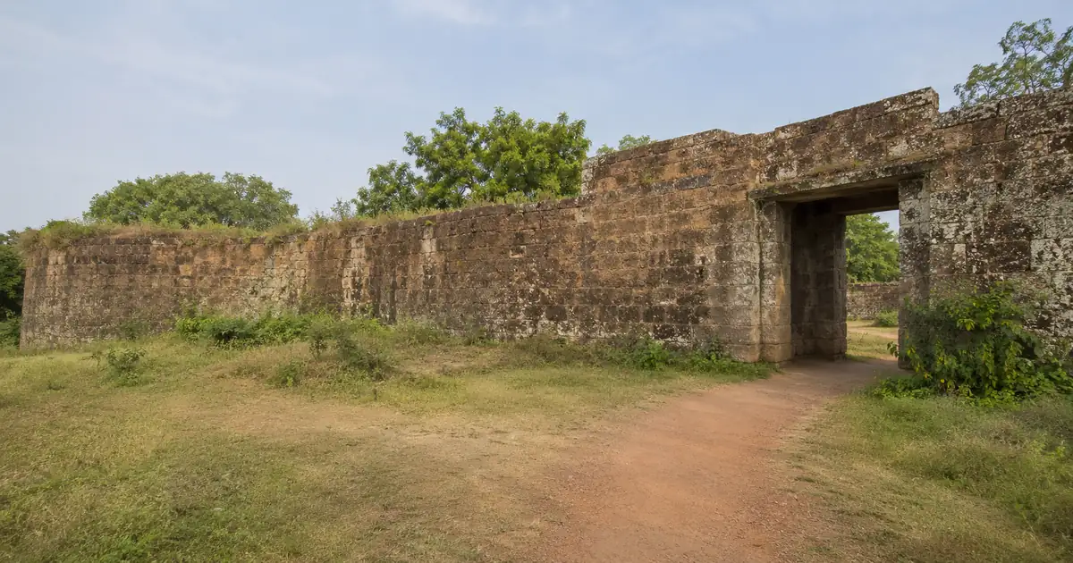
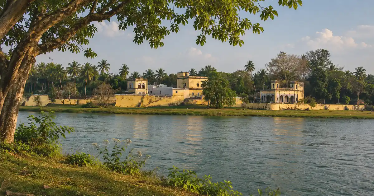
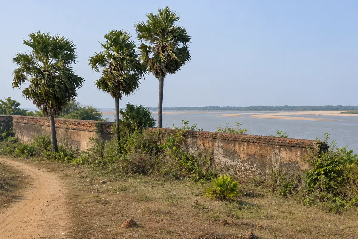
Standing quietly where the Rushikulya River approaches the Bay of Bengal, Potagarh Fort Ganjam represents one of eastern India’s most unusual coastal fortifications. Locally referred to as Potagada or the “Buried Fort,” its sunken earthen ramparts and deep moat sheltered military commanders across three distinct colonial chapters. Today, travelers can walk along intact brick arches, inspect subterranean escape tunnels, and absorb uninterrupted maritime river breezes without tourist crowds.
Key Takeaways
- Location & Setting: Situated in Ganjam town in southern Odisha, right along the scenic northern bank of the Rushikulya River estuary.
- Entry Fee & Timings: Free entry for all visitors. The open-air complex remains accessible daily between 8:00 AM and 5:00 PM.
- Distinct Heritage: Features a rare pentagonal star-shaped design constructed in 1768 CE by Edward Cotsford over older French and Qutb Shahi settlements.
- Transit Connectivity: Located 8 km from Chatrapur railway station, 30 km from Berhampur, and 140 km south of Bhubaneswar via National Highway 16.
Potagarh Fort Ganjam at a Glance: Quick Timings, Fees & Key Facts
Potagarh Fort offers travelers a rare physical glimpse into the turbulent 18th-century maritime commerce and power struggles of coastal Odisha. For history students and road trippers exploring southern Odisha, this quick reference table summarizes the practical facts for planning your trip.
| Parameter | Verified Details | Notes |
|---|---|---|
| Location | Ganjam Town, Ganjam District, Odisha | North bank of Rushikulya River near sea mouth |
| Fort Foundation | 1768 CE by Edward Cotsford | Built over 1753 French and Qutb Shahi foundations |
| Timings | Daily: 8:00 AM to 5:00 PM | Open all days including Sundays and national holidays |
| Entry Fee | Free entry | No ticketing counter; free public access |
| Photography | Allowed free of charge | Mobile phones and cameras permitted |
| Best Season | October to March | Cool coastal breezes and pleasant walking temperatures |
| Nearest Railhead | Chatrapur (CAP, 8 km) / Berhampur (BAM, 30 km) | Frequent express trains along Howrah-Chennai mainline |
| Nearest Airport | Biju Patnaik International Airport (BBI), 140 km | Accessible via regular taxis along National Highway 16 |
Key Heritage and Location Highlights
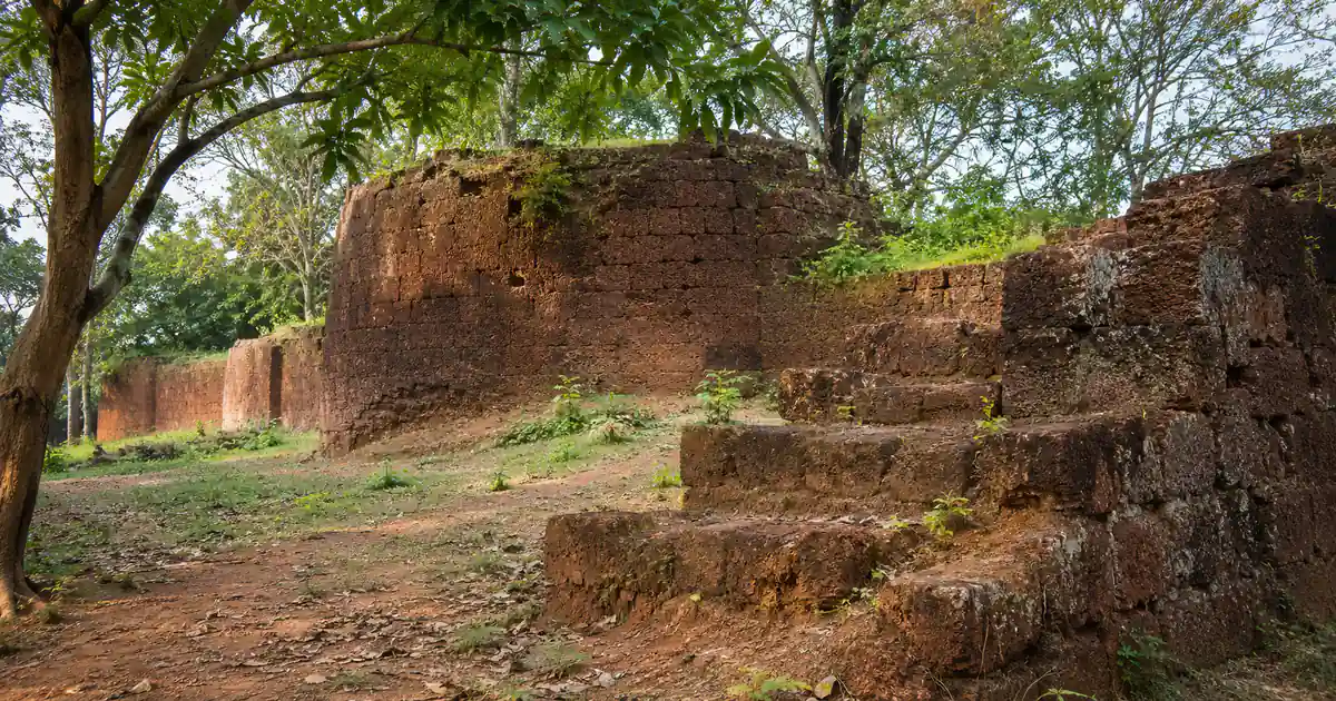
Unlike hilltop strongholds such as the ancient ruins of Sisupalgarh Fort, Potagarh was engineered deliberately as a sunken fortress. Builders dug deep into the alluvial silt along the river bank, banking the dug-out earth outward to construct thick defensive glacis walls. This ingenious design ensured that naval cannons out at sea could not spot or strike the fort’s stone bastions directly.
The fort served as the first British collectorate headquarters of the Ganjam district administration under the Madras Presidency. Today, state conservation projects overseen by the Official Ganjam District Administration and Odisha Culture Department preserve the surviving British residency, magazine arsenal, and boundary bastions for visitors.
Who Will Enjoy Visiting Potagarh Fort
Heritage seekers who appreciate raw, uncrowded archaeological sites will find Potagarh deeply rewarding. Photography enthusiasts can capture dramatic stone silhouettes framed by leaning palmyra trees and golden river currents.
Families touring our comprehensive Ganjam district heritage guide often pair Potagarh with nearby picnic spots. Because the paths consist of grassy trails and weathered steps, travelers should plan for moderate walking across open ramparts.
The Fascinating History of the Buried Fort in Ganjam
The land where Potagarh stands has witnessed maritime trade for over four centuries. Long before European companies claimed territorial control, the Rushikulya river mouth was a busy commercial dock for Odia merchant vessels (Boitas) sailing toward Southeast Asia.
| Era / Year | Controlling Power | Historic Role & Development |
|---|---|---|
| 1600s | Qutb Shahi Governors | Fortified customs post overlooking coastal shipping routes |
| 1753 | French East India Company | Fortified outpost under Marquis de Bussy |
| 1766 | British East India Company | Edward Cotsford appointed first Resident of Ganjam |
| 1768 | British Administration | Star-shaped fortress built as first District Collectorate |
| 1815 | Post-Epidemic Era | Administration abandoned fort and relocated inland |
From Northern Circars to French Occupation (1753)
During the middle of the eighteenth century, the coastal strip known as the Northern Circars formed an administrative corridor connecting Bengal with Coromandel ports. In 1753, the French military general Marquis de Bussy secured administrative rights over the Chicacole and Ganjam circars from the Nizam of Hyderabad.
French officers fortified the mouth of the Rushikulya to collect maritime tariffs and store provisions. Although their tenure lasted less than a decade, French masons constructed deep water wells and arched doorways that provided the foundation for subsequent British engineering works.
Edward Cotsford and the British Collectorate Era (1768)
Following the Battle of Buxar and the 1765 Treaty of Allahabad, the British East India Company gained control of the Northern Circars. In December 1766, Company engineer Edward Cotsford received appointment as the first British Resident of Ganjam.
Arriving on site in 1768, Cotsford recognized the vulnerability of the river estuary against regional Odia resistance and Maratha raiding parties. He transformed the previous French compound into a massive pentagonal star-shaped stronghold, using laterite blocks, burned bricks, and hydraulic lime mortar. For nearly five decades, Potagarh functioned as the supreme judicial, revenue, and military seat of southern Odisha.
The Sudden Epidemic and Abandonment in 1815
Potagarh’s glory ended unexpectedly in the early nineteenth century. In 1815, a catastrophic outbreak of malignant fever, believed to be an virulent strain of malaria or cholera, swept through the low-lying wetlands surrounding the fort.
The epidemic claimed the lives of hundreds of residents, soldiers, and colonial administrators within a few months. Surviving British officers abandoned the fort complex, relocating their district offices higher inland to Chatrapur and Berhampur. The grand residences and courtyards were left to nature, allowing wild banyan roots to weave through the brickwork.
Unique Star-Shaped Architecture and Defensive Engineering
The design of Potagarh Fort sets it apart from traditional medieval Hindu military forts like the historic Barabati Fort in Cuttack. Influenced by Vauban military engineering concepts popular in 18th-century Europe, the fort utilized geometric angles to eliminate blind spots for defending artillery.
Pentagonal Ramparts and the Tidal Moat
The perimeter wall forms an irregular pentagon flanked by angular bastions at each corner. These projecting bastions allowed garrison soldiers to sweep rifle and cannon fire across the outer walls, preventing attackers from scaling the ramparts undetected.
Surrounding the entire landward perimeter was a wide, steep moat connected directly to the Rushikulya River. During high tide, seawater and river currents flooded the moat, creating an impenetrable water barrier that also deterred wild animals and hostile cavalry.
Colonial Residencies, Magazine House, and British Cemetery
Inside the central precinct, visitors can explore the roofless remains of Cotsford’s administrative mansion. Tall classical archways, deep fireplace alcoves, and thick stucco plastering demonstrate the comfortable colonial lifestyle maintained even in isolated coastal stations.
A short walk eastward leads to the ammunition magazine house, built with curved, blast-resistant brick barrel vaults. Just outside the main gate stands an ancient cemetery containing stone obelisks and weathered epitaphs marking the resting places of British officers, merchants, and their families who perished during the tragic 1815 epidemic.
Subterranean Escape Tunnels Leading to the Rushikulya
Among the most captivating features of Potagarh Fort are its secret underground tunnels. Local lore recounts that two distinct vaulted passages were constructed beneath the main ramparts.
One tunnel provided a clandestine emergency escape corridor running directly to the secluded bank of the Rushikulya River, where waiting boats could evacuate senior officers during a siege. The second passage linked the residential quarters to a secluded river landing, permitting women of the royal household to reach bathing ghats in absolute privacy.
Best Time to Visit Potagarh Fort and Seasonal Weather
Coastal Ganjam enjoys a tropical climate influenced by maritime weather systems from the Bay of Bengal. Planning your visit during the cooler months ensures a pleasant experience while walking through the open, unsheltered fort grounds.
Winter Season (October to March)
The period from October to March is by far the best time to explore Potagarh Fort. Daytime temperatures hover between 20°C and 28°C, accompanied by gentle breezes blowing inward from the sea.
Early mornings and late afternoons offer the softest golden light for photography. Visiting during winter also enables you to combine the fort tour with the mass nesting of Olive Ridley sea turtles along nearby beaches.
Monsoon and Summer Considerations
Monsoon months from June through September bring heavy coastal showers that replenish the Rushikulya River. The fort grounds turn lush and emerald green, but overgrown wild vegetation and slippery stone pathways can make walking tricky.
Summer months between April and June bring high humidity and midday temperatures exceeding 36°C. If traveling during summer, visit strictly between 8:00 AM and 10:00 AM or after 4:00 PM, and always carry adequate drinking water and sun protection.
How to Reach Potagarh Fort Ganjam: Road, Rail, and Air Routes
Potagarh Fort is easily accessible thanks to its proximity to the Golden Quadrilateral highway network connecting major cities along the eastern seaboard.
| Transit Hub | Distance to Fort | Recommended Transit Option |
|---|---|---|
| Chatrapur Railway Station (CAP) | 8 km | Direct auto-rickshaw or taxi via Ganjam Town Road |
| Berhampur Railway Station (BAM) | 30 km | Intercity express taxi or private cab via NH-16 |
| Biju Patnaik Airport Bhubaneswar (BBI) | 140 km | Outstation taxi or train connection along NH-16 corridor |
Reaching by Train via Chatrapur and Berhampur
The nearest railway station is Chatrapur (station code: CAP), located just 8 km away from the fort gates. Several express trains running along the Howrah-Chennai trunk line stop here daily.
For broader national train connectivity, Berhampur Railway Station (station code: BAM) is situated 30 km southwest. From either station, travelers can hire private auto-rickshaws or app-based taxis to reach the fort in under forty minutes.
Driving via National Highway 16
Driving to Potagarh Fort offers a scenic coastal road trip experience. Travelers from Bhubaneswar can take National Highway 16 southward through Khordha and Rambha before taking the Ganjam town exit near the Rushikulya river bridge.
The branch road from Ganjam town to the fort covers roughly two kilometers of paved village roadway. Free roadside parking space is readily available right outside the main archaeological gateway.
Reaching by Air via Bhubaneswar Airport
Travelers flying in from other Indian states should book flights to Biju Patnaik International Airport (BBI) in Bhubaneswar. The airport sits approximately 140 km north of the fort.
From Bhubaneswar, you can book an interstate outstation taxi or take a scenic morning express train to Chatrapur. The road journey along NH-16 takes roughly 3 hours through green rural farmland and coastal Chilika Lake landscapes.
Nearby Attractions in the Ganjam Coastal Circuit
Potagarh Fort forms an anchor point for an enriching full-day southern Odisha coastal itinerary. Travelers can pair their heritage walk with clean beaches, nature reserves, and famous pilgrimage shrines.
Tampara Lake Freshwater Boating
Located merely 10 km northwest of the fort, Tampara Lake in Chatrapur is one of Odisha’s largest freshwater recreation spots. Formed by rainwater runoff and connected to the Rushikulya, it offers thrilling speed boating, paddle boats, water scooters, and scenic lakeside promenade dining.
The lake has well-maintained eco-tourism cottages and manicured gardens, making it an ideal midday lunch stop after your morning walk through the fort ruins.
Rushikulya Rookery and Olive Ridley Turtle Sanctuary
Less than 5 km south of Potagarh, near the mouth of the Rushikulya River at Purunabandha, lies one of the world’s most critical mass nesting rookeries (Arribada) for Olive Ridley sea turtles.
Between February and March, tens of thousands of mother turtles emerge from the sea to lay eggs on the golden sandspits. Community eco-guides managed through Odisha Tourism Department conduct organized, low-impact night observation walks during this magical ecological phenomenon.
Colonial Charm at Gopalpur on Sea
Travelers continuing 35 km southward can spend their evening relaxing along the sands of Gopalpur Sea Beach. Formerly an ancient commercial port for the Kalinga empire, Gopalpur features quiet colonial sea villas, a historic lighthouse, and fresh seaside seafood stalls.
If you have an extra day in southern Odisha, consider driving westward into the Eastern Ghats foothills to soak in the therapeutic waters of Taptapani hot spring. History enthusiasts can also venture upstream along the Rushikulya valley to visit the ancient Mauryan citadel of Jaugada Fort, famous for Emperor Ashoka’s 3rd-century BCE rock edicts and preserved earthen ramparts.
Practical Visitor Tips and Conservation Etiquette
Exploring Potagarh Fort requires thoughtful preparation, as the site remains an open-air archaeological ruin with limited commercial infrastructure on premises.
Walking Gear and Site Safety
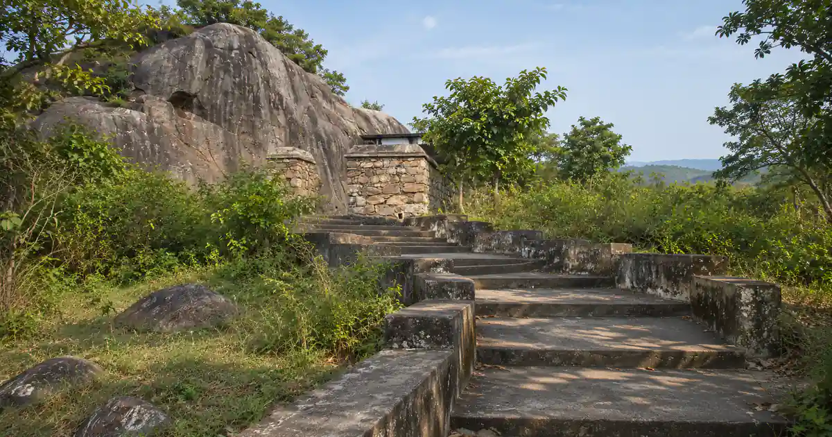
Wear sturdy walking shoes with reliable rubber grip, as steps leading up to the bastions can be uneven and mossy during damp periods. Long cotton trousers are advisable to guard against thorny scrub and grass burrs.
Carry at least one liter of drinking water per person, as there are no convenience shops directly inside the fort compound. Small tea and coconut water stalls operate along the village approach road outside the gates.
Heritage Photography and Environmental Guidelines
Potagarh Fort is protected under state archaeological heritage guidelines. Visitors must refrain from defacing historic plaster, removing bricks, or climbing unsupported vaulted roofs that may be structurally fragile.
Keep the fort grounds clean by taking all snack wrappers, water bottles, and plastic waste back to municipal disposal bins in Ganjam town. Respect the solemnity of the colonial cemetery grounds located near the outer moat.
Frequently Asked Questions (FAQs)
What is Potagarh Fort in Ganjam famous for?
Potagarh Fort is famous for its unique 18th-century star-shaped ramparts situated at the confluence of the Rushikulya River and the sea. It preserves architectural remnants of French, Muslim, and British colonial administrations, including Edward Cotsford’s first district collectorate house.
Is there an entry ticket or camera fee at Potagarh Fort?
Entry to Potagarh Fort is completely free for both domestic and international visitors. Travelers can take mobile photos and amateur cameras into the complex without paying any additional permits or fees.
Why is Potagarh Fort called the Buried Fort?
The fort earned its Odia name Potagada because it was engineered low into the earth with massive surrounding earthen ramparts that concealed its masonry bastions from naval cannon fire. From a distance across the sea or river, the fort looks partially buried under the coastal terrain.
What are the opening hours of Potagarh Fort?
The fort complex remains open daily from 8:00 AM to 5:00 PM throughout the entire year. Visitors are advised to enter before 4:00 PM to ensure adequate natural daylight for exploring the ruins safely.
How far is Potagarh Fort from Chatrapur and Berhampur?
Potagarh Fort is located approximately 8 km south of Chatrapur railway station and about 30 km northeast of Berhampur city. Both towns offer straightforward road access via auto-rickshaws, private taxis, and local buses.
Can I visit the Olive Ridley turtle nesting beach from Potagarh Fort?
Yes, the world-famous Rushikulya turtle rookery at Purunabandha beach is located just 4 km away from Potagarh Fort. Visitors traveling during February and March can easily combine both destinations in a single morning or afternoon outing.