Hukitola Island Kendrapara: Heritage Rice Warehouse & Boat Guide
Plan your trip to Hukitola Island in Kendrapara, Odisha. Explore the 1867 British rice warehouse, False Point lighthouse, boat route from Jambu, and history.
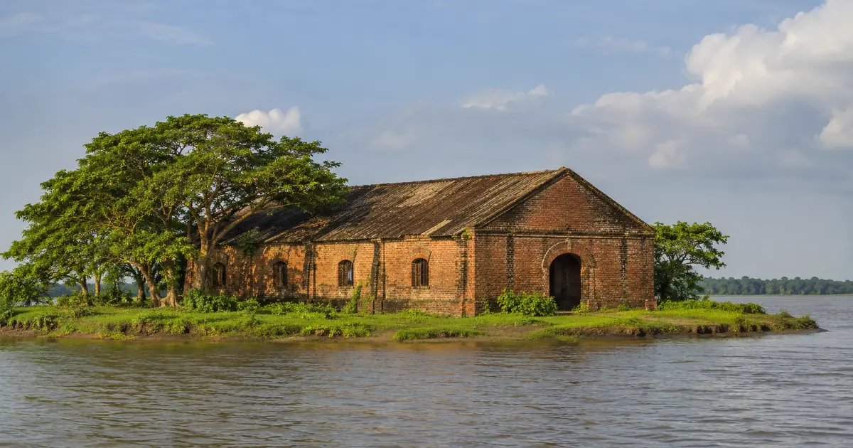
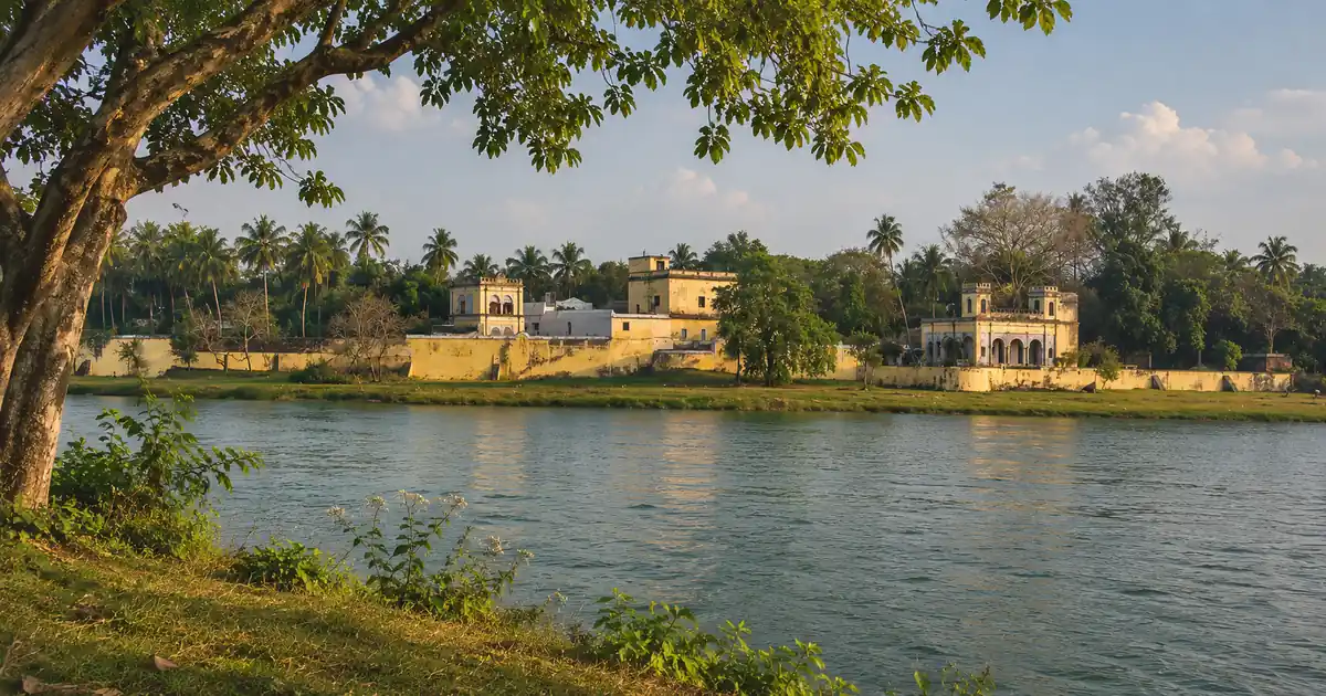
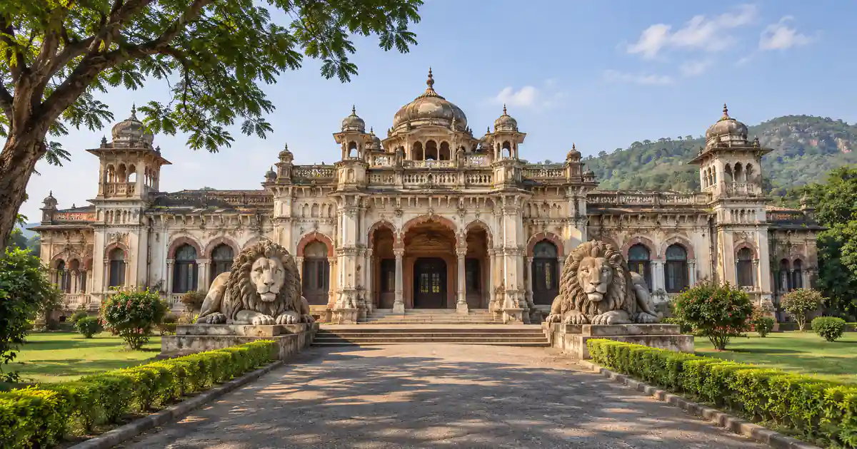
Hukitola Island Kendrapara stands as one of the most intriguing coastal heritage monuments and historical maritime landmarks in eastern Odisha. Situated on an offshore island off the Mahanadi delta in the coastal reaches of Marshaghai block, approximately forty-five kilometers southeast of Kendrapara town, this isolated barrier island houses an imposing colonial-era complex known across the region as the Palace of Hukitola.
Constructed in 1867 by the British administration, the colossal masonry building served as a storm refuge and emergency rice distribution depot following the devastating Na’Anka Famine of 1866.
Surrounded by tidal mangrove creeks, mudflats, and casuarina groves of the Bay of Bengal, the island offers travelers a rare combination of 19th-century colonial engineering, natural coastal wildlife, and poignant regional history. The monument is protected under the custodial care of the State Archaeology Department, the Kendrapara District Administration, and regional coastal tourism initiatives guided by Odisha Tourism.
Key Takeaways
- Island Geography: Situated on an offshore barrier island in the Bay of Bengal, accessible by boat from Jambu and Ramnagar jetties in Kendrapara district.
- Historical Purpose: Built in 1867 under British rule as a storm-proof rice warehouse and maritime refuge following the catastrophic Na’Anka Famine of 1866.
- Architectural Scale: Encompasses a massive 14,000-square-foot masonry structure featuring laterite blocks, grand arched colonnades, and thick cyclone-resistant walls.
- Ingenious Hydrology: Equipped with an innovative rooftop rainwater harvesting network that channels seasonal rainfall into large underground freshwater reservoirs.
- Travel Logistics: Reachable by motorized country boats from Jambu jetty, requiring approximately one hour of scenic navigation through tidal mangrove channels.
Hukitola Island at a Glance: History, Geography & Maritime Setting
Hukitola operates as an open-air historical monument and a scenic destination for cultural travelers exploring coastal Odisha. The island sits near the historic maritime harbor of False Point, where colonial merchant vessels anchored during the 19th century to transfer cargo to inland river barges. The building rises starkly from the sandy marshland, its weathered reddish laterite arches contrasting against green mangrove trees and open coastal skies.
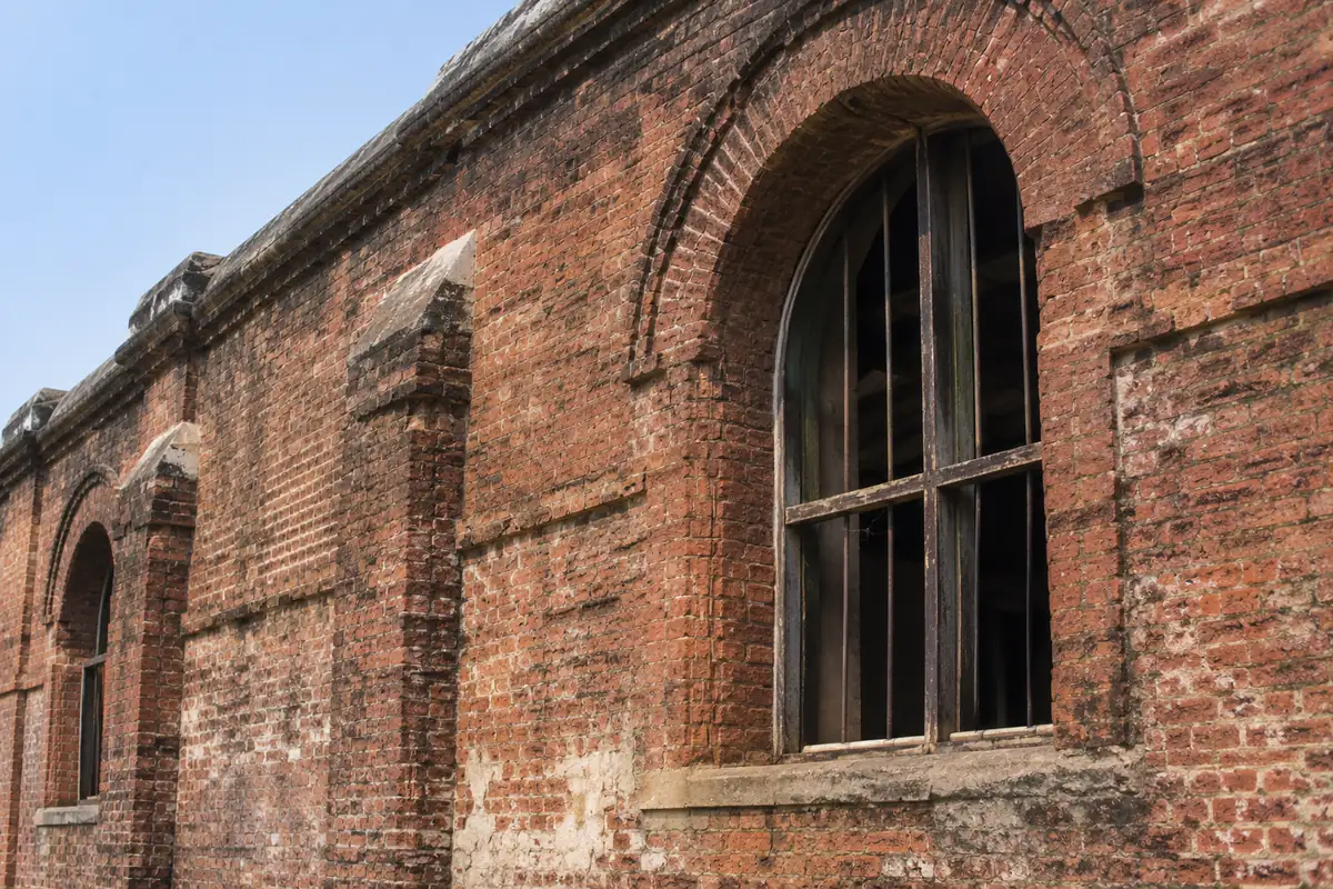
The master reference table below presents core geographic parameters, architectural metrics, and travel hours for planning your boat trip to Hukitola:
| Metric / Parameter | Visitor Information |
|---|---|
| Site Name | Hukitola Colonial Rice Warehouse & Island Monument |
| Administrative Territory | Marshaghai Block, Kendrapara District, Odisha |
| Geographic Coordinates | 20.4000° N, 86.8000° E |
| Built-Up Floor Area | Approximately 14,000 square feet |
| Year of Construction | 1867 (Following the 1866 Na’Anka Famine) |
| Visiting Hours | 7:00 AM to 4:30 PM (Daylight boat operations only) |
| Entry Fee | Free public viewing (Motorboat hire charges apply) |
| Primary Boat Jetties | Jambu Jetty (15 km by boat) and Ramnagar |
| Nearest Railhead | Cuttack Railway Station (CTC, 95 km) |
| Recommended Visit Duration | 4 to 5 hours (Including two hours of round-trip boat travel) |
Core Geographic and Administrative Parameters
Hukitola Island is situated in the southeastern corner of the Kendrapara district travel guide region. The island forms part of an intricate estuarine network where the distributaries of the Mahanadi and Brahmani rivers deposit sediment before meeting the ocean.
Because the island is uninhabited and exposed to the open sea, visitor access is governed strictly by the rhythm of daily ocean tides. Tourist boats depart from inland river docks, gliding past fishing hamlets and coastal mudflats where red ghost crabs and mudskippers scurry along the banks.
The Strategic Geography of the Mahanadi River Estuary
In the 19th century, before modern ports like Paradip were dredged, the False Point harbor at Hukitola served as the primary deep-water anchorage on the northern coast of the Madras Presidency and Bengal Presidency. Deep-draft European sailing ships could not enter shallow river mouths like the Baitarani or Devi, making this sheltered offshore anchorage critical for sea trade.
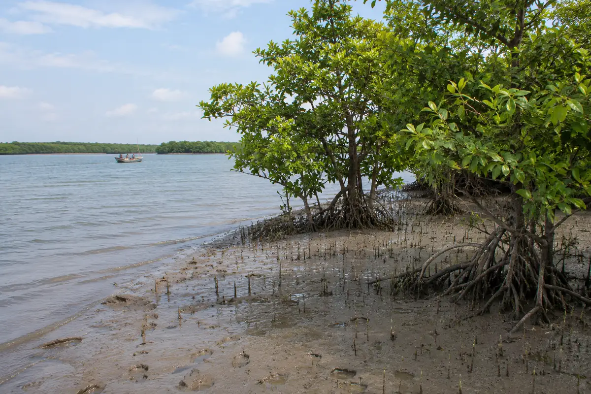
Cargo brought by ocean-going ships was transferred to small flat-bottomed country boats at Hukitola, which then traveled upriver along canal networks to Cuttack and central Odisha markets.
The 1866 Famine Tragedy and the Building of Hukitola Warehouse
The origin of Hukitola is inextricably tied to the darkest humanitarian disaster in the modern history of Odisha, the catastrophic Na’Anka Durbhikshya (Famine of 1866). Severe monsoon failure, combined with catastrophic administrative indifference by colonial authorities, resulted in the loss of nearly one million lives across coastal Odisha.
When relief ships carrying imported rice from Burma eventually arrived off the coast of False Point, rough monsoon surf and the absence of storage depots on the exposed beaches caused relief vessels to capsize, spoiling thousands of bags of grain while citizens starved miles inland.
The Dark Shadow of the Na’Anka Durbhikshya
The horrific mortality of the 1866 famine sparked widespread condemnation in the British Parliament and led to the appointment of the Famine Commission under Sir George Campbell. The commission identified the utter lack of transport infrastructure, coastal ports, and emergency granaries as the primary causes of the famine’s catastrophic toll in Odisha.
Recognizing the urgent need for a secure deep-water cargo depot, colonial engineers surveyed the offshore sandbanks near False Point to identify a storm-proof location for storing emergency grains.
Commissioning of the False Point Rice Depot in 1867
In 1867, construction began on the massive hukitola rice warehouse under the direction of colonial maritime engineers. Indigenous stone cutters and laborers quarried massive dressed laterite blocks from inland river quarries, transporting them by river barges down the Mahanadi to the barrier island.
The building was completed within a year, serving as a fortified storehouse where thousands of tons of grain could be safely held during cyclonic weather. The hukitola monument subsequently served as a customs house, quarantine post, and shelter for maritime sailors until modern railway lines reduced coastal shipping dependence in the early 20th century.
The historical timeline table below highlights critical milestones in the life of Hukitola:
| Year / Period | Historical Event | Significance to Coastal Odisha |
|---|---|---|
| 1866 | Na’Anka Famine (Na’Anka Durbhikshya) | Devastating famine claims over a million lives, exposing relief transport failures |
| 1867 | Construction of Hukitola Warehouse | Colossal masonry granary erected to safeguard emergency rice shipments |
| 1880–1910 | Peak Port Activity at False Point | Hukitola serves as the primary customs post and grain depot for international shipping |
| 1925 | Shifting of Maritime Trade to Paradip | Gradual decline of False Point harbor as inland railways take over cargo transport |
| 2014–Present | Heritage Conservation & Eco-Tourism | State Archaeology Department repairs stone arches and installs tourist walkways |
Colonial Architecture & Ingenious Rainwater Harvesting System
The architecture of this hukitola building represents a masterpiece of utilitarian colonial engineering adapted to harsh coastal conditions. Designed without modern concrete, the structure was constructed from durable laterite blocks bound with traditional lime and surkhi mortar, allowing it to withstand more than a century and a half of saline sea air, storm surges, and severe cyclonic gales.
The building is single-storeyed but stands elevated on high stone plinths to protect interior storage bays from tidal flooding. Thick external buttresses reinforce the peripheral walls against maritime winds.
Grand Stone Arches, Buttresses and British Masonry
The interior layout of this hukitola palace spans over fourteen thousand square feet, divided into wide interconnected chambers by majestic semicircular arches. Slender arched windows and high clerestory vents ensure cross-ventilation, keeping interior rooms cool and preventing stored grains from developing mildew in the humid coastal atmosphere.
A broad covered verandah wraps around the eastern and western facades, supported by sturdy square masonry pillars. The symmetrical arrangement of colonnades creates dramatic geometric shadows that delight architectural photographers.
The Innovative Underground Freshwater Cisterns
Because Hukitola is an isolated barrier island surrounded by salty sea water, obtaining potable freshwater presented a major engineering challenge for 19th-century builders. To overcome this obstacle, colonial engineers created an extraordinary rooftop rainwater harvesting network that remains functional today.
The massive flat roof of the warehouse was graded with gentle inward slopes, directing every drop of seasonal monsoon rain into central stone collection spouts. The rainwater filtered through charcoal and sand beds before descending into four subterranean masonry cisterns constructed beneath the building floorboards.
The table below outlines architectural specifications and freshwater storage metrics:
| Architectural Component | Engineering Specification | Practical Function |
|---|---|---|
| Total Enclosed Area | 14,000 square feet | Massive storage capacity for grain bags and maritime cargo |
| Primary Building Material | Chiseled laterite stone and kiln-fired brick | Extreme resistance against coastal saline corrosion |
| Roof Catchment System | Sloping lime-terrace catchment | Channeled monsoon rainwater to central filtration shafts |
| Underground Cisterns | Four deep subterranean brick tanks | Stored over 100,000 liters of freshwater for year-round survival |
| Ventilation Network | Arched clerestory wall vents | Maintained air circulation to prevent grain spoilage |
Boat Ride Logistics: Navigating from Jambu and Ramnagar Jetties
Reaching Hukitola requires charting a motorized boat through the coastal river waterways of Kendrapara. The boat journey forms a memorable part of the travel experience, carrying visitors past fishing harbors, mangrove forests, and tranquil estuarine bays.
Boarding Points at Jambu and Ramnagar
The primary boarding point is the Jambu boat jetty, situated along a tributary of the Mahanadi River roughly twenty-five kilometers east of Marshaghai. A secondary boarding option is the Ramnagar fish landing quay located slightly further upriver.
At Jambu jetty, visitors can hire certified community motorboats operated by local boatmen associations. The boat ride covers approximately fifteen kilometers along the winding river channel before emerging into the sheltered bay facing Hukitola Island. The boat journey takes roughly forty-five minutes to one hour each way, depending on engine capacity and water currents.
Tidal Dynamics and Safety Protocols on Mangrove Waters
Navigation to Hukitola is governed by ocean tides. During low tide, shallow sandbanks emerge in the estuary, which can ground motorboats. Boat captains schedule departures during high tide windows to ensure adequate water depth for crossing river mouths.
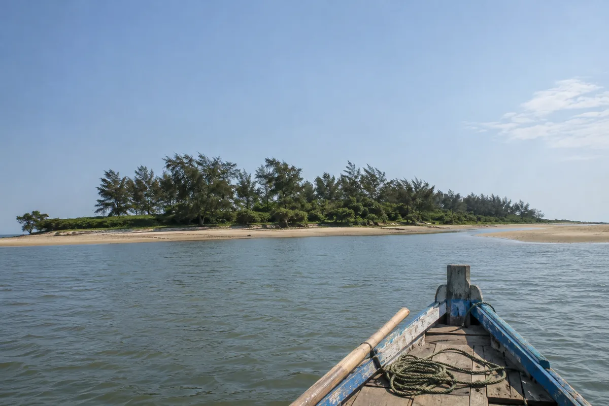
The table below summarizes standard boat charter tariffs and travel schedules from Jambu jetty:
| Boat Type / Service | Passenger Capacity | Approximate Round-Trip Tariff | Travel Duration (One Way) |
|---|---|---|---|
| Standard Wooden Motorboat | Up to 10 passengers | ₹2,000 – ₹2,500 | 50 minutes |
| Medium Covered Tourist Boat | Up to 15 passengers | ₹2,800 – ₹3,200 | 45 minutes |
| Combined Circuit (Hukitola + False Point) | Up to 10 passengers | ₹3,500 – ₹4,000 | 1 hour 15 minutes |
Every visitor must wear a buoyant life jacket throughout the hukitola boat ride. The boatmen cooperative maintains safety standards, but travelers should confirm that safety equipment is onboard before leaving the dock.
How to Reach Hukitola from Bhubaneswar, Cuttack and Kendrapara
Reaching the boat boarding points near Hukitola involves traveling through the agrarian heartland and deltaic wetlands of coastal Odisha.
Driving Route via Cuttack, Kendrapara and Marshaghai
Motorists departing from Bhubaneswar or Cuttack drive east along State Highway 12 toward Kendrapara town. From Kendrapara, continue eastward along the Cuttack–Chandbali highway past Marshaghai and Mahakalapada toward Ramnagar and Jambu. Exploring this monument is widely recognized as one of the most rewarding places to visit in kendrapara for maritime history enthusiasts.
The total driving distance from Bhubaneswar to Jambu jetty is approximately 125 kilometers, requiring about three hours of steady driving. From Cuttack city, the distance is roughly ninety-five kilometers, taking approximately two hours and fifteen minutes.
Railhead Access via Cuttack and Paradip Stations
For rail passengers, Cuttack Railway Station (Station Code: CTC) serves as the primary transit junction, receiving express trains from all major Indian cities. Taxis and private cab operators can be booked from Cuttack directly to Jambu jetty.
Alternatively, Paradip Railway Station (Station Code: PRDP), situated thirty-five kilometers southwest across the Mahanadi mouth, connects to local passenger trains. However, because no direct vehicle bridge crosses the coastal estuary between Paradip and Jambu, travelers arriving by road must approach via the Marshaghai highway route.
The table below outlines road distances and transit metrics from primary regional centers:
| Origin Hub | Route Corridor | Distance to Jambu Jetty | Estimated Driving Duration |
|---|---|---|---|
| Kendrapara Town | State Highway via Marshaghai & Ramnagar | 45 km | 1 hour 10 minutes |
| Marshaghai Block Center | Rural Paved Road eastward | 25 km | 40 minutes |
| Cuttack City Junction | SH 12 through Kendrapara | 95 km | 2 hours 15 minutes |
| Bhubaneswar Airport (BPIA) | NH 16 to Cuttack, then SH 12 | 125 km | 3 hours |
| Paradip Port City | Via Kujang and Marshaghai | 60 km | 1 hour 30 minutes |
Local Transport and Vehicle Parking at Jambu
Public passenger buses run regularly from Cuttack and Kendrapara bus terminals to Mahakalapada and Ramnagar. From Ramnagar, local auto-rickshaws and shared utility vehicles convey passengers the remaining eight kilometers to Jambu boat landing. Secure open-air parking for private cars is available near the jetty under community supervision.
Hukitola vs False Point Lighthouse: Exploring the Maritime Twin
Travelers planning an excursion to Hukitola often pair the island visit with False Point lighthouse situated on an adjacent coastal spit. Both landmarks document the 19th-century maritime legacy of the British administration in the Mahanadi estuary.
Key Differences in Historical Role and Architecture
The historic lighthouse tower was commissioned earlier, in 1838, as a towering navigation landmark designed to prevent shipwrecks along the treacherous shoals of the Odisha coastline. Rising over 125 feet, the structure features massive granite blocks and a rotating optical lantern that guided international merchant ships entering the Bay of Bengal.
Hukitola, built thirty years later in 1867, served a completely different functional purpose as a horizontal storage depot and humanitarian refuge. While the maritime light station provided vertical navigation warnings, Hukitola offered practical shore logistics, housing customs officers, fresh water, and relief grains.
The table below compares key features of these twin maritime heritage sites:
| Comparison Attribute | Hukitola Island | False Point Lighthouse |
|---|---|---|
| Year of Commissioning | 1867 CE | 1838 CE |
| Primary Architectural Form | Sprawling single-storey masonry warehouse | 125-foot vertical stone masonry lighthouse |
| Core Historical Role | Famine grain storehouse and storm refuge | Coastal maritime navigation and warning |
| Key Engineering Highlight | Rooftop rainwater catchment and 4 cisterns | Imported revolving optic lens and granite tower |
| Accessibility | Motorboat from Jambu jetty (1 hour) | Extended boat journey across coastal channels |
| Visitor Experience | Atmospheric colonnades and historical ruins | Panoramic sea views and active lightkeeper post |
Combining Both Coastal Heritage Sites on a Single Boat Charter
Travelers with a full day to spare can negotiate a combined boat charter from Jambu jetty to tour both Hukitola and the False Point light station. Visiting both sites provides an unforgettable perspective on the 19th-century maritime gateway that linked coastal Odisha to global ocean trade routes.
Best Time to Visit, Travel Tips & Nearby Coastal Attractions
Because Hukitola is an isolated offshore island with no permanent commercial inhabitants, timing your visit carefully is essential for a safe and comfortable trip.
Seasonal Climate and Winter Weather Window
The ideal time to visit Hukitola is between October and March. Winter days feature gentle coastal breezes, calm sea conditions, and pleasant ambient temperatures between 16°C and 28°C. Calm waters during winter make the boat crossing smooth and enjoyable.
Monsoon months from June through September bring rough ocean swells, high tidal surges, and frequent tropical squalls that make boat crossings hazardous. Boat services to the island are typically suspended during heavy storm warnings. Summer months from April to May bring intense humidity and blazing sunshine on the unsheltered island.
The seasonal guide below helps you select the best window for your excursion:
| Season | Calendar Months | Marine & Weather Conditions | Travel Advisory |
|---|---|---|---|
| Winter (Peak Season) | October to March | Calm waters, cool breezes, clear skies | Outstanding; optimal conditions for boat ride and island walks |
| Monsoon | June to September | Heavy rain, rough swells, storm alerts | Not recommended; boat services suspended during squalls |
| Summer | April to May | High humidity, strong sun, warm winds | Moderate; depart early morning by 7:00 AM to beat midday heat |
Essential Visitor Packing and Island Etiquette
To ensure an enjoyable trip to this remote monument, keep the following practical guidelines in mind:
- Carry Drinking Water and Food: There are no food stalls, drinking water taps, or tea shops on Hukitola Island. Bring adequate drinking water and packed snacks for your entire group.
- Sun Protection: The walk across the island is completely open to the elements. Carry wide-brim hats, sunscreen, and polarized sunglasses.
- Footwear Selection: Wear sturdy rubber sandals or walking shoes that can tolerate wet sand and mud during boat boarding.
- Pack Out All Trash: As an uninhabited island monument, Hukitola has no municipal trash collection. Pack out every plastic wrapper, bottle, and tissue to keep the historic grounds clean.
- Observe Tidal Deadlines: Always heed your boat captain’s departure schedule. Delaying departure can cause boats to become stranded on sandbanks as the ocean tide recedes.
Pairing with Bhitarkanika and Paradip Sea Beach
A heritage trip to Hukitola fits seamlessly into a broader coastal exploration of Kendrapara and Jagatsinghpur districts. Travelers can head northward to explore the mangrove waterways and estuarine crocodiles of Bhitarkanika National Park, one of India’s celebrated Ramsar wetland sanctuaries.
Heading southward, visitors can explore the busy maritime docks and expansive shoreline of Paradeep sea beach in Jagatsinghpur. Those interested in state history can also tour historic Barabati Fort in Cuttack or discover scenic picnic spots across the coastal delta. For travelers planning excursions from the state capital, regional tour itineraries conveniently link coastal wetlands with temple hubs.
Frequently Asked Questions (FAQs)
Where is Hukitola Island located in Odisha?
Hukitola Island is an offshore barrier island situated in the Bay of Bengal off the coast of Marshaghai block in Kendrapara district, Odisha. It lies approximately forty-five kilometers southeast of Kendrapara town and 125 kilometers from Bhubaneswar.
Why was the Hukitola building constructed?
The massive masonry building was constructed in 1867 by colonial engineers as a cyclone refuge and emergency rice storehouse following the catastrophic Na’Anka Famine of 1866. It safely housed grain shipments arriving at the deep-water False Point anchorage.
How do visitors reach the island by boat?
Visitors charter motorized country boats from Jambu jetty or Ramnagar fish landing quay. The scenic boat ride covers fifteen kilometers through tidal river creeks and takes roughly forty-five minutes to one hour each way.
What makes the rainwater harvesting system special?
The building roof was engineered with sloping terraces that guided monsoon rainfall into central filtration shafts and four underground masonry cisterns. This clever design stored over one hundred thousand liters of fresh drinking water on an isolated salty barrier island.
What is the best season to explore the island?
The best time to visit is between October and March when the weather is cool and coastal waters are calm for boat navigation. Visiting during the monsoon season is discouraged due to rough sea swells and stormy weather.
Is overnight stay allowed on the island?
No, overnight stays are strictly prohibited on Hukitola Island because it is uninhabited and lacks electricity or running water. Visitors must return to the mainland at Jambu jetty before sunset.